|
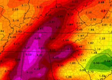
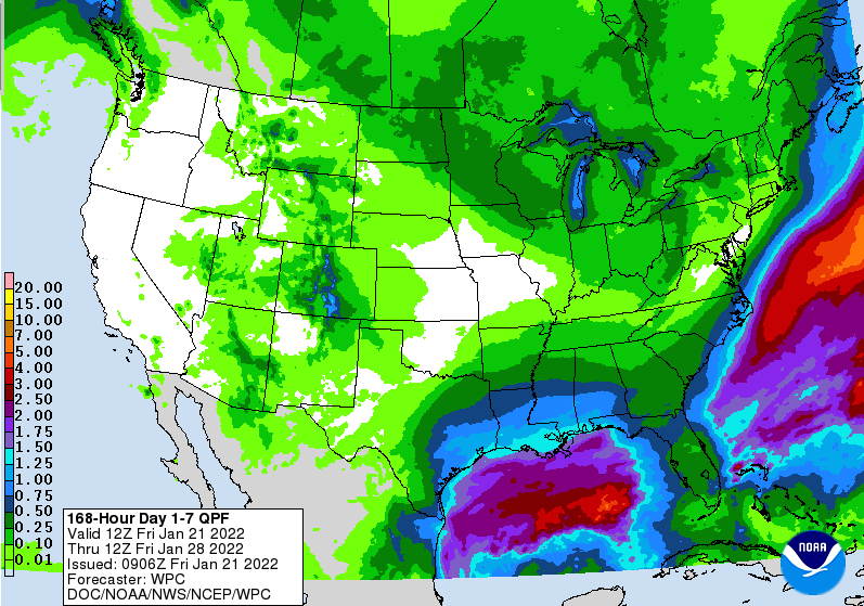
After a chilly weekend with some snowfall for the higher terrain, Newfound Gap still has 9+ inches of snow depth. Mt. Leconte recorded a 20" snow depth Saturday, as nearly a foot fell. Closer to home, conditions are pleasant region wide. High pressure remains in control, setting up pleasant temperatures and most sunny skies. We will continue to warm up into Tuesday, with highs near 60 (yes that's correct) for some! This will be short lived though, as a flooding threat and the return for cold air arrives the second half of the week. Breaking down modeled guidance, a warm front will build north tomorrow increasing moisture across the area. As such, rain will arrive Wednesday and continue on and off (with periods of breaks) through the day/night. A cold front will then take aim Thursday, bringing heavy rainfall and the chance for all precipitation types. As cold air overrides warm air, a change over to some freezing rain, sleet, and snow is possible. Fortunately for us, the bulk of this threat will be to our north and west. The arrival of cold air looks to be slower, resulting in mainly a rain to brief change over event. Even so, the potential for impacts will be possible. This will be particularly so with flash flooding/flooding, but slick roads (especially for the higher terrain) is possible Friday morning. Looking at rainfall totals Wednesday through Saturday, upwards of 5 inches can't be ruled out across middle and western TN. There still remains lots of uncertainty in the track of this system, but rainfall is expected. Across East Tennessee, 2-3+ inches, with locally higher amounts is likely. This could lead to rising high waters and flash flooding. I anticipate the WPC to issue flash flooding risks in the days ahead, as well as a shot at flood watches for some. Depending on the track we could see higher rainfall amounts or even lower, but time will tell. For now, be aware of the potential and check back in for updates on any changes. Cold air will finish out the work week, with highs Friday in the 30s to low 40s. Sunshine will make a return this weekend after all the rain expected Wednesday through early Friday morning. Pre-recorded for 5pm show
0 Comments
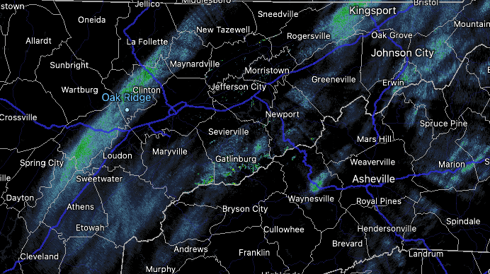
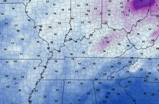
The latest radar scan depicts a few light showers to flurries (depending on where you are). These shouldn't be impactful, while cloudy skies dominate above. Temps today will continue to warm, topping out in the upper 30s to around 40 by this afternoon. As this cold front and weak moisture return behind the front pulls through, isolated showers to flurries will continue into the early night. Though no accumulations are expected across the valley, temperatures will be very cold. Looking upstream (north and west), that is what is on the way for us. A change of 20+ degrees is likely overnight tonight, with a swing of 10+ degrees likely for afternoon highs Saturday. Looking at modeled guidance, lows for the valley are expected to bottom out in the low to mid teens, with elevated locations in the upper single digits to low teens. If clearing arrives quicker, I would not be surprised to see these lows 3-5 degrees cooler. Either way, the point is it's going to be cold to start the morning Saturday. The good news is, if you can make it through tomorrow, Sunday will be a big rebound with highs in the mid and upper 40s. That warming trend continues into next week, with mid 50s by Tuesday. NWS Morristown has issued winter weather advisories for the far Northeast and the Northern Plateau....these locations can expect between 1-3". A winter storm warning is in effect for the Smokies, with the highest peaks receiving 6+ inches. The remainder of us should expect some flurries with maybe a dusting possible in banded snow locations. Have a good one, stay warm, and look forward to the warm up expected this next week! Pre-recorded for 5pm show
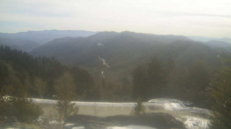
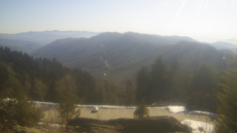
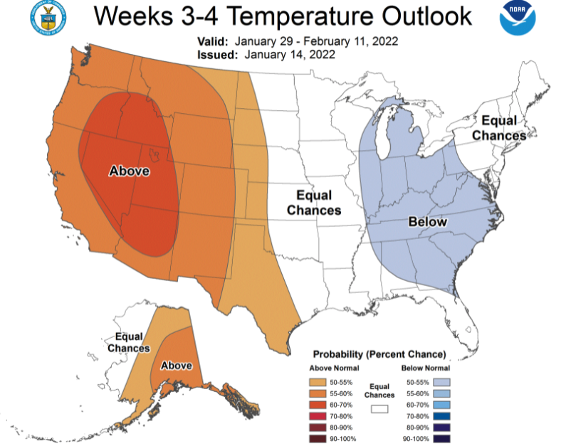
Mostly sunny skies are present across the high terrain (Newfound Gap) late this morning. An approaching disturbance and front will bring additional cloud cover this afternoon, resulting in mostly cloudy skies for Friday morning. Remnant snow also remains at this 5,000 foot mark, with 7.5" still remaining on the ground. Moving forward, a weak disturbance will cross the area, bringing limited opportunity for a few light rain showers to snow showers. No impacts are expected with this system for the central valley, but the Smokies will likely see several inches through the second half of Friday and into Saturday morning. The biggest impacts will be seen in temperatures. Overnight lows Friday will range from the upper single digits to mid teens for East Tennessee. Highs Saturday won't make it feel too much better, topping out in the 20s to low 30s. Further ahead, a bit of change is expected. Given the cold January we've had thus far, a change to near/to above average temperatures is anticipated for the beginning of February. Though we likely have not seen the last of winter, it is nice to feel some warmer air return to the Volunteer State. We'll even have highs this next week back into the low and mid 50s. Other than increasing clouds this afternoon, today should be pretty mild. Highs will top out in the mid and upper 40s with winds light and out of the south/southwest. Have a good one and bundle up for the cold swing expected into Friday night. Highs tomorrow will top out in the mid 30s to around 40 degrees. Pre-recorded for 5pm show
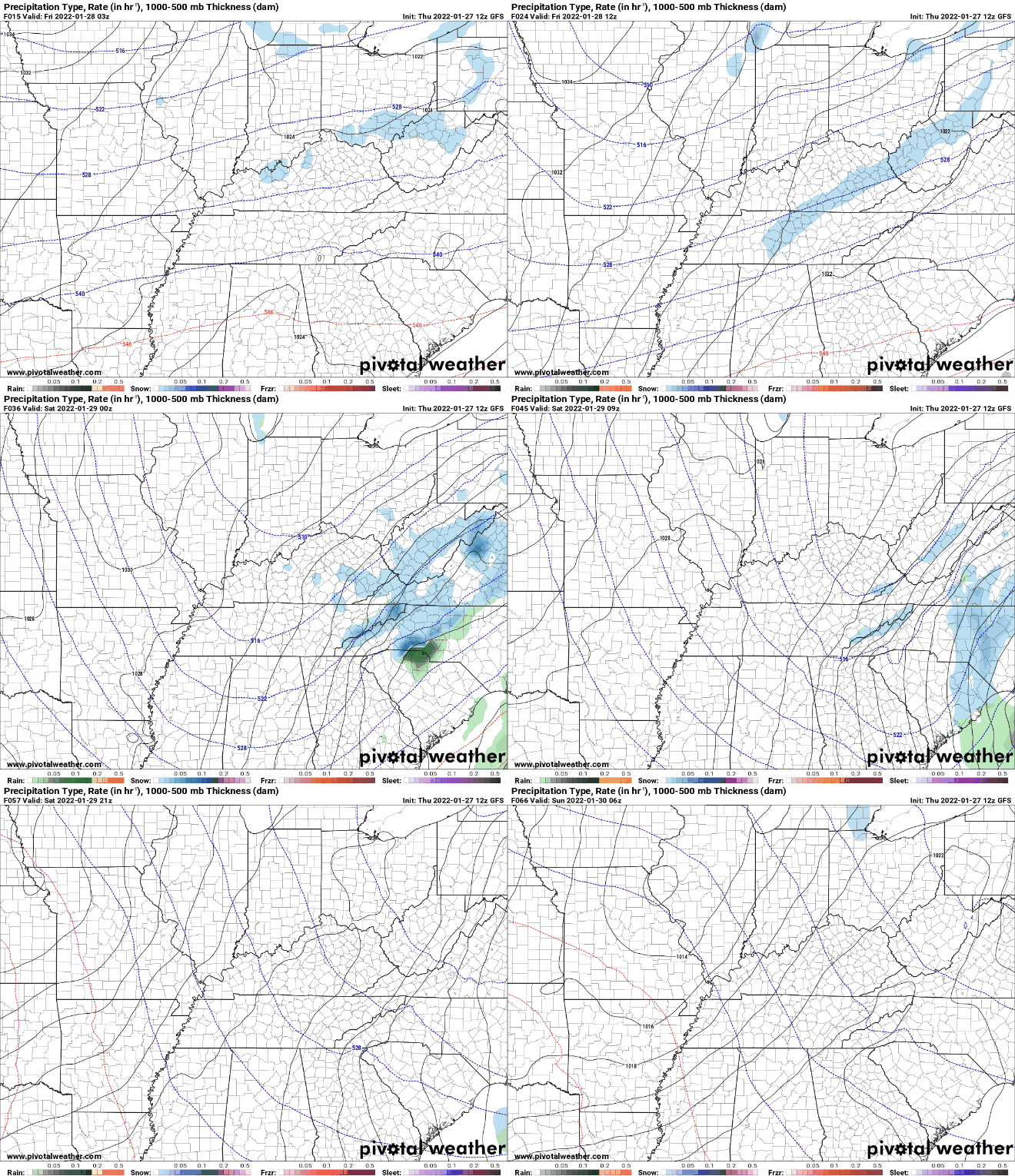
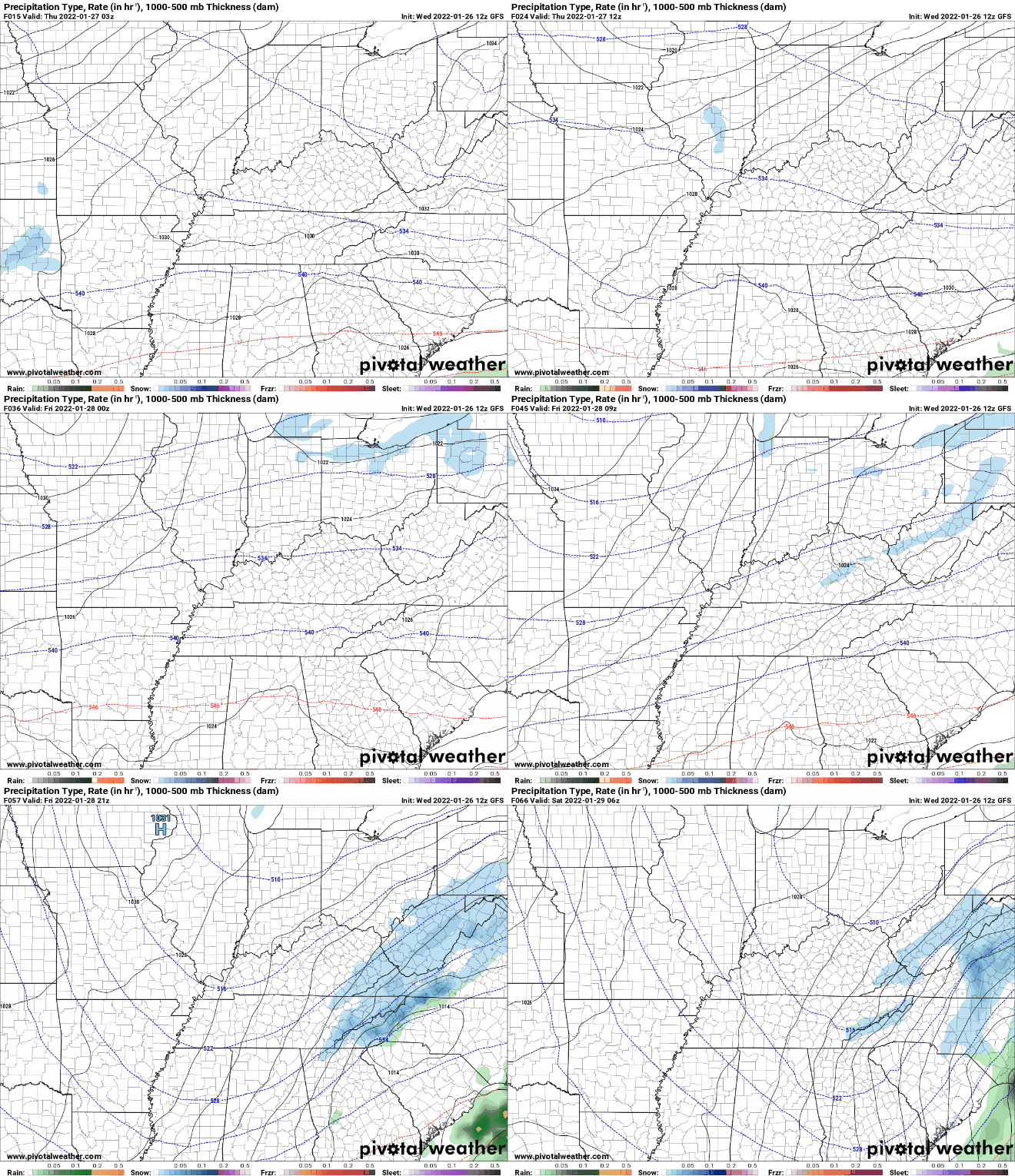
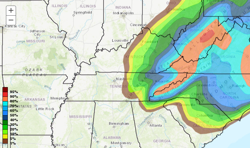
A gorgeous afternoon is on tap with sunny skies and highs in the mid to upper 30s (some could even top out around 40). Similar conditions are in the plans tomorrow, though we will see increasing cloud coverage through the afternoon and into the overnight. Highs will also be a bit warmer, in the mid and upper 40s. We have discussed a late week system and the opportunity for a few snow flakes. Guidance continues to come into better agreement, but there still remains some unknowns. What we do know is a quick moving disturbance will pass through, bringing a chance for scattered rain (Friday afternoon) to light snow (Friday night). Accumulations will be very minimal, with upwards of a dusting to a few tenths at best for most locations. The Foothills and highest peaks of the Smokies will have the best opportunity for light to moderate accumulating snow. This system will eventually evolve into a snow storm across the Northeast this weekend. Further looking into this event, probabilities hint at a 0-30% chance (for valley locations) of seeing an inch of snow or more. Again, the best opportunity will be in the high terrain bordering NC and VA, but a light coating elsewhere isn't ruled out. We will continue to eye the evolution of this system, but do anticipate very cold temps to follow. Highs Saturday will be lucky to top freezing, and overnight lows will be in the single digits to mid teens Friday night and Saturday night. Pre-recorded for 5pm show
Good afternoon! A fairly mild afternoon is on tap with cloud cover gradually clearing. Low level clouds remain across the northern half of the Plateau but will vacate by this evening. The remainder of us will be sunny to partly sunny. A cold front is present just to our west, bringing much cooler air to the Central US and eventual Eastern US. Highs tomorrow are expected to top out in the mid to upper 30s under mostly sunny skies. Working ahead, the weather will be fairly quiet. A quick moving wave will bring the opportunity for isolated to scattered rain showers Friday afternoon before transitioning to some snow flakes overnight. There continues to be large uncertainty within guidance, but all signs point to a very minor event. Following this Friday system, sunny skies return but so does cold air for the weekend. Looking at highs Saturday afternoon, most will struggle to break the freezing mark. Even more so, elevated locations will likely top out in the 20s with overnight lows in the teens and 20s Friday night and Saturday night. We will gradually warm back up Sunday and into the new work week. Temperatures will cool off Wednesday, but rebound Thursday. This will then be followed by another cold bout Friday and into the weekend. Have a good one and be sure to check back in for any updates for the late week system. Pre-recorded for 5pm show
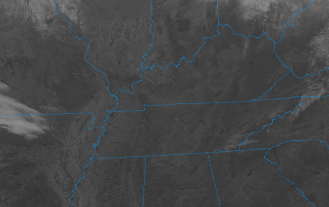
Good afternoon! After another chilly weekend, we start off pretty mild. Temperatures for the southern half of the state are much more mild than the northern half. Reason being? Cloud cover. Low level clouds are hanging around the northern tier of Tennessee. Satellite does show trends of this slowly eroding through the afternoon, until then, slightly cooler and a lot less sunshine. This cloud cover is all associated with a disturbance across the Great Lakes. It will again increase overnight tonight, with remnant coverage into the day tomorrow. A fairly dry cold front will also slide through tomorrow, bringing much cooler air for Wednesday. Other than a few sprinkles tomorrow, most will stay dry. Looking at high temperatures Wednesday, it is going to be another chilly one! Highs for valley locations will range from the mid to upper 30s and low to mid 30s for the Plateau and foothills. Temperatures should rebound toward Thursday, with yet another opportunity for rain/snowfall Friday and the early weekend. Touching more on this late week event, we are in good location for snow. Guidance has been all over the place with this system, so this is to say "who knows" for right now. We will continue to eye consistency between runs and other data, but for now, anticipate isolated rain to snow mix at a ~30% chance. That will wrap it up for today, be sure to bundle up mid week as the cold front slides through the afternoon tomorrow. Another system could clip us late week, but the confidence and level of uncertainty remains high for now. Tune back in for a better idea as we work ahead. Pre-recorded for 5pm show
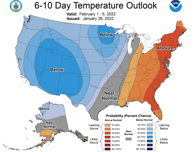
I hope you are saying warm this morning as most locations are ranging from the low to mid 20s. Unfortunately, we won't warm up too much today with highs topping out in the low to mid 30s. Progressing overnight, a very cold night is in store. Guidance is struggling to pick up on the clearing expected through this afternoon, and as a result, suggests lows in the upper teens and low 20s. With that said, our forecast incorporates the clearing and high pressure, making lows a bit closer to the mid teens ballpark. Either way, its going to be COLD to start the weekend off. We are pretty much stuck between systems to the south and the north for the next couple of days. As such, precipitation will be fairly light over the next 7 days. Our next real system won't arrive until late Monday night and into the day Tuesday. Another mix of rain to snow will be possible, but details remain too little to give any meaningful predictions (snow-wise). Looking longer term, our lean toward below average temperatures looks to remain locked in place. After a well above November and December, I guess it's only right we finish out Winter on the cooler side. This graphic comes courtesy of the Climate Prediction Center. That will wrap it up for today....other than the cold temperatures to start the morning tomorrow, we'll see gradually warming temps and plenty of sunshine throughout the weekend. Enjoy and have a good one! Pre-recorded for 5pm show
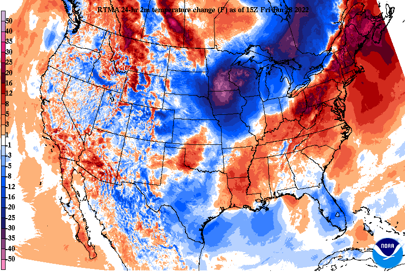
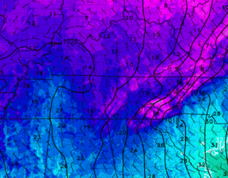
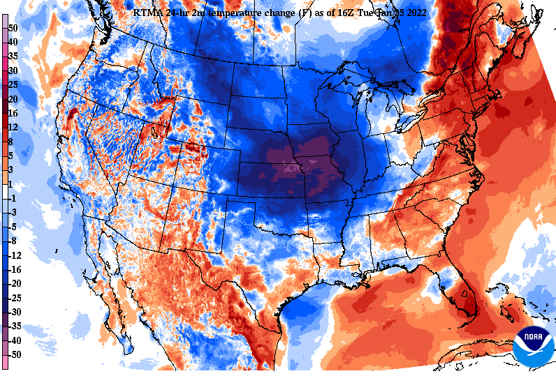
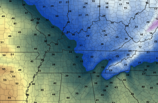
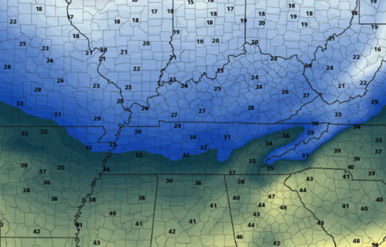
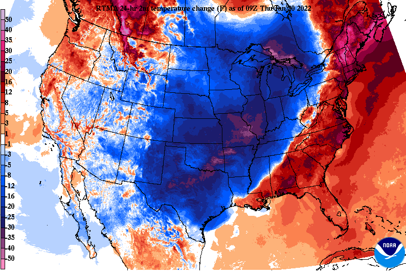
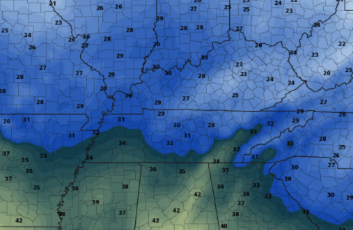
Looking at the past 24 hours, a stout cold front has exited east. As you can see MUCH colder air is filling in with values between 15 and 30 degrees cooler than this time yesterday. As colder air surges in today, highs will come early...this morning in fact. As such, we'll see low 30s to upper 20s during the evening commute tonight, with overnight lows in the teens to near 20 degrees. Trust me it'll only get colder for Friday too (more below). With high pressure in place to our north and west, dry conditions can be expected over the next several days. This is a pro but also a con....the clockwise flow of the high is ushering in very cold Arctic air from the north, leading to the very cold temperatures we'll see today, tomorrow, and Saturday. Other than mixed sky conditions, things stay quiet until early to mid next week. Looking over Friday temperatures, highs tomorrow will only top out in the upper 20s and low 30s. Most won't even break the freezing mark for the day. Depending on how quick skies clear through the day tomorrow, we could be facing a very cold overnight. How cold? The current forecast calls for mid teens, but if clearing persists, we could be closer to the upper single digits and low teens, so...... COLD. We'll gradually clear out and warm up into the weekend, with highs by Sunday in the low to mid 40s and Monday in the mid and upper 40s. Stay warm, use caution as slick spots from lingering surface moisture could cause issues this morning and again tomorrow. Pre-recorded for 5pm show
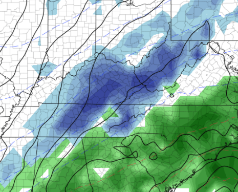
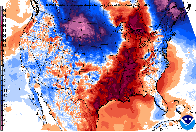
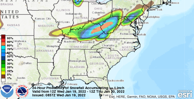
Good morning! A powerful cold front will take aim at the region tonight, bringing rain showers and a few snow flakes. Looking at the past 24 hours, warmer air has filled in across through the Lower Mississippi, Ohio Valley, and up to the Great Lakes. This is all ahead of an approaching cold front, looking to bring much cooler air the remainder of the work week. As the front overrides moisture late tonight, this could allow just enough time for some to see a few flakes early into Thursday. Accumulation wise don't count on seeing anything pile up, but a few flurries during the morning commute can't be ruled out. The best opportunity for any snowfall will be to our north in Eastern Kentucky, the northern plateau, and the highest peaks of the Smokies. The remainder of us can anticipate flurries followed by cold temperatures through the early weekend. Taking a look at probabilities, The chance for one inch of snow or grater remains across central-east Kentucky. A few of the bordering counties and portions of the northern plateau could see a dusting, but most will see little to no accumulations outside of these areas. Another rounds of flurries will be possible from a southern stream system on Friday, but guidance continues to downplay and suggest a drier solution with this system. For now anticipate flurries at best Thursday and Friday, with cold air (low 30s for highs) each day. That will do it for today. Even with little snowfall expected, slick spots will be possible. Overnight lows are expected to be in the upper 20s to low 30s, allowing for wet roads to freeze over. Use caution during the morning commute and account for some extra time. Pre-recorded for 5pm show
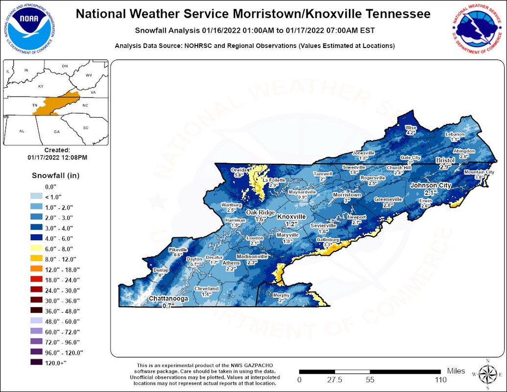
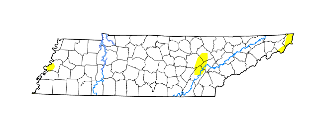
After an extended weekend (for some), we make a return to sunshine and gradually warming temperatures. Most locations saw a decent snow this past weekend, with valley locations generally between 0.5 and 3 inches. The better snowfall was seen across the high terrain of the Plateau as well as the Smokies. A transition to snowfall as cold air advected in even allowed for some light accumulations in the southern valley for the Chattanooga area as well. Moving forward, the heavy rains we have seen the past couple of weeks has allowed for the improvement of minor drought conditions seen across the state. There still remains some very limited abnormally dry spots in East Tennessee, but nothing our next rain maker can't handle. As one system exits, our next one looks to arrive later tomorrow. A cold front out of the Midwest will develop and pull east. As it does so, showers will develop out ahead before overrunning colder air could provide a chance at a changeover to mixed precipitation overnight and into Thursday morning. The bulk of this event will be in the form of rain, with little to no snow accumulations expected for the central valley. The best opportunity for any accumulations will be the higher peaks of the Smokies tomorrow night. This will be a fairly quick mover, dumping upwards of an inch of rainfall tomorrow and early Thursday, with sunshine gradually returning for the end of the work week. Temperatures will be the warmest tomorrow, topping out near 50. The remainder of the week will see highs in the 30s, with most Friday lucky to break the freezing mark (32). Have a good one, and don't forget to follow us on Twitter/Facebook for the latest! Pre-recorded for 5pm show
|
Your trusted source for everything weather in East Tennessee.
Social Media
|

