|
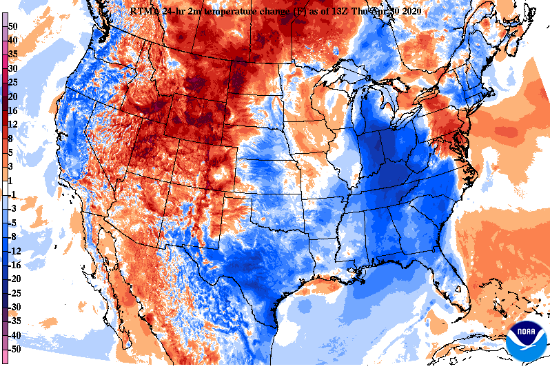
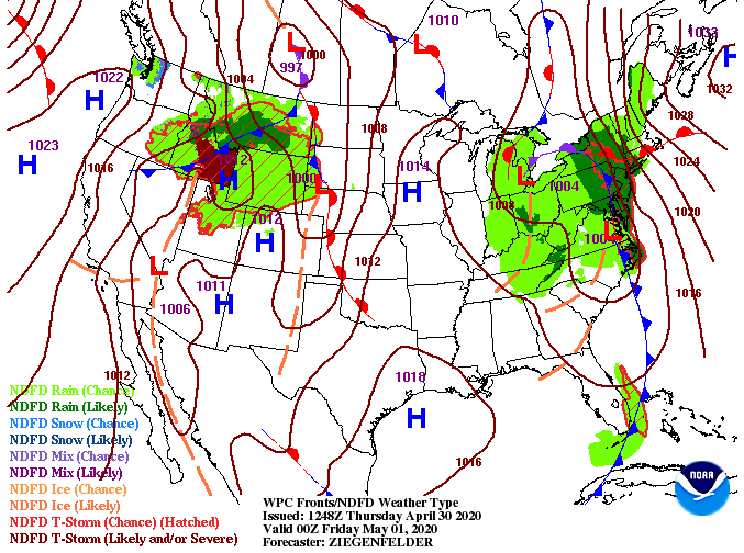
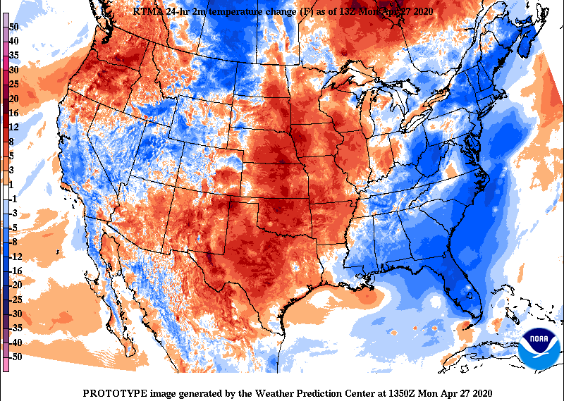
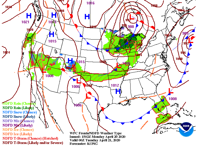
We are sitting a bit cooler today with the passing of a cold front. From the Great lakes region down to northern Florida, temperatures are anywhere from 5 to 20 degrees cooler this afternoon. This won't last long though as temperatures will build to the lower 80's by Sunday. The latest surface map shows yesterday's system slowly working its way out before being replaced with a high pressure system to the west. Sunny skies will find their way back Friday and much of the weekend as temperatures increase as well. Even with this system working north and east, don't be surprised to see a light isolated shower this afternoon and evening. Most of us will stay dry through the day today but light wrap-around moisture is possible this afternoon. Planning ahead, sunny skies return for Friday and much of the weekend before showers are back in the discussion late Sunday and early Monday. For a full forecast and a look at the current conditions outside, watch today's video forecast below. Stay warm this afternoon and enjoy the sunshine as we work back into Friday.
2 Comments
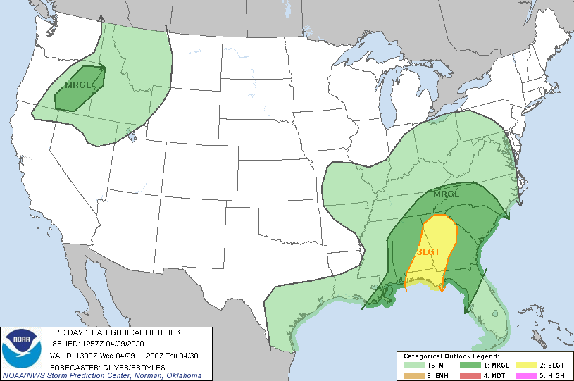
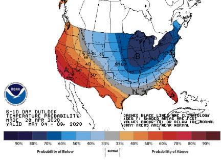
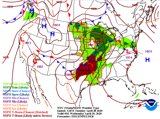
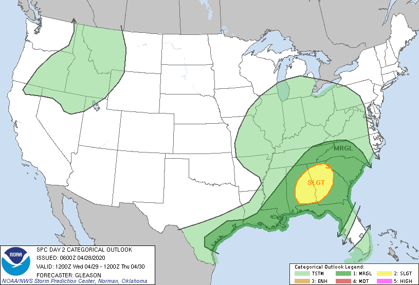
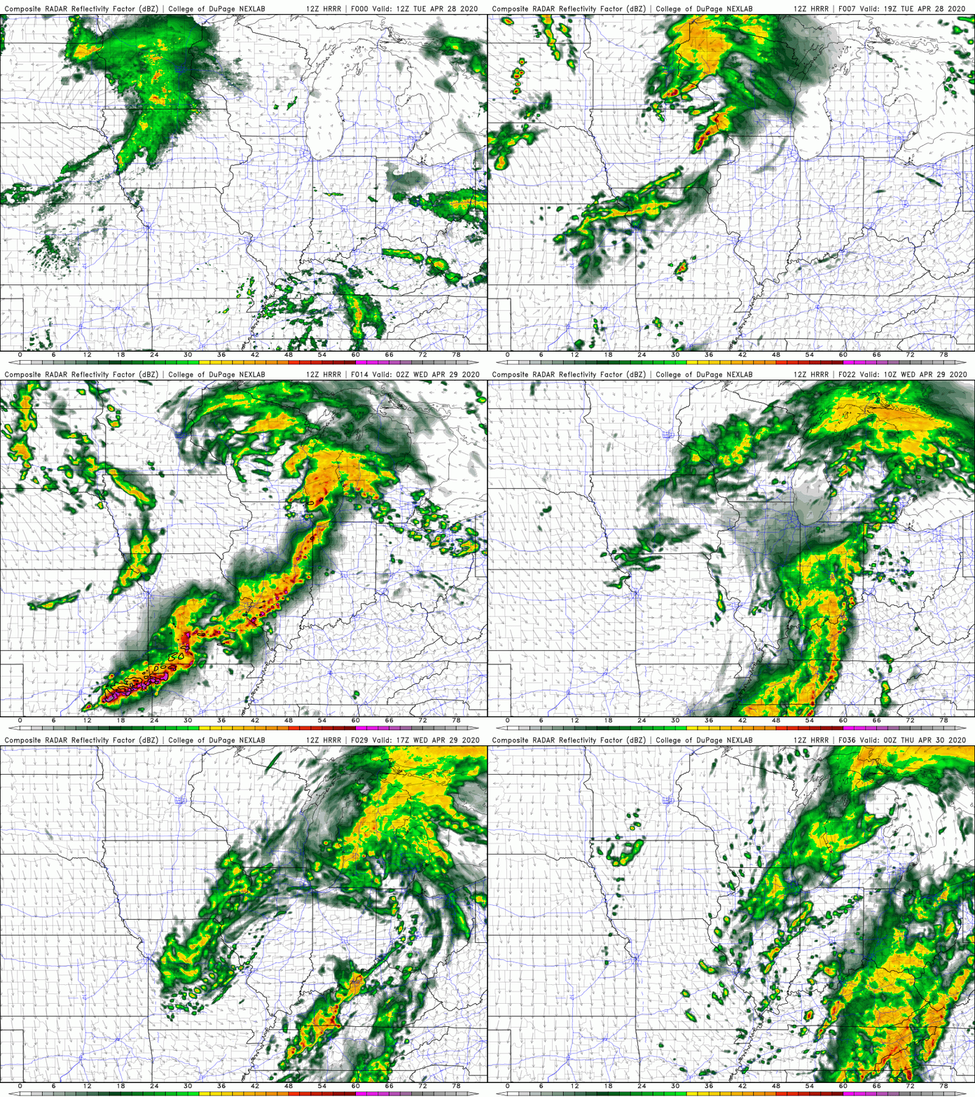
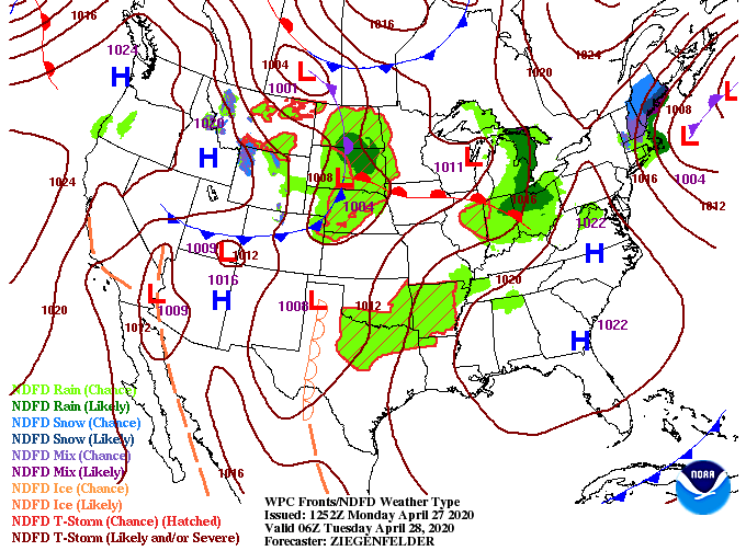
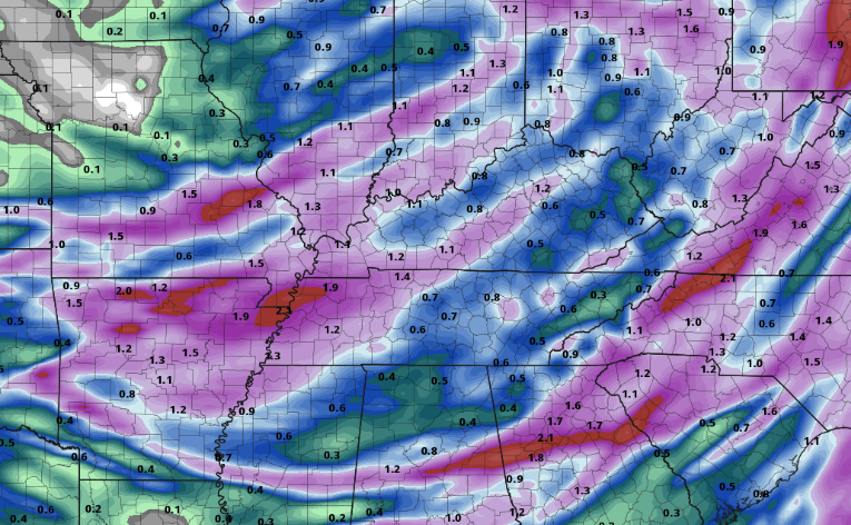
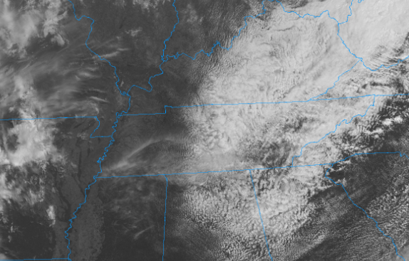
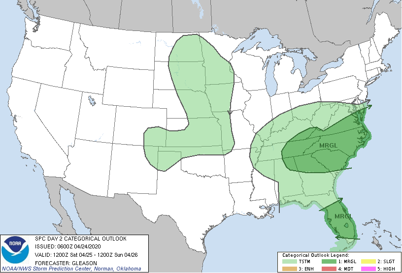
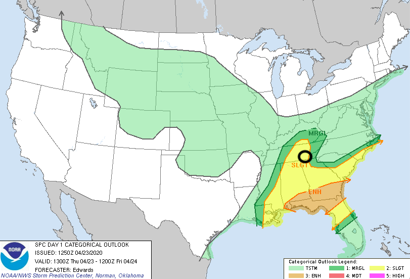
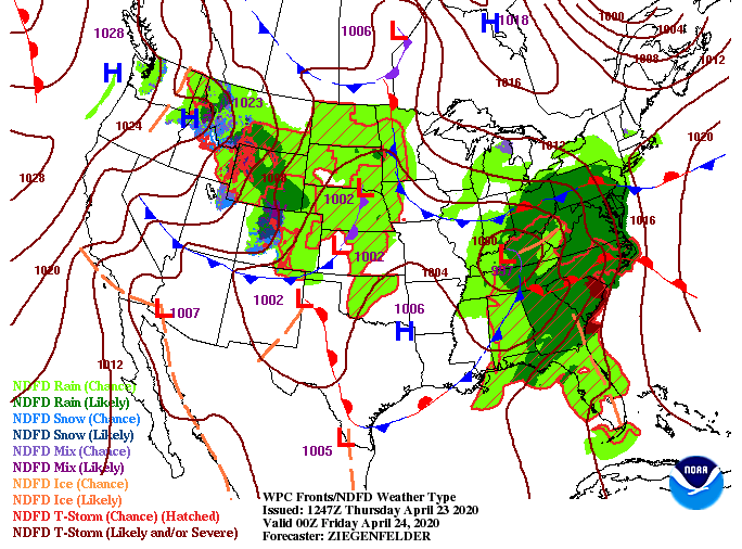
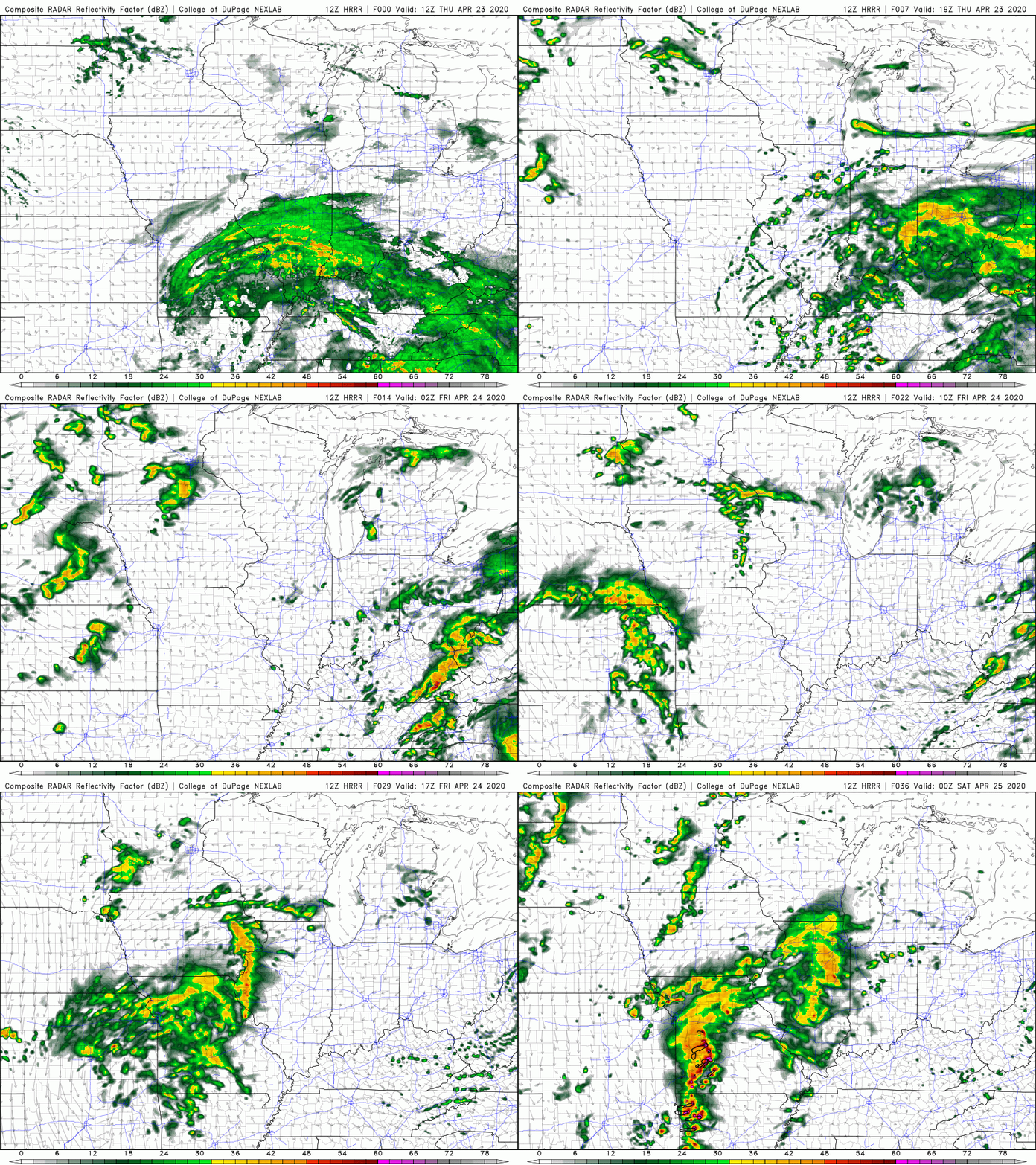
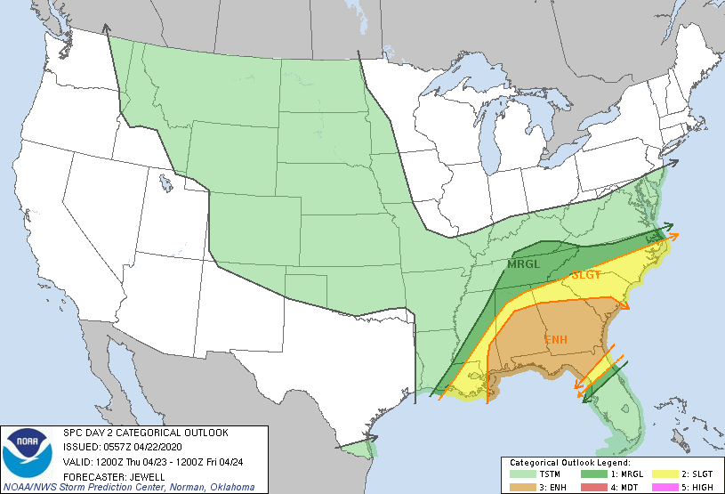
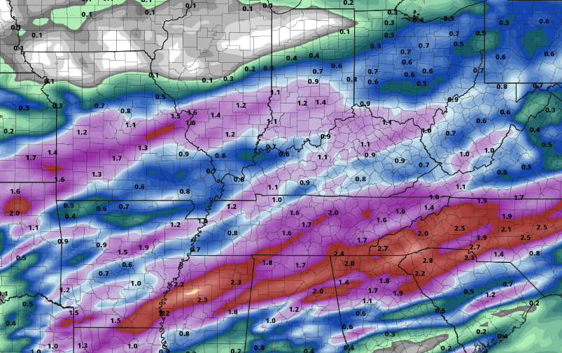
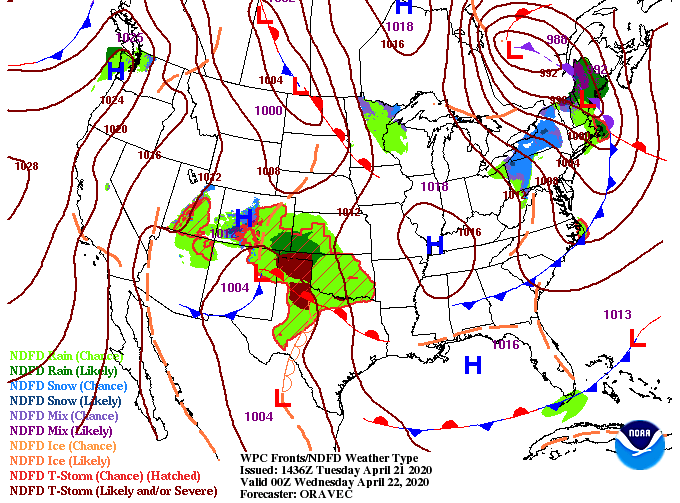
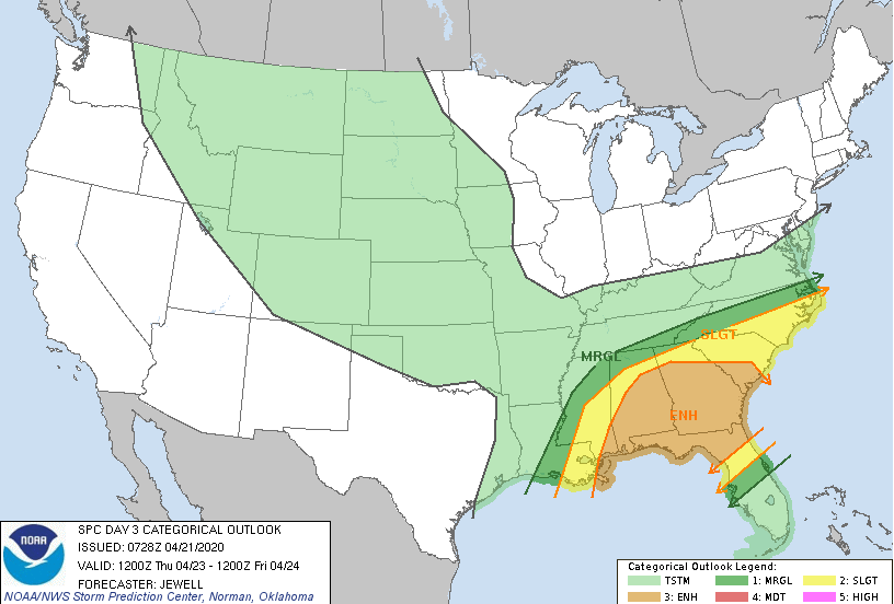
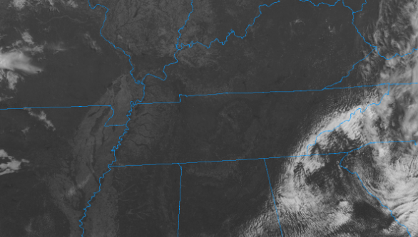
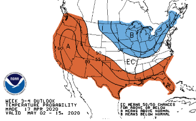
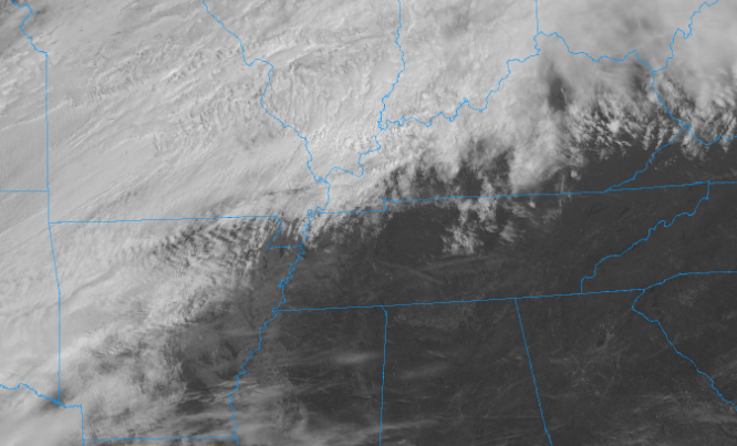
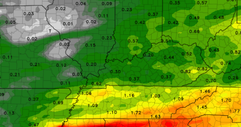
Severe potential remains low today as east Tennessee lies under a marginal risk this afternoon. Showers and storms will begin working in between 2 pm and 6 pm. Gusty winds and small hail can't be ruled out so use caution. High's will be comfortable in the lower 70's. Model guidance shows a few spotty showers into this afternoon before heavier showers and storms arrive. As mentioned, 2-6 is the timeframe for these storm to work in. Though severe potential is low, be weary of gusty winds, small hail, and localized downpours. Breezy conditions will continue today as winds out of the south are kicking gusts up to 30 mph. A cold front will slide through overnight cooling things off for Thursday into the low 60's. Spotty showers remain possible the first half of the day tomorrow before some clearing begins overnight. Sunshine and warm temperatrues move back in Friday and the weekend. We will more than likely transition into early May with below average temperatures. The latest from the CPC suggests cooler air for the first week of May for much of the eastern US. This won't last long though; warmer temperatures are expected to follow close behind. That will do it for today but use caution with some of the heavier showers & storms this afternoon and don't blow away with the breeze we have been seeing so far! A mix of sunshine and cloud cover will dominate the day as high's will climb into the mid 70's. Wednesday's forecast is a bit different though as showers and thunderstorms are expected. Looking first at today's surface map (left), severe storms are likely throughout parts of Oklahoma, Texas, Arkansas, and Missouri this afternoon. As they slide east ahead of the cold front, they will begin dying out overnight. Jumping to the SPC outlook (right) a slight risk is in place for northern Georgia and parts of Alabama. The main line of showers will start our day Wednesday bringing the chance for moderate rainfall. The threat we will be eyeing comes in the afternoon and evening hours tomorrow. As you can see, parts of Arkansas and Oklahoma will see very strong storms this afternoon and evening before that line of storms weakens overnight. It will arrive to our neck of the woods by the morning hours bringing moderate showers (non-severe) to the area. As daytime heating persists tomorrow, we could see stronger showers develop in the afternoon. I wouldn't be surprised to see the SPC extend the 'slight' risk a bit further north (into TN) as the chance for strong to severe storms is possible. We will continue to monitor this but be aware that gusty winds and hail are possible tomorrow afternoon & evening. That wraps it up for today...have a good Tuesday and stay dry for Wednesday. For more information on how Secret City Weather can help you and your business, contact us at [email protected] or visit our "services" tab. We started the morning on the cool side with temperatures in the lower 40's but that will quickly be replaced with warmer air to the west. For this afternoon, look to have high's near 70 with sunny skies overhead. For the days ahead, a low pressure system (currently in the Upper Mid-West) will begin working east. With this system, a cold front will begin extending down from the Great Lakes to southern Texas. Ahead of this front is where we will see most of the action late Tuesday and throughout Wednesday. Severe potential remains low in our neck of the woods but a few thunderstorms, gusty winds, and downpours can't be ruled out. Sunshine will stick around this afternoon and again early Tuesday. Cloud cover will increase throughout the day tomorrow as our next rain maker draws near. Showers will arrive late overnight Tuesday and early into Wednesday. We will likely begin the first half of the day with heavier showers and thunderstorms before scattered showers follow overnight. Clearing will take place Thursday afternoon with sunshine and warmer temperatures Friday and the weekend. Rain totals Wednesday and early Thursday will be in the ballpark of 0.5" and 1". Locally higher amounts are likely within heavier pockets of showers/t'storms. That will wrap it up for today but enjoy the sunshine and warming temperatures before showers return Wednesday. Happy Friday! Cloud cover is beginning to thin out across the region with a mix of sunshine likely to return this afternoon. High's will remain around that 70 degree mark but cooler air will eventually find its ways back the later part of the weekend. Looking into what is next, a marginal risk for severe weather is present tomorrow. Very similar to what we saw yesterday, heavier showers, rumbles of thunder, small hail, and gusty winds are all possible. Severe weather potential is low but can't be ruled out. Short term model guidance hints at heavier storms developing in the afternoon hours for parts of the plateau and moving north and east. Keep in mind the first half of the day should be mostly cloudy with shower activity not arriving until after noon. Showers and a few rumbles of thunder will carry into the evening before clearing begins taking place Sunday. A cold front will swing through backside, dropping temperatures into the upper 50's to lower 60's on Sunday. Sunshine and warmer temperatures work back in Monday and Tuesday. That concludes today's forecast but keep the umbrellas handy for tomorrow, light jackets for Sunday, and sunglasses for Monday. Have a good weekend! The moderate showers we saw this morning have worked out becoming more scattered early this afternoon. This will be the trend for the next several hours before a line of heavy showers & storms rolls through this evening/ overnight. We have highlighted our "target area" which encompasses parts of the Plateau and southern Valley. Taking a step back from today and looking longer term, a reprieve from showers will come tomorrow afternoon before another system arrives Saturday. Again this will be a single day event as clearing begins taking place Sunday afternoon. Along with showers Saturday, cooler air will follow with high's in the lower 60's Sunday and upper 60's Monday. Anticipate sunny skies to return by early next week. Jumping back into this evening, keep a close eye on middle & southern TN. A line of showers & storms will develop to our west by the evening hours. As they work east, darker shades of yellow and red work through the Plateau and Chattanooga area. The timeframe for heavier showers & storms will be between 8 pm and midnight for the central valley. For those to the west (Plateau & parts of the southern valley) 6 pm - 10 pm is a better timeframe. Keep in mind the best threat lies to the south and west but gusty winds, heavy downpours, and small hail are all possible. Model guidance continues to suggests this line to be broken so not everyone will be impacted. Nonetheless be weary as we work into the evening and overnight. Severe weather confidence remains low but check in for updates if things change. If you aren't on Facebook or Twitter, you can always follow along here on the website. Our tweets are posted on the far right side of this page. High thin clouds continue working in this afternoon with showers eventually arriving overnight. We'll stay dry and comfortable today with high's around 70 degrees. As we work ahead, a different forecast is in store for Thursday. Much of the deep south is at risk for more severe weather through the day tomorrow. Here at home, the SPC has marked us in the 'Marginal' risk. This means severe potential is low, but I do expect heavier showers, some rumbles of thunder, and gustier winds at times. The timing of showers will come in the early morning hours tomorrow and continue throughout the day. By Friday morning, this system will begin moving east allowing for a bit of clearing in the afternoon. Some of us could even see a mix of sunshine and cloud cover Friday afternoon. This will be short lived, though, as scattered showers return Saturday. As the post titled hinted at, lots of rainfall is expected tomorrow. The central valley is looking to have between 1" and 2" with locally higher amounts possible. Moving further south, Chattanooga and northern Georgia look to be between 2" and 3". This is the area we could see the best chance for heavier showers, a few storms, and gusty winds. Again, severe weather potential remains low with gusty winds the main concern. With lots of rainfall in the forecast, flash flooding is something we'll be eyeballing. The WPC doesn't highlight a threat in our area but I believe flood prone areas should be cautious throughout the day. We welcome your weather reports which can be given through email or by social media (Twitter & Facebook - @SecretCityWx). Thank you for being patient and I hope you checked out our daily video forecast (for those on social media). The web host we are under has had several issues today, but luckily those have been fixed. Temperatures outside are rather comfortable but breezy conditions could make it feel cool to some in the shade. If we look ahead, Wednesday will be almost a carbon copy of today with high's back in the lower 70's and mostly sunny skies. By the later part of tomorrow, cloud cover will work in as showers return Thursday. Another active set of days are in the forecast for the deep south with parts of Florida, Georgia, South Carolina, and Alabama under an enhanced risk (Day 3). As indicated by the image below, I believe much of the severe weather will stay to our south. This doesn't rule out the chance for a few thunderstorms and gusty winds, but the "severe stuff" should stay south. Chattanooga would be the only area of concern (right now) as there could be some "ingredients" in place. We will continue eyeing this next system, but until then, enjoy the sunshine and comfortable temperatures! That will wrap it up for today; thank you for being patient and I hope we are back to normal tomorrow. After steady showers last night and into this morning, we have cleared up nicely. Just over 0.8" is what we picked up since midnight. Luckily, lots of sunshine has returned with temperatures staying pretty fair as well. Looking ahead, a weak front will slide through overnight providing a very slim opportunity for showers. Most of the region will stay dry but we left a small chance for mainly the northern Tennessee valley. Tuesday and Wednesday will be sunny and comfortable as a high pressure system will stick around. We are looking at Thursday for the target day of shower activity to return. The latest data suggests moderate & steady showers with upwards of an inch to 1.5" through the day and into Friday. As we work into the later half of April, what does early to mid-May entail? The latest from the CPC suggests average temperatures. Keep in mind the average high for early to mid May is in the mid to upper 70's. That means over the next few weeks we will gradually warm up as we inch further into Spring and closer to Summer. Go out and enjoy the sunshine early this week before rainfall arrives the later half of the work week and into the weekend. If Secret City Weather can help you or your company, visit our "Services" tab at the top of our page or send us an email at [email protected] and we would be happy to work with you! Lots of sunshine has started the day with temperatures currently in the low 60's. Cloud cover, as you can see below, is slowly working east. Expect a mix of clouds to work in by this afternoon/evening and showers by the late overnight hours. Luckily, this rain maker will be quick hitting with the majority of rainfall while many of us are asleep. The timing will be early in the morning (1-3 am) with rainfall moving out between (7-9 am). Rainfall totals will be around a quarter of an inch with half an inch possible in isolated areas. With this system being an early morning one, sunshine will return by tomorrow afternoon. If you had any plans tomorrow and see rainfall in the forecast, don't let it damper your day! Cooler and drier air will be around tomorrow afternoon with sunshine overhead. As highlighted by our title post, round two of showers arrive mid-morning Sunday. These will start scattered with more moderate showers overnight and into Monday. A few rumbles of thunder are possible as well but nothing is expected to be severe. Sunnier skies return Monday afternoon and through Tuesday. Shower totals will vary depending on your location. Tonights rainfall will leave around a quarter of an inch for most of the area. Sunday's system will primarily be to the south, providing 1 to 1.5" of rainfall for Chattanooga and southern TN. Closer to home, expect upwards of 3/4" with locally higher amounts possible. If you had afternoon plans Saturday, keep them! Rain will move out in the morning with clearing by the afternoon. Much of Sunday and early Monday will be wet but sunny skies return early next week. Have a good weekend! |
Your trusted source for everything weather in East Tennessee.
Social Media
|

