|
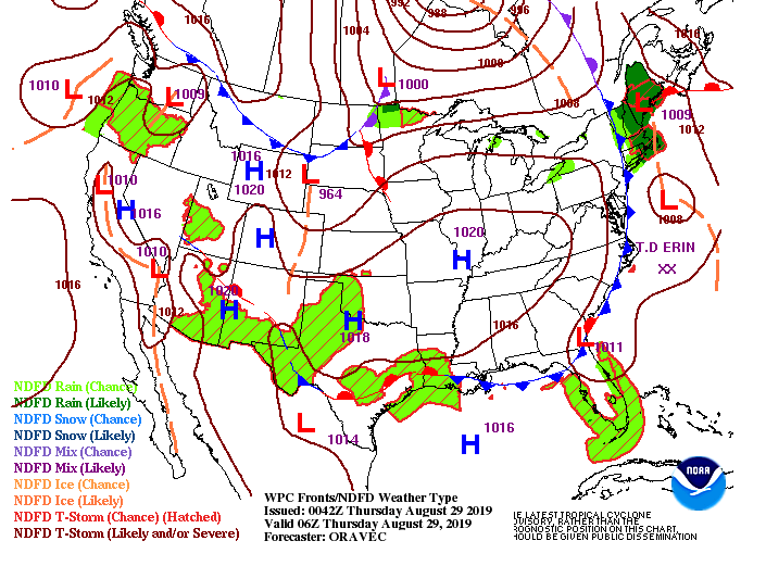
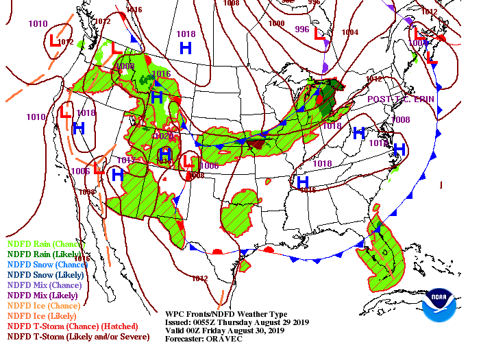
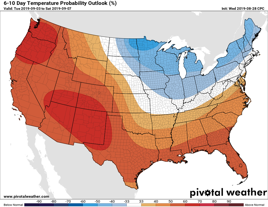
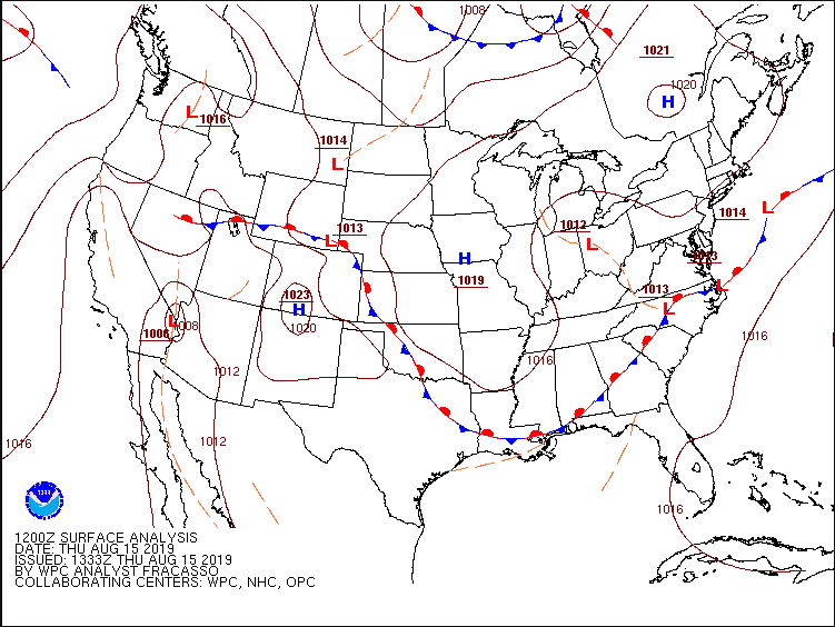
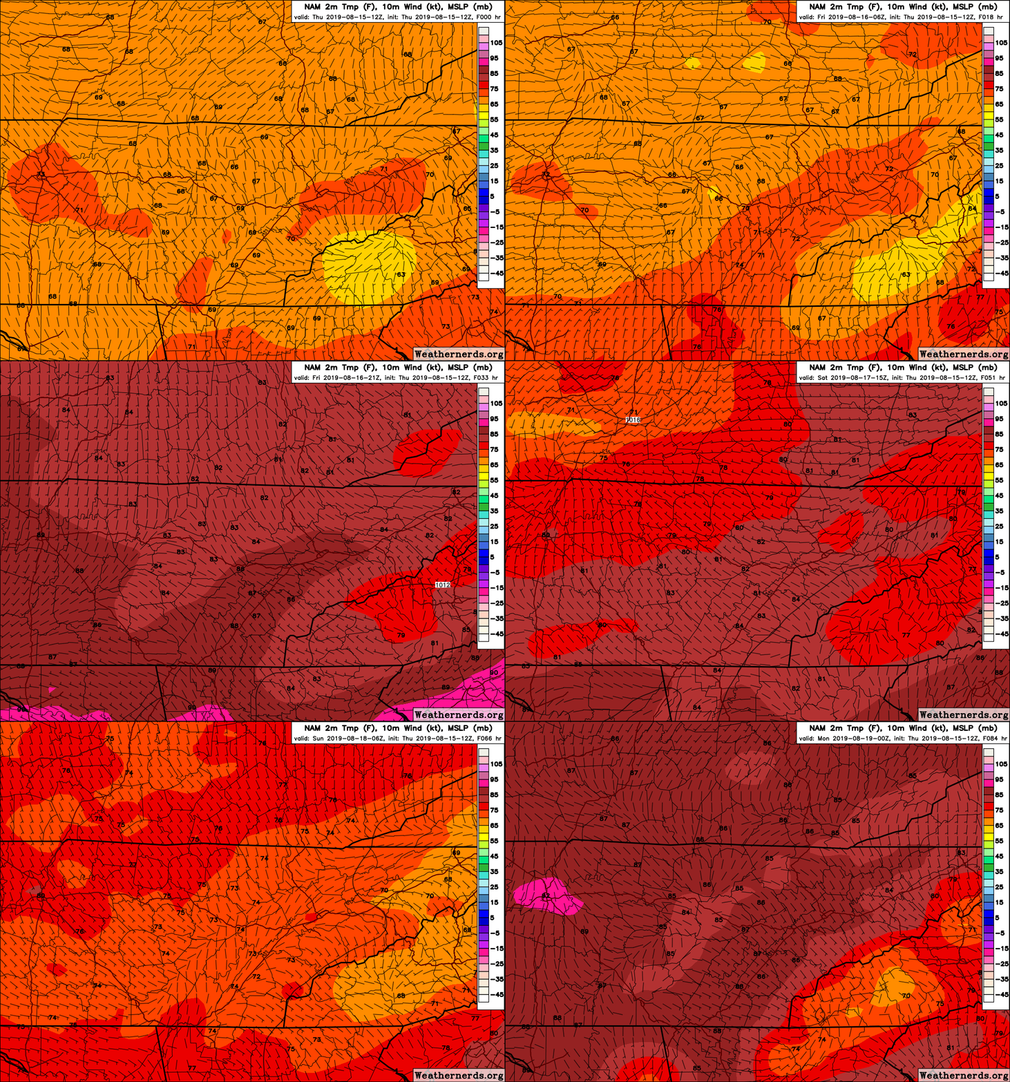
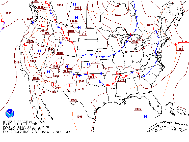
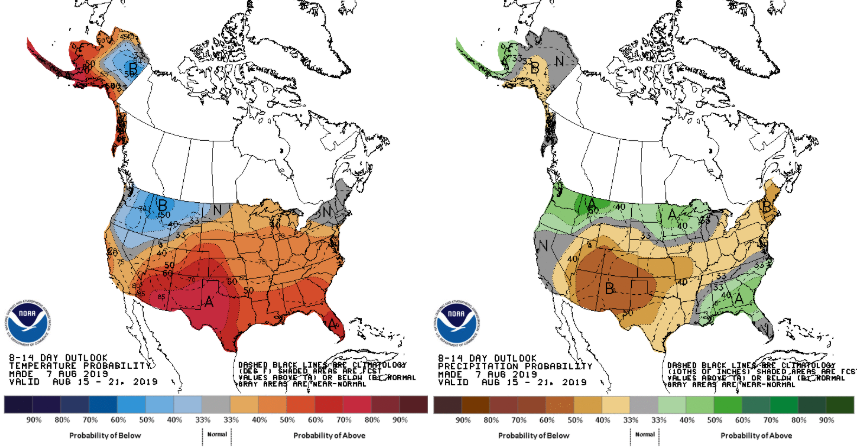
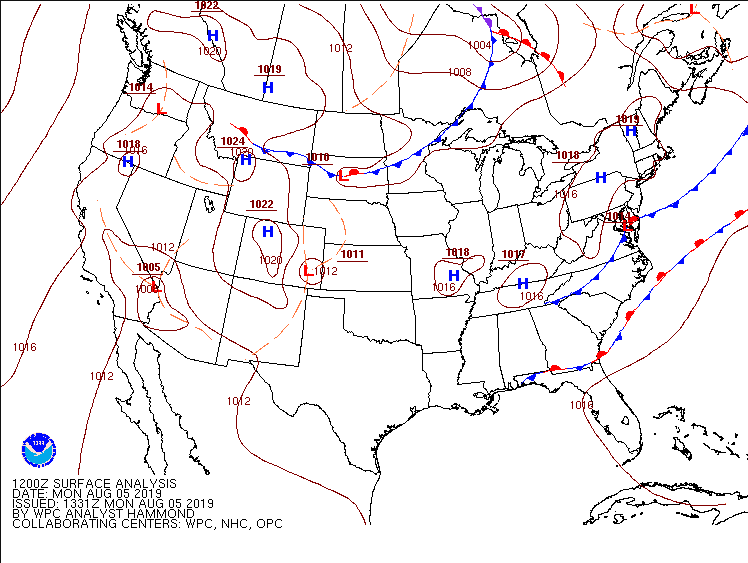
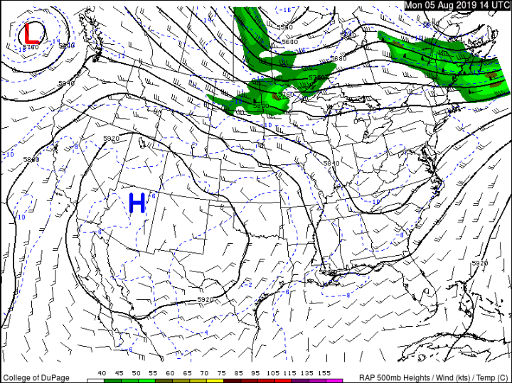
Happy Thursday! It will be another beautiful below average (temps) day for east Tennessee. Don't get too excited, though, as much warmer temperatures are already on their way. Taking a look below (from left to right) we have a high pressure system pushing through the eastern portion of the U.S. This will keep us dry through the day today, tomorrow, Saturday, and much of Sunday. As we get into Friday (right image) this high pressure system will continue pushing east allowing for the return flow of warmer temperatures and increased moisture. If we look at our latest models, we see the high pressure system keeping us dry for the next few days. As we get into Sunday, the chance for an afternoon pop up storm or two becomes possible. Looking into next week, much of the same is expected. Another high pressure system will move in (further to the north) keeping us pretty dry. Slightly warmer than average temperatures and the chance for isolated afternoon pop up storms remain the forecast for the first half of next week. Looking longer term (next 6 to 10 days) the temperature outlook looks to be near to slightly above the average for this time of the year. This is unfortunate for the Fall lovers, but Fall will get here soon enough, just be patient. Precipitation over the same period (6-10 days) will be near to slightly below the average. Overall, we will continue this summer time pattern of warm temperatures and the chance for afternoon pop up storms. Have a good rest of the week and enjoy a sunny and warm weekend; perfect for the lake!
0 Comments
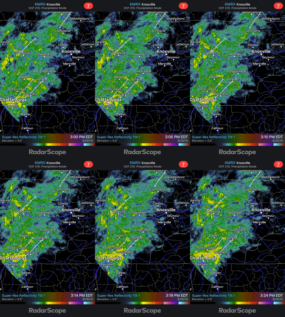
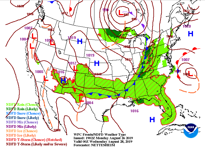
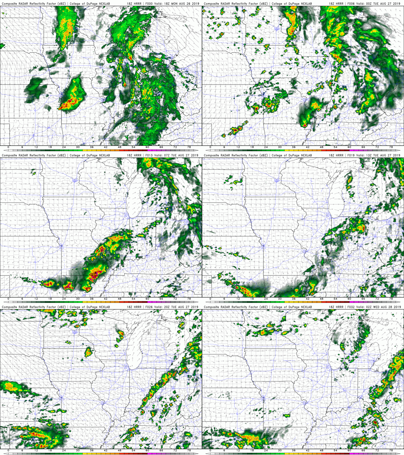
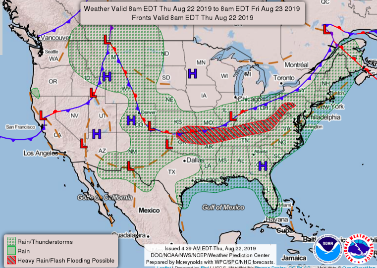
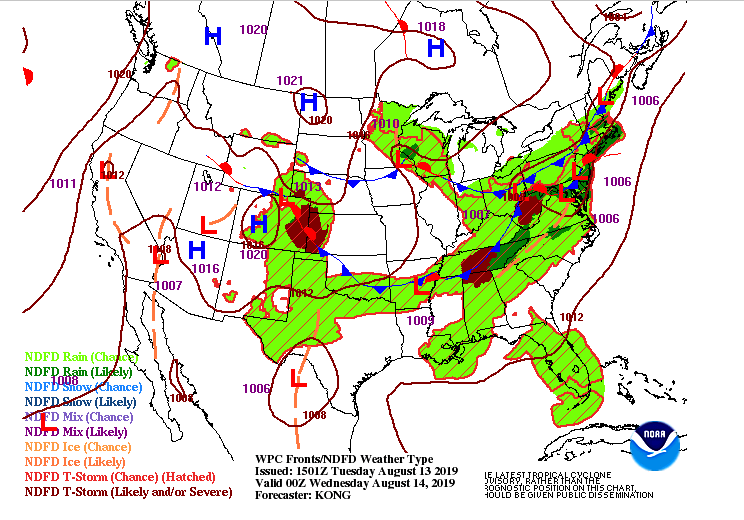
I hope everyone remembered their umbrellas out of the door this morning as its been a wet one so far. As we continue into this afternoon and evening, showers will continue on and off. A few rumbles of thunder can not be ruled out, either. Radar (below) shows the steady showers that are currently falling throughout much of the area. Analyzing the Tennessee valley, we see a very slow moving front. This is what brought many of the showers and storms late last week and into the weekend. It will continue to slowly move through the area before moving out tomorrow afternoon. Once this moves out, a separate cold front will push through bringing showers and thunderstorms late Tuesday and into Wednesday morning. This graphic shows the cold front moving through the Tennessee and Ohio Valleys Tuesday around 8 pm. Note behind this front is a strong high pressure system that will dry us off through the remainder of the week. Ahead of this cold front, expect a line of scattered showers and storms to push through. This will be much different than the light and steady showers we have felt today. If we look at our model guidance (below) we see that line of storms develop late Tuesday before becoming scattered. This is good news, as nocturnal cooling will help cap off or "kill" the stronger storm potential that is present during the daytime hours. With this system, we can't rule out some stronger storms (gusty winds, lightning, and small hail), so stay weather aware. The good news is Thursday looks to be beautiful with sunny skies, much lower humidity, and high's in the low to mid 80's. A high pressure system will move in (as mentioned) bringing us plentiful sunshine to closeout the week. We will stay sunny through the weekend with temperatures increasing, along with humidity (creeping back in), each day. By Sunday afternoon and into early next week, we could see the chance for afternoon pop up storms return. Until then, stay up to date on our social media handles (Twitter/Facebook: @SecretCityWX) for the latest!
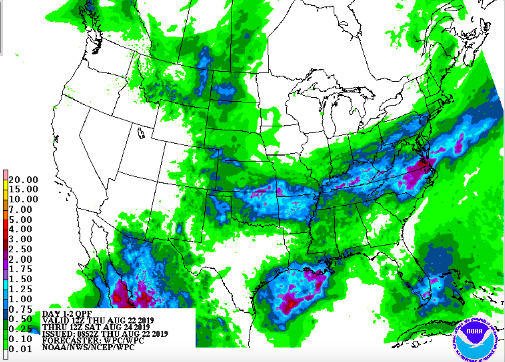
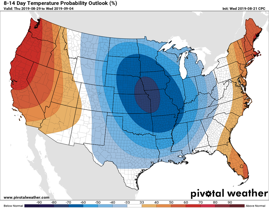
As I said earlier in the week, a break in the heat is near. In fact, Friday and into this weekend we will be back in the mid 80's for high's. A low pressure system and its associated cold front are making their way southeast this evening bringing with it showers and thunderstorms. We are seeing a few isolated storms popping up already and this will continue into the afternoon. The latest high resolution model suggests more widespread showers and storms moving in by late this afternoon and into the overnight hours. I am not expecting a washout for the area but localized flash flooding (in heavier thunderstorms) can't be ruled out for flood prone areas. Overall, tonights activity will be scattered at times with heavier downpours, gusty winds, and lightning all likely. The Weather Prediction Center has a QPF (Quantitative Precipitation Forecast) of around 1 inch of rainfall through very early Saturday morning. Higher rainfall amounts are expected in portions of northeast Tennessee. Overall, we will add some much needed rain to the bucket and also cool off a little bit. Looking ahead to the 3-4 day model guidance, we will return to partly cloudy skies and the chance of afternoon pop up storms each day for the start of the work week. Temperatures will also remain average for this time of the year, in the upper 80's for the first half of next week. Looking ahead to end the month of August and into the first week of September, we will likely feel slightly below average temperatures. So yes, FINALLY some cooler temperatures for east Tennessee. Don't get too excited, though, as we will remain pretty muggy and likely continue the chance for afternoon pop up storms. Check back in with us on social media for the latest in regard to tonights storm activity and I hope everyone has a good rest of their day! Remember to follow us on Twitter and Facebook (@SecretCityWX) and, if you don't mind, share Secret City Weather with your friends and family!
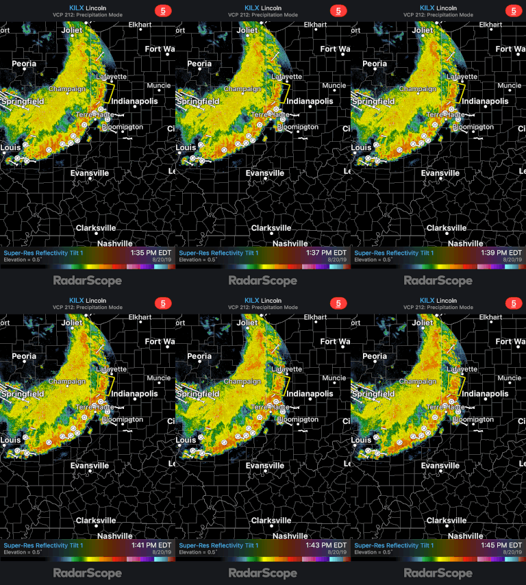
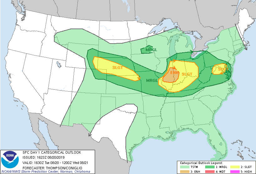
Good afternoon! A little update in the weather world for tonight. We are currently tracking a large complex of storms residing in Illinois and Indiana. This system is moving southeast, eventually arriving into western/central Kentucky and middle TN. Lucky for us, this system will weaken substantially before arriving into east TN. As you can see from the latest model guidance, this system will travel southeast this afternoon before dissipating as it arrives to Tennessee. With the loss of daytime heating and a large ridge to our southeast, it will help in the dissolution of this system. For tonight, we will be closely monitoring how well this storm stays (or doesn't stay) together. As models suggest, I expect this storm to begin dying out as it reaches western and central Kentucky (near sunset). This will leave some of us with remnant scattered showers and storms around the midnight hour. Aligned with the recent data and current forecast, the SPC has released the latest graphic showing areas with the highest severe risk. As suggested, we could see some scattered thunderstorms tonight but the severe potential is very low. The northern half of TN is under a marginal risk (category 1 of 5). We will continue to update you on the latest, but expect some scattered showers and storms from a quickly dissipating system around the midnight hour. We will clear up late leaving partly cloudy skies and high's around 90 degrees for your Wednesday.
I hope everyone has stayed cool the past few days as we have had high's in the low to mid 90's each day. Unfortunately, these temperatures will continue through much of the first half of the week along with higher humidity. Below is the current surface map showing the high pressure system that has kept us so hot and dry for much of the later half of last week. Today, this high will begin pushing out where a front will move into the area by mid week. Looking at the heat indices for tomorrow, we will stay hot with temperatures near the triple digit mark Tuesday afternoon. As we transition to Wednesday, we will feel slightly cooler as clouds begin to move in ahead of the front. The latest model data shows isolated pop up storms this afternoon and tomorrow afternoon (mainly in the higher elevations). As we move into Wednesday, cloud cover increases and so do those rain chances. Models are suggesting our best chance for rain comes Thursday and Friday. With rain chances higher toward the end of the week, we will also have cooler temperatures, thanks to cloud cover and rain-cooled air. Looking ahead, the end of August looks to be back toward average with high's in the upper 80's and near to above average precipitation. For you Fall lovers, Summer looks to be far from over. As we get into September, we will be eyeing for any pattern changes that hint toward to arrival of fall and those cooler temperatures.
It has been a beautiful day so far with seasonal temperatures, plentiful sunshine, and limited cloud over (as seen on satellite below). Lucky for us, those high dew points have decreased a bit today allowing us to feel much closer to the true temperatures. Enjoy it while it lasts, as very warm temperatures are set to arrive starting tomorrow and into this weekend. Those higher dew points will also make a comeback, making us feel much closer to the triple digit mark by Sunday afternoon. Analyzing the current surface map, a high pressure system is continuing to settle into the area keeping us "high and dry" for the next several days. Unfortunately, as it meanders to the east by this weekend, we will get clockwise flow pulling in warm temperatures and muggy conditions once again. This will allow for your typical afternoon pop up storms to occur for Sunday and Monday . By Monday afternoon, a dominating ridge will settle over the central portion of the US maintaining those warm and muggy conditions for much of next week. Expect highs in the upper 80's and low 90's, as well as afternoon pop up storm chances each day. Model guidance shows that ridge playing its part by keeping us dry through Saturday afternoon. An isolated shower or two cannot be ruled out for the northern portion of middle Tennessee Friday afternoon and Saturday, but given the parameters needed, as well as ample moisture, this chance is low. Nonetheless, expect east TN to continue staying mostly sunny with high's increasing each day. Below is a model run over east TN depicting the temperatures through Sunday afternoon. As the GIF plays through, notice those purple colors by Sunday. Models are indicating very warm temperatures Sunday with high's in the low to mid 90's and "feel-like" temperatures pushing the 100 degree mark. For those of you who enjoy the lake, Saturday looks to be the perfect day as we will be warm with mostly sunny skies. Don't forget to share your outdoor weekend adventures with us by sending pictures to [email protected] or tagging us on Twitter or Facebook @SecretCityWX. I hope everyone has a great rest of their week and remember to stay cool & well hydrated this weekend!
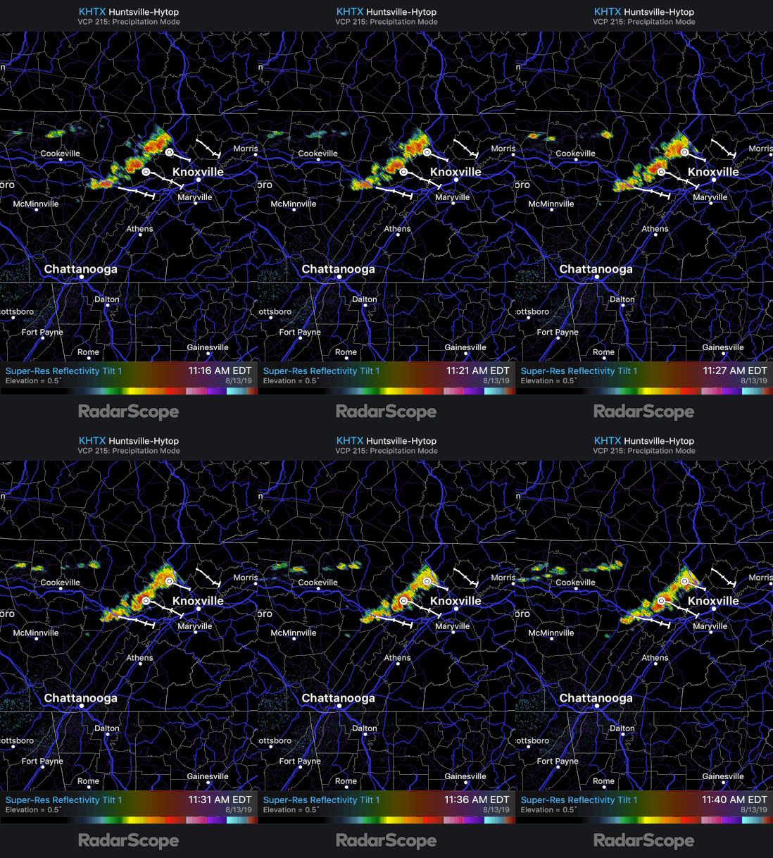
Good afternoon and happy Tuesday. There has been some changes on the storm chances this afternoon. We are expecting those strong to severe storms to arrive earlier than previously thought. As the cold front works its way through Kentucky and Tennessee this afternoon and evening, it will provide lots of forcing in an unstable atmospheric environment. Currently, we have a line of storms pushing through parts of the valley bringing lightning, heavy downpours, and small hail in spots. As we get further into this afternoon, storms will become more widespread throughout the area. As of 12:05 pm, NWS Morristown has issued a SEVERE THUNDERSTORM WARNING for parts of Roane, Anderson, Knox, and Loudon counties. Hazards associated with this warning include wind gusts up to 60mph and hail up to a quarter in size. This warning is valid to 12:45 pm. Unfortunately, the radar site in Morristown is under maintenance this week so we must use other locations that cover parts of the area. Bare with us as precipitation and data may not be as clear (on radar) with the main site down for the week. Looking ahead, storms will continue to develop this afternoon bringing with it the chance for damaging winds, hail, and flash-flooding. With this environment we can't rule out isolated areas of spin-up, but confidence is very low in this. By tomorrow morning, showers and storms will have moved through leaving mostly cloudy skies. By the afternoon, we will start to clear out leaving high's in the upper 80's and partly cloudy skies. For the remainder of the work week, a high pressure system will move in leaving us dry with high's in the upper 80's. We will also feel a bit more comfortable as dew points will be lower. Friday and into this weekend, the moisture will return and so will the higher temperatures. Until then, continue monitoring our social media for the latest in the development of these storms today.
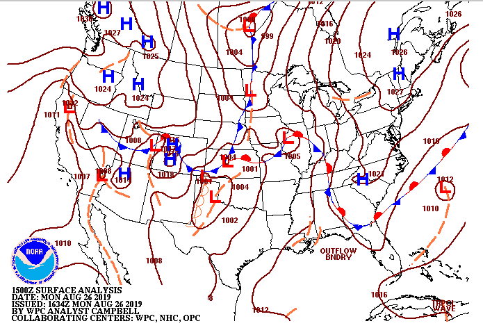
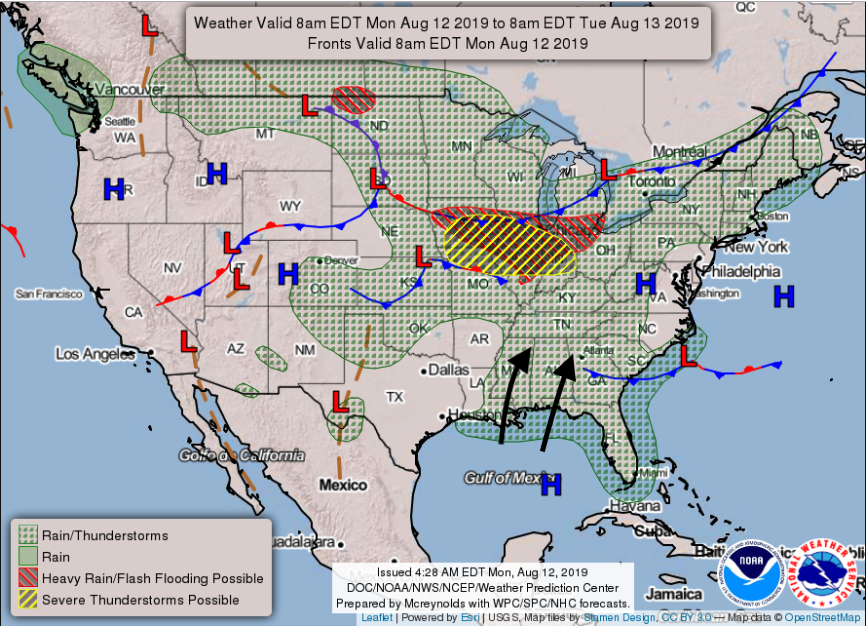
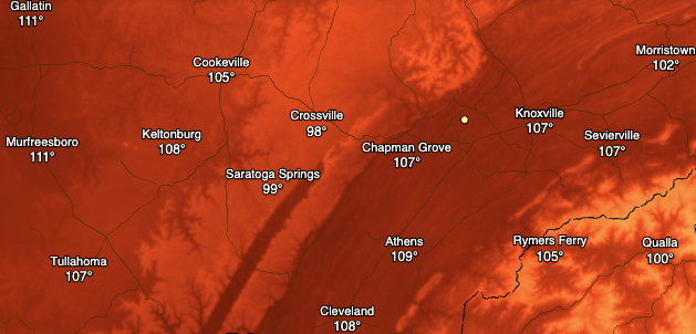
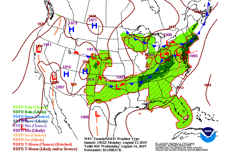
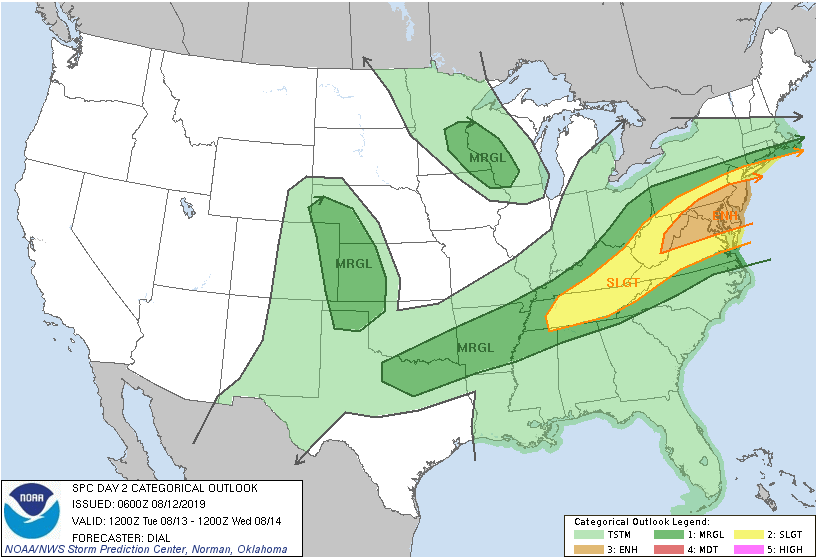
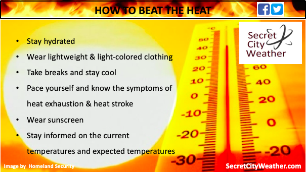
With lots to discuss, let's jump right into it. First, it is important to note we have released a HEAT ALERT for today (Monday) and Tuesday. This means abnormally high temperatures are expected across the east TN area. In addition to temperatures being in the mid 90's, the humidity will make temperatures feel close to 100 today and close to 110 tomorrow. With this said, PLEASE use caution if outdoors as heat exhaustion and stroke can strike quickly. Also, "look before you lock" as more than 30 children have already died in 2019 due to being left in hot vehicles. So why is it SO hot? Taking a look below is the current surface analysis graphic from the NWS. The high pressure system that has been keeping us dry this weekend has now pushed east. In return, the clock-wise flow allows for moisture to be pumped into our region (as shown by the arrows). With the combination of a dominate high pressure system and moisture being drawn in, temperatures are expected to feel in the triple digits through tomorrow. As an example, models are picking up on temperatures feeling close to 110 degrees for much of the valley by 4pm tomorrow afternoon. With these conditions, heat exhaustion and heat stroke can strike fast. Know the warning signs for each by referencing this site. Beyond the temperature hazards, we could also see the chance for severe weather Tuesday night. Taking a look below, you can see a front moving through the area. With plentiful moisture and heat already in place, this front will provide additional forcing (creating an unstable atmosphere). As of now, it is hard to pick up on the exact timing and impacts. As we get into tomorrow, I will have a better idea on the variables going into the forecast. I will mention that the rain we do receive will be "spotty". What I mean is stronger storms will produce heavier rainfall in certain spots than in others. Overall, we are in need of rain and, unfortunately, this system will not be a good one for replenishing the whole area. Current data has models suggesting a line of storms developing tomorrow night ahead of the front between 8 pm and 1 am. Depending on the exact time this forms, it can play a big factor in the severity. If this line forms early in the night (8pm or earlier) we could see a higher possibility of some severe weather. Another factor is cloud cover. Cloud cover will also play a part in temperatures tomorrow afternoon. If clouds arrive by tomorrow afternoon, temperatures could be a bit cooler (this is relative) than if they arrive later in the day. With all of this said, I would not be surprised to see NWS Morristown issue some Heat Advisories across the area, but again, this will depend largely on when clouds ahead of the front arrive. Below is the latest Severe Prediction Center release depicting the east TN region under a slight risk for severe weather. This system is a bit complex and hard to forecast for a full 30+ hours in advance with so many variables not completely known. As of now, I do expect a line of storms to develop tomorrow evening/night with the chance of some severe warned storms. This line will develop to our north and depending on the variables and timing, could keep its "form" (linearity) through our area. The greatest impacts associated with this will be damaging winds, large hail, and isolated areas of heavy downpours within stronger thunderstorms. I will continue to monitor this system as it nears, so check back in tomorrow via Twitter and Facebook (@SecretCityWX). For those who do not have social media, you can follow along by viewing our tweets to the right of the screen. Simply scroll through or click on our twitter to view all of our content. For some ways to beat the heat, check out our latest graphic below. I hope everyone has a good start to their work week and remember to continuously check back in with us for the latest on the heat and tomorrow's severe potential.
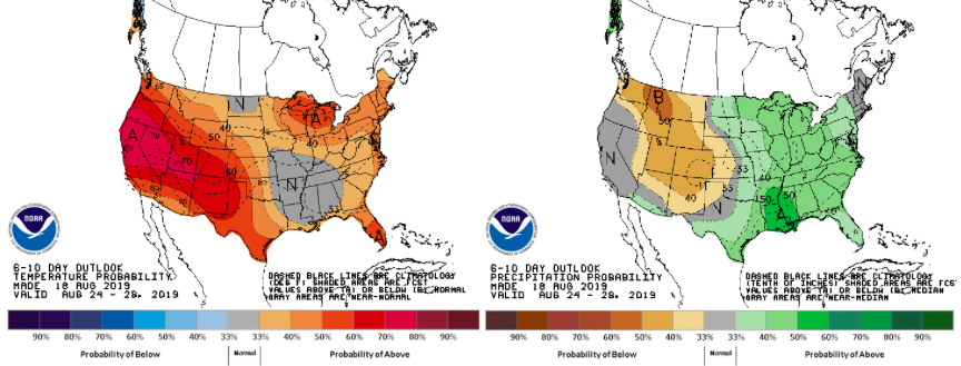
Good morning and happy Friday-Eve. We have had patchy fog around the region for much of the morning. Luckily, that is beginning to lift and fade out leaving behind partly sunny skies and warm conditions again today. The latest surface analysis shows a familiar pattern with a cold front drapped to our north. Just like earlier this week, this cold front will move through tomorrow bringing showers and thunderstorms. Models suggest the timing to be later in the day and into the overnight hours Friday. Looking ahead, scattered showers and storms will roll through late Friday leaving behind some residual showers and storms for your Saturday. As we continue through the day Saturday, a high pressure system (to the north) will move in giving us a warm and dry end to the weekend. The model below is our short term "high resolution" model. As similar models are in sync, it suggests scattered showers and storms begin to move through later tomorrow afternoon and into the overnight hours. I am not anticipating much on the severe side, but some rounds of storms can be stronger at times. Models continue to suggest the bulk of activity will be in middle Tennessee and to our friends to the south and west. Looking long term, the CPC released their latest predictions on temperatures and precipitation over the next couple of weeks. Data is suggesting we will continue staying warm with near average to slightly above average temperatures. For precipitation, we will be near average to slightly below average over the next couple of weeks.
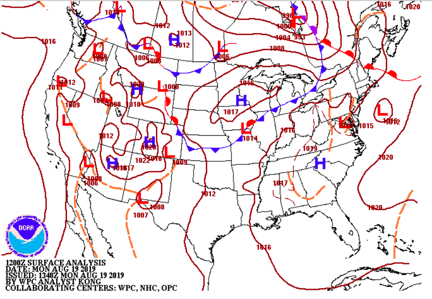
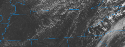
Happy Monday to everyone. This week we will continue much of the same as we have had. Taking a look at the current surface analysis map we see a high pressure system hanging over the region. This will keep us mostly dry and warm today. As we push into Tuesday, I expect much of the same as our next real rain chance doesn't arrive until Wednesday. As you can see from the map below, a low pressure system currently located in the South Dakota/Iowa area will bring with it storm potential mid week. First, looking at our current conditions we see mostly sunny skies across the entire state. Along with the sunny skies, satellite indicates a dense layer of dry air (second image below). The high pressure is contributing to all of these factors, thus, shower potential will be held at bay today. To our east, we could see some afternoon pop up storms (due to orographic lift) but these will stay in the higher elevations. Moving forward, the low pressure system (as described above) will follow the trough pattern (flowing to the southeast), which will impact our area late Tuesday into Wednesday. Along with this low is an associated cold front that will bring storm potential ahead and cooler temperatures following. This will also leave the door open for the remainder of the week as northwest flow in the trough could allow for addition development following the cold front. Overall, Wednesday will involve scattered thunderstorms bringing heavy downpours, the possibility of small hail, and gusty winds at times. Current models indicate the bulk of rain will be in the middle Tennessee area with upwards of half an inch possible. As I mentioned, the current pattern will allow for storm formation each afternoon for the remainder of the work week and into the start of your weekend. As discussed, models are trending toward the bulk of rain landing in the middle Tennessee area. As I do expect this to be the case, I also would warn taking this run as is. I believe in total we could see up to a quarter of an inch in spots with a few strong to even severe storms at times. Friday we could see similar action, but I will have a better picture as time gets closer. Until then, enjoy some sunny weather today and tomorrow. Wednesday we will cool off a bit, thanks to the rain, and then afternoon storms remain possible through the end of the week.
|
Your trusted source for everything weather in East Tennessee.
Social Media
|

