|
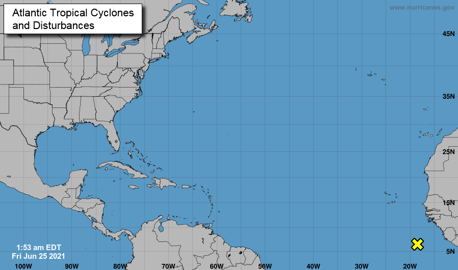
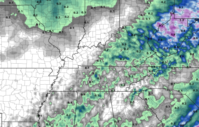
Good news to end the work week: drought conditions have continued to improve. Nearly all the dry spots across East Tennessee have vanished with only a few counties in the west engulfed in the "abnormally dry" this morning. A fairly dry pattern will continue into early next week before better shower chances make a return. After a busy start to hurricane season, the Atlantic is once again pretty quiet. A disturbance is off the coast of Africa, but it is too soon to tell if this will develop and where it may go. Earlier in the week we touched on the idea of heavy rainfall and flash flooding potential. More good news for Tennesseeians -- we miss this opportunity. A low and front are across the Midwest and Upper Mississippi Valley, expecting to dump 7+ inches of rainfall for parts of Illinois. Here at home, high pressure is locked in off the coast of the Carolinas, providing drier weather across the Southeast. Other than a few isolated to scattered afternoon showers/storms, anticipate to stay dry, warm, and muggy this weekend and next week. We will be off this next week from posting on the site, but we'll continue to provide weather updates via Twitter/Facebook. If you don't follow us already, you should! @SecretCityWx Pre-recorded for 5pm show
0 Comments
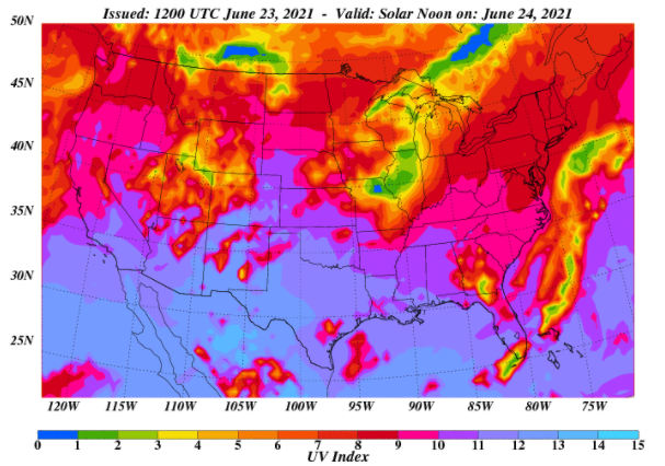
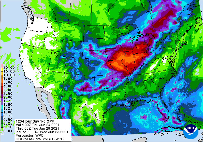
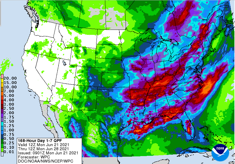
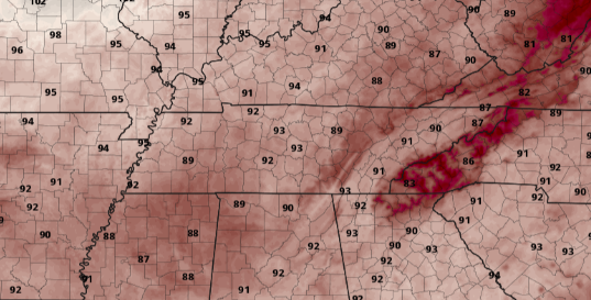
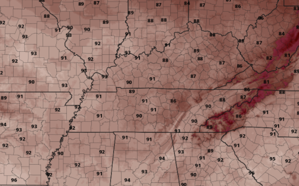
As high pressure sits across Maryland and Pennsylvania this morning, return flow will again raise temperatures today. Highs will generally be in the mid to upper 80s with humidity unfortunately increasing as well. Looking below (valid for Saturday), we'll be at risk for quick sunburns. UV indices will be between 9 and 10 (high) for East Tennessee. Be sure to throw on the sunscreen, bring lots of water, and find a cool spot if you plan to be outdoors for extended periods of time. Moving forward, better news is in the forecast for us (at lease in the shorter-term). As you can see below, HEAVY rainfall is expected across the Upper Mississippi Valley the next few days. In fact, areas of Illinois can expect upwards of 7+ inches by early next week. A low and front will sit nearly stationary just to our west, dumping lots of rainfall across that area of the US. Here at home, scattered showers/storms will be the main impact over the next 5 days with up to half an inch possible (averaged area-wide). Most of us should stay dry into Friday, but as humidity increases, it will lead to afternoon pop-up showers/storms by the weekend. These will become more scattered for Sunday and and and early next week. After a few days of pleasant weather, Mother Nature is cranking back up the heat and humidity. Remember your heat safety and take the proper precautions. Tomorrow and much of Saturday should be good days to cool off at the lake or pool. Pre-recorded for 5pm show
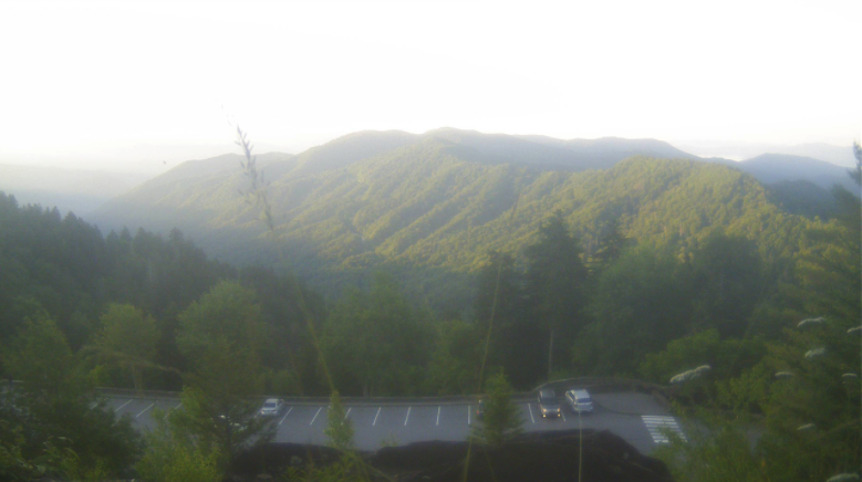
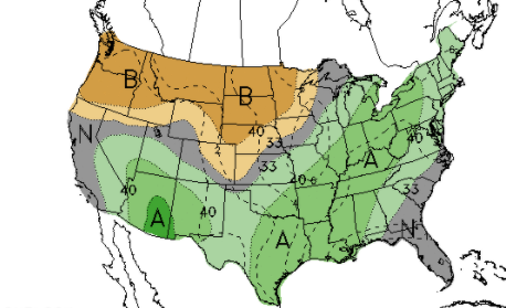
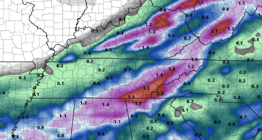
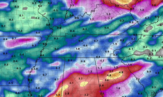
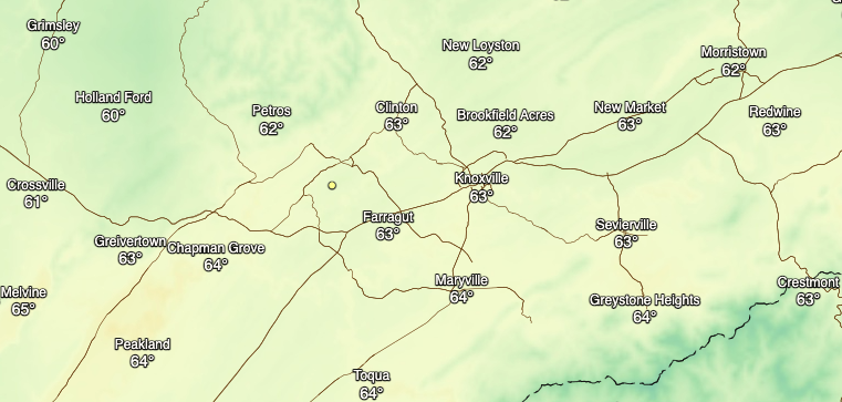
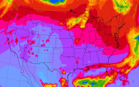
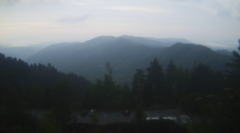
Good morning! It has been a cool but pleasant start to the day so far with light valley fog possible near water bodies. Over the Smokies, the skies are clear and the temperatures are cool. Newfound Gap sits at a temperatures of 50 degrees this morning. As we work forward, the CPC suggests above average rainfall for much of the eastern half of the US. We will begin to see some of this towards the weekend, but much better chances arrive next week as several waves arrive to the region. Looking at long-term data, parts of East Tennessee could receive upwards of 3 inches Friday through Tuesday. Comparing this one model to ensemble data (multiple models), The axis of heavy rainfall could set up further west, keeping East Tennessee on the drier side of weather. For now, the details remain fuzzy as guidance is having trouble pinpointing a solution. We also must account for the 5-7 day range of lead time. Another beautiful day is in the forecast, so take advantage while you can. High pressure will continue to shift eastward, allowing for return flow and building warmth. Highs Thursday and Friday will make a return to the mid and upper 80s, respectively. Find out more details by watching our video forecast below. Pre-recorded for 5pm show
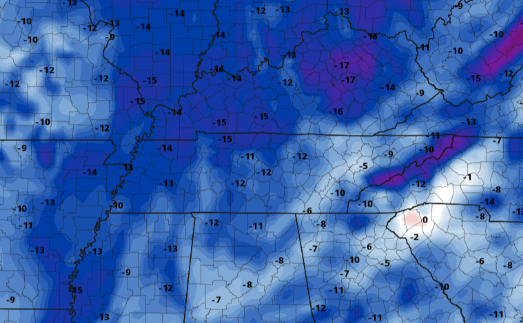
After a fairly active day that brought upwards of 1.5 to 2 inches of rainfall and a few bouts of severe storms, things have calmed down. The last of showers is working east this morning. A cold front also sits along the Appalachians, which will continue to funnel in much cooler air. For this afternoon, highs will range from the mid to upper 70s. When comparing this with the average high for this time of the year, temperatures are 5-10 degrees cooler. For the Smokies, this is 15-20 degrees below average. With that said, this won't last long so take advantage while you can. Looking ahead, a pretty wet pattern is likely to set up. In addition to the moderate to heavy rainfall picked up yesterday, multiple waves will work across the Tennessee and Ohio Valleys Friday through early next week. Another flash flooding threat could become apparent, so tune in for updates in the days ahead. The first round will be an upper level shortwave that will bring isolated to scattered rain/storms Friday and early into the weekend. Following, a low and front will move very slowly, dumping upwards of a couple of inches late weekend and early next week. As you can see above, 3 to 4 inches of rain is expected over the next 6 days. For the time being, expect sunshine and mild temperatures today and tomorrow, before warming right back up Thursday and Friday. That will do it for today. Things should turn out beautiful by this afternoon. That will continue into Wednesday as well before temperatures warm back up and the threat of rainfall again enters the forecast. Check out our full video forecast below. Pre-recorded for 5pm show
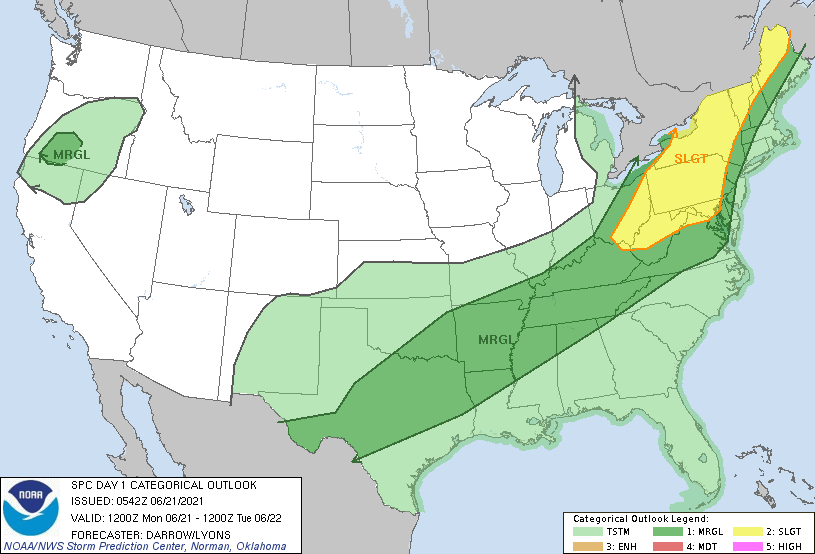
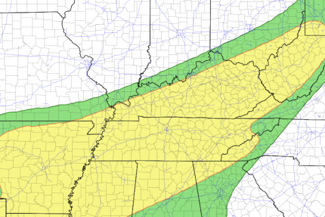
A low currently near the Great Lakes will bring showers and storms later today as a cold front sits to the west. The SPC has placed us under a Marginal Risk for severe storms, so a few could be strong to severe this evening and overnight. The bigger risk is the chance for flash flooding. The WPC has placed nearly the entire state under a Slight (10-20%) chance of flash flooding. As storms work through the latter half of today and into early Tuesday, heavy rainfall could lead to rising waters. Use caution and be aware of any watches or warnings that are issued. Estimate rainfall forecasts leave East Tennessee with 1 to 2 inches by Tuesday afternoon. As we work ahead, this will be the main weather-player of the week. Not only will this system bring moderate to heavy rainfall, but also much cooler air by Tuesday afternoon. The cold front will knock temperatures down 10-15 degrees, as well as bring drier air back across the region. Following the cold front, sunny skies will pull us through the end of the work week where we could see isolated afternoon activity popping up Friday. Though the severe threat is low, the risk for flash flooding is much better. Use caution, especially near water bodies, flood prone areas, and in low-lying locations. Send us reports via email ([email protected]), Twitter (@SecretCityWx) or Facebook (@SecretCityWx). Have a good one, be safe, and anticipate showers and storms developing later today and through Tuesday morning. Pre-recorded for 5pm show
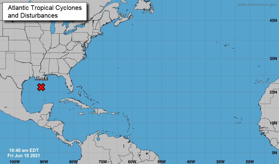
A HOT one in the plans for today. Most valley locations will be in the low 90s with Chattanooga and west potentially finding the mid 90s this afternoon. Those in the higher elevations will still be warm in the upper 80s, nearly 10 degrees above average for this time of the year. An update for the tropics....The system once in the southern Gulf is now nearing the panhandle and is officially Tropical Depression number 3 of the season. This will work north and east in the days ahead bringing the potential for rainfall across East Tennessee. Heavy rainfall can be expected across the southeast over the next few days. As you can see below, this model in particular favors a SE path (in regards to us) for the Depression. It remains unclear on where this system will track, but confidence is growing on the SE shift. Regardless, do anticipate some showers with this system. In combination with the low and front to the north and tropical system south, we should generally expect upwards of an inch through early next week. If the path of the depression works more northward, much heavy precipitation is expected (similar to what's in central Alabama & Georgia). Humidity will continue to increase into the weekend with showers popping up in the afternoon and evening hours. This will become more widespread into next week. Have a good one and don't forget to check out our daily video forecast below. Pre-recorded for 5pm show
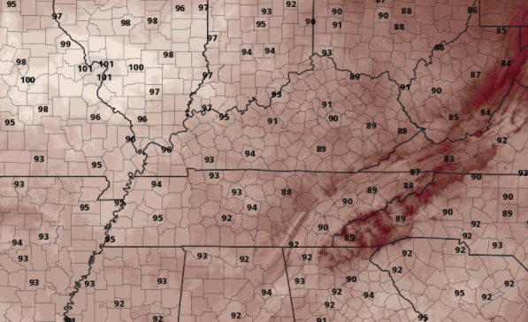
For some I can say it is a chilly morning. The Newfound Gap area of the Smokies is currently 49 degrees, while the valleys are sitting in the upper 50s. As we work through today, temperatures warm up a bit, but stay seasonable. For tomorrow, much warmer air is in store. Highs will range from the upper 80s to lower 90s, with some locations in the mid 90s. Check out our friends on the western side of the state where highs across the board will be in the mid 90s+. In addition to the heat for Friday, all eyes are pointed toward a tropical system expected to form into at least a depression by Friday. This will work north making landfall in the Panhandle this weekend. As it does so, we could see heavy rainfall with this system. There is still lots of details to be worked out with its exact path after landfall, but the model below in particular suggests heavy rainfall across East Tennessee. We will continue to keep you updated, but for now anticipate a chance to see tropical moisture across the Volunteer state. With high pressure in place and a low to the north, we will be wedged between two pressure masses. Because of this, anticipate to stay dry with cloud cover increasing through the afternoon and evening hours tomorrow. By Saturday, isolated showers will work in for the afternoon with scattered showers/storms Sunday. Again, depending on the path this tropical system takes will dictate how much rainfall we see for Monday and early next week. Enjoy the last bit of comfort. The heat and humidity work back in tomorrow bringing highs in the upper 80s and low 90s. Those further west will get it worst with highs in the mid to upper 90s. Stay cool, hydrated, and take breaks! Have a great Thursday. Pre-recorded for 5pm show
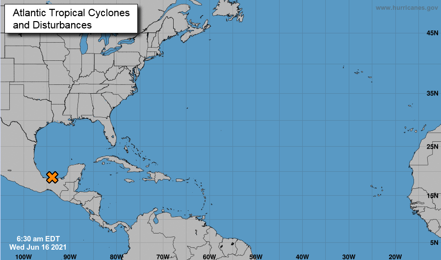
A beautiful morning across the Volunteer state. Current temperatures are sitting in the lower 60s for the valley with highs this afternoon topping out in the low 80s to upper 70s. Humidity will also remain low, making things feel even better for this time of the year. Though it will feel great, don't forget to throw on the sunscreen. The UV index is high and sunburns will come easy. This trend will continue through the end of the work week as well. Looking ahead, high pressure is stationed across the region. This is allowing for plenty of sunshine across East Tennessee. As this shifts east, much warmer and muggier air will arrive for Friday. Highs for most will range from the upper 80s to lower 90s. Into the weekend, a disturbance, currently in the southern Gulf, is expected to make landfall. As of now the NHC believes this will just be a Tropical Depression, but with the warm Gulf waters we could see something greater. Regardless, this system will work northeast, bringing the chance for a tropical airmass to the area. We'll keep you posted, but anticipate the chance to see rainfall from this early next week. Go out and enjoy the beautiful conditions today. It is not too common to have low 80s and low humidity in mid June. We warm up a tad into Thursday before the heat and humidity return in full force on Friday. Pre-recorded for 5pm show
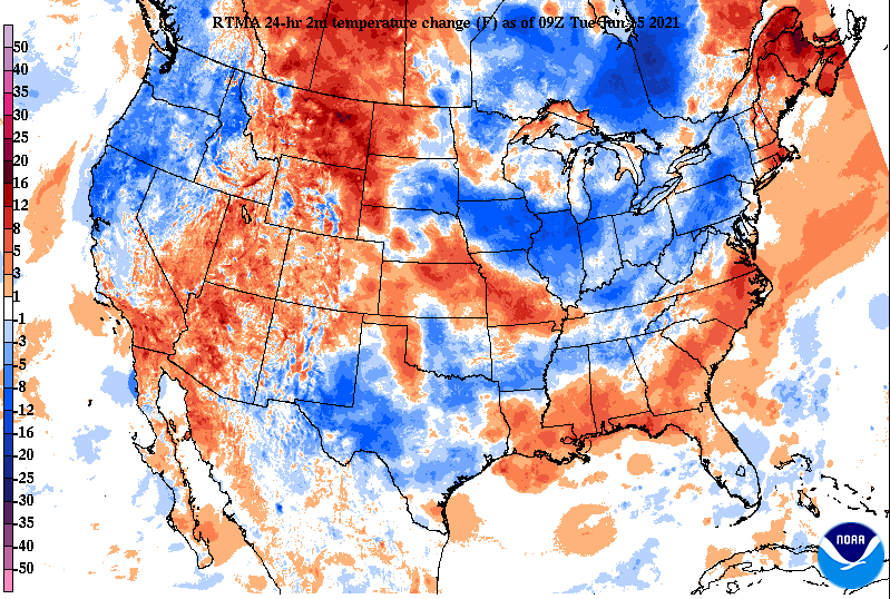
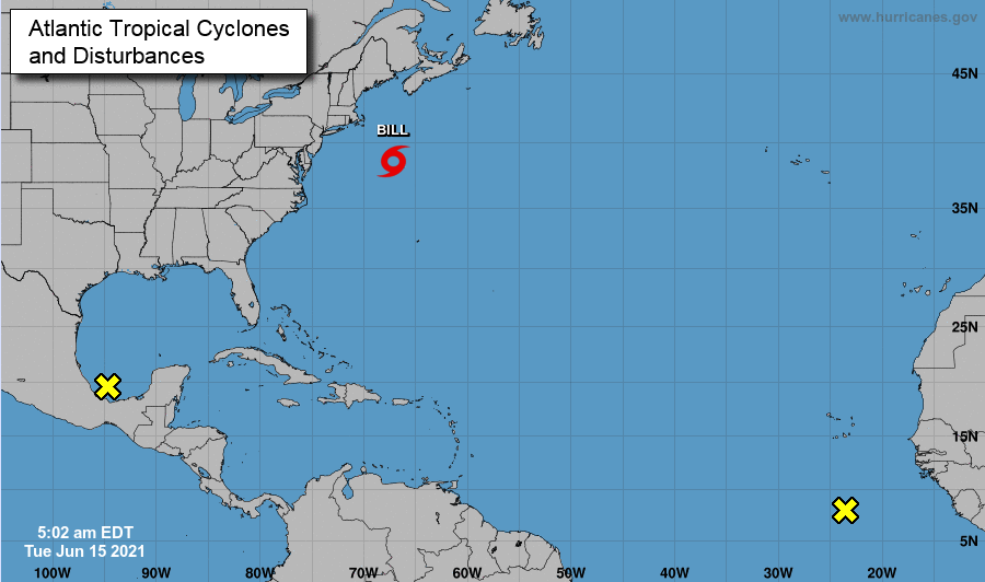
With the passage of a cold front, temperatures will be a bit cooler today. Highs will still range in the mid 80s, but will continue to lower for Wednesday (low 80s). Humidity will also be lower today, making today through Thursday feel very comfortable. Overall, the next few days should be dry, sunny, and beautiful. Looking at the Tropics, we are 15 days into the official hurricane season and already have our second name, Bill. Luckily, Tropical Storm Bill will not impact the US and will continue to work north/northeast before weakening into colder waters. To the south, two disturbances could bring impacts later in the week. Namely, the one in the southern Gulf, which could make landfall in the Panhandle by Friday. Tropical moisture could be felt across East Tennessee later in the weekend deepening on the path this system takes. For now enjoy the beautiful conditions! Temperatures will begin rebounding upward Thursday into Friday as highs to end the work week will again find themselves in the upper 80s and lower 90s. Some rainfall also returns to the forecast for the weekend. Find more details below: Pre-recorded for 5pm show
I hope you enjoyed your weekend! As we kick start the new work week, temperatures will be warm. Highs for most valley locations will be in the 90s with higher elevations in the upper 80s. An isolated afternoon/evening shower can't be entirely ruled out, but is unlikely for most locations. Looking below, we start the morning peaceful and mild. Temperatures in the valley are current sitting in the lower 70s while the current temperature in Newfound Gap is 62. As mentioned, this afternoon is going to be a HOT one. Humidity will make it feel that much warmer with highs in the low to mid 90s across the valley. I would not be surprised to see Chattanooga hit 95 today, though this won't be record beating. 97 degrees is the high temperature record today for the city. Other than an isolated shower today and again tomorrow, things will be quite dry across the Volunteer State. Showers don't begin to work back into the forecast until mid to late weekend and early next week. For now, stay cool. Highs will be above the norm today and slightly cooler, but still warm Tuesday. A cold front will then knock highs into the low 80s before things gradually warm back up towards the end of the work week and into the weekend. Pre-recorded for 5pm show
|
Your trusted source for everything weather in East Tennessee.
Social Media
|


