|
Unsettled and active period of weather ahead. Showers will become increasingly likely this weekend, with another round into Tuesday and midweek. The good news is temperatures stay at to above normal through this time. Check out more details from our video forecast below: Pre-recorded for 5pm show
0 Comments
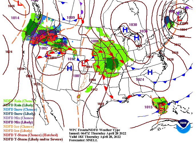
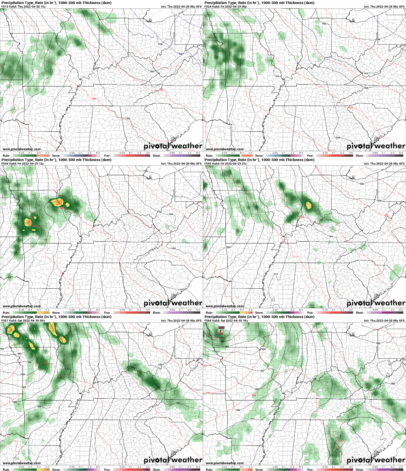
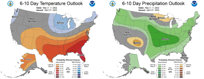
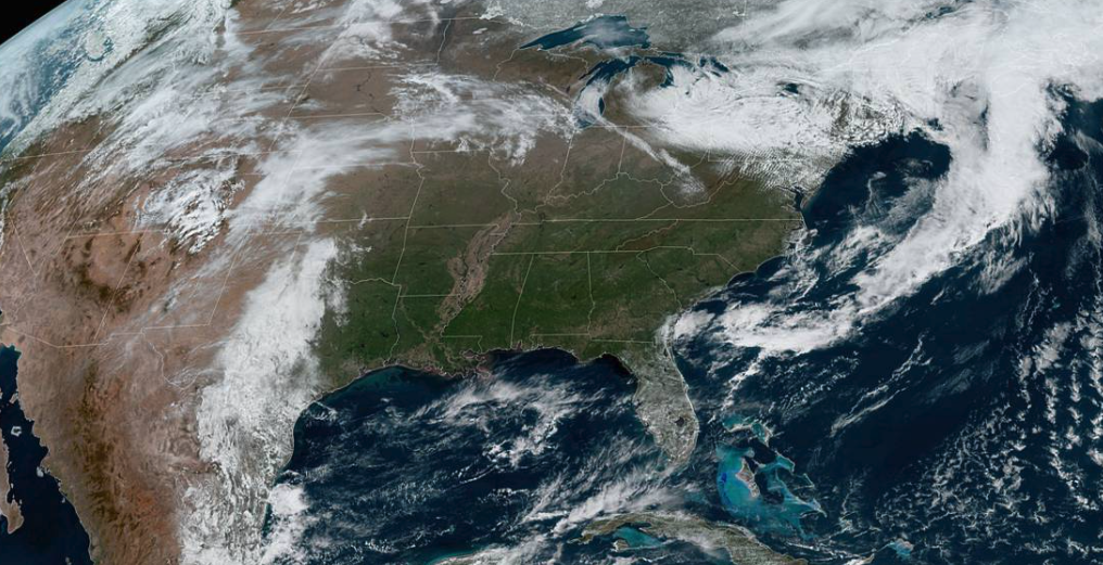
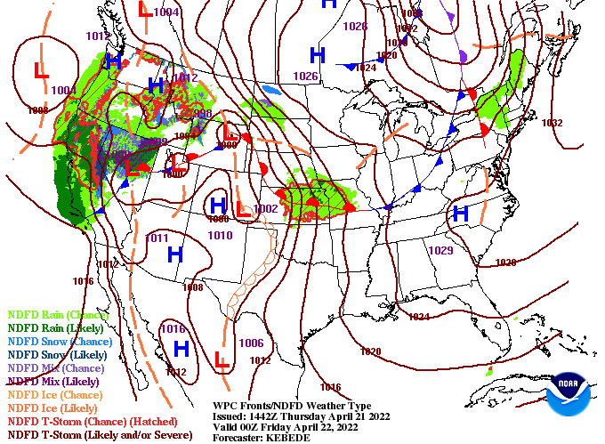
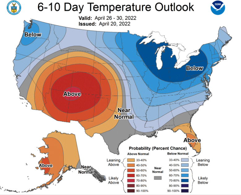
Top of the morning to you! A fairly average start to the work day, with temperatures in the low 40s. Thankfully, we will warm to find highs in the mid 70s this afternoon, with warmer air continuing to funnel in through the weekend. As far as that sunshine, soak it up while we have it. Cloud cover is quickly on the way and that will lead to rainfall at times Friday and onward. A frontal boundary stands across the area now, with a low pressure system just to the west. This will lead to cloudy skies overnight and into Friday. As far as showers, they will hold off until Friday. A few isolated showers/storms can't be ruled out during the afternoon and evening. These will become more scattered into Saturday, then widespread Sunday. A few could even be strong, dumping between a quarter and half an inch (in total) during the afternoon and evening to end the weekend. Another wave will then bring the return of showers and storms early to mid next week. Looking deeper into the horizon, a trend back toward near and slightly above average temperatures looks increasingly likely. On the flip side, rainfall looks to also veer above average to begin May, with confidence pretty high. The next 7 days will be pretty active, with several rounds of showers and storms. These will begin (isolated) Friday afternoon and pick up through Sunday, before another wave brings additional chances Tuesday and midweek. For now, enjoy another beautiful day before an opportunity for rain arrives later tomorrow. Pre-recorded for 5pm show
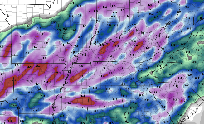
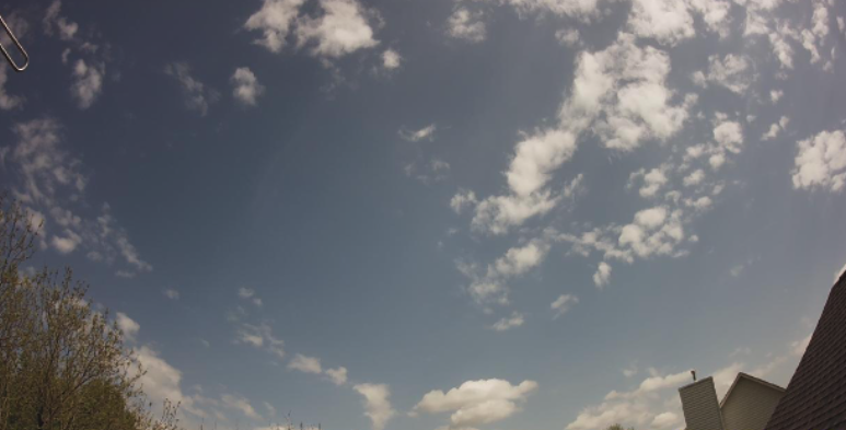
Good afternoon! A bit of a delayed post (my apologies) but how about this weather? Nearly perfect out! Not a cloud in the sky and highs topping out in the upper 60s and low 70s. Moving forward, an unsettled weather pattern will find the area. A frontal boundary will stall out just to the north, bringing cloud cover and on and off showers Friday. As the disturbance draws closer, rainfall will pick up, becoming more widespread, with isolated thunderstorms possible Sunday afternoon. Showers and isolated storms will also continue into next week. As far as rainfall amounts, they will vary but the outlook through Sunday is for 0.5 to 1.5". Heavier amounts will be possible within thunderstorms. With conditions running much drier and below average since March, these rainfall amounts and the ones into next week will be beneficial. That will do it for today. Get out and enjoy this beautiful weather and don't hesitate to share your outdoor adventures! Pre-recorded for 5pm show
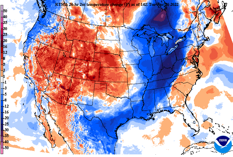
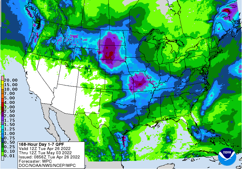
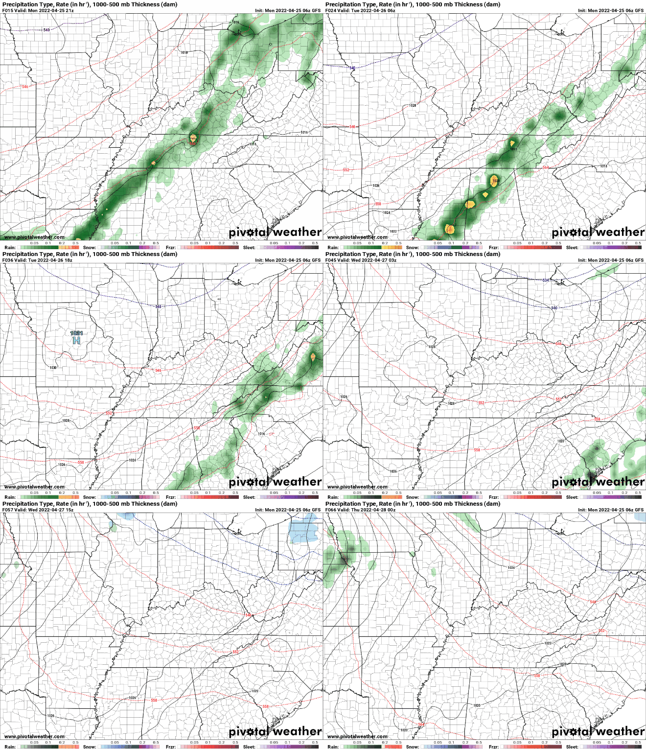
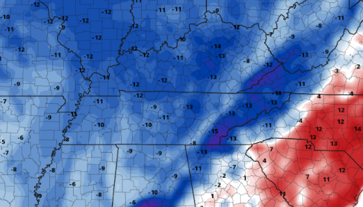
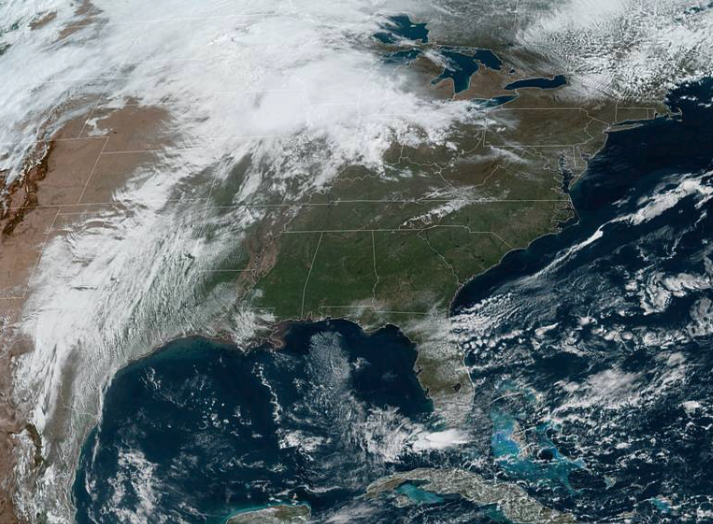
With the passage of the cold front it is much cooler today. Compared to this time yesterday, temperatures are on a scale of 15 to 20 degrees cooler and afternoon highs in the mid 60s will also highlight this change. Fortunately, we will gradually warm in the days to come, with highs Friday and into the weekend in the 70s to low 80s (for some). As far as the remainder of the day, any lingering showers in the east will diminish as cloud cover works out and sunnier skies build in. We remain mostly sunny through Wednesday and parts of Thursday, before our next disturbance arrives late Friday and into the weekend. Checking out rain totals over the next 7 days, they will run fairly close to average. The WPC suggests rainfall totals between half an inch and an inch. This would be good as we have been running on the drier side, even with the ~0.5" last night. Nonetheless, shower potential will make a return late Friday and into the weekend. For now, enjoy the cool off and increasing sunshine this afternoon. We will see temperatures gradually warm in the days ahead, with plenty of sunshine through Thursday. Pre-recorded for 5pm show
Partly cloudy skies hang around for now, but increased cloud cover is on the way. An approaching cold front will look to bring showers and isolated storms overnight and into Tuesday morning. For today, warm once again with highs in the upper 70s and low 80s. Cloud cover will continue to build in, allowing for showers this evening and overnight. Breaking it down, a line of showers and embedded thunderstorms will arrive across the Plateau this evening, pushing east as we get into the overnight. Severe potential will be low but not entirely ruled out. The biggest threats will be damaging wind gusts, but hail up to a quarter in size is also possible. Showers will diminish tomorrow morning, with cloud cover to gradually clear out through the remainder of the day. Sunshine then returns Wednesday and sticks around through Thursday and early Friday. As far as temperatures, a big cool off is in store. After enjoying the 80s all weekend and today, a return to 60s arrives. With colder air advecting in tonight and tomorrow, highs will top out in the mid 60s Tuesday, and upper 60s to low 70s Wednesday. We gradually warm through the second half of the week, with upper 70s to low 80s this weekend. Rainfall with this system will be low, generally around a quarter of an inch. With how dry and warm it has been as of late, this could pose issues with drought and fire related issues over the coming weeks. We'll keep a close eye on things and release the latest drought map later in the week. Pre-recorded for 5pm show
Sunny skies have returned and are in full force across the Southeast today. A warm front will build north through the weekend, advecting even warmer air into the area Saturday and Sunday. Highs today will top out in the lower 80s, with mid 80s expected Saturday. Looking at how these temperatures compare to the norm (low 70s), we'll be well above average. Most will top out 10-15 degrees above seasonable norms, before cooler air once again finds us Tuesday and Wednesday. A stout low pressure system is currently crossing the Rockies and will bring a sweeping cold front east. This will arrive Monday and into Tuesday, allowing for widespread rainfall and a few thunderstorms. Over the 7-day period, this will generally be the only system we can expect, with rainfall amounts between 0.25-0.5" with locally higher amounts within thunderstorms. As mentioned, cooler air will accompany Tuesday and Wednesday, before trending back up late in the work week. Take advantage of a beautiful and warm weekend, with highs topping out in the 80s. Be sure to give us a follow if you haven't already @SecretCityWx on Twitter and Facebook. Pre-recorded for 5pm show
Good afternoon! Cloud cover remains locked in so far today, but will gradually thin out through the remainder of the day and overnight. This will set up a sunny end to the work week, with highs finding the 80s. As for today, highs will run from the mid to upper 70s under a breezy south wind. As far as weather in the days ahead, we stay mostly dry and warm. A frontal boundary hanging just to our north is resulting in the cloud cover and sprinkles we've seen so far today, but this will build north in the form of a warm front through Friday and the weekend. This will bring the return of sunshine and continued warmth through at least Sunday. Another disturbance will then bring shower chances toward early next week. Looking toward the end of the month, A swing back to below average temperatures looks increasingly promising. In addition, rainfall looks to be at to below average. This will be something to watch for as limited rainfall could lead to increased drought conditions across the state. Other than a few sprinkles early this afternoon, the day will stay cloudy with gradually clearing skies. Take advantage of the sunshine and warmth Friday and the weekend before showers and a swing back to cooler temperatures returns next week. Pre-recorded for 5pm
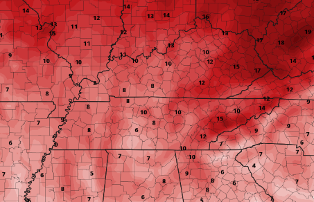
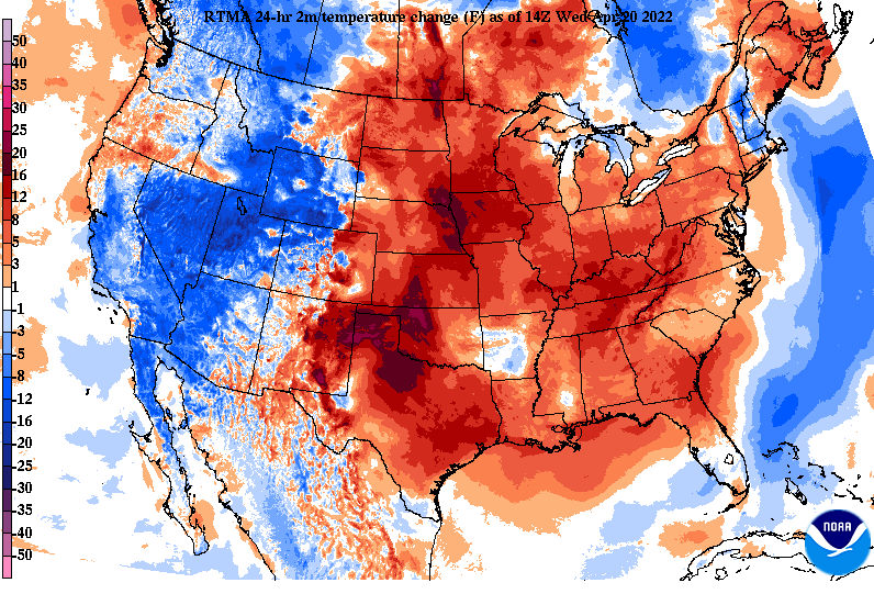
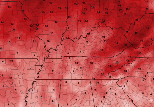
Another beautiful afternoon and one that is much warmer! Highs will run right on average, topping out in the low 70s this afternoon. As you can see below, temperatures are already much warmer than this time yesterday by about 5 to 10 degrees. This trend will continue through at least the weekend, where the 80s will find us. As far as rain potential, it looks very low. A frontal boundary will shift east today increasing cloud cover through the overnight. A few very isolated instances of showers and/or sprinkles will be possible during this time and into Thursday morning, before clearing returns the latter half of the day. Overall, this will be the only blip on radar until early next week. Take advantage of the sunshine and warm temps the next several days! Pretty straight forward forecast as things veer toward a summer-like feel the next few days. Enjoy it while it is here and have a good one! Pre-recorded for 5pm show
A gorgeous but chilly day across East Tennessee, with mostly sunny skies and temperatures currently running in the low to mid 50s. We will warm over the next few hours to highs in the upper 50s to low 60s, before 70s return Wednesday. Looking ahead, a washing out frontal boundary will sag to our north. This will increase cloud cover tomorrow afternoon and bring the opportunity for very isolated showers to sprinkles overnight and into Thursday morning. Sunshine will then build back in as temperatures sky rocket through the weekend. Looking at those temperatures, Friday and Saturday afternoon will average highs 10-15 degrees above average. The average high for mid April is 73 degrees and most will find themselves in the low to mid 80s. A few southern locations or those in deeper valleys could even end up closer to the upper 80s. Either way, it is going to be a warm end to the work week and into the weekend. The weather pattern looks pretty quiet over the next several days, but this looks to pick back up next week. For now, enjoy the increasing temperatures and mostly sunny skies (with the exception Thursday). Have a good one and don't forget to follow us on Twitter/Facebook if you don't already! You can also find all our tweets just to the right of this blog, aligned along the right edge of this page. Pre-recorded for 5pm show
Cool start to the work week, but we quickly warm! Highs by this weekend will be well above average, topping out in the mid 80s. Check out our full forecast below for more. |
Your trusted source for everything weather in East Tennessee.
Social Media
|

