|
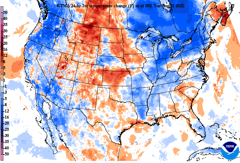
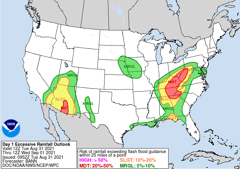
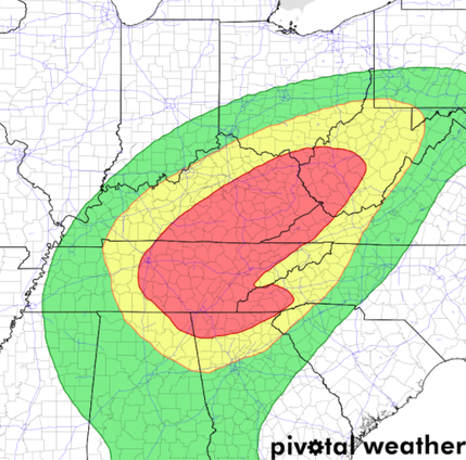
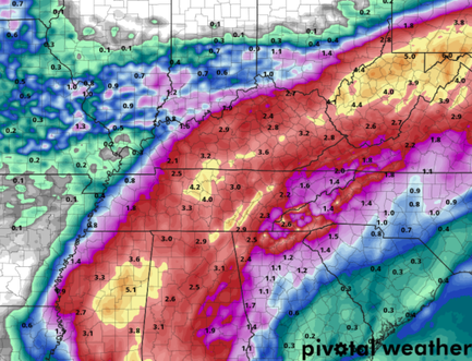
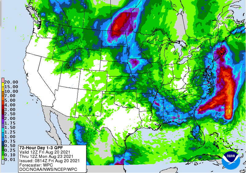
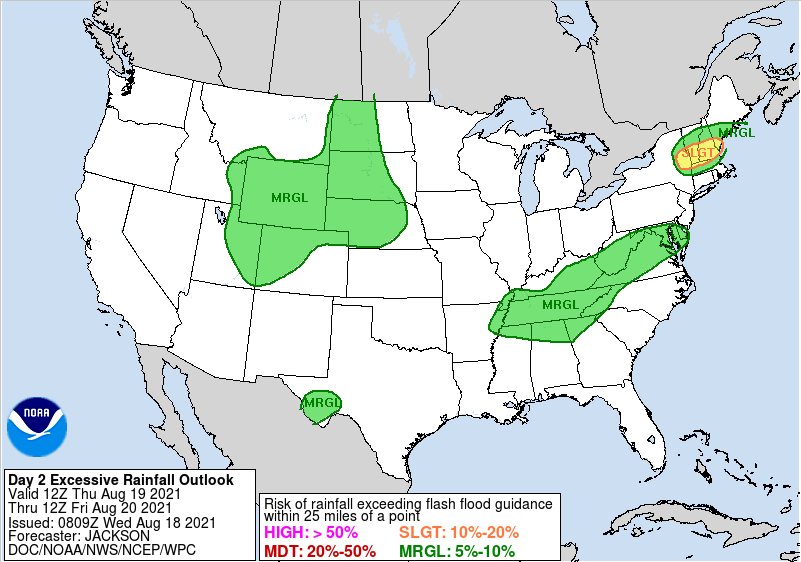
Good morning and I hope you are staying dry out there. The remnants of Ida will continue to charge its way through today, bringing the heaviest of the rainfall this evening and overnight. With the added cloud cover, rain cooled air, and cold front to the north, much cooler air has been seen across the Eastern CONUS. This will continue to be the trend ahead, as highs now through this weekend will be in the low to mid 80s. With Ida still to our south, heavy rainfall will continue today and tonight. As a result, the WPC has continued to leave Eastern TN and KY in a Moderate (20-50%) chance of flash flooding. This is 3 out of 4 on the categorical scale, so take action now if you are in flood prone areas, low-lying locations, or near water bodies. Let us know via email or social media what you are seeing across the area. These reports help us, the NWS, and others know what is going on and where. Looking at the play-by-play ahead, the tropical system will arrive by tonight, dumping heavy rainfall across the region. Anywhere from 1-2+ inches can be expected tonight alone, and that's on top of the roughly 1" through 7am this morning. The forecast remains fairly on track from yesterday as the rainfall breaks down as: Plateau & western valley: 3-5" TN Valley: 2-4" Foothills/Smokies: 1-3" Be sure to have a way to receive alerts/warnings as we progress through the day and into Wednesday. The good news is this system will ride a cold front north, bringing much drier and cooler air for us Thursday and to the weekend. Stay safe, stay dry, and prepare for more rainfall through the day and overnight. Bettering conditions are ahead, but we unfortunately likely have to deal with some flooding issues first. Pre-recorded for 5pm show
0 Comments
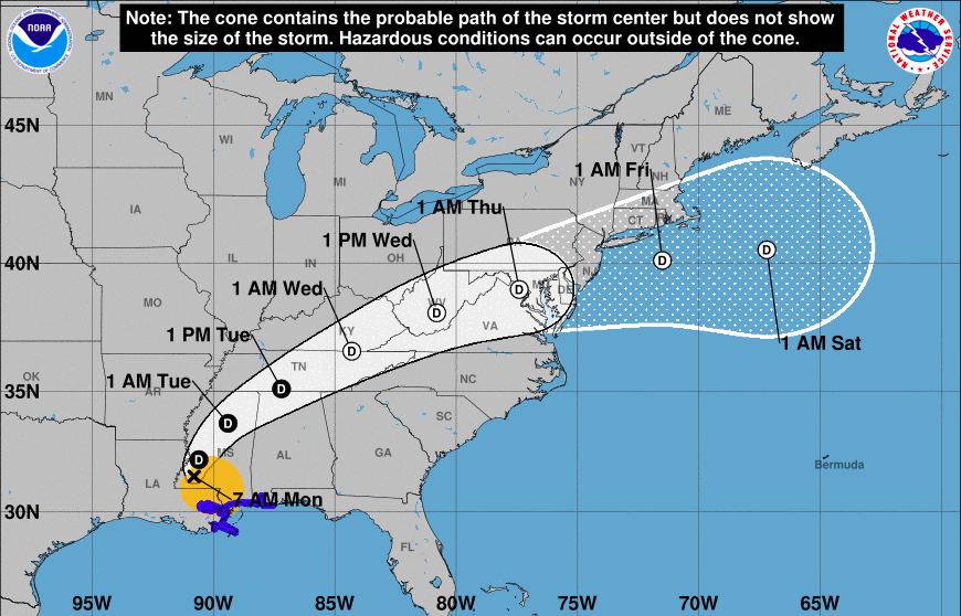
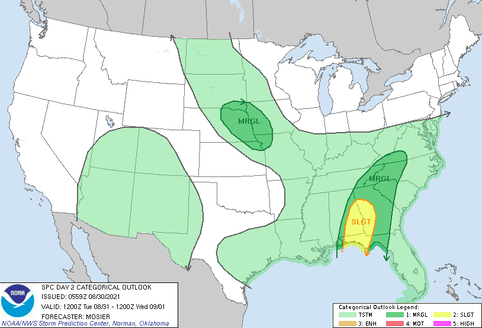
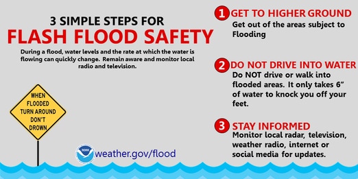
Lots to discuss, so jumping right in....Current Tropical Storm Ida is working through the Deep South and will shift northeast with time. The current track, as seen by the NHC below, depicts the storm crossing parts of Middle and Eastern Tennessee tomorrow and early Wednesday. This will bring heavy rainfall to the region. Because of this, a FLASH FLOOD WATCH has been issued from 8am Tuesday to 2pm Wednesday. The biggest concerns will be flooding/flash flooding, as the WPC has placed the area under a MODERATE (20-50%) chance of flash flooding tomorrow. Additionally, a marginal risk (1/5) of severe weather is also in place for winds and isolated tornadoes. Take the proper precautions now, especially for those in low-lying and flood prone areas. Also know where your "safe place" is if severe storms do strike. Looking at the expected rainfall, guidance varies. The general consensus is between 2-5 inches along Middle TN and the Plateau, 2-4 for the Valley, and 1-3 along the foothills and Smokies. Locally higher amounts will certainly be possible, especially accounting for terrain induced rainfall rates. As a reminder, here are some flash flood safety tips to follow. Always remember, "Turn around, don't drown" Have a way to receive alerts tomorrow through Wednesday. With heavy rainfall expected, we certainly could expect flash flood warnings at some point during the event. Be sure to follow us on Twitter/Facebook for the latest. Pre-recorded for 5pm show
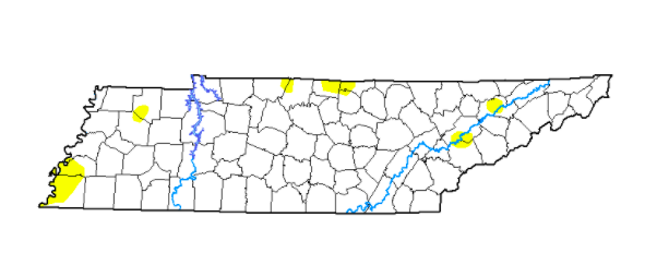
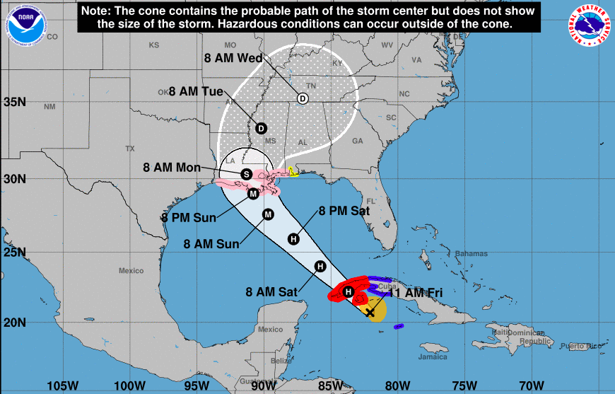
Good afternoon! We have finally made it to Friday and there is some good news to share. The dry conditions we once had, especially in our northeast, have greatly improved since last week. With the help of Fred, heavy rainfall brought conditions much closer to the norm. We are still seeing some abnormally dry spots here and there, but another round of Tropical moisture could be in the near-future. Looking at the latest from the NHC, now Hurricane Ida is expected to increase in strength to a MAJOR Hurricane. This means a category 3 or greater this weekend, before making landfall through the heart of Louisiana. Once making landfall (likely early Monday morning), it will pivot eastward, working towards TN. Given some uncertainty still after landfall, changes are likely, but Tropical moisture of some kind across the area is likely. This could again lead to flooding potential midweek, so check in for updates in the days ahead. Little changes are expected in the forecast this weekend and into early next week. The typical summer pattern with warm/muggy temps and pop up afternoon showers/storms can be expected. Stay cool, safe, and have a good weekend! Pre-recorded for 5pm show
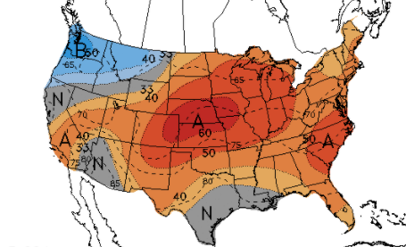
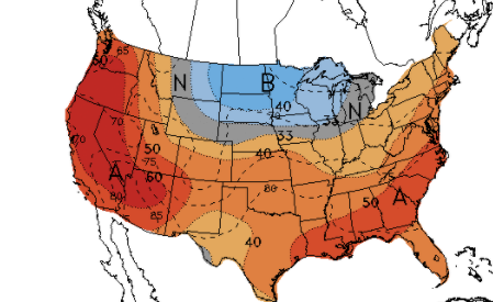
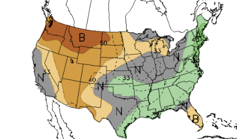
Good afternoon! Temperatures remain warm and muggy today but with the added cloud cover, we should top out a few degrees cooler. Looking into the heat index forecast tomorrow, the East Tennessee Valley will again see values near the 100 mark and the higher elevations around us in the mid 90s. Isolated showers/storms have already begun popping up this afternoon and will only becoming more widespread with time. These, again, will have the chance to provide heavy rainfall in slow moving cells. A few could even become severe for a short period of time, before raining themselves out. A mid-level wave will likely bring the best potentially for activity this afternoon. Ahead, summer-like activity continues. Pop up afternoon isolated showers/storms are possible each day. Longer term, the heat looks to continue. The CPC suggests above average temperatures through the end of August and into the first week of September. Rain also looks to be a bit less, at to slightly below the norm. This isn't surprising though, as we are beginning to transition to our driest months of the year. Something of note is Tropical Depression Number 9. This is currently southwest of Cuba and will strengthen with a northward push. Expectations are for this to be a hurricane by the weekend, eventually making landfall in the Gulf States (Mississippi, Louisiana, Alabama). We'll continue to keep a close eye on this, but let family/friends know what they could be in for by late weekend if in these areas. Pre-recorded for 5pm show
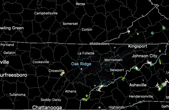
The current radar scan shows isolated showers popping up mainly to our west. We do have an isolated shower or two across the Plateau and into the Smokies, otherwise sunny to partly sunny and HOT. Temps are in the upper 80s now and are expected to top out in the low to mid 90s. Heat indices remain high, in the upper 90s to low 100s. Looking back at the 7-day rainfall, we have been near to slightly below average. Working westward, parts of Middle Tennessee this past weekend were hit hard. Estimated totals between 15-20 inches can be found over just a 24 hour period. We will see how things change in the drought map release, which we will discuss on Friday. As for weather across East Tennessee, things remain on cue with summer. Afternoon pop up showers and thunderstorms are possible in the afternoon hours before dissipating into the later evening and overnight. Our best chance, though minimal, comes tomorrow as a weak wave passes to our north and a tropical wave to our south. Overall, activity will be scattered in nature. Better rain/storm chances don't make a return until at least next week. Other than a slow moving shower/storm that could provide heavy rainfall and gusty winds, the biggest threat remains the heat. Temperatures will continue to stay in the upper 80s and low 90s through the weekend, with heat indices in the mid and upper 90s. Pre-recorded for 5pm show
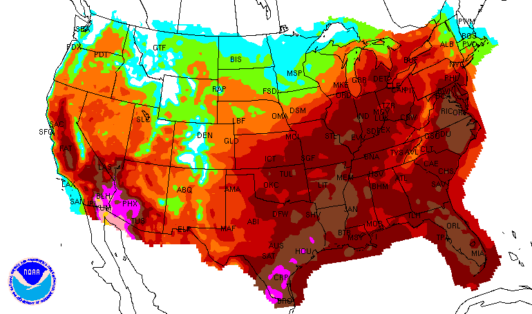
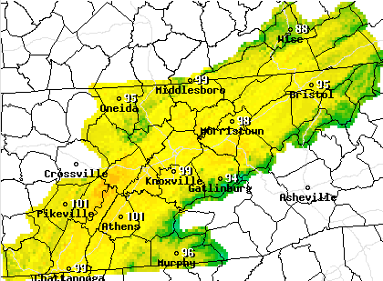
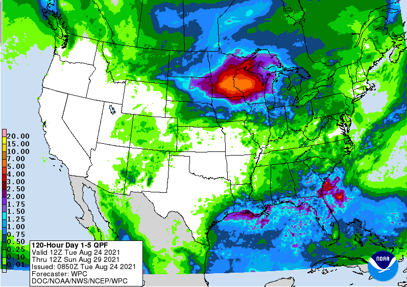
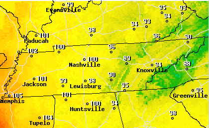
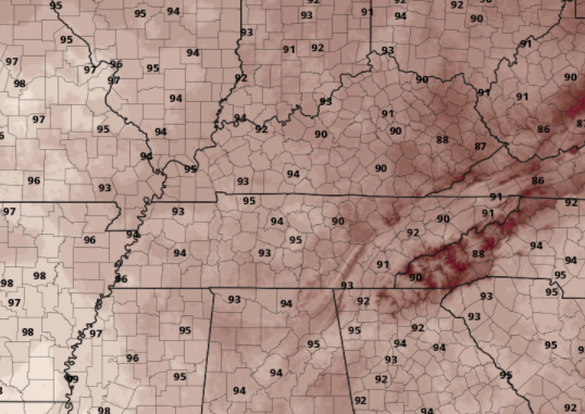
Good afternoon folks! I hope you are staying cool across East Tennessee. Not only are temperatures in the 90s early this week, but humidity will make things feel closer to 100. Looking below, this is what temperatures will feel like this afternoon and again Wednesday. Stay cool, hydrated, and rested. After a very wet pattern, things dry out a bit for us across the area. The day 1-5 rainfall forecast shows limited rainfall potential. Other than the usual summertime afternoon shower/storm, we really don't have a good rainmaker until next week. Rainfall totals will generally average between a tenth and half an inch through Saturday. A weak system will pass through the region Thursday, bringing our best chance of rain for the week. Again though, this looks to provide fairly limited rainfall with scattered showers and storms expected through mainly the afternoon. Strong storms and localized hydro issues can never be ruled out with these slow moving summer-time storms, so be weary of that. Things will look to dry back out toward the late evening and overnight each day. That wraps it up for today, thanks for join as always! The heat doesn't look to let up for some time, so keep your heat safety in mind as we work towards September. Pre-recorded for 5pm show
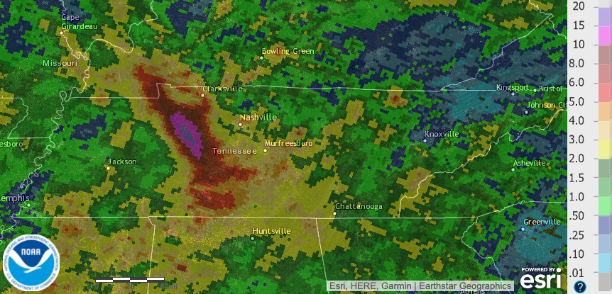
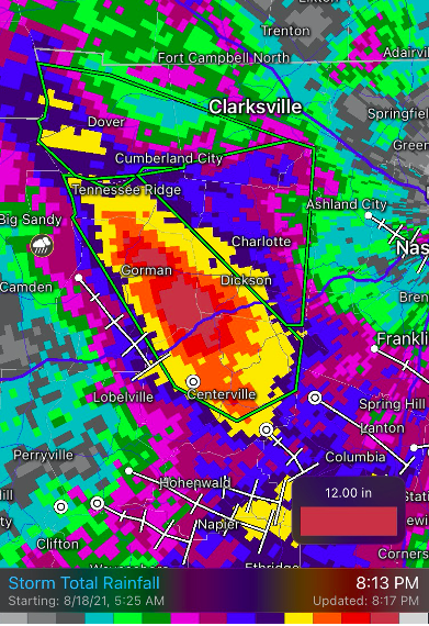
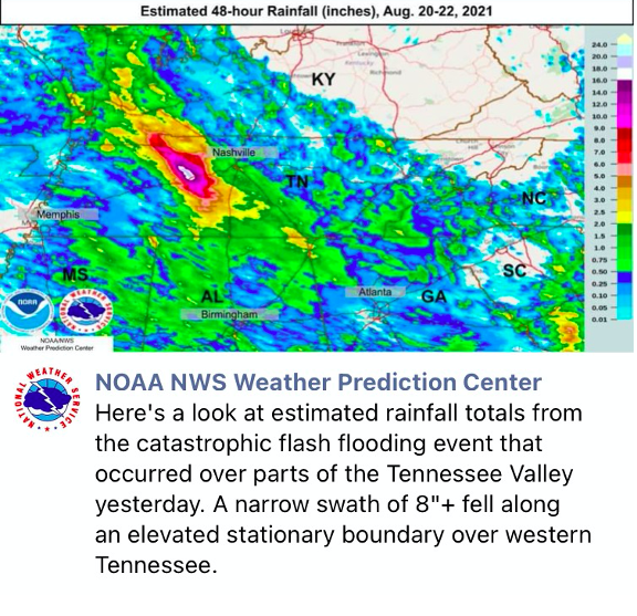
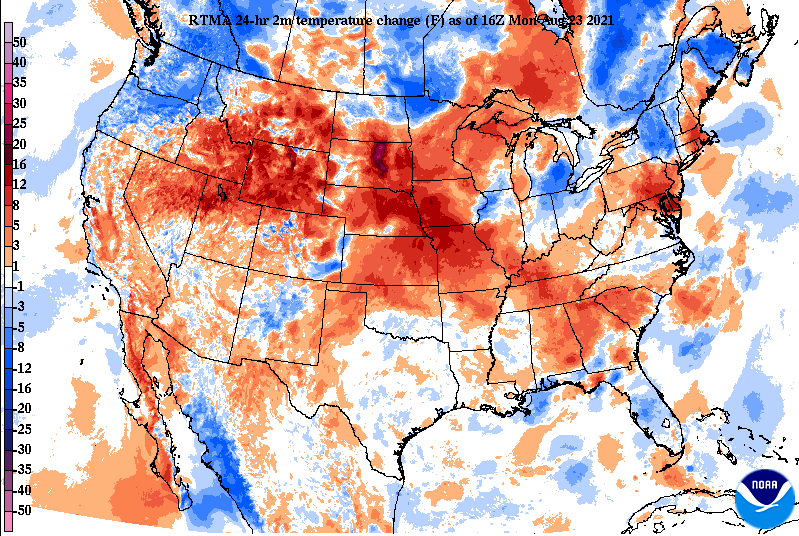
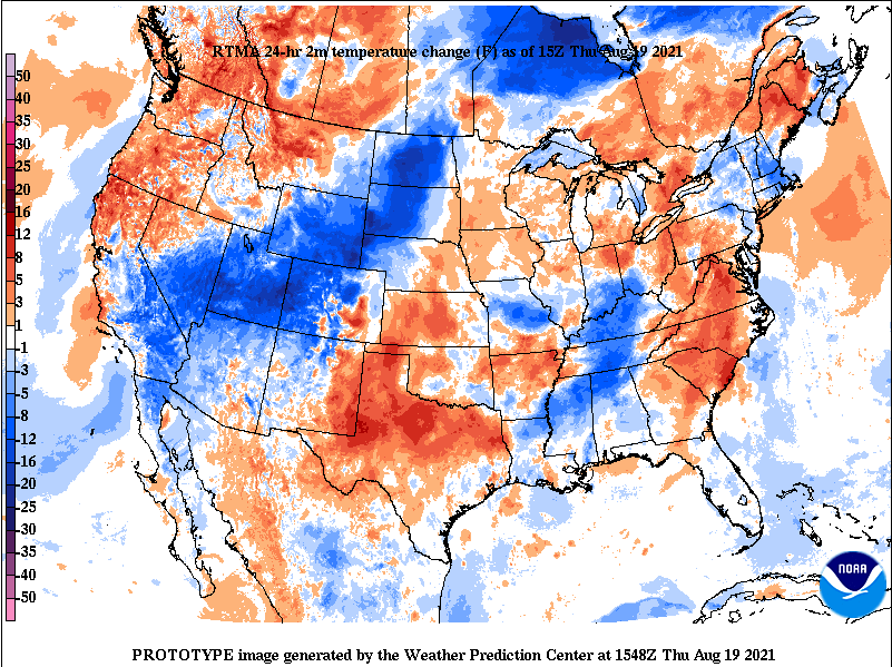
Though things were pretty tame for East Tennessee this past weekend, the same can't be said for those near Nashville. A slow moving back building storm brought heavy rainfall Friday night and into Saturday morning. Within an 18 hour period, another strong meso-convective system dumped additional rainfall in nearly the same exact spot. The first round of rainfall dumped upwards of 8-10+ inches and led to a flash flood emergency that ran several hours. The second round, Saturday afternoon, added an additional 8-12". This, unfortunately, led to several deaths, likely multimillions in damages, and extreme flooding just south of Clarksville. This area was fairly sparse with gauge data, but a TVA site in McEwen recorded 17.02" in a 24-hour period. This easily set the most rainfall for the state of Tennessee within a 24 hour period. The "white" indicated on estimated rainfall totals (right image) indicates between 16-18" of rainfall. The left image shows the storm total rainfall for the second system Saturday afternoon (up to 12 inches!). For those out and about this afternoon and in the days ahead, things are very warm. Looking at the temperature changes from this time yesterday, we aren't the only ones "feeling the heat". Portions of South Dakota are 30+ degrees warmer today than this time yesterday. Moving forward, the heat doesn't look to let up. Highs today through Wednesday will range from the low to mid 90s. Combining this with increasing humidity, feel-like temperatures will be in the lower 100s. Several heat advisories have already been issued for areas just to our west, so we'll keep an eye out for this trend if additional NWS offices follow suit more local. After an active pattern the past several weeks, things will steer a bit more dry. Thursday looks to be our best shot for rainfall, with only isolated afternoon showers/storms in the days prior and thereafter. The main concern will be the heat as highs today are anywhere from 6-10 degrees above average. Pre-recorded for 5pm show
Cloud cover is beginning to clear out across the area with temperatures currently in the lower 80s. Isolated showers will again be possible today, primarily working in from the west and shifting east with time. Activity should lesson with the onset of nightfall. Rainfall will be lean the next couple of days across East Tennessee with the bulk of activity to the west. Given the heavy rainfall from Fred and our latest system, we deserve a break. The drought map this next week should show much improvement from recent weeks where many locations were dry in the northeastern portion of the state. Surface high pressure will continue to sit across the Southeast, once again increasing temperatures into the lower 90s. Humidity will make things feel closer to the mid 90s some days as well. Look for this trend to continue into next week. Tropical Storm Henri is expected to increase in strength as it shifts northward, making landfall in New England by late weekend. Stay tuned for updates via Twitter & Facebook this weekend. Have a good one, stay cool, and don't forget to view our forecast video below. Pre-recorded for 5pm show
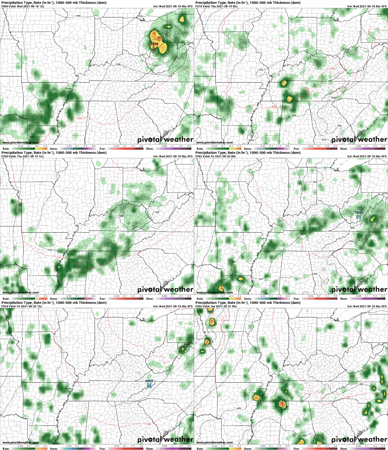
With our next weather maker impacting southern East TN, and to soon bring scattered showers/storms to the remainder of the area this afternoon, temperatures are much cooler. Looking below, most areas are 5 to 10 degrees cooler than this time yesterday. The added cloud cover and rain cooled air is making things feel fairly commutable (minus the humidity). Looking at modeled guidance, showers and storms will be scattered today and again Friday. These will primarily be during the afternoon and early evening hours (during peak heating) before fizzling out overnight. Into the weekend, high pressure begins to dominate, leading to increased temperatures and lesser opportunities for rainfall. As hinted above, the latter part of August will likely feature higher than normal temperatures and near normal precipitation. For reference, Knoxville averages a high of 86 late August to early September and daily precipitation of 0.1". After a very wet week, look forward to some drier weather. As a result, temperatures will be warmer than average but we are closing in on Fall; officially beginning September 22, 2021. Pre-recorded for 5pm show
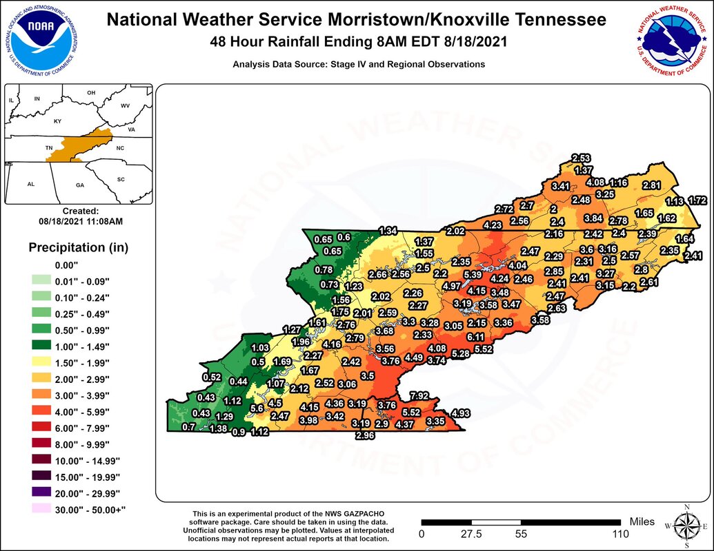
Official rain totals from the remnants of Fred are now in from the NWS. Looking below, you can definitely see the rainfall gradient from west to east. High rainfall totals were along the high terrain with some locations near 8 inches. Further west across the valley, most locations averaged between 1.5 and 4 inches. Unfortunately, more rain is on the way. Given the heavy rainfall picked up through the day yesterday, a Marginal risk for flash flooding has been highlighted for the entire state of Tennessee. Luckily, we are dry through much of the day today would should help things out a bit. Model guidance depicts our next rain maker streaming in from the southwest. This is expected to dump another 0.5-1" Thursday and into parts of Friday. By the weekend, we return to a more summer- afternoon pop up shower/storm scenario. Temperatures tomorrow and Friday will be right on par with the norm (low to mid 80s) before warming back up into the upper 80s this weekend. Enjoy today, but be on the lookout for moderate rainfall again tomorrow.
|
Your trusted source for everything weather in East Tennessee.
Social Media
|

