|
Hot and sunny again today with highs in the upper 80s to low 90s. A very isolated shower can't be ruled out, but chances are low. An approaching cold front works east today, bringing our next opportunity for showers/storms Wednesday night and into the day Thursday. A few strong to severe storms can't be ruled out with this system. Watch our video forecast below for more.
0 Comments
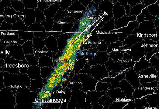
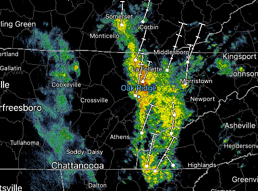
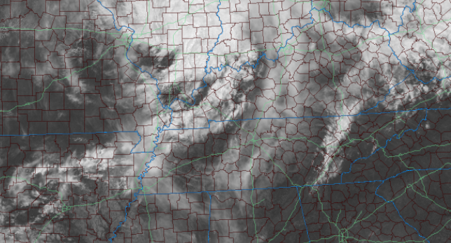
Good morning! Showers do not want to give up, as wrap around moisture from the low pressure system is aligned across the plateau and pushing into the valley. Fortunately, this will be the last push, as activity through the remainder of the day will be isolated. By tonight, skies will begin clearing allowing for lots of sunshine this Holiday Weekend. We have been monitoring drought conditions across the state and mentioned it will likely get worse before it gets better. As expected, this was the case. More than half of the state now sits in a D0 (abnormally dry), with a section in East Tennessee under a Moderate Drought. The good news is we picked up between 1 and 2 inches of rainfall Wednesday night and through Thursday, which should reduce these dry spots. On the contrary, rainfall will be hard to come by over the next week, so we quickly could return to these or worse conditions. We will keep you posted. As far as what is to come, high pressure will begin edging in tonight. As it does so, temperatures will gradually warm in the days to come. Highs Memorial Day will top out in the upper 80s to low 90s, before continuing to rise toward mid week. Wednesday will feature low 90s for most valley locations, which is 10+ degrees above average. Keep your heat safety in mind and remember to drink plenty of water! That will do it for today, other than this line of showers and isolated instances through early this afternoon, activity will diminish and work out by tonight. A beautiful and warm weekend will then find us, so take advantage. You can find our Memorial Day forecast in our video forecast below. Pre-recorded for 5pm show
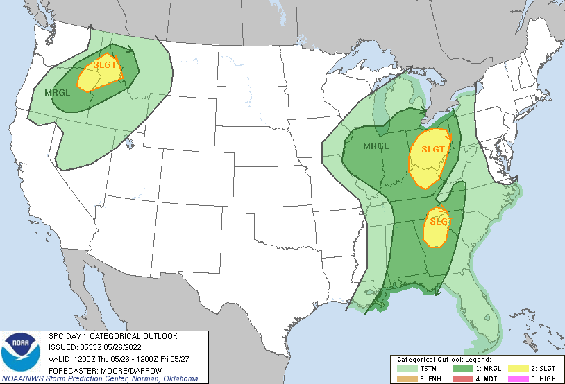
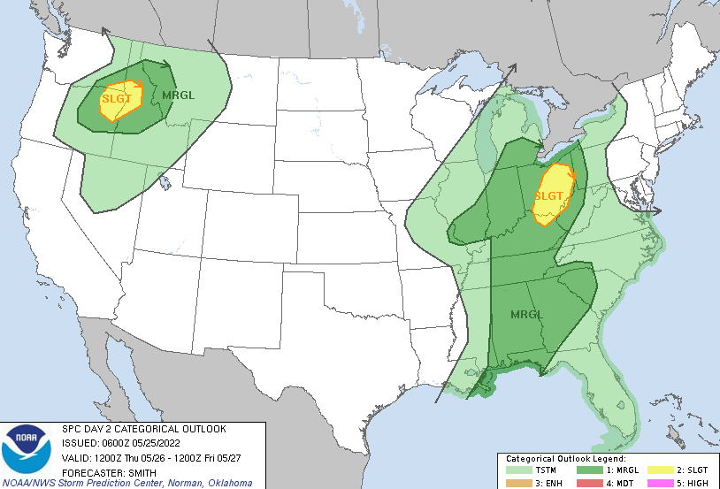
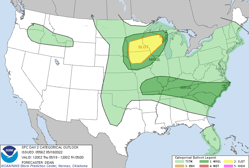
Good morning! If you are heading out of the door for work or school, don't forget those umbrellas. Showers and a few thunderstorms are currently working through much of the valley. This will be one of several rounds we see today with strong to severe storm potential this afternoon. With that said, severe potential will be marginal (or conditional as we like to call it). Meaning, things will need to fall into place just right for us to see any severe storms. The biggest unknown is how much recovery we see between this round of showers/storms and the ones this afternoon. If we can find a few breaks in sky cover and warm up enough, we could see a better opportunity. Given the unknowns, SPC has placed the majority of the area in a Marginal until better confidence arrives through the day. With that said, if strong to severe storms do develop, the primary threat is damaging winds, but isolated areas of spin up can't be ruled out. The timing will primarily be this afternoon to early evening. Showers & storms will begin to fade out tonight, becoming more isolated to scattered in nature. Some wrap around moisture from the low will stick around into the first half of the day Friday, before conditions start to dry back out by Friday night. This will set up a gorgeous and warming Holiday weekend, with highs Saturday near 80 and highs Memorial Day near 90. With the lack of confidence in knowing how much instability (or usable energy) we gain today, the severe threat is low but not out of the question. Primary concerns today will be the heavy rainfall contributed to the several rounds of showers and thunderstorms (which could cause flash flooding), and damaging wind gusts with isolated instances of spin up. Have a way to receive alerts and know what to do if warnings were to be issued. Pre-recorded for 5pm show
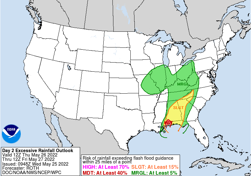
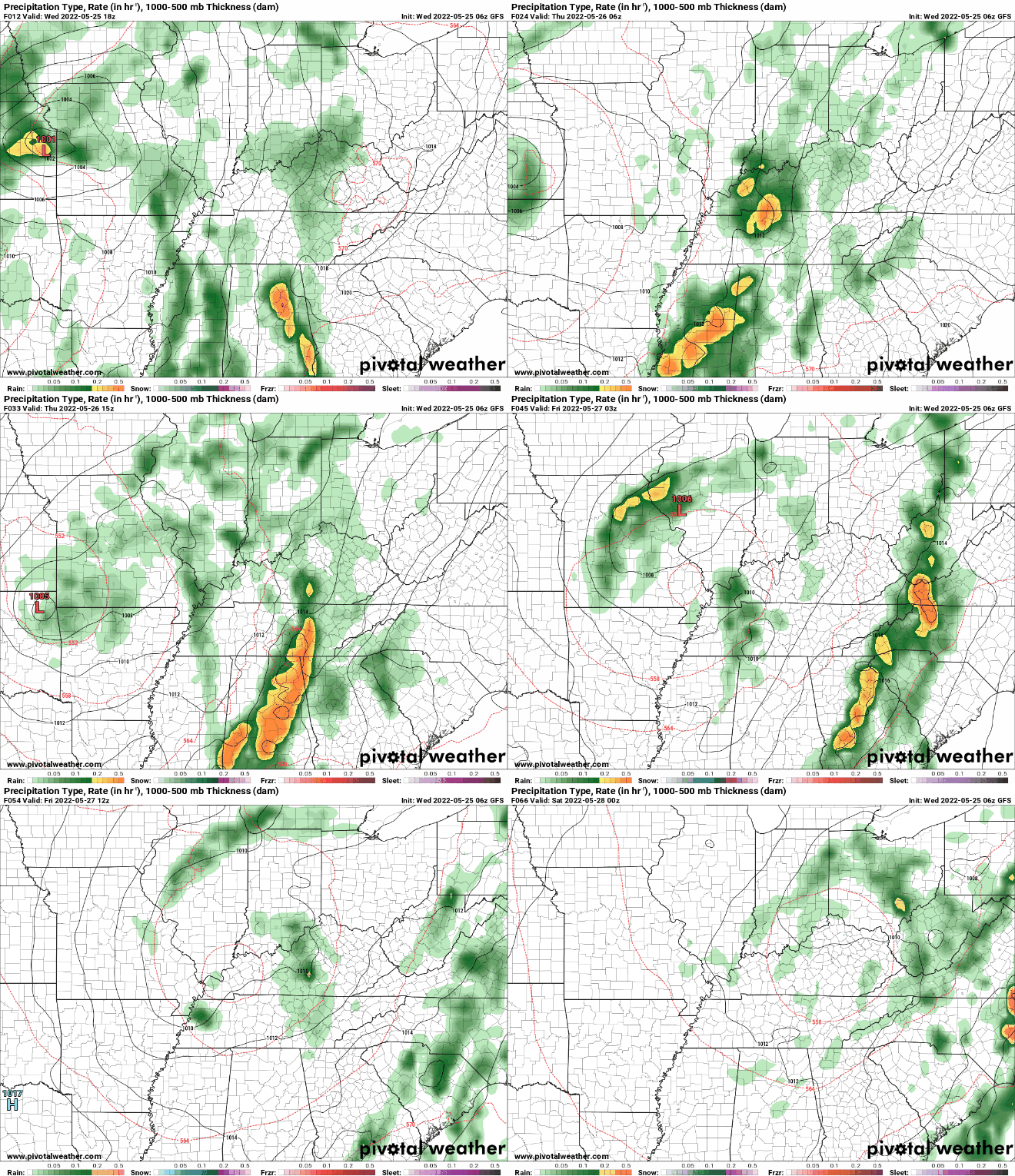
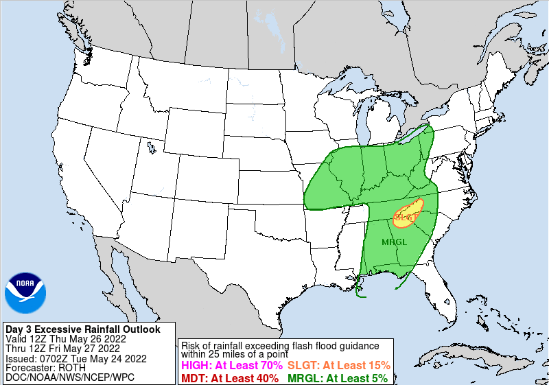
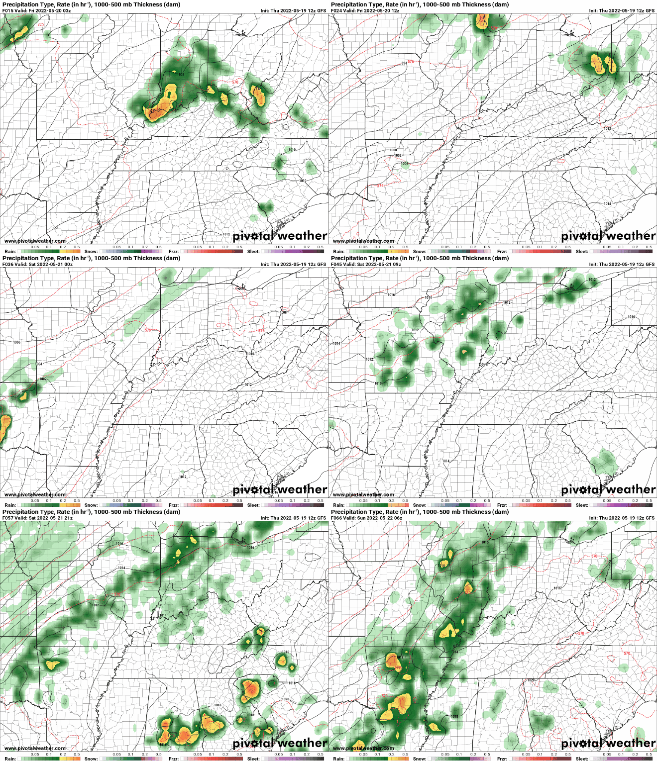
We will jump right into it as there is a bit to discuss. The break down consists of a slow moving low pressure system and an associated cold front, which will drag east slowly tonight and through tomorrow, before crossing the area Friday. As it does so, stronger storms could develop Thursday afternoon to early evening. The primary threat is damaging wind gusts, but an isolated area of spin up and large hail can't be ruled out. Further more, with heavy rainfall expected and rounds of showers and storms, flash flooding could also become a concern. A marginal risk for flash flooding from the Weather Prediction Center is in place as a result, where rainfall amounts between 1 and 2 inches is expected. We fortunately have been on the drier side in recent weeks, which should help, but won't eliminate the chances. This is especially true in areas that see multiple rounds of heavy showers and storms. Use caution, have a way to receive alerts, and pass along any reports you may have (severe storm or flooding wise). Through today, showers will generally be tamed through early this afternoon. They will begin to pick up thereafter, becoming scattered to widespread overnight and throughout Thursday. A few strong to severe storms will then be possible Thursday afternoon and evening, as we warm through the day and the front approaches from the west. These will then taper off from west to east throughout Friday, with sunshine back in for the holiday weekend. Highs today will sit right around average, in the upper 70s to low 80s. Keep the umbrellas handy, as it will be soggy the next 36 hours or so. Pre-recorded for 5pm show
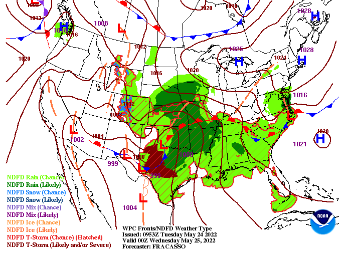
Good morning! Patchy fog can be seen across East Tennessee this morning, so use caution as you head out. Through today, we will see a mix of cloud cover, sunshine, and isolated showers. The bulk of this will begin to edge in tonight, as a warm front builds north across the area. A few rumbles of thunder also can't be ruled out. Highs today will top out in the upper 70s to low 80s. With showers working in this evening and overnight, they will dissipate out toward the early morning and through the early afternoon Wednesday. This will give way to some sunshine as temperatures warm into the mid 80s. Following, a low pressure system (currently in the Southern Plains) will swing through. This will bring widespread showers & thunderstorms Wednesday night and throughout Thursday. The severe threat is low, but not zero. As such, a marginal risk (1/5) is in place and we'll keep an eye on how this whole system evolves. With rounds of showers & storms expected, some of which could be strong at times, a risk for flash flooding will present itself. This coming from the WPC where a marginal to slight risk for flash flooding is in place Thursday. Rainfall totals will likely topple 1 inch Wednesday night and through Thursday, so know what to do if you live in flood prone areas and low lying locations. Drier conditions will then prevail through Friday, with a very pleasant and warm holiday weekend on tap. This will continue into Memorial Day as well, with highs Saturday through Monday ranging from the upper 70s and warming towards 90 degrees. Pre-recorded for 5pm show
Showers continue today, before working out tonight. A mix of sunshine and cloud cover finds us Tuesday, before showers edge back in the later half of Wednesday. Widespread showers & storms will work through Thursday, where some storms could be strong. Drier conditions then return Friday and into the weekend. Highs throughout will vary from the 70s to low 80s. Check out our video forecast below for more: The heat will be the main story today, as highs top out in the low to mid 90s across valley locations. Keep cool and well hydrated if outdoors for extended periods of time! A passing cold front will then bring shower and storm potential late Saturday, before becoming widespread Sunday. The severe threat is low. Check out our video forecast below for more. Pre-recorded for 5pm show
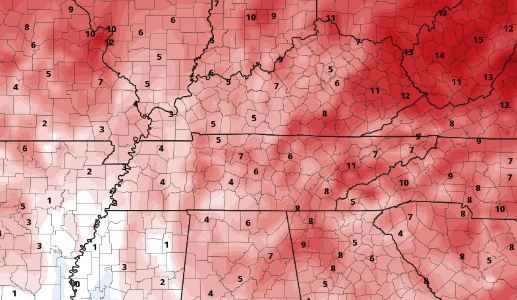
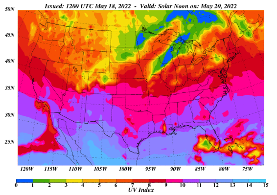
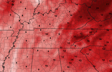
If you recall from earlier this week we mentioned the very dry soil moisture conditions we have noticed over the past 7 days. Because of this and the lack of rain in recent days, abnormally dry conditions have popped up across much of the area. Much of the southeaster half of the state is sitting on the dry side. Rainfall amounts over the next 7 days look to be between 0.5 and 1.5", which should help but likely not wipe the drier conditions present. The SPC has highlighted a marginal risk of severe weather for much of the area today, but it looks very limited. As such will warn of the potential for a few isolated stronger storms, but most (if not all) should fair on the drier and calmer side. High pressure will then fill in tomorrow, bringing the warmest temperatures of the year so far. With mostly sunny skies expected, UV levels will be high (ranging from 9-10). Be sure to bust out the sunscreen and practice your heat safety, as highs will range from the upper 80s (plateau) to as high as the mid 90s across the valley. Into the weekend, our next rain maker arrives. Isolated to scattered showers/storms will be possible Saturday afternoon and evening, picking up overnight. Sunday will likely be the wettest day, with widespread showers and storms anticipated. Some could be strong, but the severe threat for now is low. That will do it for today, the biggest take away is the heat tomorrow with highs for most in the 90s. Stay cool, stay hydrated, and have a good Friday! Pre-recorded for 5pm show
Beautiful day across East Tennessee with partly cloudy skies and temperatures ranging in the lower 80s (1 pm). As we move into tonight, isolated to scattered showers/storms will find us. These will continue into Thursday, before drier air again returns tomorrow night and into Friday. Looking at the severe potential tonight and into the first half of the day Thursday (mainly late morning to early afternoon), a marginal 1/5 risk is present. The primary concerns are damaging wind gusts but large hail can't be ruled out. Showers will be fairly isolated to scattered, so no widespread rainfall/activity is expected. With drier air returning by the evening Thursday, very warm temperatures are in store for Friday. Highs will range from the upper 80s in the plateau to low and mid 90s across the valley. Looking at how this compares to seasonal norms, we will be running between 10 and 20 degrees above average. Keep your heat safety in mind as Friday and Saturday will be very warm and above normal. Have a way to receive alerts if warnings are issued tomorrow. Activity will be few and far between and mainly across the northern half of the state, but the environment is conducive for a few isolated strong storms. Again, timing for these will be late morning to early afternoon, before drier and warmer air returns. View our video forecast below for more. Pre-recorded for 5pm show
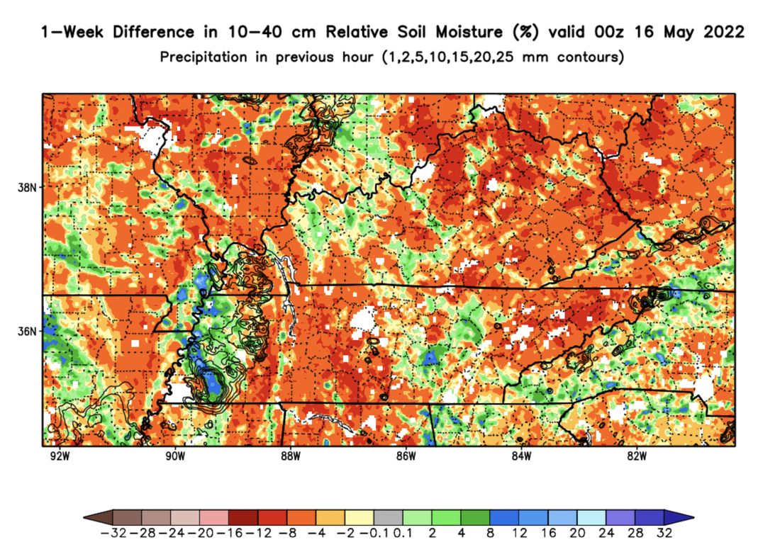
Good morning! Changing things up a little, lets start by breaking down the dry conditions we have across the state. Looking at soil moisture percentage over the past 7 days, we have been very dry. In fact, some areas are nearly 20+ percent drier than this time a week ago. With a few abnormally dry spots in place already, I would not be surprised to see these expand in this weeks output. For now, nothing of major concern just a note and something we will keep an eye on as we move forward. Looking at model guidance, a low working to our north will bring the opportunity for isolated showers late tomorrow and into Thursday. The SPC has highlighted a marginal risk for our far northern counties bordering KY, but I think the chances are fairly low for our neck of the woods. With that said, activity will be a bit more widespread into Thursday, with a few strong thunderstorms not entirely ruled out. Unfortunately, keeping with the rain/drought theme, very little rainfall can be expected wit this system (at least area-wide). Our better opportunity comes this weekend where a passing cold front finds us. Other than a few showers and thunderstorms late tomorrow and into Thursday, dry conditions and warming temperatures will prevail. By Friday, highs will be the warmest we have seen this year, topping out in the upper 80s and low 90s. A few spots may even find the mid 90s before all is said and done with. Keep your heat safety in mind as this may come as a surprise to some. Check out our video forecast below for more. Pre-recorded for 5pm show
|
Your trusted source for everything weather in East Tennessee.
Social Media
|

