|
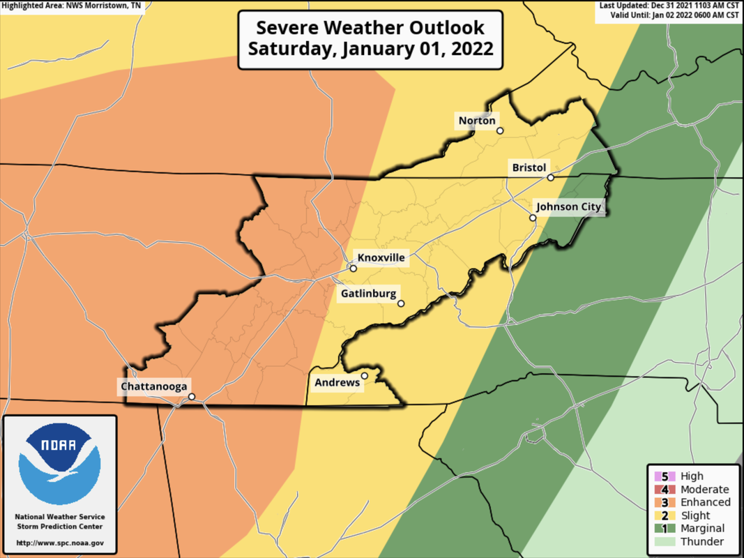
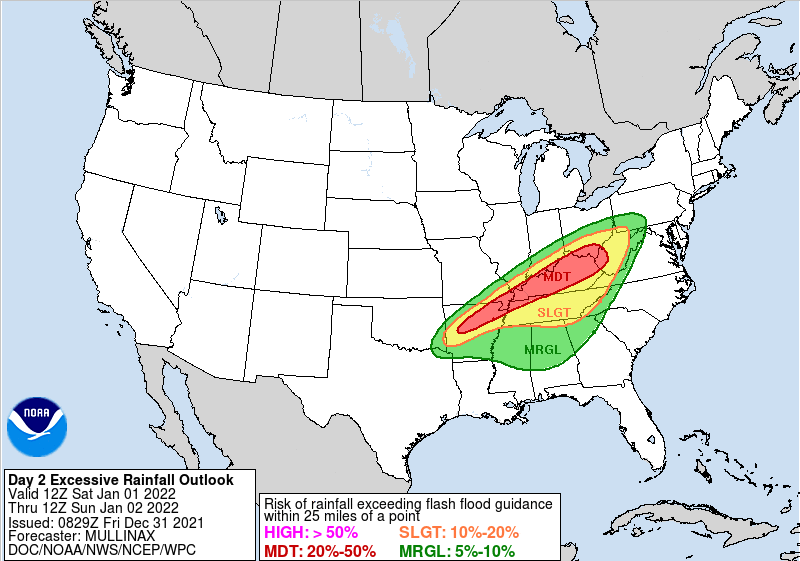
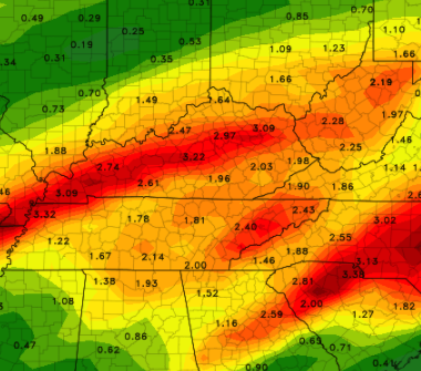
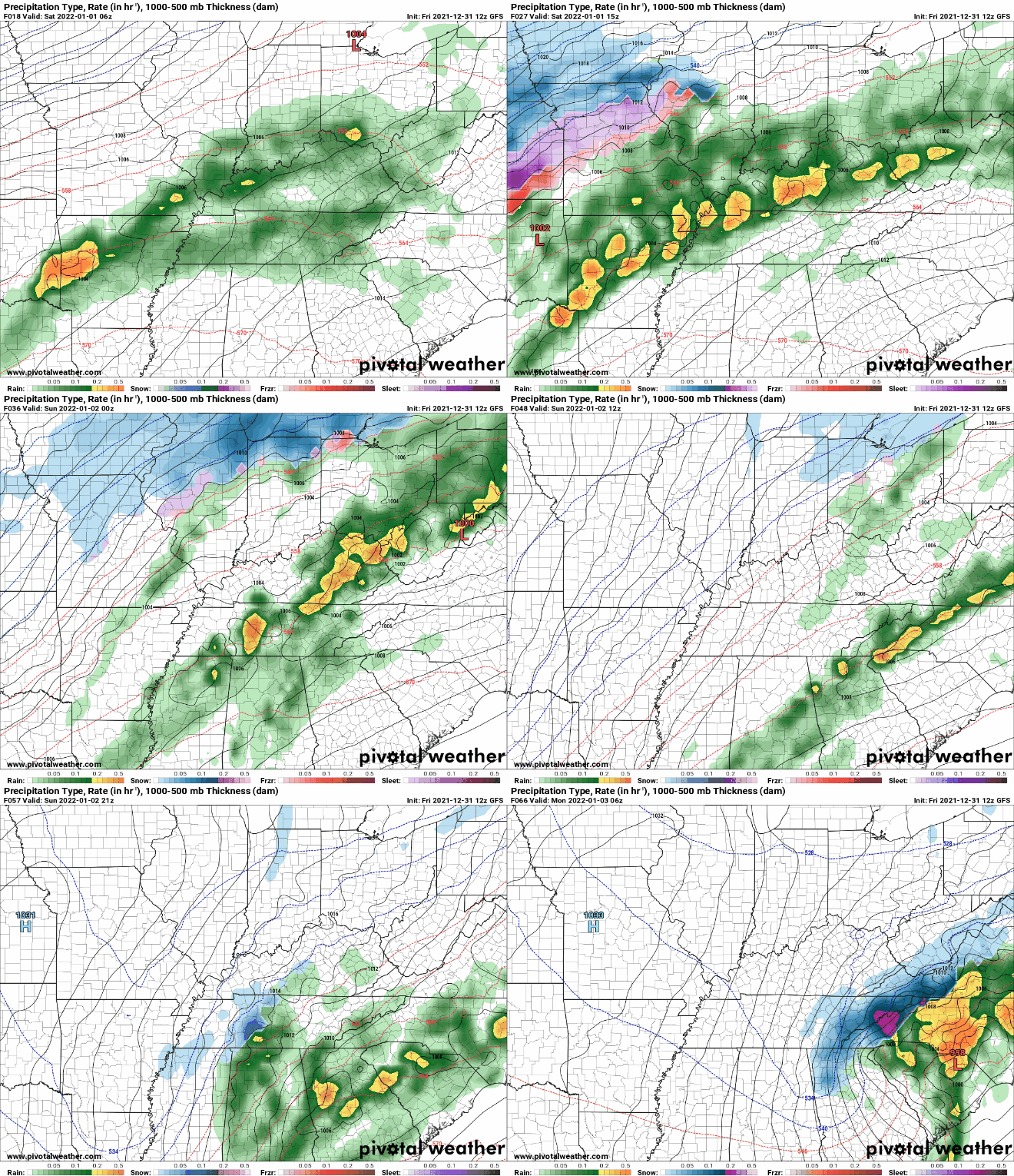
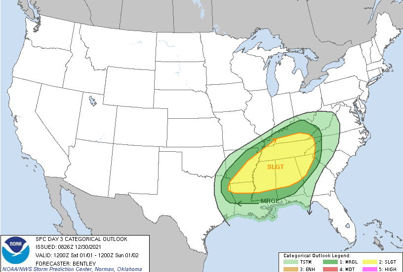
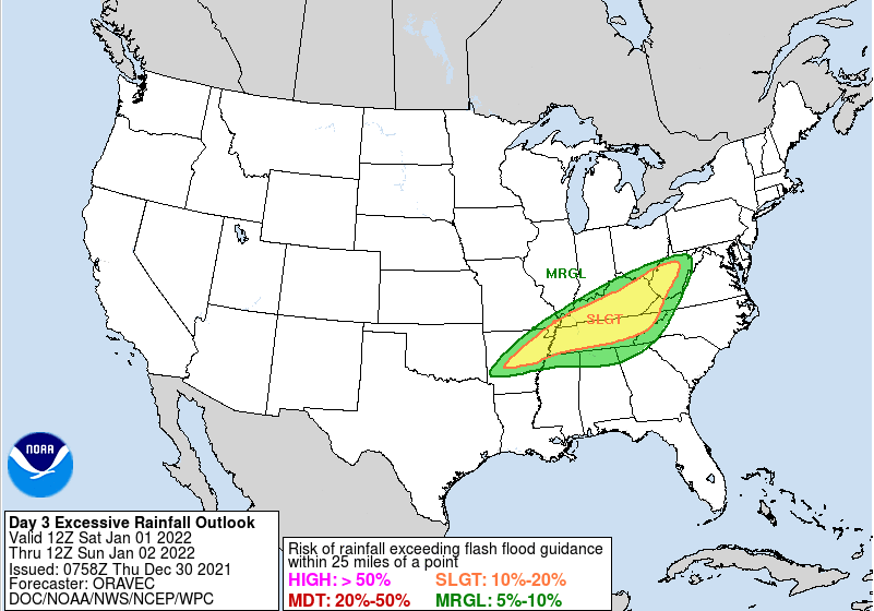
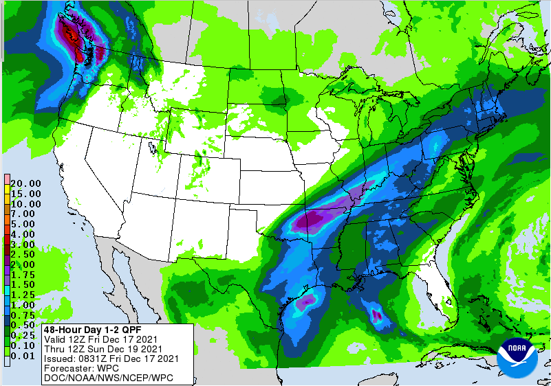
Good afternoon and happy last day of 2021! We look to enter the new year with a bang, as SPC has further increased the severe risk tomorrow evening/night. An Enhanced (3/5) risk is now present across the western half of East Tennessee. A powerful cold front will work east, bringing the opportunity for damaging wind gusts, tornadoes, and heavy rainfall. There lies a threat for damaging winds and isolated spin-up tonight as well, but this threat will primarily be to our west. In addition to the severe risk, heavy rainfall could lead to areas of flash flooding/flooding. A slight risk (10-20%) of flash flooding remains in place Saturday morning through Sunday morning. Depending on how heavy showers/storms are tonight and how many work across similar areas could dictate the results of tomorrow. Showers and thunderstorms are expected tomorrow and areas that see consistent rainfall over the same area will pose the biggest risks. Those near water bodies, flood prone areas, or low lying areas should use caution and stay up to date for the latest alerts. The threat for the heaviest swath of rainfall has thankfully shifted a bit further north and west, but there still remains a low to medium concern for Saturday. Heavy rainfall rates will bring 2-3 inches of rainfall with locally higher amounts up to 4+ inches possible in thunderstorms & training activity. Breaking it down a bit further, isolated to scattered showers continue this afternoon, picking up to be more widespread tonight. A risk of strong to severe storms will be present, but confidence is low and the better opportunities sit west. Into Saturday, a lull in activity will be possible mid morning and through the early afternoon. By tomorrow evening and night, a band of strong to severe storms will work east, providing the opportunity for embedded damaging winds, tornadoes, and heavy rainfall. This will gradually work east, decreasing in strength with time and leaving scattered showers into Sunday. As the front passes late Sunday, enough moisture could be left behind to see a few snow flakes across the area. Though we aren't looking at accumulations (for now) across the valley, it will be nice to see a change. Accumulation chances will be the best atop the Smokies or elevations above 2500 ft. We will then start off Monday with highs in the upper 30s to low 40s with sunshine overhead. With severe potential at a medium confidence, have a way to receive alerts. Watches and warnings will be possible, especially tomorrow afternoon and night. All severe hazards are on the table, so prepare now and know what to do if severe weather strikes. We'll be providing updates via Twitter/Facebook this weekend, so be sure to give us a follow if you don't already (@SecretCityWx) Pre-recorded for 5pm show
0 Comments
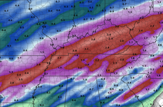
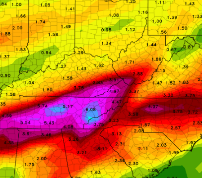
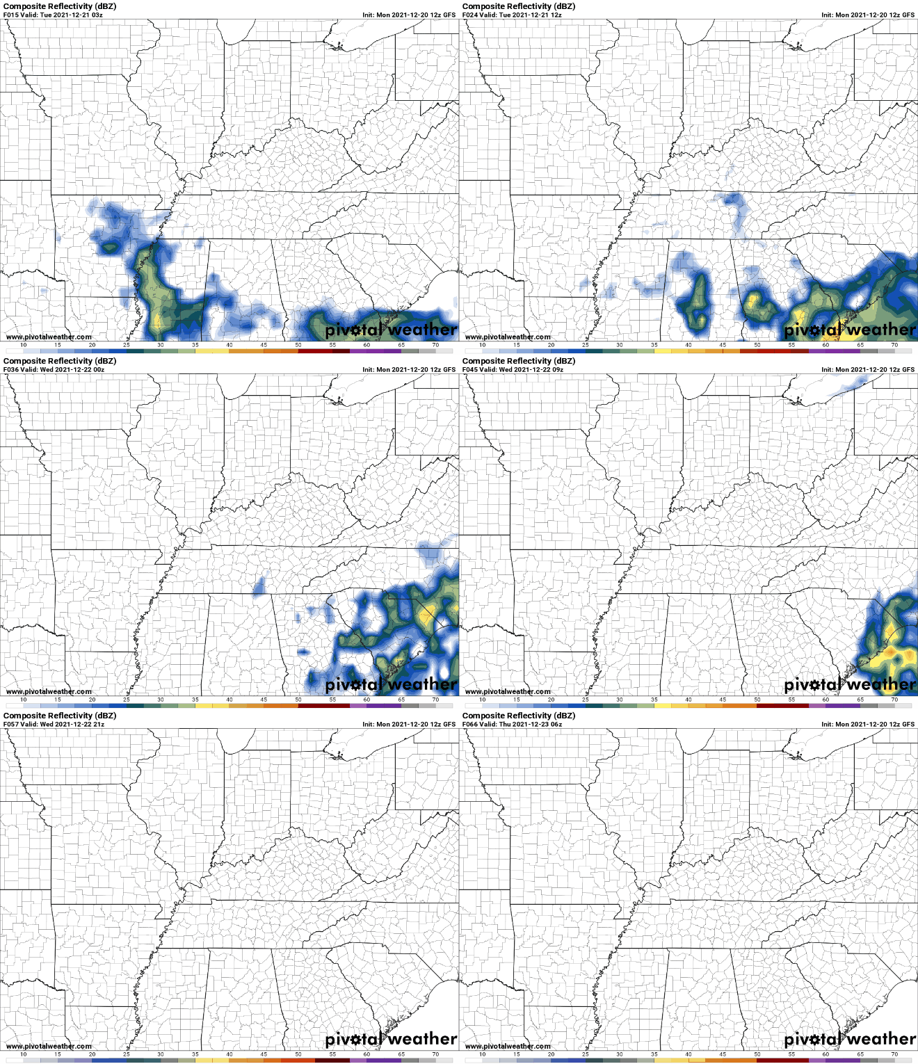
Another dynamic storm system looks to take aim at the Volunteer State. A front is wavering across the area today and will lift north in the form of warm front. As such, warm and moist air will advect back in tonight, leading to increasing shower chances Friday. The SPC has placed the area under a Marginal risk for severe storms tomorrow evening, and a Slight risk for Saturday. The biggest threat with this system will be damaging winds, but hail, and localized spin-up can't be ruled out. Additionally, heavy and consistent rainfall will accompany this system. As a warm front lifts north today, showers will spawn in for Friday and Friday night. With this eventually working far enough north, we'll see a break from activity (briefly) before a powerful cold front works eastward bringing the severe threat. This will also leave an opportunity for flash flooding as heavy rainfall with yesterday's system, combined with the rainfall expected the later half of tomorrow, could lead to quickly rising waters. Use caution as this will likely dump heavy rains at times across East Tennessee. Looking at the one of many models offered, the consensus between them all is for between 2.5 and 3.5 inches with locally higher amounts not out of the question. Many locations picked up 2+ inches through this morning, with another 2-3+ to go. Given the saturated soils and little time for recovery, flash flooding will be a concern throughout Saturday. A powerful cold front looks to take aim at the area, bringing severe opportunities Friday night and throughout Saturday along with heavy rains and flash flooding/flooding potential. Anticipate for it to be breezy both Friday and Saturday. Once the front passes, MUCH cooler air is anticipated with highs on Monday lucky to break the 30s for some. Most valley locations will top out in the low 40s with overnight lows into Tuesday, for the higher elevations especially, in the teens. Pre-recorded for 5pm show
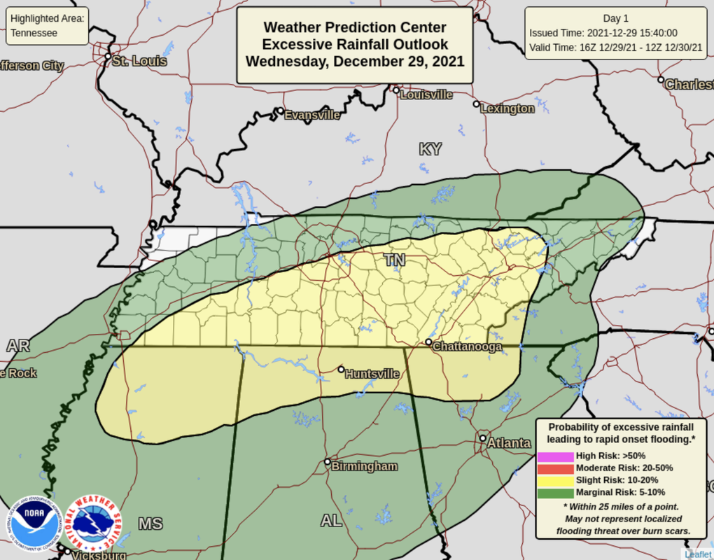
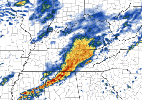
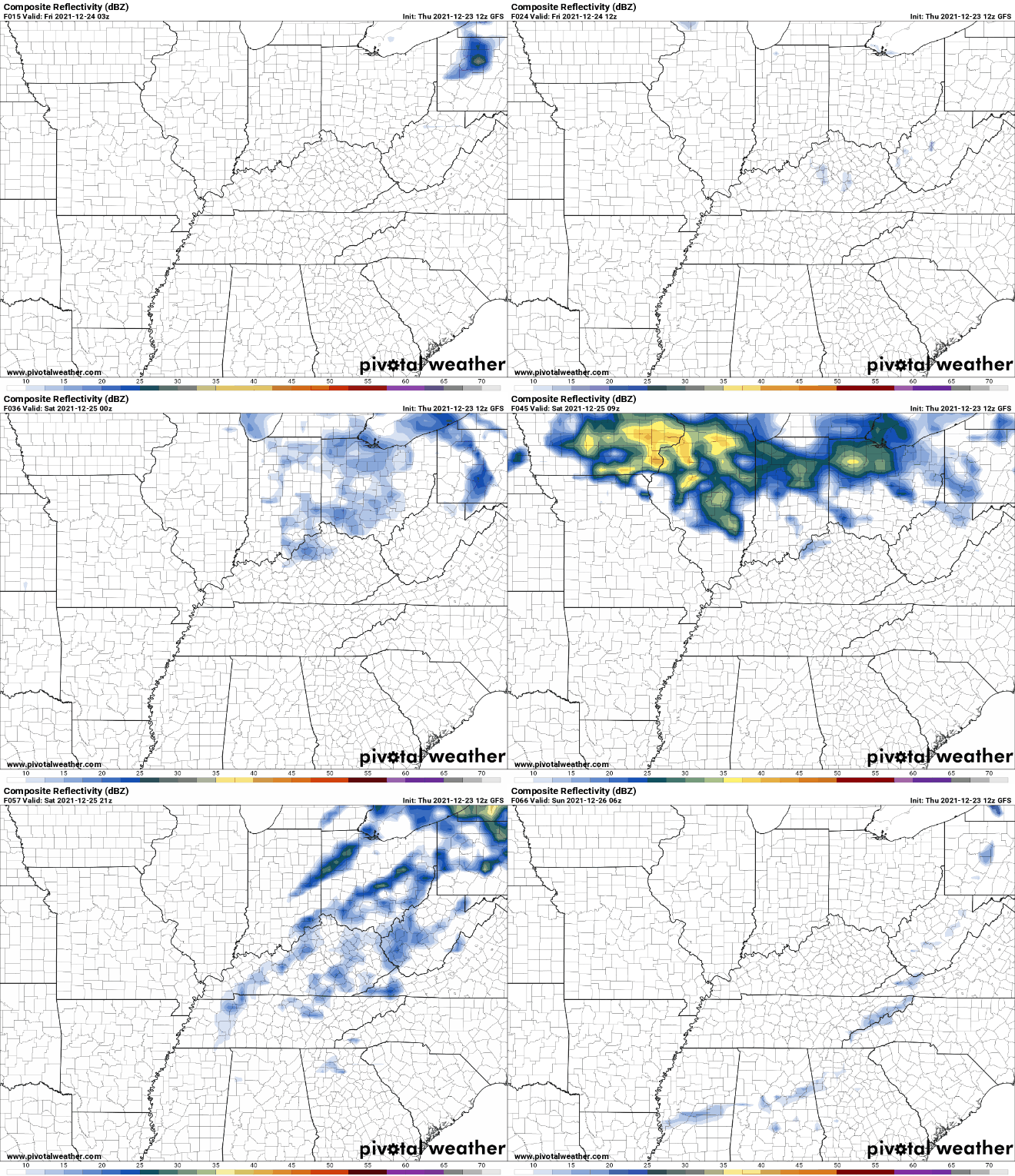
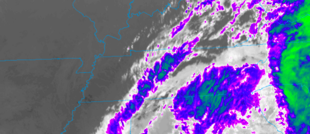
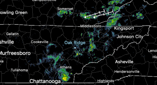
The Storm Prediction Center has again up-ed the severe risk today, particularly along our southern counties. Chattanooga and the surrounding area sits within the Enhanced (3/5) risk. All areas, but primarily Knoxville and south, will see the opportunity for severe storms. These can include: tornadoes, large hail, and damaging winds. Please have a way to receive alerts and know your safe spot if it is needed. The timing remains similar to what we said yesterday, with the primarily impacts arriving between 7pm and 10pm and gradually working east. Most activity should begin exiting towards midnight, with only a few lingering showers possible. As is the case in most severe weather days, flash flooding will also be a concern. A slight risk has been expanded to include most of East Tennessee. In areas of "training" storms (meaning storms working over the same areas) or in strong storms, the flash flooding risk will be the greatest. This will again be possible, in addition to a severe risk, New Year's day. Here is a snip of Hi-resolution data depicting the showers and storms expected this evening/tonight. As you can see, the strongest locations (reds/oranges) are located on the southern flank of the line. This is where we will see the best opportunity for severe storms and particularly the strongest winds for tornado growth. This threat will be the greatest south and west of our area, but remains possible for all. Know your safe spot now if warnings are issued and have a way to receive alerts from the NWS via social media, NOAA weather radio, or TV (assuming you have power) sources. We will be monitoring things closely tonight and updating on our Twitter/ Facebook as well. Another shot at severe weather and flooding will find us Friday and Saturday, with a similar setup in store. We will have more details into tomorrow, but for today, stay safe, have a way to receive alerts, and know your safe spot if severe thunderstorm or tornado warnings are issued. Pre-recorded for 5pm show
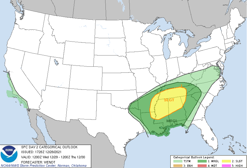
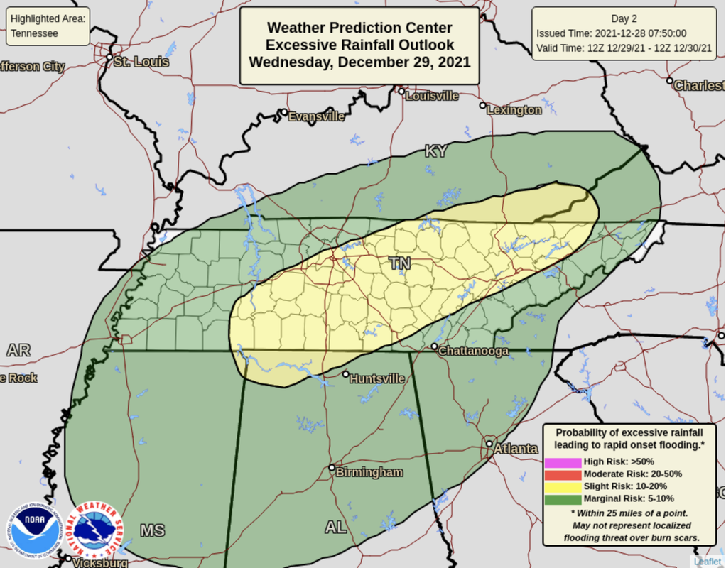
Theres lots to discuss, so we'll jump right into it. A cold front is expected to take aim at the area, bringing the opportunity for strong to severe storms and flash flooding/flooding. The Storm Prediction Center has upgraded the risk to a Slight. This includes an opportunity for: -Damaging/large hail -Low risk tornadoes -Damaging winds (60 mph) In addition to the severe threat, there is also a flash flooding threat. Given the rainfall expected to arrive later today/tonight and throughout the day tomorrow, heavy rains could easily lead to flash flooding. This risk has also been upgraded to a Slight chance (10-20%). Breaking down the day....Showers will be off and on throughout Wednesday (beginning this evening). An approaching cold front is then expected to develop a cluster of storms tomorrow evening to the early overnight. Timing for this is still a bit uncertain but generally between 6pm and 10pm is when the strongest of these storms will arrive. Moving forward, the potential for flash flooding and severe storms isn't over. A potent cold front will again bring the chance for flash flooding and severe weather. A peak into total rainfall between now and Sunday shows upwards of 7 inches possible. With between 2-3 inches expected through Thursday morning, another 4-5 inches is possible Friday and through the weekend. This system (of the two) looks to be the biggest concern. For now, we'll keep you updated with the latest alert and conditions through tomorrow, but more is to come. Please use caution into tomorrow. The bulk of hazardous activity will come tomorrow evening and into the overnight, but there could be opportunities (at times) during the afternoon as well. Have a way to receive alerts and know your game plan if warnings are issued. All severe hazards, along with flooding, are on the table. Pre-recorded 5pm show
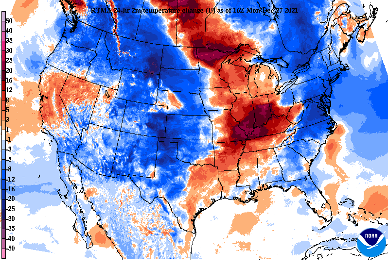
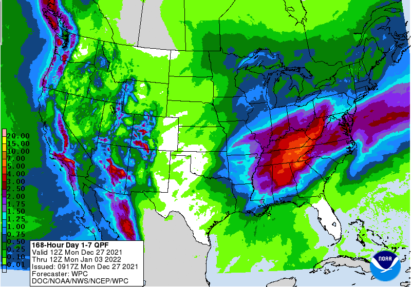
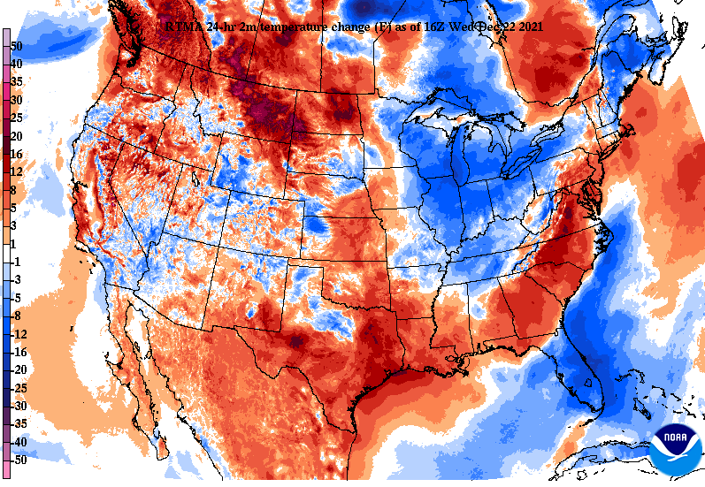
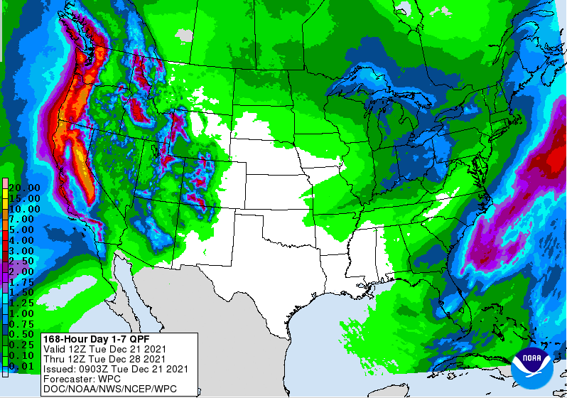
Good afternoon and I hope you're enjoying another Spring...whoops I mean Winter day. Looking across the Ohio Valley, temperatures have really warmed up over the past 24 hours. A northward moving warm front has lead to upwards of a 25 degree swing from this time yesterday for portions of Western Kentucky. Moving forward, anticipate the "heat" to stick around. Something we are closely monitoring is the flood threat not only midweek but also again this weekend. As the warm front continues to lift north, showers will arrive for Tuesday, with a cold front to then swing through on Wednesday. Because moderate to heavy showers are possible at times tomorrow and this will likely saturate grounds, a Marginal flash flooding risk has been placed from Wednesday morning into Thursday morning. The heaviest rainfall will be associated with the cold front Wednesday, with upwards of 2 inches or more will be possible with this system. Longer term, another similar setup is in place for New Year's weekend. We will continue to eye the potential for flooding, but this second wave could be a bit more hazardous than this first one. The graphic below highlights the 7-day rainfall expectations from the Weather Prediction Center (WPC). As you can see, upwards of 5 to 7 inches is anticipated through next Monday morning. Again, the greater half of this amount is expected from our second system Friday and this weekend. With moderate to heavy rainfall through midweek and only portions of Thursday and Friday to dry out, there is limited time for grounds to recover. Because of this and the heavy & consistent rainfall expected, flash flooding/flooding will be a concern. We will continue to provide more details in the days to come with the next system. For now, eyes are on our current one. Though the risk is low (5-10%), there is still concern for flash flood/flood prone areas across East Tennessee. If you are seeing flash flooding/flooding (particularly Wednesday), let us know via Twitter/Facebook or by email. Pre-recorded for 5pm show
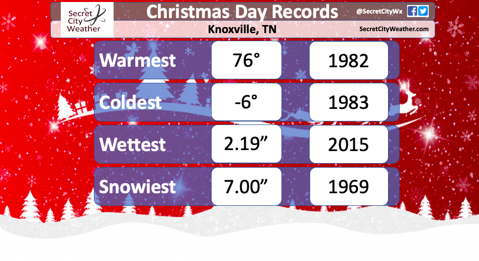
Looking across East Tennessee, sunshine dominates today with temperatures nearly 10 degrees warmer than this time yesterday. We will continue to warm through the weekend, but sky conditions won't be as pleasant in the days ahead. Looking at the play-by-play, cloud cover will increase through Friday, leading to a light shower or few sprinkles overnight and into early Christmas morning (hope Santa has his rain gear to our north!). On Christmas Day, cloudy skies will be the main impact across the area, before gradually clearing out through the evening and overnight. Sunday will feature a return to sunshine and continued warmth, then our next disturbance arrives Monday and early next week. Temperatures through the period are expected to be well above average. Though highs Christmas Day are expected to be in the mid 60s, the record for the day stands at 76 (for Knoxville). Last year many saw a White Christmas, or at bare minimum, a few flakes on the day. This year the scene will be quite the opposite. The month of December and even November has been running well above average, with no snow recorded thus far. You can find your full Christmas Day forecast and more by watching our Video Forecast below. The next few days will mainly be quiet with rounds of cloud cover and pockets of sunshine. We plan to take the day off tomorrow for Christmas Eve but you can find our forecast, along with updates, on our Twitter & Facebook pages. Have a wonderful Christmas and we'll see you back here on Monday! Pre-recorded for 5pm show
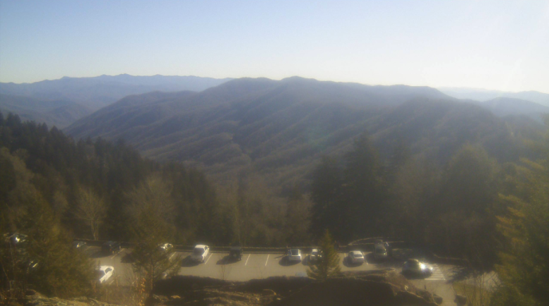
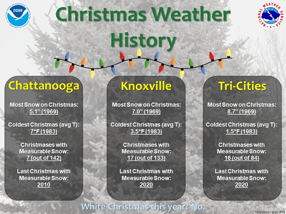
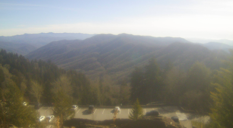
A beautiful but cool afternoon across the Volunteer State. Most valley locations are sitting in the mid 40s, with highs to top out only a few degrees warmer. Across the Newfound Gap area of the Smokies (below) current temps sit right at 30 degrees (1pm). Though we were cool yesterday, we are a touch cooler (on average) across the region. Looking at the past 24 hours, cold air has advected in behind a dry front, leading to the 5-10 degrees of a change we are seeing across the Ohio and Tennessee Valleys. We will warm through the next several days. With Christmas only days away, check out some weather history about the day. Knoxville has had record cold and snowy days, but only 17 out of 133 days (since records began) have had measurable snow. If you recall last year, most saw a white Christmas. This year will very much be the opposite....warm and cloudy to partly cloudy is what you can expect for the day. We will continue our dry stretch the next several days with only isolated showers to sprinkles possible Friday evening and overnight. Most will likely only see cloudy skies before sunshine returns into Sunday. Pre-recorded for 5pm show
Good afternoon! Cloud cover has been pesky so far, leading to cooler temperatures and plenty of cloud coverage. This is all associated with a system to our southeast, moving out by tonight. As a result, temperatures will be cooler today, topping out near 50 degrees. Into tomorrow, a dry cold front will pivot through, reinforcing cool air and leaving highs in the mid and upper 40s. The 7-day rainfall outlook looks limited. Rainfall chances will be possible Friday night and into Christmas Day, but will me minimal with only a tenth of an inch at best for some locations. Following, drier conditions return for Sunday and into early next work week. Overall, quite conditions are expected. Highs will average near to slightly below today and tomorrow before working the remainder of the week. By Christmas, we'll see highs in the 60s under partly cloudy skies and a chance for a few isolated showers. This is all to say a White Christmas is off the table this year. Pre-recorded for 5pm show
Good afternoon! After a chilly start, things are warming up. Current temperatures area-wide are in the mid and upper 40s, warming to around 50 before days end. Here's a look across the Newfound Gap area of the Smokies where temps here are at 37 degrees. Cloud cover will thin out at times, but a system to our south will again increase coverage overnight. Moving forward, there's little to talk about as dry conditions persist through at least Thursday. A system pushing in from our north and west will bring the chance for rainfall late Friday and into Christmas Day. With that said, I can promise you there won't be a White Christmas as temperatures so far this "cold season" have been above average. Look for some changes though in the large scale pattern into January as we could have a few cold outbreaks swing through the Southeast. After Wednesday, temperatures will warm, with highs Friday into the lower 60s. This is over 10 degrees (for some) above average. This will continue into Christmas day as well. That will do it for today....bettering sky conditions will find us mid week with warming temperatures to follow. Pre-recorded for 5pm
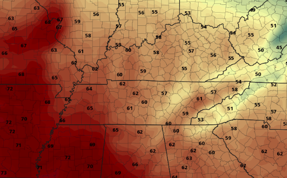
Good morning! Isolated to scattered showers remain across East Tennessee (6:45 am) but will begin lifting northward as a warm front slides through Kentucky today. As a result, we will be between fronts giving us a brief period of reprieve from the rainfall. A few showers will hang around through early this afternoon, before cloudy skies dominate through early Saturday. Highs today in the mid 60s. Looking at modeled guidance, Showers lift north as a warm front before a cold front swoops across the area tomorrow. This will provide showers and even a few embedded thunderstorms before exiting Saturday night. Following, high pressure arrives from the west, bringing a chilly Sunday and slowly moderating temperatures through midweek. Sunshine will stick around through at least Tuesday with highs generally in the low and mid 50s early work week. Rainfall totals with this system have continued to come down in the recent days. We picked up generally 0.5-0.75" yesterday and into this morning (so far) with another 0.5-1" possible through tomorrow night. Overall, this will be beneficial to the abnormally dry conditions we are seeing across portions of the state. Other than breezy conditions at times Saturday, it'll be a rain even with no severe threat. Clearing skies will begin into Sunday, leaving cool temps for the day as well. Have a great weekend and don't forget to follow us on Twitter/Facebook (@SecretCityWx) for the latest! Pre-recorded for 5pm show
|
Your trusted source for everything weather in East Tennessee.
Social Media
|

