|
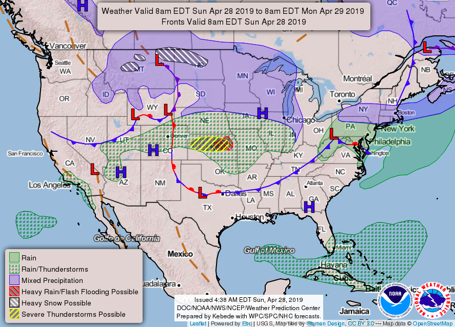
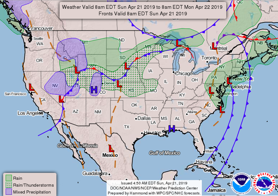
Good evening! I hope everyone had a good weekend. It turned out to be a nice Sunday with sunny skies and comfortable temperatures. Moving into this week expect Mother Nature to turn up the thermostat a bit with highs to be in the mid to upper 80's through Wednesday. Our average temperatures for this time of the year is in the mid to upper 70's and we could see upper 80's Tuesday. Shown below is a general forecasting map showing areas of high and low pressure systems throughout the nation and what you can generally expect. As seen, we are stuck between a low to our north and high to our south. We will stay mostly dry for the first half of the week only having a mix of clouds stroll through. Monday we will have much warmer temperatures with high's in the low to mid 80's and scattered clouds throughout the day. This seems to be the pattern for the next few days: warm with patches of sun and clouds. Our next disturbance will come Wednesday into Thursday with showers and thunderstorms possible (Mainly Thursday & Friday). Showers for the beginning of the week will stay to our north as the air in east Tennessee looks to stay pretty dry. Have a good week and stay cool as we will get a taste of some summer time heat over the next few days. Thank you for your responsesI also want to thank those that provided feedback recently. We are driven around you, so your feedback is beneficial to both us and you. Secret City Weather plans to include some new and creative things soon, so continue telling us what we can do to better provide for you. If you ever have ideas for us, kind words, things you would like to see or not see, and/or things we can change, you can let us know through our feedback link or email. Both of these can be found in the "Contact" tab found at the top of our page.
0 Comments
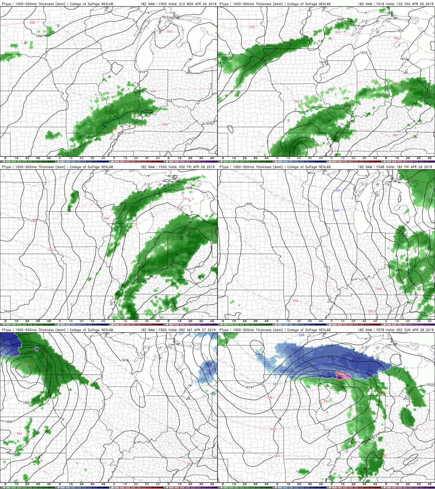
I hope everyone has had a good Wednesday. It was abnormally warm (June feel) today with highs reaching the mid 80's in some spots. Luckily, a low will be moving through our area bringing with it rain potential and cooler temperatures. Below is the latest NAM model run depicting the showers we will see tomorrow and tomorrow night. Most of this rain will move out by Friday afternoon, leaving a beautiful Saturday. Showers tomorrow during the day will be light and mostly scattered, allowing for relatively little issues (weather-wise). Tomorrow evening around midnight we can expect the more moderate rain and thunderstorms to roll through. There is nothing severe associated with this system besides a few rumbles of thunder. With these rain showers we can expect the temperatures to cool off a bit with high's in the lower 70's Friday. Showers, along with the clouds, should be on their way out by Friday afternoon, leaving a pleasant Saturday. This is where you can expect sunny skies and high's in the upper 70's. Sadly, this will not last long as another quick moving system passes through Sunday bringing some scattered showers. Monday we look clear with temperatures warming back into the lower 80's. Buckle up, as it will likely be an above average Spring and Summer. Enjoy the "cooler" temperatures and pretty start to the weekend before summer-like temperatures find their way in later this next week.
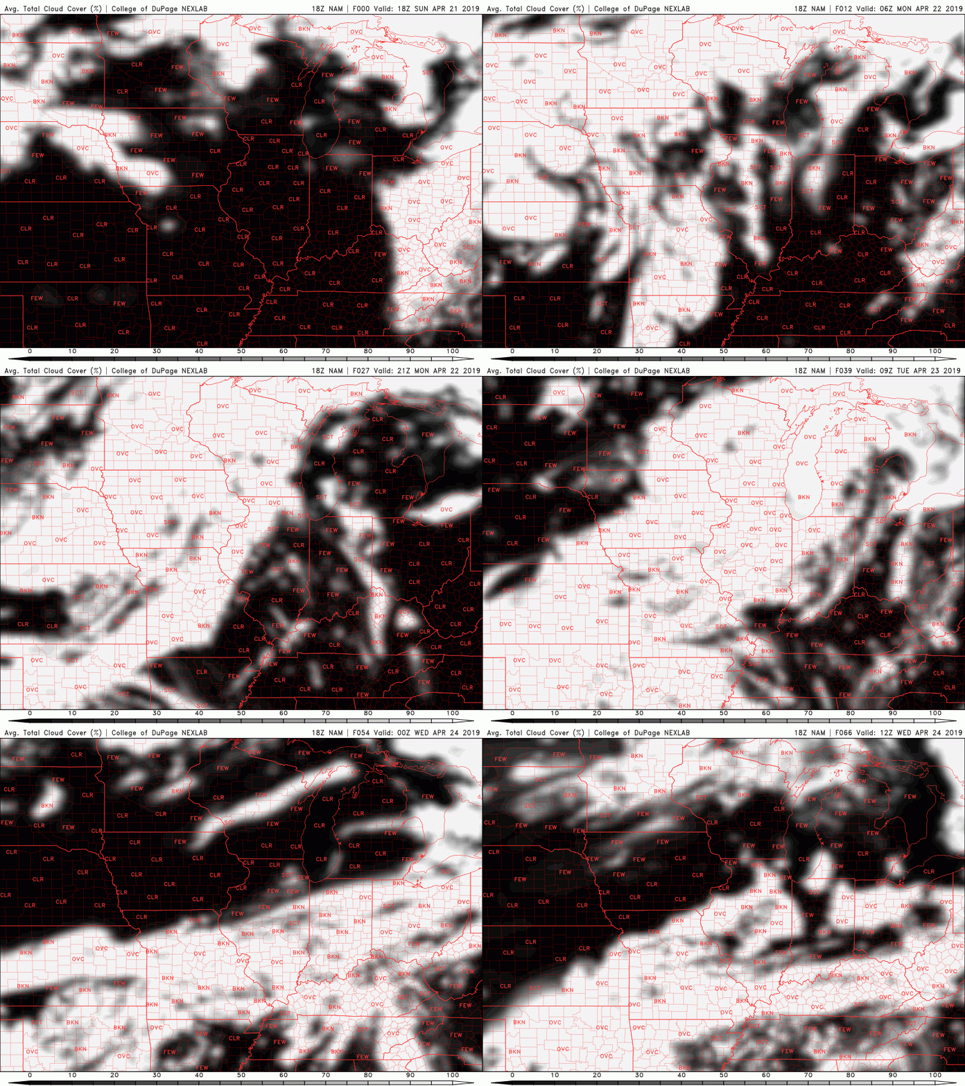
It was a near "perfect" day with sunny skies and high's near 70. This trend of pleasant conditions will continue for at least the next few days. A high pressure system in the southeast is allowing us to stay "high and dry" for the start of the week. This will allow for lots of sun and warm temperatures to stay in the area. Below shows the average cloud cover over the next couple of days. As you can tell, we will stay pretty sunny until Tuesday evening when some clouds begin to build. Luckily, the sun will stick around Wednesday before showers move in Thursday. For your day to day conditions check out our "weekly Forecast" tab at the top of the page. It should be an enjoyable start to the work week before showers return Thursday. As always, I will update you midweek on what you can expect. Until then, soak up the rays and warm temperatures. If you wouldn't mind helping Secret City Weather out in providing us feedback, that would be much appreciated! Let us know what you like about us, what you may dislike, and what we can add/change for the future. Our services are entirely built around you, so your feedback is much appreciated so that we can better serve you. You can provide feedback through the link below. Thank you again for your help in making Secret City Weather better!
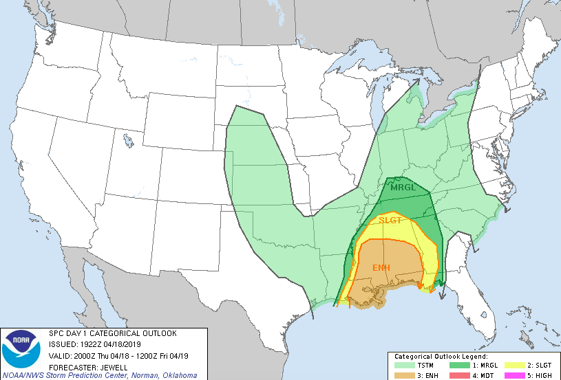
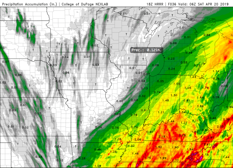
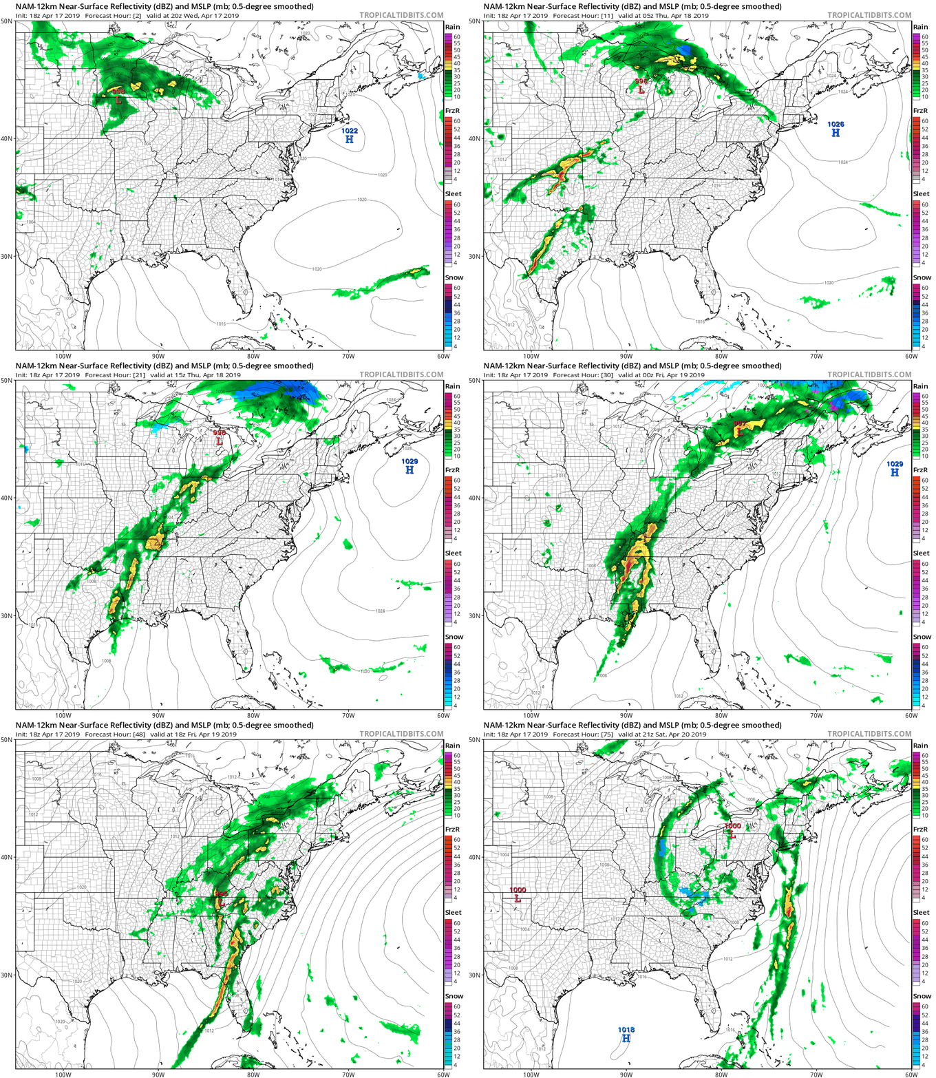
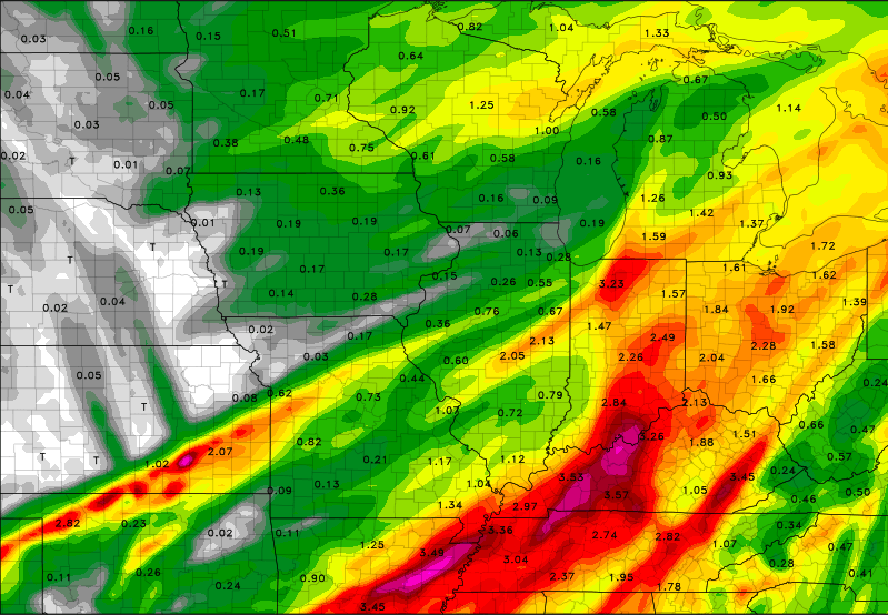
Happy Thursday! Warm temperatures and mostly sunny skies stuck around today. Unfortunately, changes are coming. If you haven't noticed, clouds have been slowly increasing this afternoon and will continue to into tonight. Overall, the SPC has stuck with us staying in the Marginal risk of severe weather. As I talked about in the last post, we will mainly have times of heavier winds and thunderstorms, but a severe storm or two isn't out of the question. As seen below, lots of rain will likely fall across the entire mid-south region from late tonight into Saturday evening. With it will come a sharp cold front. This means temperatures will begin falling Friday afternoon and overnight. Overnight Friday, showers will continue and snow showers will arrive for the highest of elevations. Yes, SNOW. Winter isn't quite over for the mountains, as they are expected to receive up to an inch+ by Saturday. Of course this is for the highest of elevations, but nonetheless, snow in mid April for Tennessee is unique. As for us, we will be left with high's in the 50's Saturday. We will rebound Easter Sunday with those high's back in the 70's and pretty blue skies. How Much Rain Can We Expect?This is a good question, models are having a challenging time pinpointing amounts. Overall, I am sticking with my latest post in saying we can expect between 1 and 2.25 inches. Again, some spots could be lower and some higher, but overall this is a good range. Beware of the flooding potential, a few inches of rain within 36 hours can cause havoc in our region, especially with high water levels and moist grounds already. Showers will move in late tonight and carry throughout until Saturday afternoon when they eventually move out leaving a beautiful and comfortable Easter Sunday. If you can make it through the rain and storms the next couple of days, sunny skies will arrive back Sunday and early next week. I will keep you updated (via Twitter [@SecretCityWX]) for any severe storms that could break out. Remember, all of our tweets can be seen on the right side of our website!
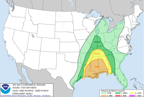
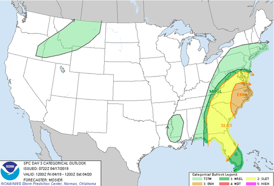
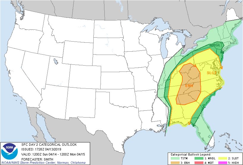
Happy Hump Day! I hope you all have enjoyed this Spring weather as it has been mostly sunny and warm with temperatures in the mid 70's most days this week. These conditions will soon change, as lots of moisture is on the way. As this next low pressure system nears, we are getting a better outlook on the severe potential. The graphic above was released by the SPC showing areas of the highest risk for severe weather. Based on this, we are under a Marginal risk. This basically equates to the likeliness of heavy winds and thunderstorms (small hail & small isolated tornadoes are given a chance but not likely). This risk is from 8am Thursday until 8am Friday. Remember, things can change! I would not be surprised to see the "Slight" risk to move a little farther east by tomorrow, but we will see. The next SPC graphic shows a similar story, but from 8am Friday until 8am Saturday. A similar outcome is likely, with the most of this system producing heavy winds and a few thunderstorms. Based on my analysis I agree with what the NWS has put out. The "energy" supply for this system isn't there. The predominant factor associated with this system is winds and thunderstorms. There could be isolated reports of small hail, but I will keep this on the "lower potential" side of things. As seen above, a low pressure system will move in from our west bringing with it lots of rain and severe potential to our south in states like Alabama, Mississippi, and Louisiana on Thursday. As for us, this system will be arriving mainly overnight Thursday. This in itself, is a good thing. During the day, heating and additional processes happen that "ramp up" the severe potential. So, for this to be arriving at night, the lower severe chances are in line with the SPC maps. I am concerned with the possibility we have recently death with the past few months here in east TN, flooding. Seen above is just ONE of many model outputs predicting the total rainfall in our area. As for east TN I believe we can expect between 1 and 2.25 inches (depending on where you live) between Friday morning and Saturday night. Some areas could expect less and some could get more, but generally, that is a good rough estimate. So what does this mean? Flash flooding is possible, and the overall flooding potential is there, as well. Even though we have had some clear days with lots of sun, rivers and tributary heights, along with soil moisture, are still above average. Remember if water does begin to build up and rise on road ways, its better safe to find an alternate route. As for Thursday expect clouds to build and for it to be mostly cloudy throughout the day. Temperatures will stay warm with a high in the upper 70's. Late Thursday night, rain and thunderstorms will move in and stick around most of the day Friday and early Saturday. Saturday showers will move out leaving behind much cooler temperatures (due to a cold from associated with the low). For you Easter Sunday, we will rebound and warm up a bit with mostly sunny skies. Don't forget umbrellas Friday, and I will keep you updated on any changes that may occur over the next couple of days.
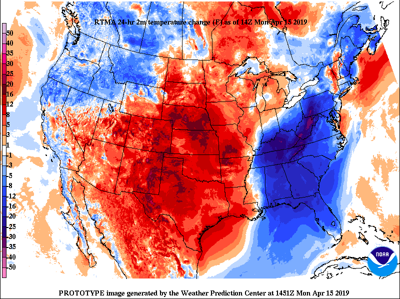
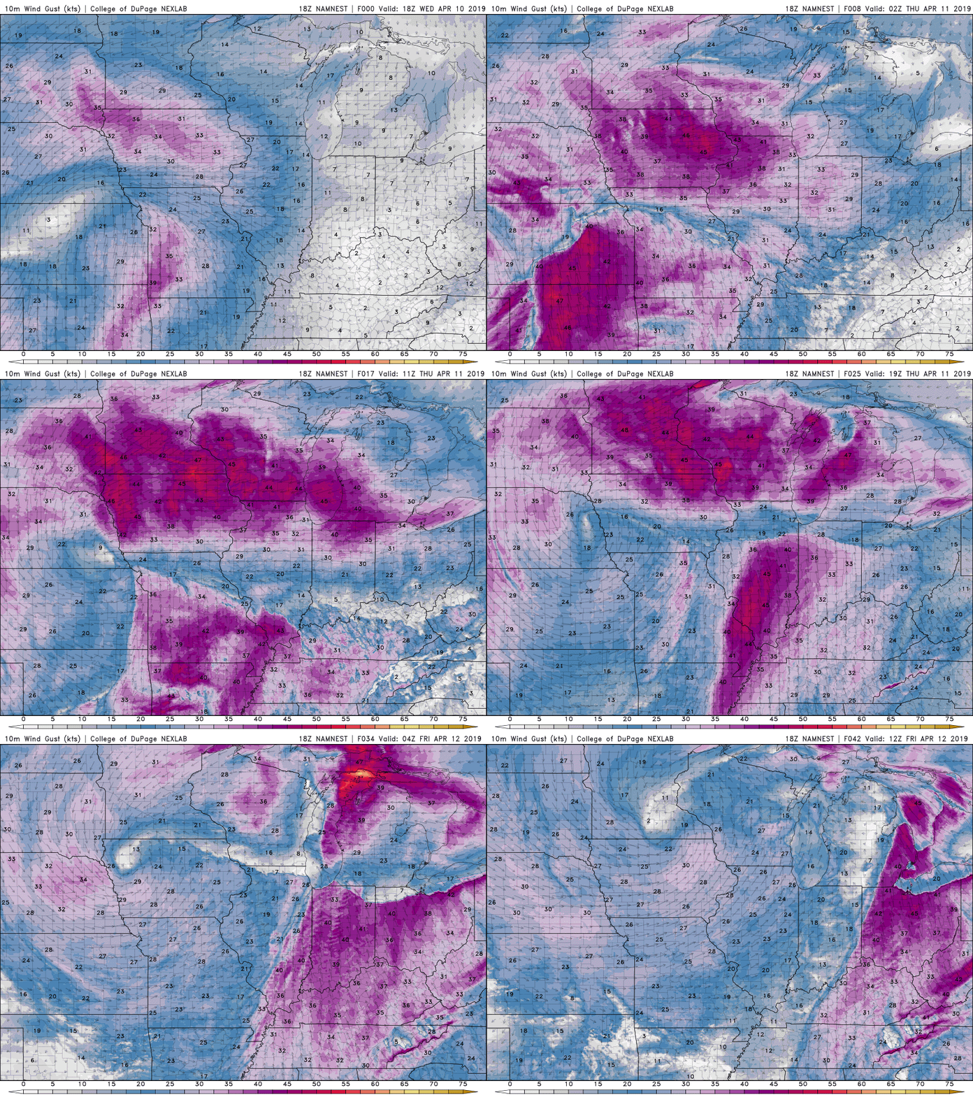
Many of you woke up this morning to chilly temperatures on your way out of the door. This can be thanked, in large part, to the cold front that moved through late yesterday. As seen below, much cooler temperatures have swept through much of the southeast the past 24-hours. As for today, expect a pleasant day with temperatures on the cooler side of things. By this evening we will have a high pressure system move right over the Tennessee/Kentucky region bringing with it much warmer temperatures Tuesday and the rest of the week. This high will also allow us to stay dry and see plenty of sunshine for the next few days. As seen below, this high pressure system will make its way into the area from the southwest. It will bring back those warmer temperatures as early as tomorrow, as well as keep sunny skies in the forecast. This will not hang around too long as another strong low pressure system is tracking across the western portion of the US, eventually impacting us. Sunday we saw severe storms move through the region. The main impacts with this system was damaging winds. If you haven't already, check out our Twitter to see a few of damages these storms did. Later in the week (Thursday evening) another powerful low will move in bringing with it the chance at another round of severe weather. Make sure to check back in with us to get the latest on what you can expect mid to late week! Until then, enjoy this beautiful weather while it lasts.
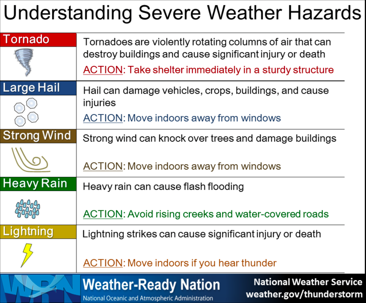
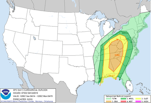
Sunday's severe weather outlook remains the same. We are under an ENHANCED risk for severe weather Sunday (mainly Sunday early afternoon). Showers and thunderstorms will roll through Sunday morning, but the main concern with these will be damaging winds. Later in the day is when we will experience the largest severe threat. As daytime heating persists, this will "prime" the atmosphere for instability (think of this as the fuel/energy needed). Below the NWS has provided "what to do's" in the event of heavy rains, thunderstorms, winds, tornadoes, or hail. With tomorrow's system the impacts are the same as previously mentioned: isolated tornadoes, hail, damaging winds, and thunderstorms. Stay weather aware tomorrow and frequently check back in with us and the NWS in Morristown. There is no reason to ever panic, but instead be prepared and have a plan of action IF something severe were to spawn up in your area.
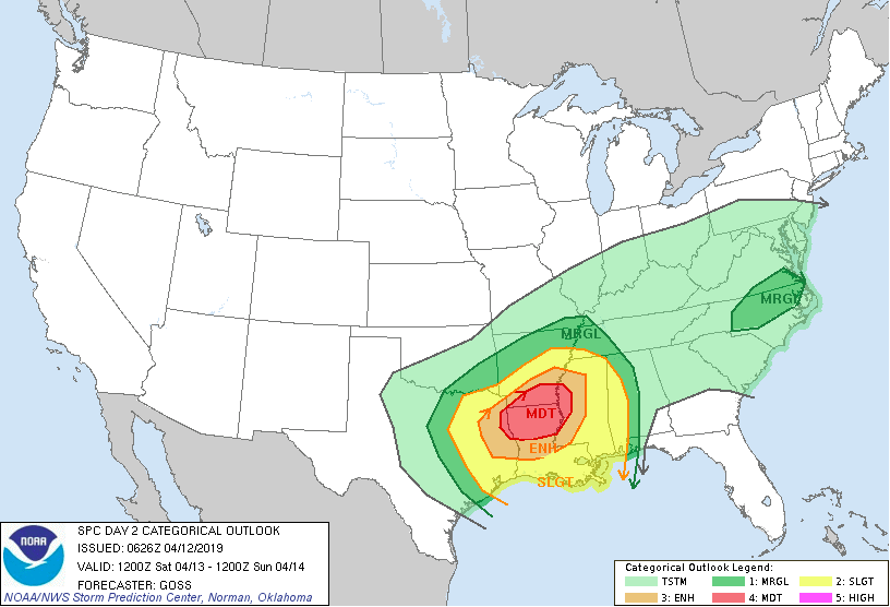
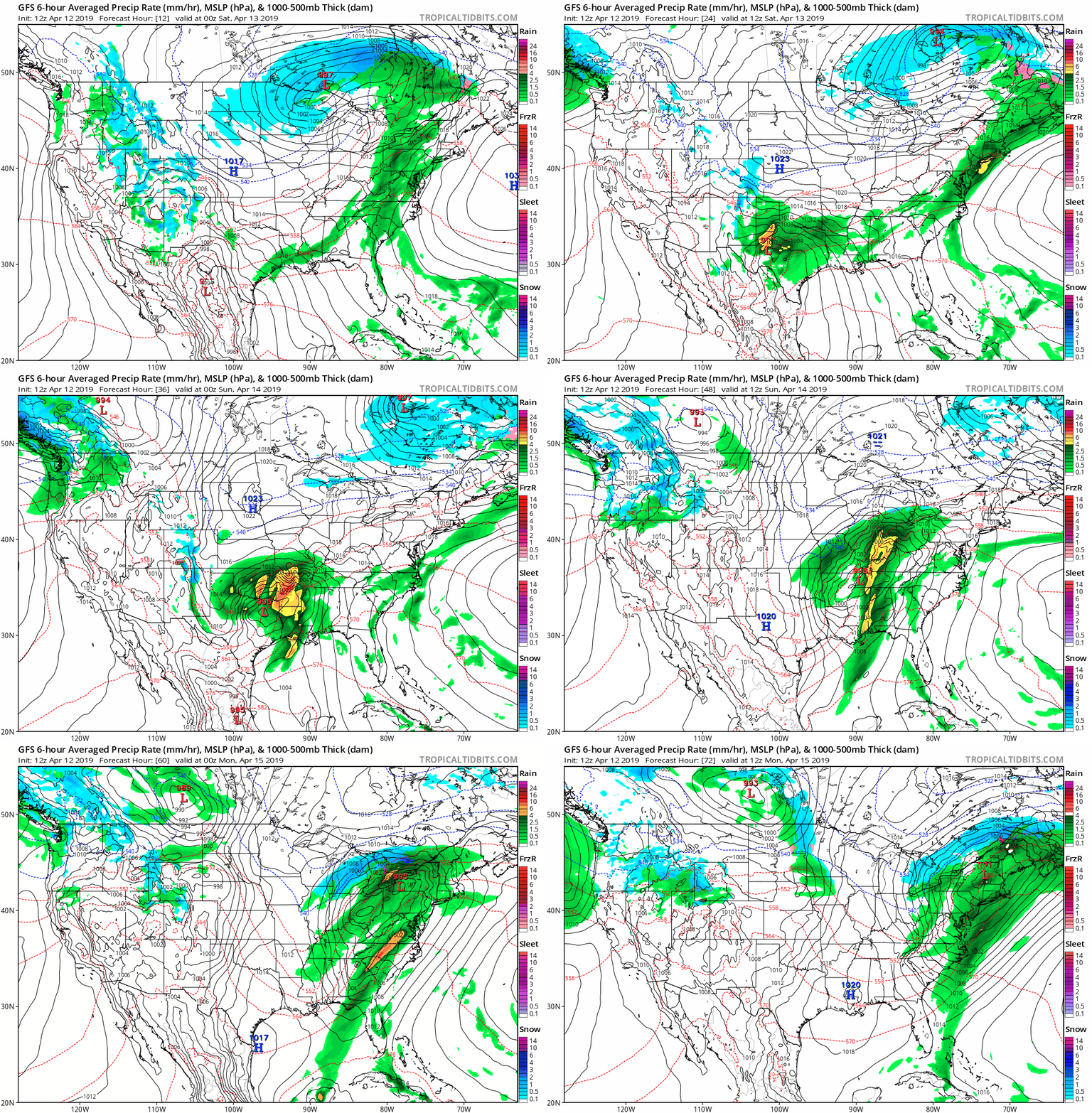
Enjoy the Orange and White game tonight as we will stay mostly dry with scattered showers possible later in the evening. Temperature wise for the game we will be sitting in the upper 60's to lower 70's. All eyes will be on the low pressure system moving out of the southwest (from Mexico) as we move into this weekend. This low is expected to deepen and increase in strength as it moves northeast. Supplied with lots of gulf moisture, warm temperatures, lifting mechanisms, and ample initiation ingredients, tornadoes, hail, strong winds, and heavy rain is likely in northern Louisiana, parts of Mississippi, and Arkansas (as indicated by the dark red Moderate risk below). As for us, we will receive some scattered showers and a few rumbles of thunder. Saturday can be thought of as the day we are stuck between two systems. A low pressure to our far north (near Wisconsin) is what is providing those scattered showers today and into tomorrow. Once this low moves out and into Canada, a stronger low to our southwest will fill in, raising questions on the severe threat. Seen below is a model simulation of the track of the low and precipitation associated with it. Moving into late Saturday and early Sunday, the rain looks to begin impacting us in the morning with some light scattered showers. The bulk of this event (strongest period) will take place early afternoon and into the evening hours. Stay weather aware later this weekend, knowing a severe risk is at the enhanced level. Things are likely to change slightly being we are a couple of days out so check back frequently here and on our Twitter page (@SecretCityWx) for the latest updates! All twitter posts can be seen on the right side of our home page, so if you do not have Twitter, do not worry.
Main impacts: Heavy rains at times, damaging winds possible, hail possible, and isolated spin-up or tornadoes possible. WHEN/Timing: Scattered showers will begin Sunday morning with the main threat in the early afternoon and into the early night. Remember: Always have a plan of action if severe weather does occur. In the event of a tornado seek shelter immediately in the most interior portion of your home, away from windows and doors. Stay tuned with your NOAA radio until you hear the "all-clear" or until the warnings have ended. If you do not have access to a NOAA radio, stay updated on your phone, computer, or tablet (https://noaaweatherradio.org). Happy hump day, and what a beautiful day it was! Seasonal conditions of sunny skies and highs in the mid to upper 70's today. As for your Thursday, very similar but a change is coming. Thursday we will start the day mostly sunny with calm winds. As the day progresses winds will pick up out of the south-southeast ahead of the front moving through. Winds in the afternoon will likely be between 10 and 15 mph with gusts up to 25+. Expect clouds to begin building tomorrow afternoon as moisture from the Gulf begins piling in. Into Thursday night, we should be mostly cloudy with the system moving in later overnight and into early Friday morning. As for the impacts of this system, we will see scattered rain showers throughout the day Friday. Some of these could be in the form of thunderstorms, but nothing severe detected as of now. Moving into the weekend, that low will move north and into Canada. Following it will be another, more impactful low pressure system, that will move in from our southwest. Obviously, we are a number of days out from Saturday night and Sunday, but I will be keeping a close eye on what impacts this could bring to our area. Until then, enjoy one more day of these seasonal temperatures before some scattered showers arrive Friday and into the weekend. Sunday looks to be much heavier rains with thunderstorms and a severe potential. Stay tuned on our Twitter (@SecretCityWX) and here on our site for the latest updates on this weekend's severe potential outlook.
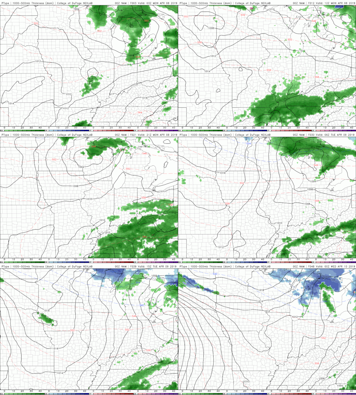
Hello and I hope everyone has had a good weekend! Overnight tonight, we will stay mostly dry (as seen from a live look at Radar below). Most of the showers moved out a bit quicker than expected leaving us just cloudy overnight. Unfortunately, more showers are to come. It was a dreary weekend with Saturday likely being the only day of much production outdoors. We saw some scattered storms roll through our area Sunday afternoon, a few of which were severe in Hawkins, Cocke, Greene, and Hamblen counties. Reports of hail and heavy winds were recorded in these counties to go with the severe thunderstorm warning issued by NWS Morristown. Moving into the start of the work week you can expect much of the same, so keep those umbrellas and rain jackets handy! Showers will likely move in Monday morning to early afternoon. Overall, some of these showers will have thunderstorms, heavier winds, and heavier rains included. As of now, the SPC (Storm Prediction Center) has the east TN area under a Marginal risk with a Slight risk of severe storms to our west in middle and west TN. Basically, a Marginal risk states that thunderstorms are possible and the chance of severe weather is low. With this said, we can never rule out the possibility of severe weather occurring so always be "weather ready" if an important alert is issued. Below is a model run of one model showing the general timing of the rain and how long it will stick around. As depicted above, most of the rain will move out by Tuesday, leaving a beautiful Spring-like day Wednesday. Mid-week looks to be dry before we once again finish the week with more rain showers. I will let you know what all you can expect going into Thursday and Friday sometime Wednesday, but until then, don't forget those umbrellas for the start of the week!
|
Your trusted source for everything weather in East Tennessee.
Social Media
|

