|
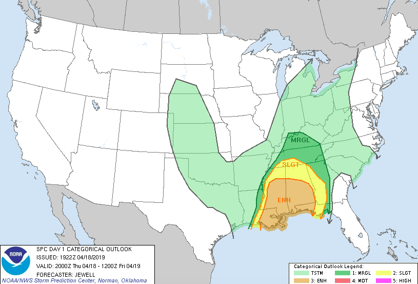
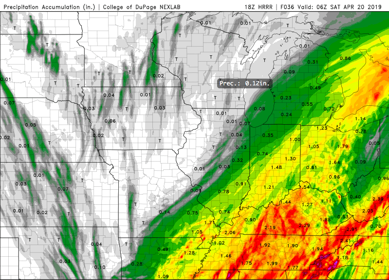
Happy Thursday! Warm temperatures and mostly sunny skies stuck around today. Unfortunately, changes are coming. If you haven't noticed, clouds have been slowly increasing this afternoon and will continue to into tonight. Overall, the SPC has stuck with us staying in the Marginal risk of severe weather. As I talked about in the last post, we will mainly have times of heavier winds and thunderstorms, but a severe storm or two isn't out of the question. As seen below, lots of rain will likely fall across the entire mid-south region from late tonight into Saturday evening. With it will come a sharp cold front. This means temperatures will begin falling Friday afternoon and overnight. Overnight Friday, showers will continue and snow showers will arrive for the highest of elevations. Yes, SNOW. Winter isn't quite over for the mountains, as they are expected to receive up to an inch+ by Saturday. Of course this is for the highest of elevations, but nonetheless, snow in mid April for Tennessee is unique. As for us, we will be left with high's in the 50's Saturday. We will rebound Easter Sunday with those high's back in the 70's and pretty blue skies. How Much Rain Can We Expect?This is a good question, models are having a challenging time pinpointing amounts. Overall, I am sticking with my latest post in saying we can expect between 1 and 2.25 inches. Again, some spots could be lower and some higher, but overall this is a good range. Beware of the flooding potential, a few inches of rain within 36 hours can cause havoc in our region, especially with high water levels and moist grounds already. Showers will move in late tonight and carry throughout until Saturday afternoon when they eventually move out leaving a beautiful and comfortable Easter Sunday. If you can make it through the rain and storms the next couple of days, sunny skies will arrive back Sunday and early next week. I will keep you updated (via Twitter [@SecretCityWX]) for any severe storms that could break out. Remember, all of our tweets can be seen on the right side of our website!
0 Comments
Leave a Reply. |
Your trusted source for everything weather in East Tennessee.
Social Media
|


