|
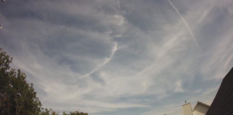
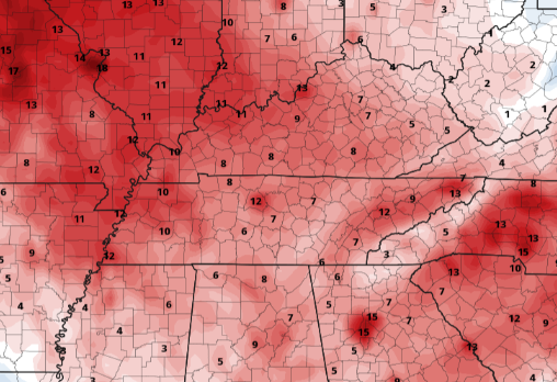
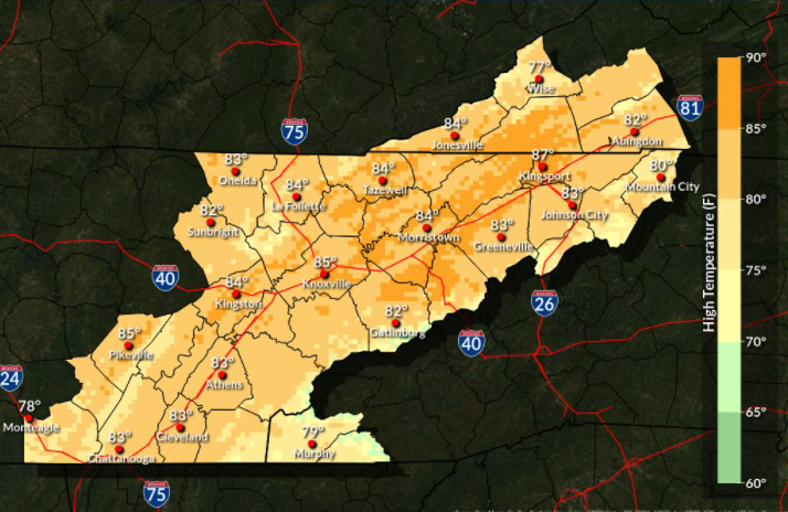
Starting off with the Stansfield's webcam in the Oak Ridge area, high cirrus clouds are present. This will do little to limit highs today, as most top out around the mid 80s. Similar conditions can be expected tomorrow, but we'll see an increase in cloud cover as a system works in from the west. With high pressure remaining locked in place across the eastern coast, temperatures will continue to stay warm this afternoon. How warm is warm for very late September? Well, comparing our average highs to the expected, we will be running 10, and even some areas, nearly 15 degrees above average. Thankfully a cool down is on its way, but that won't arrive until early next week. Our next weather maker will be a slow mover, with isolated showers not arriving until Saturday afternoon. By Sunday, activity will be more scattered before better chances arrive with the low and associated front Sunday night and Monday. Temperatures will cool as a result, with highs returning to the upper 60s (for some) and 70s for everyone else. That will wrap it up for today, another warm one is expected with mostly sunny skies. Pre-recorded for 5pm show
0 Comments
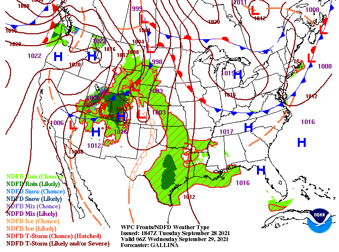
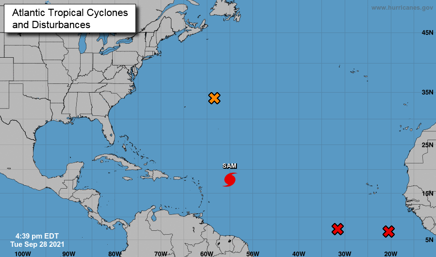
A weak cold front is slowly making its way southward and won't pass through until tomorrow. This will nudge temperatures down a degree or two Friday, but with the dry air associated with it, no real weather can be expected. High pressure also remains in place for the next couple of days, before breaking down into the weekend. A series of upper level disturbances will bring increased rain/storm potential Saturday and Sunday. This will be followed by a low pressure system and cold front that will arrive early to mid next week. The Tropicals remain active as Hurricane Sam is expected to become a major hurricane and work north and east. The good news is this system is expected to go just east of Bermuda, but not without bringing rainfall and surges to the island. Additional disturbances can be seen throughout the Atlantic, with development likely over the next 24 to 48 hours. We will keep a close eye on any new development and where it could lead in the days ahead. Temperatures will continue to stay warm with sunny to partly sunny skies expected now and through Friday. Showers (isolated) then make a return Saturday, becoming more widespread late in the weekend and into early next week. Pre-recorded for 5pm show
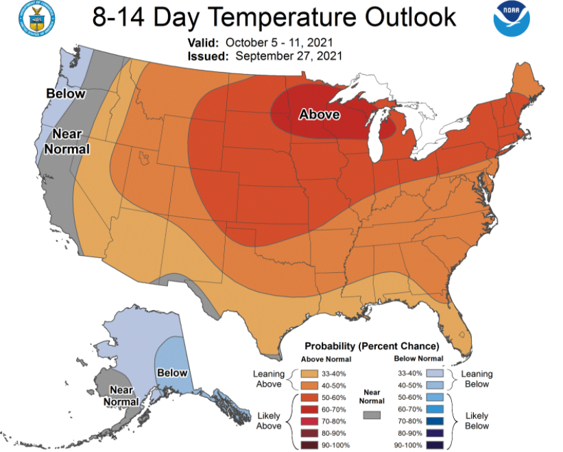
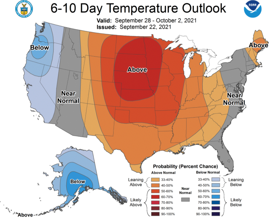
Starting off with a look into October, the CPC suggests the warm temperatures will continue to stick around. This week will feature highs in the mid 80s, nearly 10 degrees above the typical average. Mostly sunny to partly cloudy skies will also stick around through at least Friday. Looking at model guidance, things stay fairly quiet over the next couple of days. A disturbance will arrive towards the weekend, but with dry air in place there is some uncertainty if we see any rainfall at all. For now we have steered dry, but this could change for Saturday and Sunday. That will do it for today, we will continue to see the sunshine and warm temperatures through mid week. Have a good one and enjoy! Pre-recorded for 5pm show
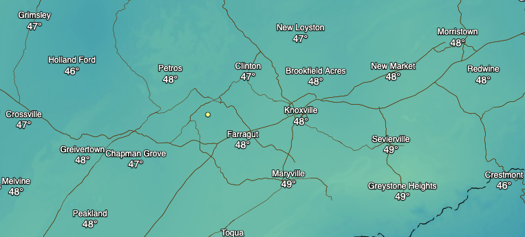
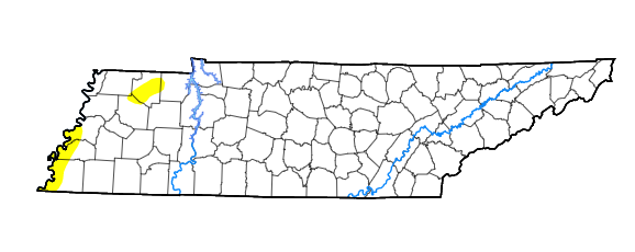
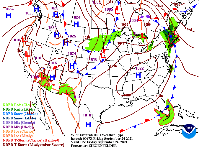
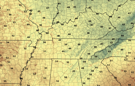
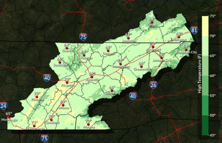
Check out temperatures (8am) across the area this morning! Very chilly start, especially for this time of the year, as our average lows are in the upper 50s. With daytime heating, we'll warm up to highs in the low to mid 70s with plenty of sunshine above. Changing gears, the drought map for this week looks normal. There are a few patches of abnormally dry, otherwise things look just fine. We will need to keep a close eye on things though long term, especially with dry air expected to hang around for some time. Looking at the surface map (below), high pressure will dominate much of the Southeastern USA. This will leave things dry through at least early to mid week with temperatures climbing back up into the 80s. For reference, the average high in Knoxville for late September is around 80 degrees so we'll be on the warmer side of things. That will do it for today...as always thanks for your support and have a wonderfully sunny and warming weekend! Pre-recorded for 5pm show
Good morning and I hope you are staying warm (feels odd to say that one). Temperatures right now across Eastern TN range from the upper 30s (Newfound Gap) to lower 50s (central valley). As we work into today, temperatures will warm to highs in the upper 60s. With cool air remaining in place overnight tonight, lows will drop into the mid and upper 40s across the area. Some locations (namely the higher elevations) could even bottom out in the 30s. As we move forward, this Fall-feel is fairly short lived. Data, along the with the latest CPC outlook, suggest highs warming back up to near and above average. By Sunday, we will warm back up to around 80 where temps continue to increase into next week. That'll wrap it up for today, slim to no rain chances present themselves through early next week, so enjoy lots of sunshine. Temps will be cool through Saturday before warming back up to near 80 degrees during the day time. Pre-recorded for 5pm show
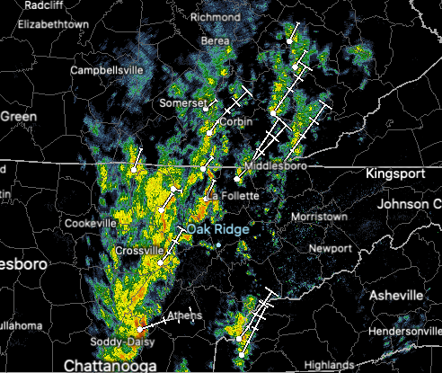
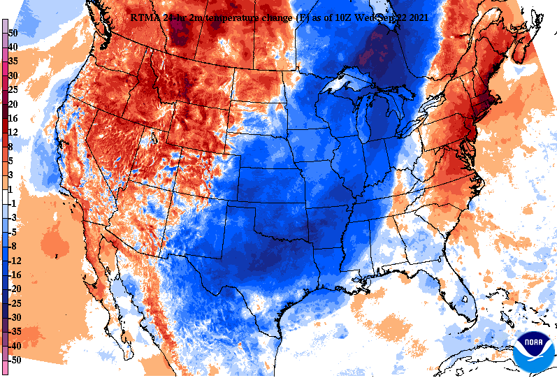
Before we fully activate Fall, showers and a few embedded storms need to work through this morning. This will then lead to much cooler air as it ushers in from the north and west. Right now, most locations are seeing moderate rainfall, with clearing eventually expected this afternoon and night. Looking at the past 24-hours, you can definitely make out where the cold front currently sits. Right along Middle TN, which you can also make out from radar. This will shift east through the day, actually cooling temperatures off this afternoon. This means highs today come early, this morning, before temperatures drop through the afternoon and into Thursday. With the cold front through by this evening, that'll set up shop for a cooler than average day. Expected highs tomorrow will range from the mid 60s (higher elevations) to around 70 (western valley). High pressure will fill in for Thursday, bringing lots of sunshine and a gradual warm up (to near 80) by Sunday. Forewarning now, you may want to break out some Winter gear, at least a jacket, as temperatures will be in the 40s to low 50s tomorrow morning. Enjoy the sunshine and cooler air; it will definitely be reflective of Fall the remainder of the week! Pre-recorded for 5pm show
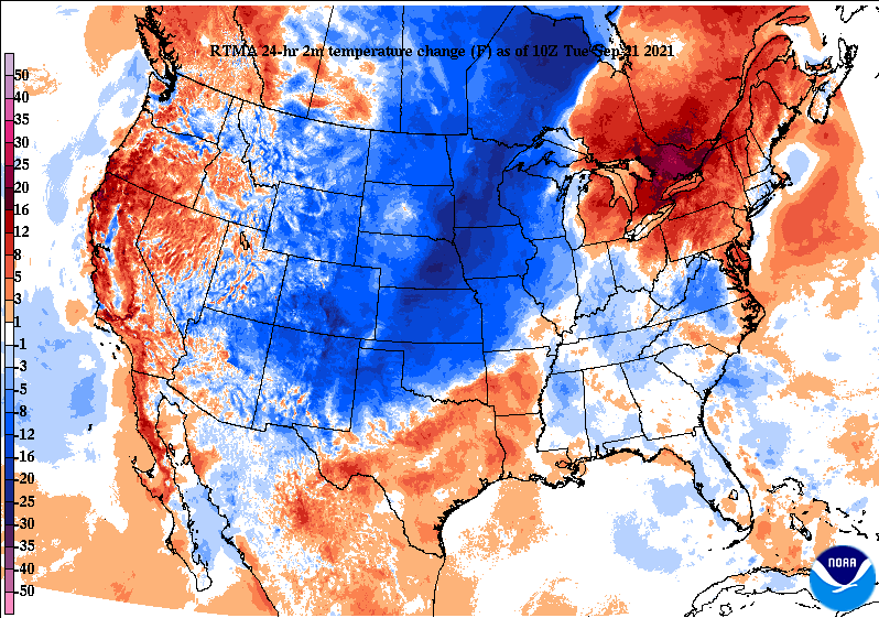
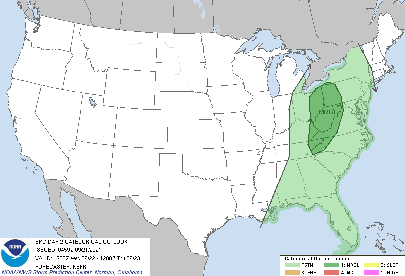
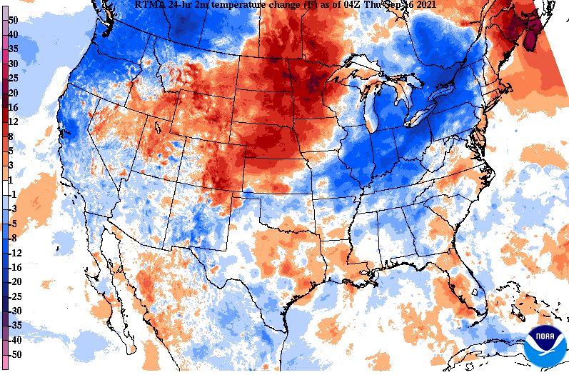
Good morning! The rain continues across most valley locations to begin the day but as we work into the early afternoon, this will begin to fade. Looking at the 24-hour temperature change map, MUCH cooler air lies just to the west. Why? Well, let's play a game of guess where the cold front is. Yep, the front will arrive midday tomorrow, bringing moderate to heavy showers and a few storms before Fall makes its mark. As the front shifts further east, daytime heating could bring localized strong to damaging winds. Fortunately, this threat remains mainly to the north into Kentucky and Virginias. With that said, the far most northeastern tip of the state is under a Marginal (1/5) chance for damaging winds. Breaking down our next system, the front will slide in tonight and the first half of Wednesday. Given its timing, the biggest threat will be heavy downpours with a few embedded thunderstorms at times right along the front. Following, much cooler air will stream in just in time for the beginning of Fall. Highs tomorrow will be in the low 70s before 60s find us on Thursday. Overnight lows will be chilly as well, in the 40s and low 50s the remainder of the work week. If you can handle just another day and a half of on/off rainfall, a big change-up in air mass is on the way. High pressure will dominate Thursday and through the weekend with temperatures slowly crawling back towards that 80 mark by next week. Pre-recorded for 5pm show
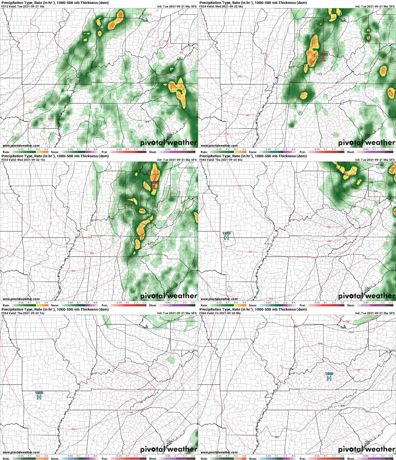
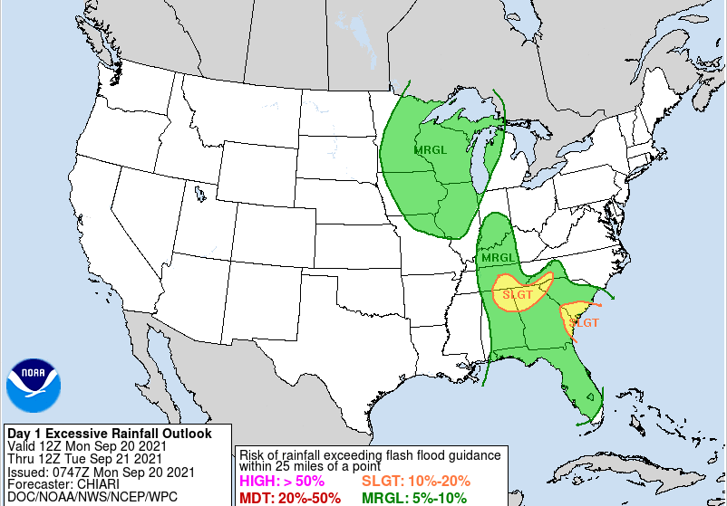
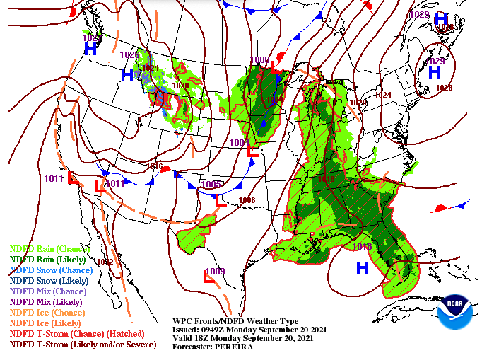
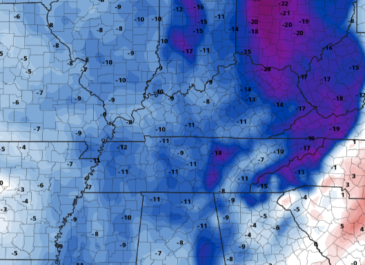
Unsettled weather continues for the start of the work week as a remnant low works north. If you recall Tropical Cyclone Nicholas making landfall in Texas, well this in combination with an upper level low, is what is left of that system. It will work north through today before a cold front slides in tomorrow and Wednesday. Looking at the excessive rainfall outlook, parts of the Southern Plateau are under a slight risk of flash flooding, while the remainder of the area is under a marginal. Days 2 and 3 also highlight a marginal risk (5-10%) of flash flooding for East Tennessee. With grounds continuing to saturate, rising water levels can't be ruled out. Looking ahead, the current surface map lays out a cold front across the Central and Northern Plains. This will work east with time, arriving Wednesday afternoon. Prior to its arrival, anticipate showers and storms, some of which could be heavier/stronger than others. Post-frontal air will feature much cooler and drier conditions as high pressure also builds in. Breaking down the rainfall now through Wednesday, we will have breaks at times as the two systems work through. Rainfall will be on and off today before a brief dry period arrives tonight. Then into Tuesday, a cold front will arrive the later half of the day bringing showers/storms through parts of Wednesday. We should see the last of the activity fade by Wednesday night (across the Smokies), leaving Thursday dry and COOL. Looking at temperature anomalies for the mid week, MUCH cooler air is en route. This image compares expected temperatures to those of which are the norm for this time of the year. As you can see, some areas will be up to 20 degrees cooler, with most locations between 8 and 12 degrees cooler than average. If you can handle a couple more days of rainfall and "icky" weather, a beautiful string of Fall days are ahead. Remember, the first day of Fall is September 22nd! Pre-recorded for 5pm show
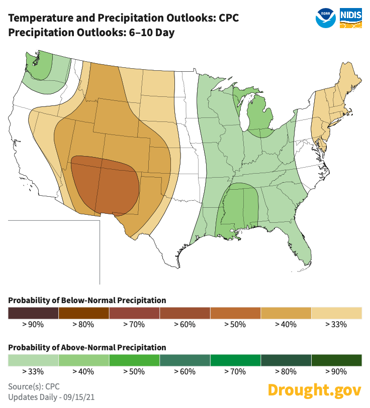
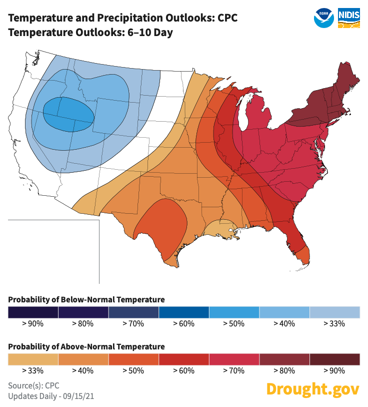
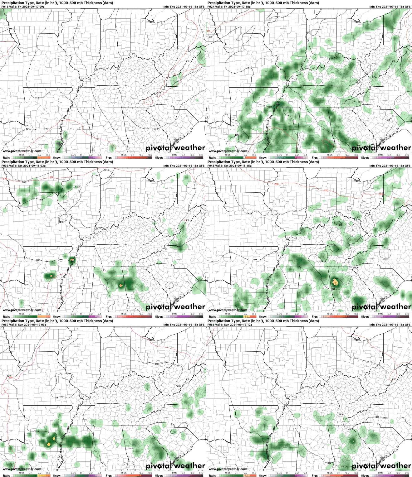
Temperatures will again be on the cooler side today before warming back into the mid (& some areas) upper 80s this weekend. Looking further into the future, warmer temperatures will continue to linger for the end of September (according to the CPC). We first will experience a cool, very fall-like, wave sometime around late next week before warming back up (as suggested below). Additionally, precipitation is expected to be at to slightly above the norm for this time the year. September typically is one of our driest months of the year but if this year as a whole says anything about our rainfall, we'll likely be above the average to close out the month. Working ahead, a low in Central Texas will merge with what's left of Nicholas and dump moderate to heavy rainfall across the Southeast. This includes East Tennessee where daily afternoon showers and storms will be possible this weekend. Into next week, a fairly stout cold front will work from the west, providing moderate showers and storms Monday through Wednesday. Following, much cooler and drier will arrive to close out the work week. That will close it out for the week. Showers/storms will be possible at times this weekend with temps in the mid to upper 80s. Activity will peak during the afternoon, before dissipating towards nightfall. Showers will be more widespread into the first half of the week next week, before highs in the 70s (and for some potential 60s) arrive Thursday. Pre-recorded for 5pm show
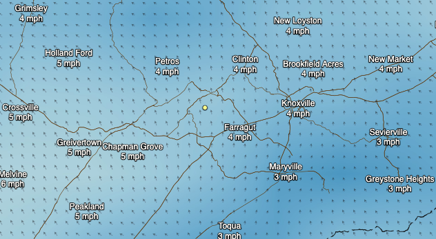
Good Thursday morning! Temperatures have started out cooler thanks to a cold front that has passed now east. Unfortunately, the cooler air doesn't stick around long as southerly flow continues to dominate for the day today (right image). Because of this, we will again feel a bit more sticky through the afternoon and also see the opportunity for pop up showers and thunderstorms. As you can see, the forecasted temperatures for today will be right on cue with our averages. If it were not for winds out of the south, we would likely be a bit cooler but we'll take what we can get for now. Most valley locations will top out in the mid 80s today with those in the higher terrain topping out in the lower 80s. Generally, the days ahead will feature warm and muggy afternoons with showers and thunderstorms possible. This trend looks to stick around for some time, at least through early next week. Most activity will be fairly benign but a few thunderstorms could be strong at times. That will do it for today...find out about the active tropics and more by viewing our video forecast below. Pre-recorded for 5pm show
|
Your trusted source for everything weather in East Tennessee.
Social Media
|

