|
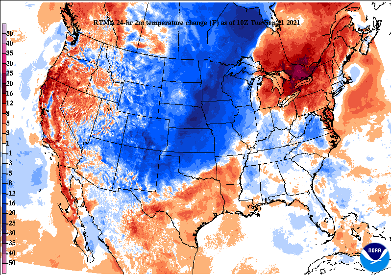
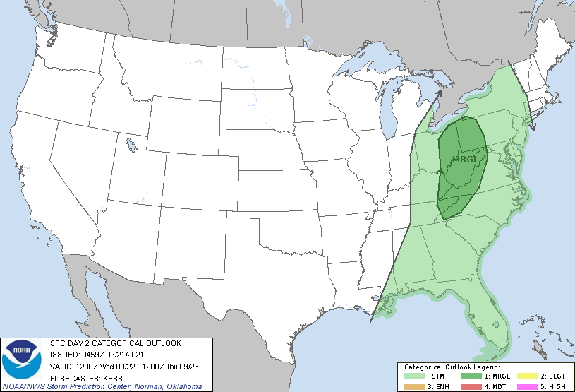
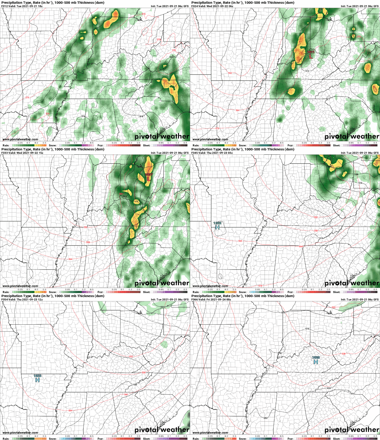
Good morning! The rain continues across most valley locations to begin the day but as we work into the early afternoon, this will begin to fade. Looking at the 24-hour temperature change map, MUCH cooler air lies just to the west. Why? Well, let's play a game of guess where the cold front is. Yep, the front will arrive midday tomorrow, bringing moderate to heavy showers and a few storms before Fall makes its mark. As the front shifts further east, daytime heating could bring localized strong to damaging winds. Fortunately, this threat remains mainly to the north into Kentucky and Virginias. With that said, the far most northeastern tip of the state is under a Marginal (1/5) chance for damaging winds. Breaking down our next system, the front will slide in tonight and the first half of Wednesday. Given its timing, the biggest threat will be heavy downpours with a few embedded thunderstorms at times right along the front. Following, much cooler air will stream in just in time for the beginning of Fall. Highs tomorrow will be in the low 70s before 60s find us on Thursday. Overnight lows will be chilly as well, in the 40s and low 50s the remainder of the work week. If you can handle just another day and a half of on/off rainfall, a big change-up in air mass is on the way. High pressure will dominate Thursday and through the weekend with temperatures slowly crawling back towards that 80 mark by next week. Pre-recorded for 5pm show
0 Comments
Leave a Reply. |
Your trusted source for everything weather in East Tennessee.
Social Media
|


