|
Pre-recorded for 5pm broadcast
0 Comments
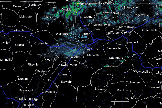
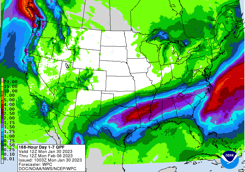
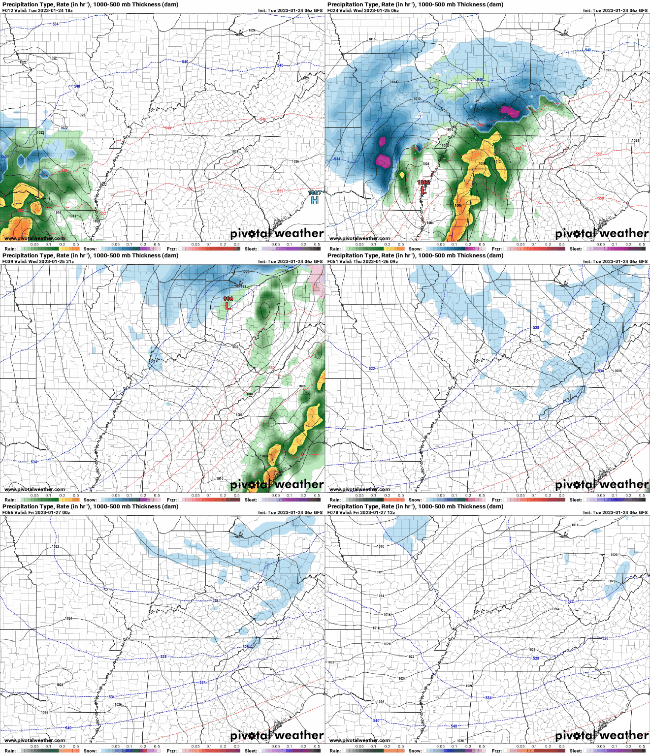
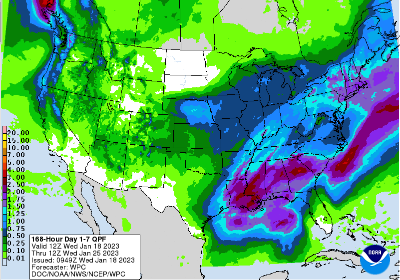
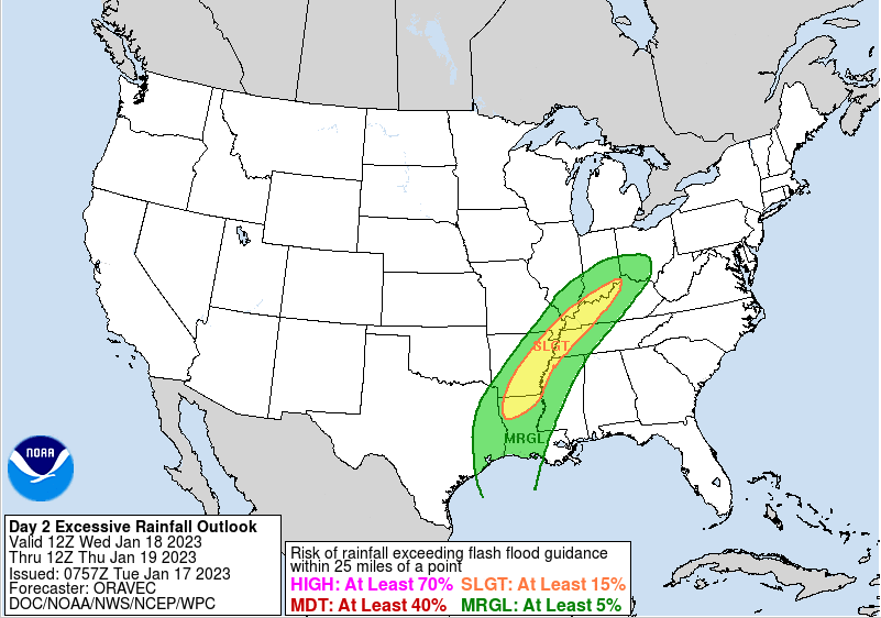
Isolated showers start the morning off (6:30 am) as a boundary sits just to the west. This cold front will break east today, passing through into this afternoon. As it does so, mostly cloudy skies will be present today with cooler air to follow Tuesday. As far as highs today, warmer, topping out in the mid 50s. Moving forward, a cool and active pattern is expected this week. The cold front, currently to our west, will pass by later today stalling just to our south. A few passing upper level disturbances will then bring rain and wintry mix opportunities to the region through Thursday. First up, an upper level disturbance will bring rain chances tomorrow, where early on portions of the northern Plateau could see this in the form of sleet or freezing rain. Road surfaces are generally slightly too warm, but a few impacts could be possible. As temperatures warm all rain is expected through the day. Another rounding system will then bring additional rain to wintry mix chances Wednesday night into Thursday morning. Again some impacts will be possible, primarily on the usual cooler surfaces (bridges, overpasses, etc). Check back in for the latest. The good news is outside of portions of the plateau, all rain is expected across the valley through Thursday. You can definitely make out where the boundary is expected to stall out at. Heavy bouts of rain will find the Deep South, with 1-2" possible across the southern valley. Elsewhere, rainfall amounts fall off the further north you head, with up to an inch possible bordering Kentucky. Note: any changes to this boundary and how far it dips south (or doesn't) could bring large changes to the forecast. Stay tuned for more details into Tuesday. We will veer more dry than wet today, so take advantage of any outdoor plans you might have. Better shower chances arrive Tuesday and continue at times through Thursday. Temperatures will also be much cooler through the work week, topping out in the low to mid 40s each day.
Pre-recorded for 5pm weather broadcast
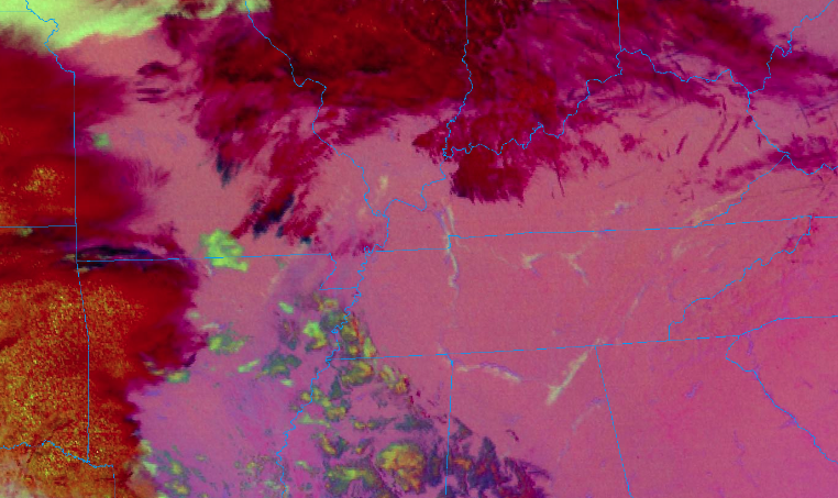
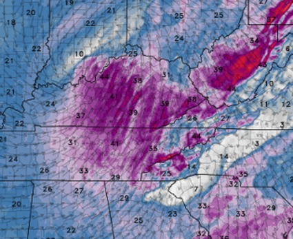
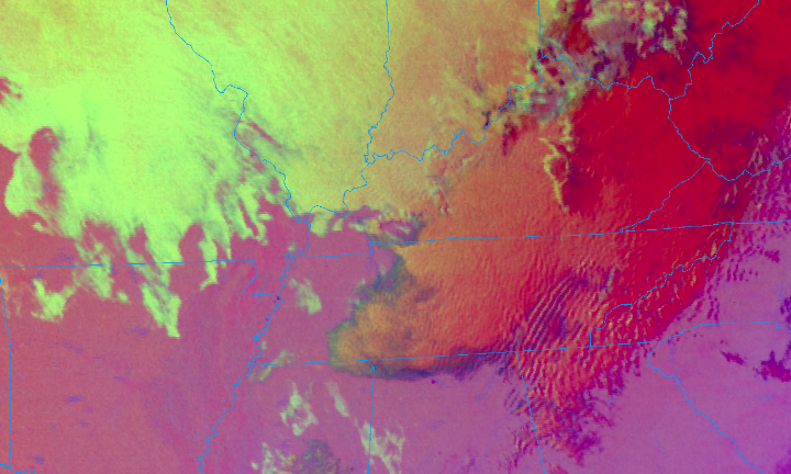
Use caution if you are heading out this morning. Those faint yellow "lines" are actually areas of fog that developed overnight. With temperatures for all in the mid 20s to around 30, freezing fog is expected. This could create slick spots for bridges and overpasses, so take your time during the commute this morning. Into this afternoon, clouds will increase. Highs will be right around average, in the upper 40s. By tonight, a warm front will build north allowing for showers to overspread the area. This will provide us with a good soaking rain, with a few light snow showers/flurries not ruled out late Wednesday and into Thursday. Overall, showers will arrive overnight and into early Wednesday, before a reprieve from activity into the afternoon. Wrap around moisture will then allow for rain/snow mix Wednesday evening and through the day Thursday. As of now, our forecast remains on track in terms of any snow accumulations. The valley will see little to none (a dusting for some), while the plateau averages more in line with a dusting to an inch. The highest peaks in the plateau will be locally higher, with 1-3" possible. Elsewhere, the Smokies will see the more significant snowfall, with locations above 3000 feet ranging from 3-6+ inches. Overall, snowfall will be minimal but don't be surprised to see some flakes to a light coating on grassy surfaces, cars, decks etc through Thursday. After that, briefly drier conditions find us Friday and the weekend, before more showers return Sunday and into early next week. In addition to the rainfall and tail end wintry precipitation, winds will be very breezy. With a tightening pressure gradient and developing low level flow, sustained winds of 15-25 mph and gusts of 35-45 mph are likely Wednesday. Use caution if operating large equipment and bring any outdoor decorations you may have inside. A wind advisory will be in effect tomorrow for all East Tennessee (none Smoky Mountain) locations. That will do it for this go around. Have the umbrellas handy and don't forget those hats. You'll be in for a bad hair day tomorrow guaranteed. Have a good one and we will update you more on the wintry precipitation tomorrow.
Cloudy skies start us off this morning, with temperatures in the low to upper 30s. A few stray light rain showers to mix will be possible the new few hours, otherwise generally dry with slowly clearing skies. Highs will be chilly, topping out in the upper 30s and low 40s. The good news is sunnier skies return tomorrow as well as warmer temperatures. Highs Tuesday will return to right around average in the upper 40s. Changes come into midweek, where showers and wintry mix return along a potent low pressure system. Cloud cover will increase Tuesday afternoon, where showers overspread the area overnight and into Wednesday morning. A few flakes aren't impossible across the high elevations in the Plateau upon onset, but no impacts are expected and this will change over to rain for all by day break. Showers then diminish by the afternoon Wednesday, where wrap around moisture could bring wintry mix Wednesday night through Thursday night. Again, no impacts expected during this time (for the valley), minus the potential for a few slick spots overnight Thursday into Friday morning. Outside of the valley, the plateau & foothills could pick up a dusting to an inch, while the high peaks of the Smokies are more in the 2-5" (or greater) ballpark. We will do some more fine tuning as clearer data comes in, but we aren't looking at anything more than light amounts in most locations Wednesday night - Thursday night. Cooler temperatures should be expected Thursday and Friday with highs in the low 40s. Enjoy the sunshine tomorrow, as unsettled weather will rule out for much of the work week. Temperatures will also average below the norm, so have the winter coats handy. Check out our video forecast below for more. Hint: it's snowing in the Smokies! Pre-recorded for 5pm weather broadcast
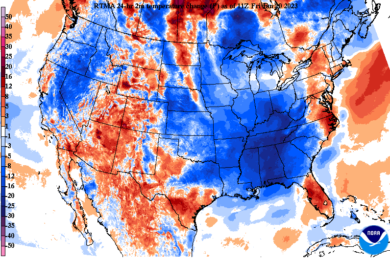
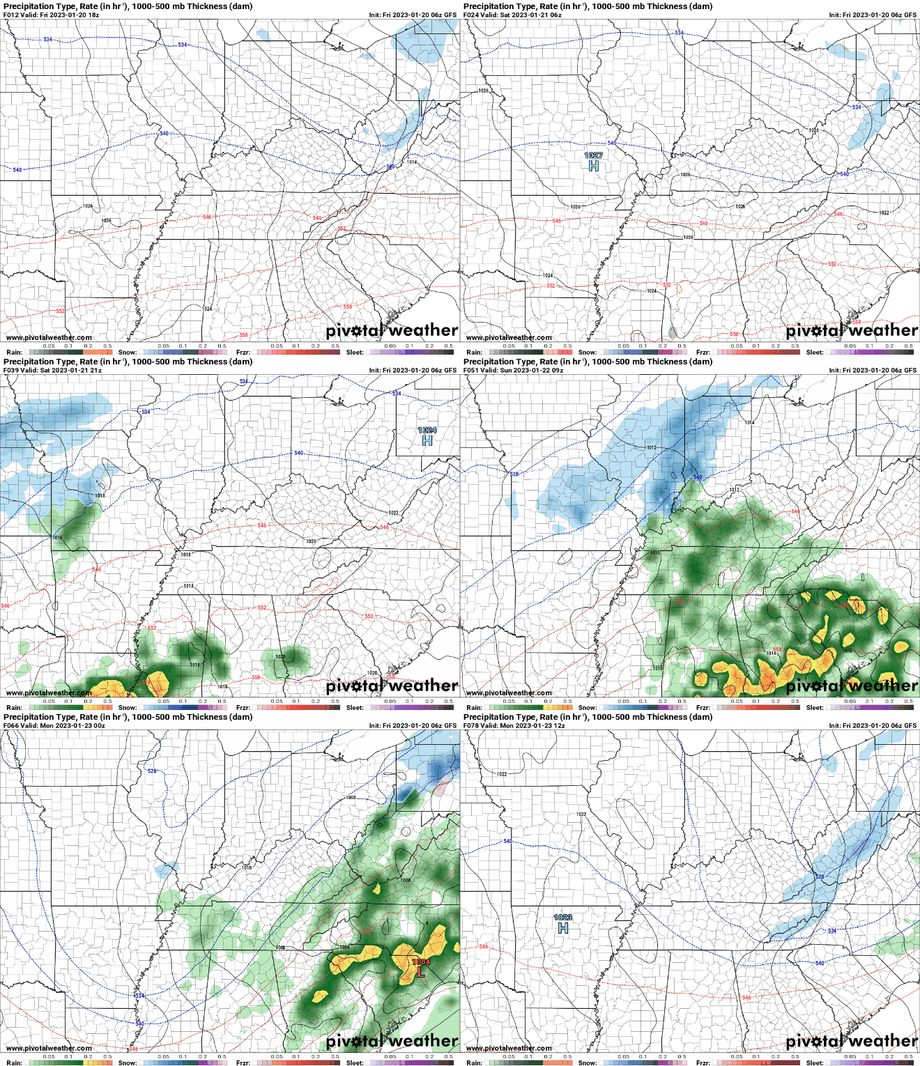
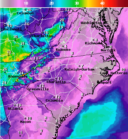
Good morning! Temperatures may come as a surprise to some, but we are starting in the 30s. As you can see below, much of the Southeast is tens of degrees cooler than this time yesterday- all thanks to a now departed cold front. Because of this, highs today will top out in the mid and upper 40s, which is right on with our typical average for mid to late January. Anticipate temperatures to stay around this range through at least early next week. Speaking of next week, we are going to have several disturbances pass through during this time. Our first arrives from the southwest Saturday night into Sunday, bringing around a quarter of an inch of rainfall. Briefly drier conditions then return Monday and Tuesday, before another round of showers Tuesday night and into Wednesday. I will note some of the high terrain (primarily the Smokies) could see wintry mix with the onset of precipitation Saturday night and again at the tail-end (early Monday morning). Elsewhere, generally a cold rain can be expected. Between bouts of rainfall, seasonable temperatures in the 40s to low 50s will be in place. Sunshine will be hit or miss depending on the day, but today, Saturday, and Monday will be your best bets. Have a good weekend, stay warm (even though things are right at normal) and have the umbrellas handy by the end of the weekend.
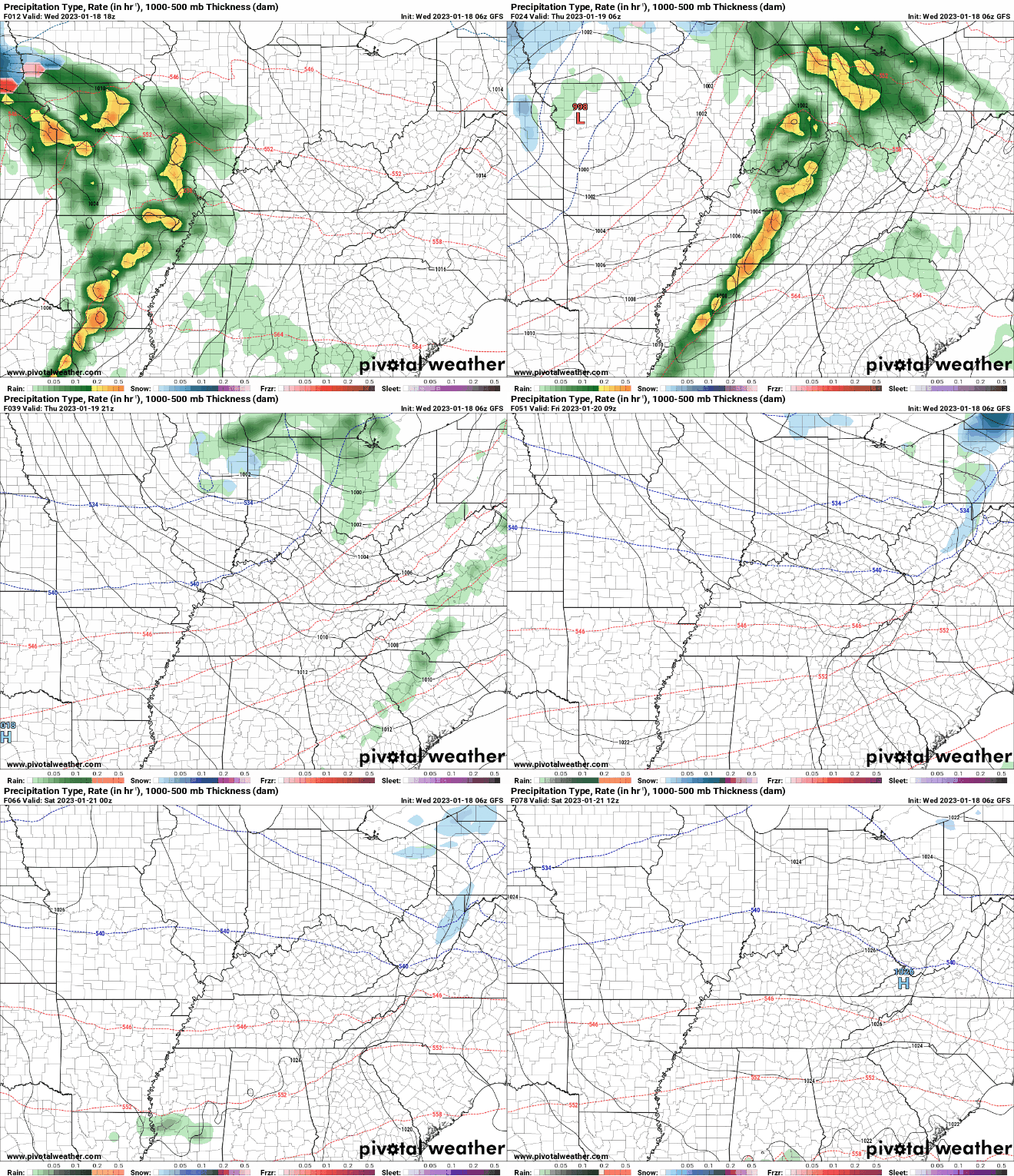
Showers will continue this morning, before drier air finds us this afternoon. Cloud cover will be slow to move out, but not to worry, as sunny skies return Friday. A cooler pattern will also find us, with temperatures generally in the 40s over the next several days. A quick moving system will then find us late weekend, before drier conditions once again return into Monday. Fog has started to dissipate this afternoon, but cloud cover remains in place as an approaching low pressure system works east. With lower level enhancement overnight, winds will pick up. Southerly flow will stream in where winds of 5-15 mph and gusts up to 30 mph are likely. Secure any loose outdoor objects and/or bring them in tonight. The high terrain of the Smokies are under a wind advisory, where wind gusts of 40-60 mph can't be ruled out at times tonight. Showers will begin to arrive overnight as well, where a few thunderstorms can't be ruled out into Thursday morning. A few strong wind gusts within thunderstorms is also possible, but the main threat of this is across the plateau and southern valley. By tomorrow afternoon, gradually clearing skies will be the trend. This will allow for mostly sunny but cool conditions to close out the work week Friday and into the early weekend. Our next disturbance then finds the region Sunday and into early next week. In terms of rainfall amounts, generally a half inch is expected tomorrow. Over the course of the next week, we could pick up around an inch in total, but it will depend on how far north our weekend/early next week system travels. As you can see, higher amounts hit just to our south, so any changes could mean higher amounts locally. For now, guidance is in fair agreement, but we will watch closely. To note: some could see a brief mix of rain/snow into Sunday morning, with the high terrain of the Smokies likely all snow. This will quickly switch to all rain as temperatures warm up into the day, but just a head up in case you do see a few wet flakes. Temperatures will be well above average tomorrow, topping out in the low to mid 60s, before crashing Friday post-front. Friday highs will be right on par with averages, upper 40s, with a similar feel on Saturday. Have a good one, enjoy the warmth (I can't believe its January), and have those rain jackets handy into tomorrow morning. Pre-recorded for 5pm weather broadcast
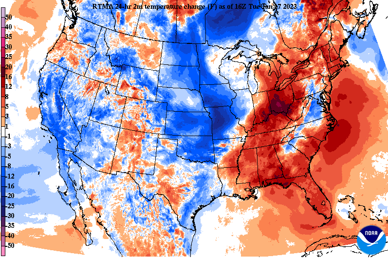
Good afternoon! Another warm one as depicted by the 24 hour temperature differences. Highs should top out in the upper 50s to near 60 degrees, with mostly cloudy skies hanging around. A few, particularly in the plateau, will have the best chance of soaking in some sun before the days said and done. Moving ahead, another system will pass through the area bringing showers and the chance for a few thunderstorms. Looking at the Flash Flood potential, it is very low. Things have come into better shape for us, as the axis of better rainfall continues to stay well north and west of the area. That is good news! That said, we are expecting another half inch or so on top of the ~half inch we just picked up yesterday into this morning. As far as the play-by-play, showers will hold off for much of the day tomorrow, with isolated chances late in the day (late afternoon/evening). The bulk of activity will come overnight and into Thursday, where a few thunderstorms can't be ruled out ahead of the front. Activity will then diminish Thursday afternoon and evening, where gradually clearing skies find us into Friday. Cooler temperatures also arrive, where a 15 to 20 degree drop can be expected Thursday into Friday. Still though, highs Friday will be near to just above average: upper 40s to some low 50s. We stay dry through the first half of the weekend, before shower chances crawl back in Sunday and early next week. That will wrap it up for today. Don't forget to also check out our video forecast below as well as giving us a follow on Twitter and Facebook @SecretCityWx Pre-recorded for 5pm weather broadcast
|
Your trusted source for everything weather in East Tennessee.
Social Media
|

