|
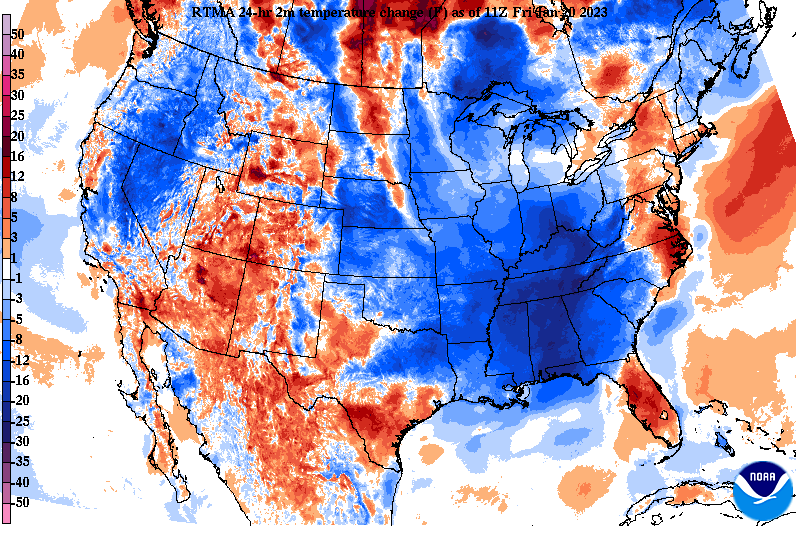
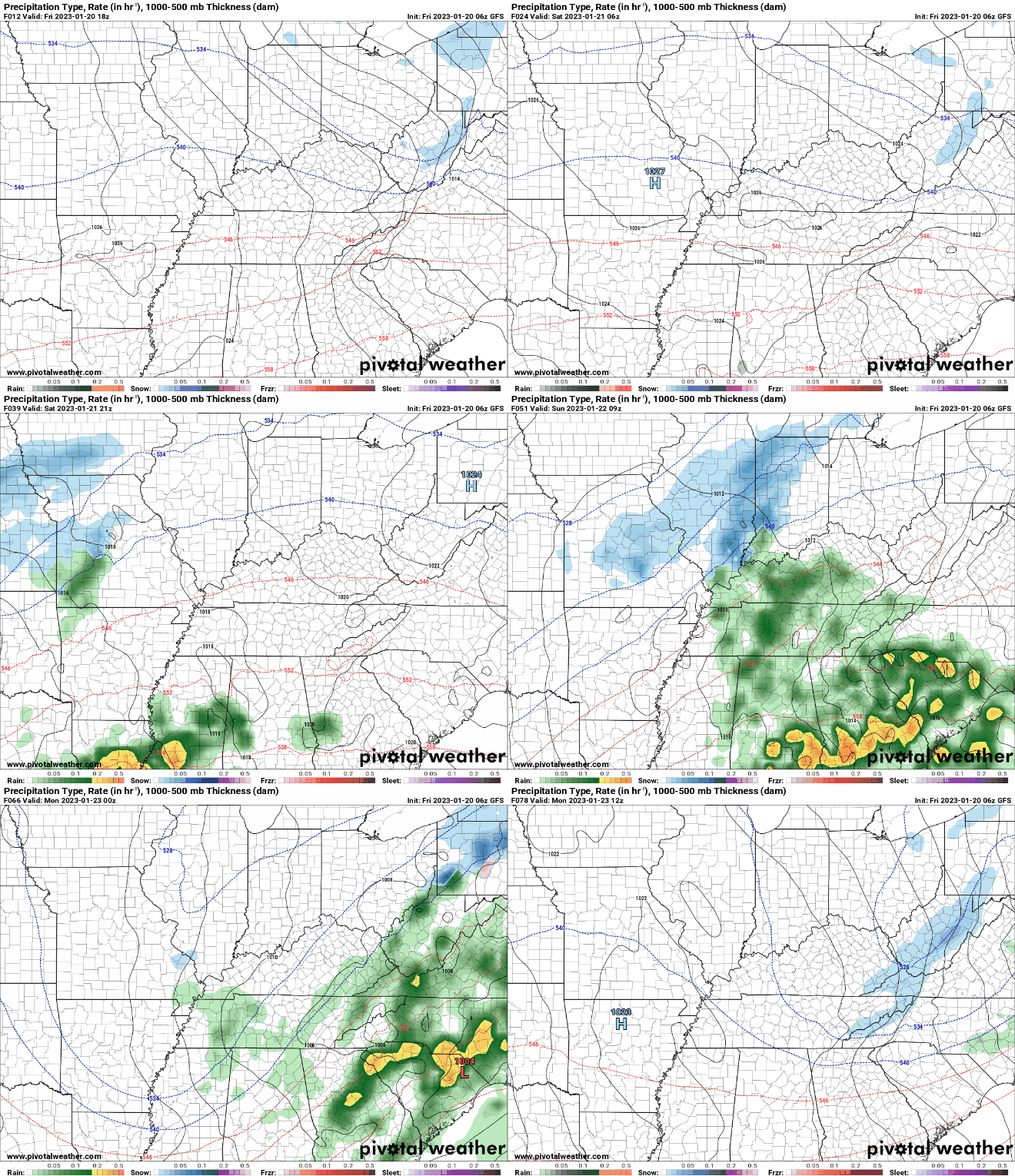
Good morning! Temperatures may come as a surprise to some, but we are starting in the 30s. As you can see below, much of the Southeast is tens of degrees cooler than this time yesterday- all thanks to a now departed cold front. Because of this, highs today will top out in the mid and upper 40s, which is right on with our typical average for mid to late January. Anticipate temperatures to stay around this range through at least early next week. Speaking of next week, we are going to have several disturbances pass through during this time. Our first arrives from the southwest Saturday night into Sunday, bringing around a quarter of an inch of rainfall. Briefly drier conditions then return Monday and Tuesday, before another round of showers Tuesday night and into Wednesday. I will note some of the high terrain (primarily the Smokies) could see wintry mix with the onset of precipitation Saturday night and again at the tail-end (early Monday morning). Elsewhere, generally a cold rain can be expected. Between bouts of rainfall, seasonable temperatures in the 40s to low 50s will be in place. Sunshine will be hit or miss depending on the day, but today, Saturday, and Monday will be your best bets. Have a good weekend, stay warm (even though things are right at normal) and have the umbrellas handy by the end of the weekend.
0 Comments
Leave a Reply. |
Your trusted source for everything weather in East Tennessee.
Social Media
|


