|
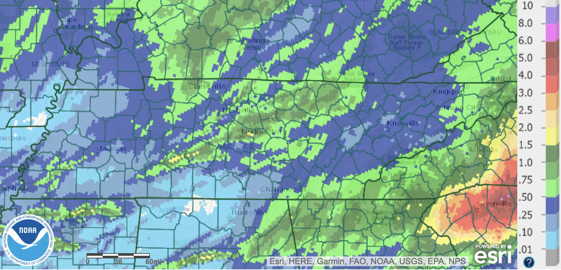
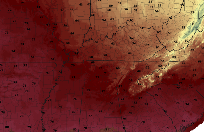
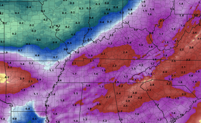
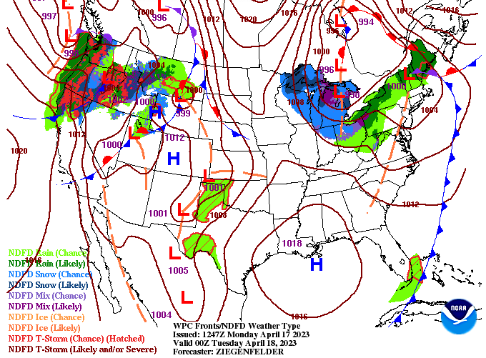
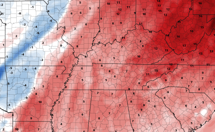
First taking a look at the rainfall we picked up yesterday into early this morning. Note, this does not account for rainfall after 8 am, so higher totals are expected with later releases. That said, East Tennessee has picked up between a quarter to half an inch, with higher amounts along the Plateau and far southeast (around an inch). Showers will begin diminishing into the afternoon, with only spotty showers expected through the evening. Drier conditions return tonight into Saturday. With one cold front exiting, briefly drier conditions find the area tonight into Saturday. Even some sunshine will be possible through the first half of the day tomorrow. It won't last too long though, as a second cold front approaches from the west and brings showers and maybe a storm Saturday night into Sunday morning. Any lingering activity should be out by mid Sunday afternoon, where clearing skies and cooling air following into early next week. We have been on a warming trend the later half of this week, but changes are coming. With the passing front Sunday, highs will fall back into the low and mid 60s. We will then trend warmer through mid week, with highs Wednesday generally depicted (below) to be in the mid to upper 60s. Though this may see warm, with the deceiving dark red colors, it is actually 5-10 degrees below average for this time of the year. Toward the end of the week we will see temperatures return to something more normal for early May. Showers will fade with time today, bringing drier and even some sunshine into Saturday. Another round of activity then returns into Saturday night through Sunday morning, with cooler conditions in the plans for the first half of next week. Take a look at our video forecast below for more as well as checking out out "5-Day Forecast" at the top of the page for your outlook. Pre-recorded for 5pm weather broadcast
0 Comments
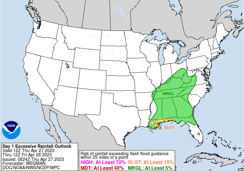
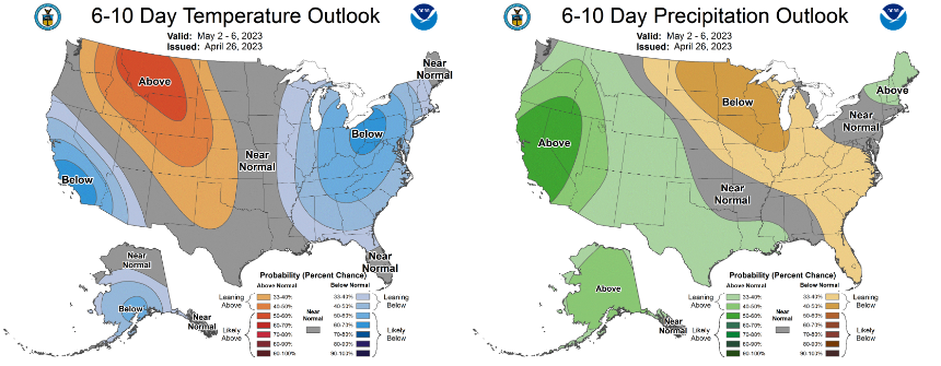
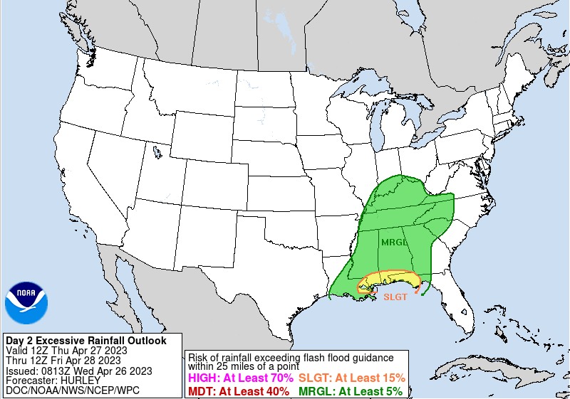
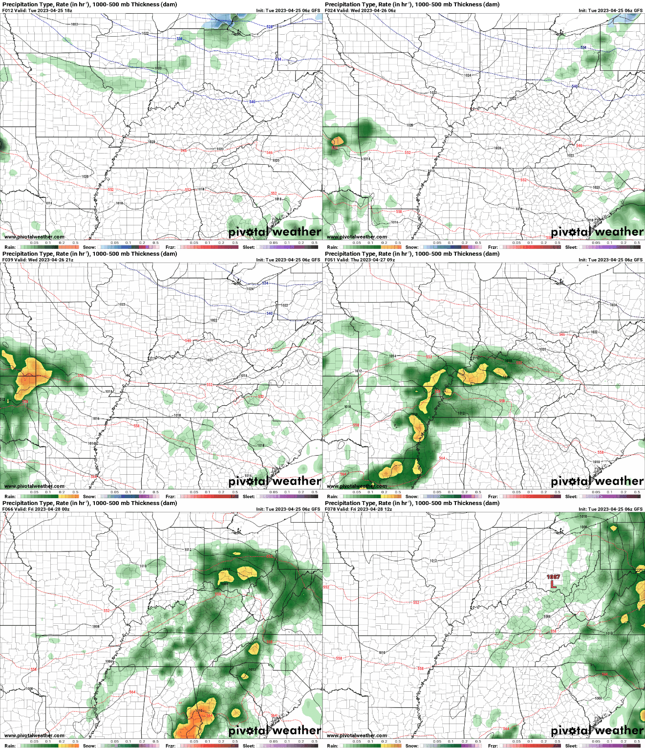
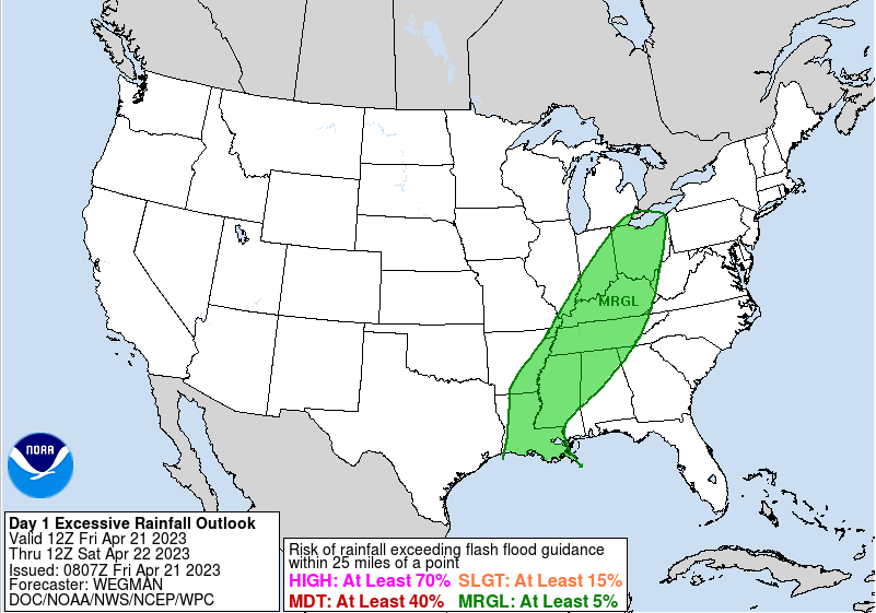
If you haven't already, be sure to have the umbrellas close by. Showers are slowly building in from the south, arriving across the central valley within the next 2 hours. This will be one of several rounds we see today/tonight, as a low pressure system works its way north across West Tennessee and toward the Ohio Valley tonight. Because of the cloud cover and rainfall expected, highs will top out in the mid 60s today. The WPC is persistent on the Marginal flash flood risk across the state, but I continue to think the chances are very low to almost null. As this waves works through this afternoon, hit and miss activity follows this evening and overnight. Precipitation amounts will generally vary upon thunderstorms, but 0.5-1.5" should be expected in total. Outlooks a week out look similar to what they did earlier in the week. The first week of May appears to favor cooler than average temperatures, while drier than normal conditions. Keep in mind our average high early May is around 76/77 degrees, so we could be looking at highs in the upper 60s to low 70s to start off the month. That will be seen Monday for sure, with highs in the low to mid 60s, but a gradual warming trend is in the works through at least mid week. With rounds of on and off showers today and tonight, have the umbrella close by. Showers will linger through the first half of the day Friday, before veering drier Friday evening through midday Saturday. An approaching secondary cold front will then bring isolated to scattered showers Saturday night into Sunday. Clearing skies then finally return Sunday evening into Monday, where temps cool off as highlighted above. Don't forget to check out our video forecast below for more. Pre-recorded for 5pm weather broadcast
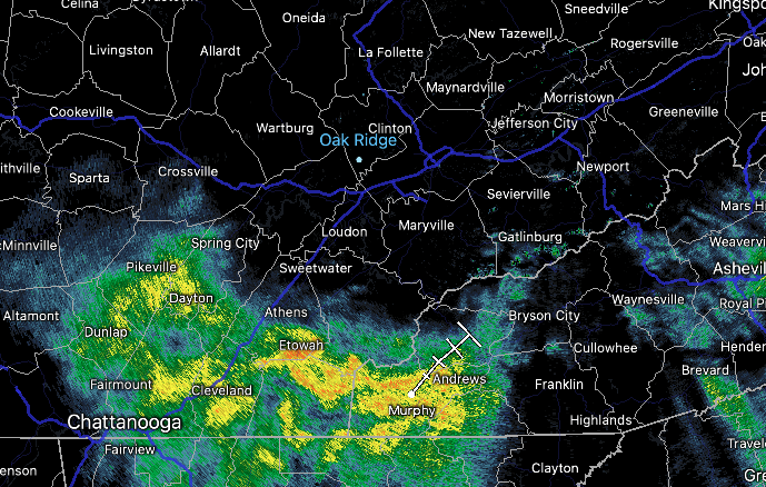
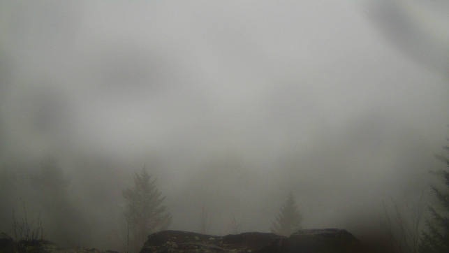
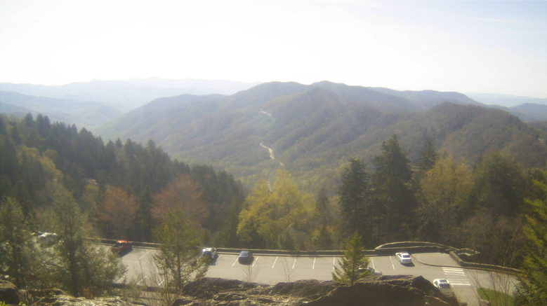
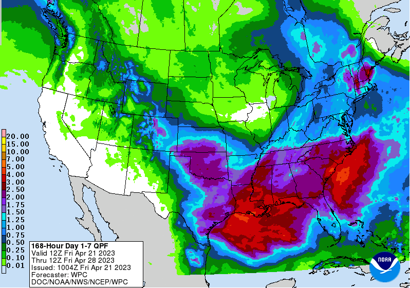
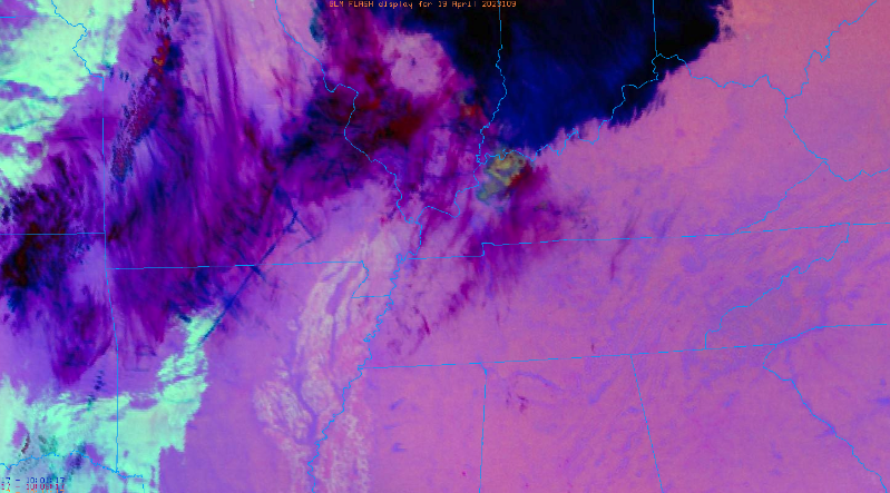
The lunch time hour is filled with lots of clouds in the valley, while fog and patchy drizzle are aloft across the Smokies (below). A few light showers are seen on radar on a line from Loudon to Gatlinburg to Etowah and moving northeast with time. This will exit over the next couple of hours, where cloudy skies will prevail through the remainder of the day. Highs will remain cooler than average, topping out in the mid 60s. Looking forward, we will generally veer dry tonight before rounds of showers return through Thursday. A low pressure system will glide across portions of the state, bringing widespread showers and a few storms. This will last through Thursday night into Friday as a cold front then slides across the area. With the passage of this feature, briefly drier conditions will be in for Saturday, followed by another round of showers Saturday night into Sunday ahead of a secondary front. So in total, umbrellas needed tomorrow and the first half of the day Friday, and then again Saturday night into Sunday morning. We have talked a bit about this in our previous posts this week, as flooding potential is very low but not entirely ruled out. WPC seems to agree, suggesting at least a 5% risk is necessary for the whole state. Rainfall amounts will vary between 1-2" today through Saturday, with another 0.25" or so Sunday. Given the dry conditions we had last week and the days since our last bout of rain, we should fair okay but we can't be too complacent to the low risk. That will do it for today. Unsettled weather will find us through the next couple of days with cooler air to again return by Monday of next week. Keep the umbrellas close by! Pre-recorded for 5pm weather broadcast
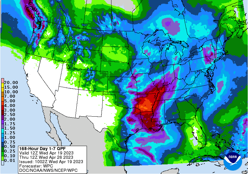
A quiet day overall with varying sky conditions. High thin coverage is working across, bringing intermittent cloudy skies, while sunnier conditions are elsewhere. As we get further into the day, coverage will thicken up more as a disturbance approaches from the west. In terms of temperatures today, highs will peak a bit warmer, finding the mid and upper 60s. Any showers will hold off until late overnight and into Wednesday. Looking at model guidance, an unsettled and generally wet next few days can be expected. As highlighted above, scattered showers will be possible late overnight and into Wednesday morning, where drier conditions generally rule out tomorrow afternoon. By Thursday, a low pressure system will be pressing in where the best shower or storm potential will be in place. Widespread rainfall is likely, with a few thunderstorms not ruled out as well. Lingering showers will then be possible Friday and Saturday, before briefly drier and cooler conditions then find us late weekend into early next week. With several disturbances working through, what do rainfall totals look like? Well, a good soaking is in store. From Today through Saturday, amounts between 1 and 2 inches are likely. Locally higher amounts within thunderstorms exceeding 2" will be possible. Fortunately, this comes over a several day span so flooding risks are low but not entirely ruled out. Enjoy the last of the mixed sunshine and dry conditions, as a series of disturbances look to bring several bouts of rainfall the next few days. Pre-recorded for 5pm weather broadcast
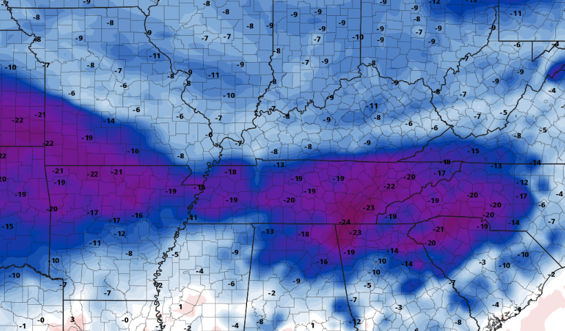
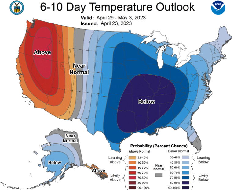
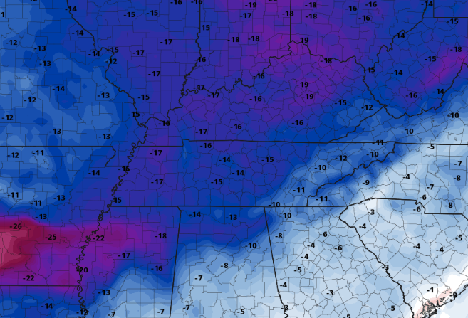
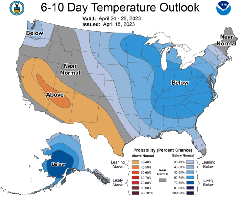
A chilly start across the Volunteer State and it will remain that way through the foreseeable future (more on that below). Looking across the Smokies though, sunny skies are at least in place today, before several bouts of shower chances find us through the week. Highs today will top out well below average, in the low to mid 60s. Moving forward, increasing cloud cover paired with rain cooled air will lead to highs remaining well below average. Check out Wednesday afternoon, where some guidance thinks we could be 20-25 degrees cooler than our typical average. Brr, if we can call upper 50s and low 60s brr in late April. Nonetheless, the biggest annoyance this week will be on and off showers so have the umbrellas and rain jackets handy! As hinted at from the start of this post, seasonably chilly temperatures look to stick around for sometime. Taking a look at the Climate Prediction Centers outlook, a strong signal for below average temperatures is shown for the start of May. Keep in mind our usual late April early May average is 76 to 77 and we will likely see temperatures 15+ degrees cooler than that. Even longer term outlooks keep the cooler pattern in place, so that will be something we will keep an eye on. If you don't already, be sure to give us a follow on Twitter and Facebook (@SecretCityWx). Also check out our video forecast below as it provides more insight into rainfall chances coming up and the varying amounts through the next 7 days. Have a good one, enjoy the sunshine, and keep the umbrellas handy for any showers we see the midweek and beyond. Pre-recorded for 5pm weather broadcast
A slow moving cold front brings the threat of heavy rains tonight, where a marginal threat of flash flooding is in place according to WPC. I believe this is an excessive excessive rainfall outlook given how dry we have been the past 10 days, but it is there nonetheless. As such, keep in mind heavy swaths of showers and/or storms will be possible later tonight into Saturday. Activity will then begin to diminish from west to east into Saturday afternoon, where sunnier skies find East Tennessee Sunday. Along with sunshine, MUCH cooler air will also come. This graphic below represents our usual average compared to expectations for the day. As you can see, highs will be 10+ degrees below average, generally in the upper 50s to low 60s for the day. That is a 20+ degree swing from what we will see this afternoon. We will warm a touch toward mid week, but really below average temperatures should be expected from Sunday through Friday. Another shot at rainfall will also be in the forecast, where additional amounts up to an inch will be possible. This next week system will primarily impact the Tennessee Valley and south towards mid week. This will add to our rainfall tonight into Saturday, bringing total rainfall amounts of 1-2" over the next 7 days. Locally higher amounts will be possible within thunderstorms. That will do it for today. After the warm and dry weather we have had changes are in store. Unsettled and cool conditions return through much of the next 7 days.
Pre-recorded for 5pm weather broadcast
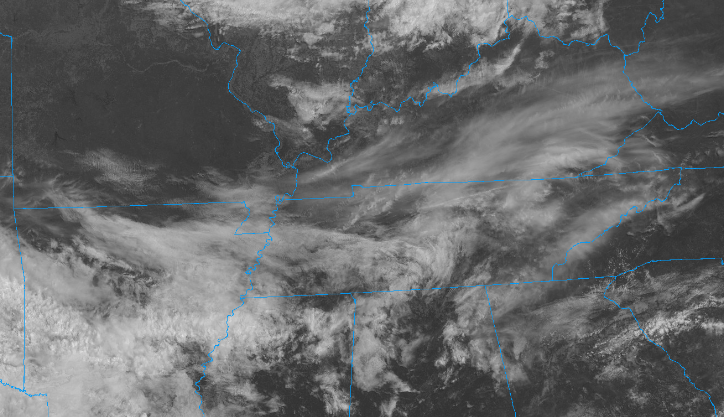
We start off mostly sunny this morning as depicted from satellite, but could see a few high clouds pass through later in the day. Overall, another beautiful day is in store with highs climbing into the lower 80s. We will see another pleasant but warm one Thursday, with highs in the mid to upper 80s. Winds will also increase across the area, leading to dangerous fire hazards. Please avoid burning tomorrow and follow local fire laws and guidance. In addition to the warm air Thursday, cloud cover will gradually increase through the day as a cold front approaches from the west. It will slowly push across the region, bringing a good shot of rainfall Friday into this weekend. Another late period rain maker could bring another opportunity into mid week as well. Overall, totals over the next 7 days will vary between 0.75 and 1.5" with the highest of these amounts across the Plateau. A big change up is in store as well. Though we have been running warm this week, and will see that especially tomorrow, a big drop off follows the front Sunday. Highs will top out near what our current lows are, with highs to end the weekend in the 50s. We will begin warming back up closer to average, achieving near 70 degrees towards Tuesday of next week. Our next system then pushes through midweek, dropping temperatures back down once more. That will do it for today, the big take aways are this: Fire danger tomorrow so don't burn, showers become increasingly likely the later half of Friday into the day Saturday, followed by much cooler air Sunday and lasting through Monday. Check out our video forecast below for more.
Pre-recorded for 5pm weather broadcast
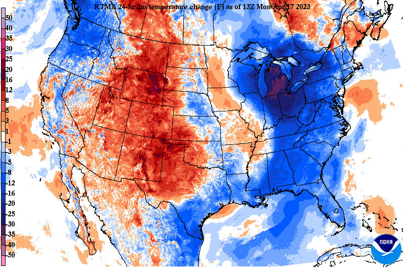
A chilly start after the passage of the front yesterday, with current temperatures (10 am) in the low to mid 50s. This is well reflected on the temperature change map as well, as many locations this time yesterday were closer to the low to mid 60 point. Not to worry though, much warmer air is set to return in the coming days. As far as today, a beautiful one is on tap. Just like morning temps, highs will be cool comparably, topping out in the mid 60s. Winds will be a bit breezy as well, blowing out of the west between 10-20 mph and a few gusts to around 30 mph. Moving forward through the week, high pressure will mosey northward bringing continued sunshine and warming temperatures. Highs will bounce 10+ degrees Tuesday in the mid to upper 70s, followed by 80 Wednesday and Thursday. A western USA low will then meander east, bringing rain or storm chances into Friday. Comparing the warming trend we have ahead to seasonal averages, it's going to be a warm one. Highs Thursday will be the warmest of the week, in the low to mid 80s, and this is 10+ degrees warmer than average. I would not be surprised to see a few upper 80 readings before the end of the day Thursday as well. Overall, a very quiet next couple of days with warming temperatures the biggest highlight. Showers or storm chances hold off until Friday and the weekend, with cooler temperatures to again follow after the system passes. Enjoy the beautiful weather the next few days! Pre-recorded for 5pm weather broadcast
|
Your trusted source for everything weather in East Tennessee.
Social Media
|

