|
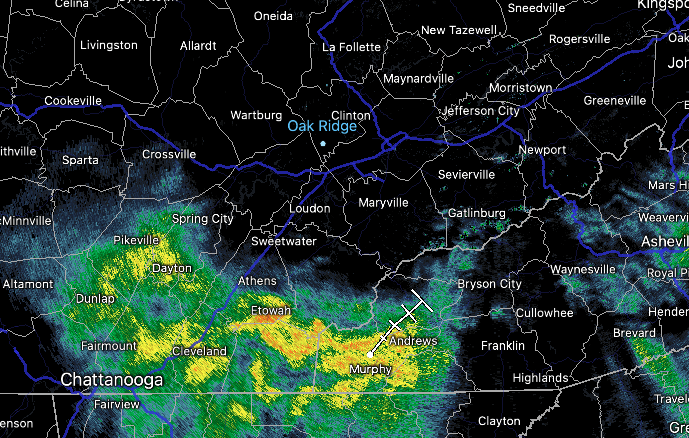
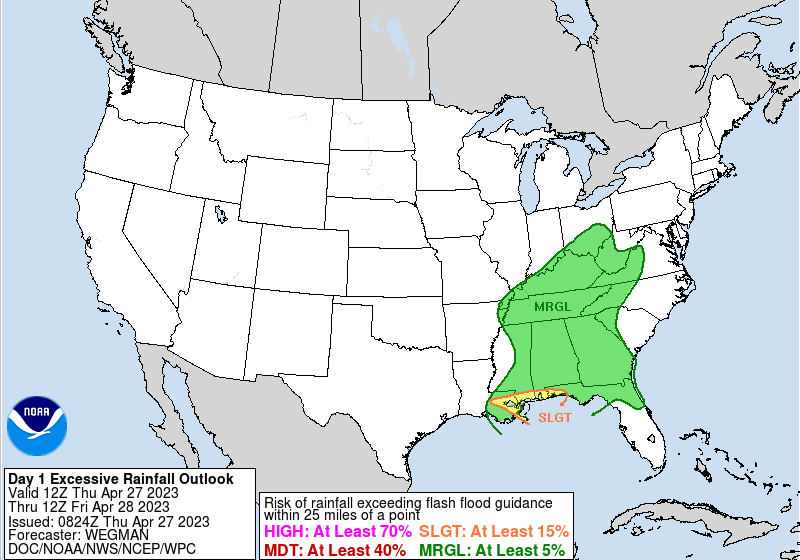
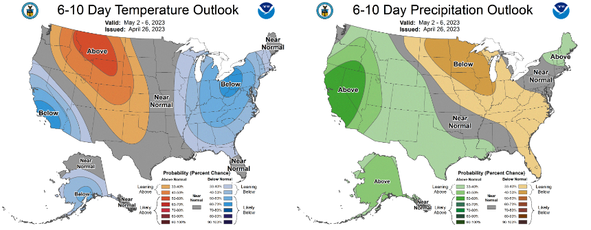
If you haven't already, be sure to have the umbrellas close by. Showers are slowly building in from the south, arriving across the central valley within the next 2 hours. This will be one of several rounds we see today/tonight, as a low pressure system works its way north across West Tennessee and toward the Ohio Valley tonight. Because of the cloud cover and rainfall expected, highs will top out in the mid 60s today. The WPC is persistent on the Marginal flash flood risk across the state, but I continue to think the chances are very low to almost null. As this waves works through this afternoon, hit and miss activity follows this evening and overnight. Precipitation amounts will generally vary upon thunderstorms, but 0.5-1.5" should be expected in total. Outlooks a week out look similar to what they did earlier in the week. The first week of May appears to favor cooler than average temperatures, while drier than normal conditions. Keep in mind our average high early May is around 76/77 degrees, so we could be looking at highs in the upper 60s to low 70s to start off the month. That will be seen Monday for sure, with highs in the low to mid 60s, but a gradual warming trend is in the works through at least mid week. With rounds of on and off showers today and tonight, have the umbrella close by. Showers will linger through the first half of the day Friday, before veering drier Friday evening through midday Saturday. An approaching secondary cold front will then bring isolated to scattered showers Saturday night into Sunday. Clearing skies then finally return Sunday evening into Monday, where temps cool off as highlighted above. Don't forget to check out our video forecast below for more. Pre-recorded for 5pm weather broadcast
0 Comments
Leave a Reply. |
Your trusted source for everything weather in East Tennessee.
Social Media
|


