|
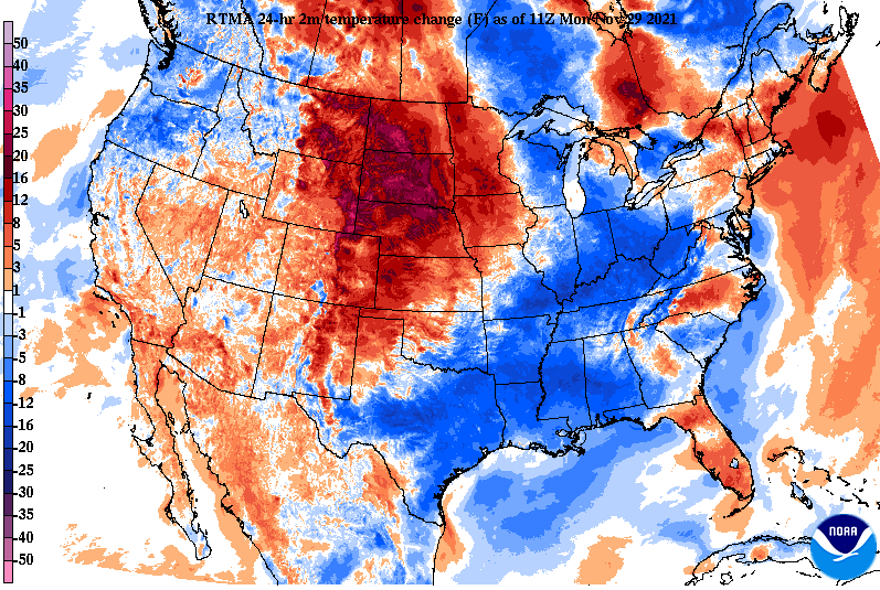
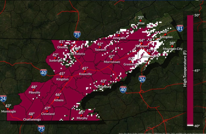
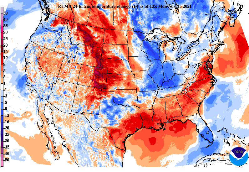
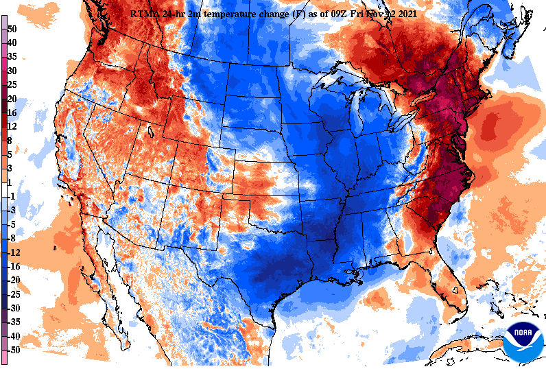
We are starting the work week off on a chilly note as temperatures will only top out in the mid 40s today. Progressing forward, much warmer air will nose in from our south. Looking below, this has been the change over the past 24 hours. Taking a peak towards the end of the work week, afternoon highs Thursday will be 15 to 20 degrees above average. Yes, you heard that right. Some locations could be as warm as 70 for afternoon highs to begin December. Take advantage, because these won't be around for too long. Warming temperatures can be thanked due to high pressure over the area. This will also lead to dry conditions for the next several days. A few disturbances will round the Great Lakes region and down into the Ohio Valley, but other than a few clouds at times, we'll stay dry. Our next best rain chance doesn't arrive until late weekend. Overall, the biggest change this week will be the warming temperatures. A change of nearly 15 degrees can be expected this time tomorrow, with even warmer temperatures in the days to follow. Pre-recorded for 5pm show
0 Comments
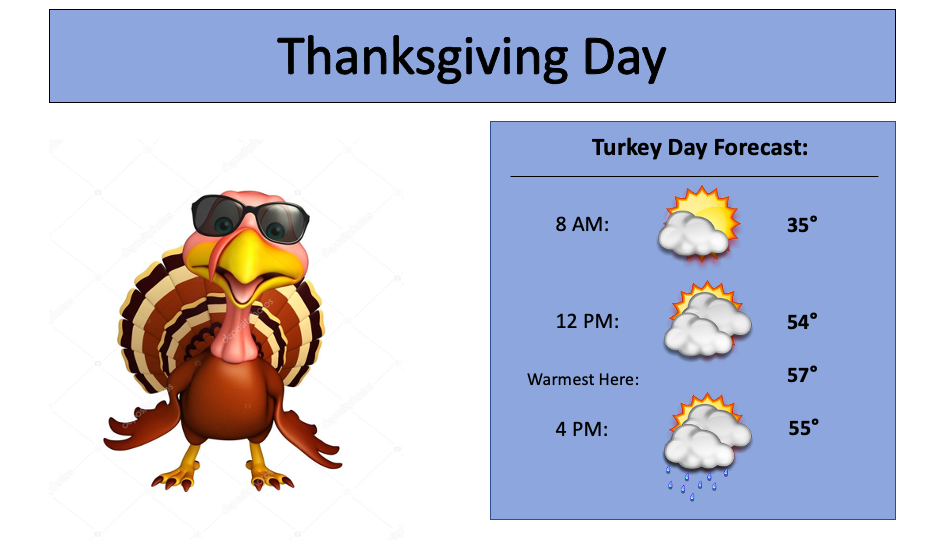
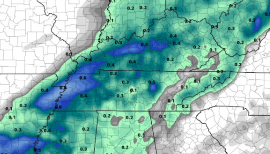
Happy Thanksgiving Eve! It has been a pleasant one so far today with lots of sunshine and temperatures a bit warmer than Tuesday. Cloud cover will slowly increase this afternoon/tonight, as a cold front slides east. This will lead to showers by the evening hours of Thanksgiving and even a chance for a few lingering flurries (assuming enough moisture within freezing temperatures). Following the showers tomorrow evening/overnight, sunshine and much cooler air returns for Friday. Highs for most will be in the low and mid 40s, improving into the weekend. Looking at your Thanksgiving Day forecast, partly cloudy skies will start us out but increase through the day. Depending on how much cloud cover to sunshine we get will depend on how warm highs reach. For now, mid 50s can be expected, but with more sunshine through the afternoon they could get as warm as 60. By the evening, showers will begin building in, continuing for portion of the area overnight. Overall rain totals are unimpressive. The bulk of rainfall will be to our west, as moisture lessons eastward. Overall, a few tenths of an inch are possible. This will mainly be a wetting rain before moving out quickly. That will do it for today. We will be off Thanksgiving and Friday but continue to provide updates through Twitter & Facebook. I wish everyone a great Thanksgiving! Pre-recorded for 5pm show
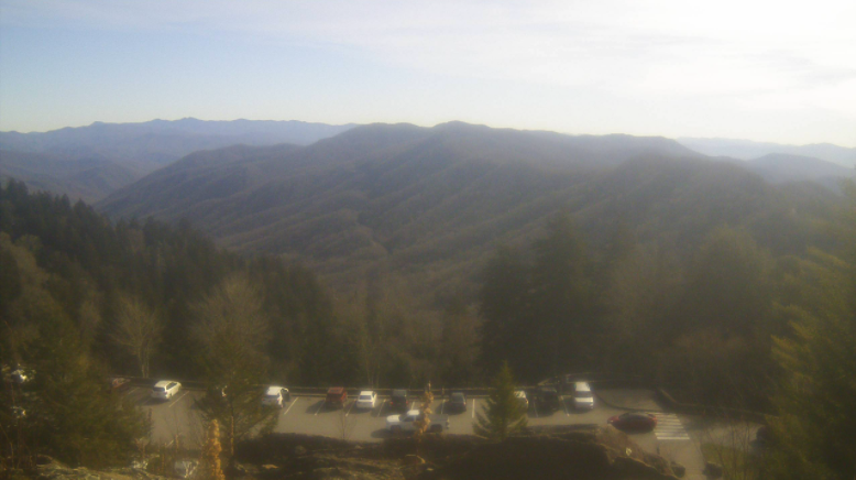
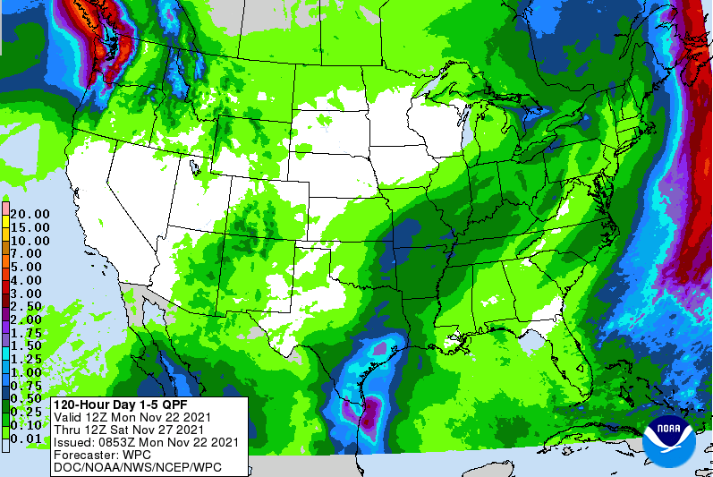
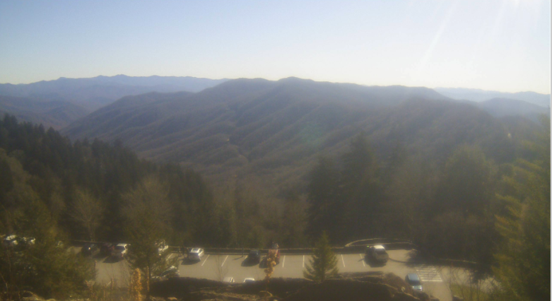
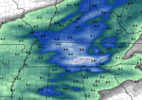
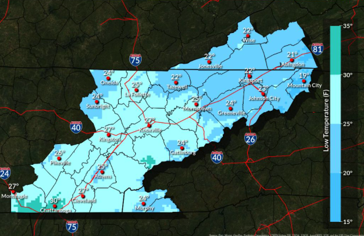
I hope you are staying warm this afternoon! Many valley locations sit in the low 40s right now, but the sunshine is making things feel a bit warmer. Check out the view across the Smokies. With a few thousand feet higher of elevation, temperatures up here are currently in the upper 20s. Nonetheless, beautiful conditions can be seen from the Newfound Gap Camera. For morning lows today, here are a few of the official readings: Oak Ridge: 24 Knoxville (McGhee Tyson): 25 Morristown: 23 Dayton: 23 Rockwood: 23 Oneida: 19 Chattanooga: 29 A dry stent will carry us into Wednesday before our next weather maker arrives on Thanksgiving. Luckily, most of this rainfall will arrive the later half of the day, so there should be some time to enjoy any outdoor activities you may have. With that said, it will be a quick mover as well. This means most of the rainfall will occur during sundown, so it shouldn't hamper too much for the day or into Friday. It is worthy to note as well there could be enough lingering moisture for a few snow flakes to fall. No accumulations or impacts are expected across the vast majority of East Tennessee, but still will be a pleasant site to see if you are lucky enough. High pressure builds back in for Friday, with sunshine into the weekend. Overall totals will be fairly light. The 5 day outlook from the WPC suggests upwards of a quarter of an inch, with is in line with recent guidance trends as well. This should be a quick moving wetting rain followed by another blast of cold air on Friday. And to that all important Thanksgiving Forecast.... We'll have a full run down for you tomorrow but I will say it likely won't be the most ideal day. Cloudy skies will persists through the greater portion of the morning before a cold front brings rain during the late afternoon, evening and portions of the overnight. Temperatures Thanksgiving day will be in the mid 50s (average for this time of the year). Pre-recorded for 5pm show
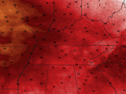
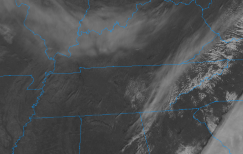
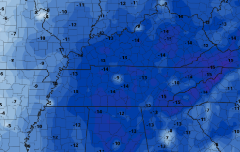
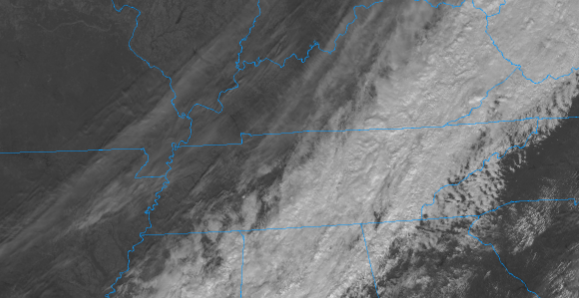
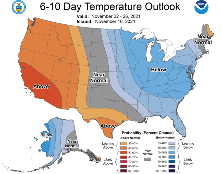
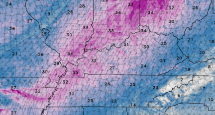
Temperatures have been pretty chilly so far today. Looking at satellite, you can make out the backside edge of the cold front that swooped through and brought rainfall last night. Most areas picked up between 0.3" and 0.75" with our station here at Secret City Weather just over 0.5". We will continue to see some high cirrus clouds today, otherwise things will be dry and sunny. We have topped out around 50 (for some) but cooler air will knock temperatures down through the remainder of the day. Most will see mid 40s by the afternoon commute. With cold air ushering in today and tonight, overnight lows will bottom out the coldest they have been of the new cold season. Lows will bottom out in the low and mid 20s tonight, with a few of the higher elevations likely in the upper teens. Cold temperatures stick around for Tuesday as well, with afternoon highs anywhere between 10 and 15 degrees below average (seen below). Bundle up! Temps will rebound towards Wednesday, topping out in the mid 50s. As for our next system, Thanksgiving may not be the most pleasant. Another cold front looks to bring rainfall the later half of Thursday, which could lead to isolated snowflakes by the early morning hours of Friday. Though no accumulations or impacts are expected, it will be nice to have the chance to see a few snowflakes fly across East Tennessee. Colder and drier air will also trail this system, bringing highs in the low and mid 40s on Friday with mostly sunny skies by the afternoon. These will be the coolest temps we have seen so far this new season, so be sure to bundle up tonight! Morning temperatures tomorrow will be in the 20s area-wide with highs only in the mid, and for some, upper 40s. We warm Wednesday but then plummet downward on Friday with a passing system on Thanksgiving. Pre-recorded for 5pm show
Good afternoon! It's a beautiful one but quite chilly. Temperatures across the valley sit in the mid 40s while upon Ole' Rocky Top things are in the mid and upper 30s. Continuing through the afternoon, sunshine hangs around with highs near 50 degrees. Cloud cover will increase Saturday, as an approaching frontal boundary brings rain into Sunday. This will mainly come the latter half of the day, but a few isolated showers can't be ruled out in the morning hours. Following the cold front, high pressure builds in. This will bring well below average temperatures into the start of next week, along with mostly sunny skies. Before getting to how cold things are likely to get, here's the expected rainfall totals. This system packs a bit more moisture than the previous one, so upwards of 0.75" are possible. With the higher elevations of the Plateau, this is where the higher rain totals will likely fall. Nonetheless a nice soaking rain can be expected early Sunday afternoon through late Sunday night. A few flakes will even be possible for those in the foothills and definitely the higher elevations of the Smokies. Now to those temperatures...pinpointing the coldest temperatures of the season, overnight lows Monday into Tuesday will be as cold as the upper teens to mid 20s. With clear skies and radiational cooling, expect even these valley temperatures to come down a degree or two in the coming days. Though this weekend will be seasonable, a cold shot of air will kick off next week. We'll keep you posted on social media, so if you don't already, follow us on Facebook and Twitter (@SecretCityWx) Pre-recorded for 5pm show
Showers have arrived this morning and will continue to progress east into this afternoon. Fortunately, clearing is soon on its way. Activity should be out by this evening, allowing for clearing skies overnight tonight and into Friday. Side note, for anyone that missed it, there was an earthquake in Williamsville, Missouri last night. The USGS recorded this being a 4.0 magnitude. Looking from above, the latest satellite imagery depicts the clearing skies across Western Tennessee. This will gradually make its way to our neck of the woods tonight, setting up shop for mostly sunny skies Friday afternoon. Temperatures will also be much cooler, only topping out in the upper 40s to around 50 degrees. Gradual warming (to near 60) will occur through the weekend, before our next weather maker arrives Sunday night and into early Monday. This will bring reinforcing cold air to the area. So how cold will this next system be? The official forecast from the NWS suggests highs in the low and mid 40s Tuesday afternoon. I think Monday will fall a similar cure depending on the timing of the front. Highs Monday could be in the mid 40s, followed by Tuesday also with similar conditions. The bottom line is, it'll be pretty cold! We'll give you more details tomorrow but brace for more cooler weather in the coming days. Showers exit tonight, dropping low temperatures into the upper 20s to around 30 degrees. It will be a cold start to the end of the work week, but on the bright side we'll have plenty of sunshine to enjoy. Pre-recorded for 5pm show
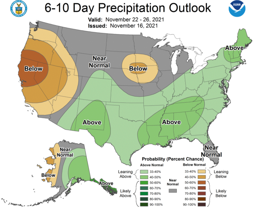
How about these temperatures?! It has been warm this afternoon due to high pressure off to the east and the southerly flow across the area. This has also led to a breezy afternoon, with gusts upwards of 25 mph. Take advantage of the pleasant conditions now, before a cold front brings rainfall and cooler air in the days to come. Glancing at the longer term, cooler than average air is more and more likely to end out the month of November. Not only will temperatures be in the upper 40s to low 50s Friday afternoon, but another system late weekend has an opportunity to knock highs into the low and mid 40s early to mid week. We'll update you more on this with time. As for precipitation, above average is expected over the next week, before a trend toward normal arrives late month and into December. Model guidance depicts the front that will arrive for tomorrow. Showers will start off the day, carrying, for some, into the mid afternoon. These should move out rather quickly, with sunshine making a return on Friday. Highs will run from the upper 40s to low 50s, warming through the weekend. Our next weather maker then arrives Sunday and into the start of the new work week. If you have any loose outdoor items, make sure to pin them down or bring them to a secure area. Winds will continue to be breezy through the afternoon before calming down overnight. Additionally, don't forget to pack the umbrella, you'll likely see showers at times through the morning and up through lunch tomorrow. Pre-recorded for 5pm show
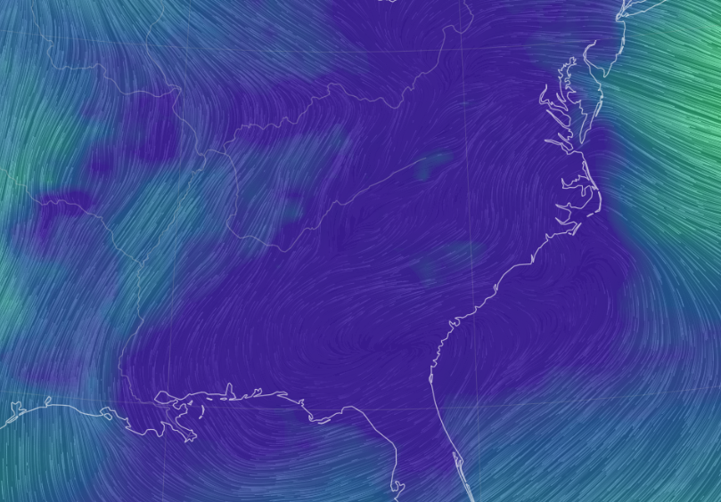
Howdy! It's been a pretty quiet day with cloud cover and cool temps. A warm front will be progressing northward tonight and into Wednesday, not only bringing warmer temperatures but also breezy conditions. Looking at streamlines, you can see the flow is generally out of the south/southwest. This will become more evident tomorrow. With a cold front pushing eastward and a warm front shifting north, winds out of the south will be breezy. Upwards of 25 to 30 mph will be possible through tomorrow. The bulk of this will hang to our north and west, but don't forget to still pin down and put away loose outdoor objects. Looking at a play-by-play, high pressure will keep things dry and tame today & most of Wednesday, before a passing cold front brings rainfall late Wednesday night and into Thursday. Showers will generally be moderate at best with rainfall totals mainly between 0.25" and 0.75". We will then clear back out Friday, with sunshine returning along with cooler air. Warm conditions continue into Wednesday, before a passing front brings a change in airmass and moisture. Cloud cover will gradually clear the remainder of today, with some pockets of sunshine expected at times. A better opportunity will be in place tomorrow, before clouds increase towards the evening. Pre-recorded for 5pm show
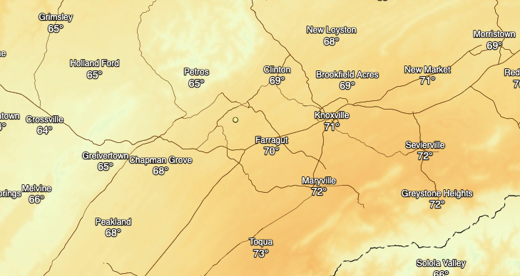
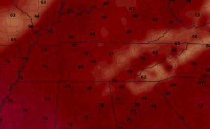
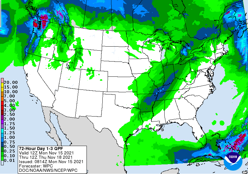
A passing front last night brought cloud cover (which has since vanished) as well as some cooler air. Highs this afternoon, for most, will top out in the upper 40s and lower 50s. This will rapidly change towards midweek, as a strong southerly flow intrudes the region. Looking at modeled highs on Wednesday, valley locations should top out in the upper 60s and low 70s. I am suggesting these be a bit warmer given the relatively sunny skies and strong southerly wind. Valley locations, specifically the southern valley, could see highs in the mid and even upper 70s. In addition, it will be a breezy day. A tightening pressure gradient along with winds out of the south, will lead to winds 10-15 mph and gusts, for some, up to 25-30 mph. A cold front will arrive overnight Wednesday and into the first half of the day Thursday. Looking at the WPC 1 through 3 day rainfall accumulation map, we stay dry the next few days. With high pressure in place for the time being things stay dry and warm before the rain and front arrive Thursday. Anywhere between 0.25 and 1" can be expected with our next rain maker. That will do it for today....enjoy the warming conditions expected through mid week. It will feel more like a mid-Spring day Wednesday with highs for most in the upper 60s and 70s. Pre-recorded for 5pm show
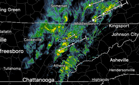
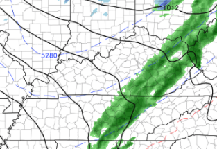
Good morning and I hope your Friday is off to a good start. Looking at temperatures compared to this time, we are much cooler. The passing cold front that brought showers out ahead of it last evening is providing temps (7am) in the mid 40s. Even cooler air will arrive tomorrow as another front passes through overnight. Highs tomorrow will be in the 40s for most (well below average). After a fairly average week rainfall-wise (thanks to this most recent passing front), conditions remain the same. Abnormally dry spots still remain along the western counties of TN, otherwise we are right at the norm. Looking into tonight, a secondary cold front will slide through. Though guidance is weary on if we'll see any precipitation, Hi-resolution data suggest we might. As you can see below, a weak line of showers could push through tonight, providing some light shower activity. A few snow flakes will also be possible but only for those in higher elevations and into the Smokies. We'll clear back out Saturday and Sunday with cool temps in place (40s and 50s). Monday will be another brief cool down before temperatures climb back up into the 60s and even near 70 mid week. Have a great weekend! Pre-recorded for 5pm show
|
Your trusted source for everything weather in East Tennessee.
Social Media
|

