|
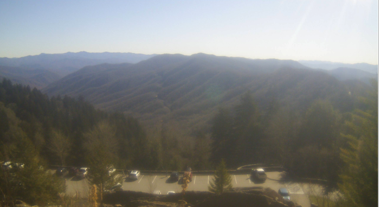
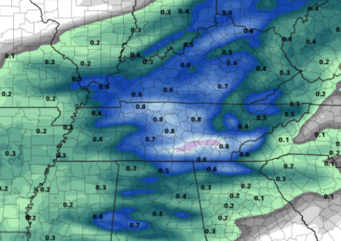
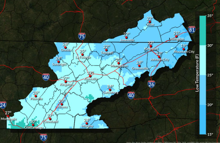
Good afternoon! It's a beautiful one but quite chilly. Temperatures across the valley sit in the mid 40s while upon Ole' Rocky Top things are in the mid and upper 30s. Continuing through the afternoon, sunshine hangs around with highs near 50 degrees. Cloud cover will increase Saturday, as an approaching frontal boundary brings rain into Sunday. This will mainly come the latter half of the day, but a few isolated showers can't be ruled out in the morning hours. Following the cold front, high pressure builds in. This will bring well below average temperatures into the start of next week, along with mostly sunny skies. Before getting to how cold things are likely to get, here's the expected rainfall totals. This system packs a bit more moisture than the previous one, so upwards of 0.75" are possible. With the higher elevations of the Plateau, this is where the higher rain totals will likely fall. Nonetheless a nice soaking rain can be expected early Sunday afternoon through late Sunday night. A few flakes will even be possible for those in the foothills and definitely the higher elevations of the Smokies. Now to those temperatures...pinpointing the coldest temperatures of the season, overnight lows Monday into Tuesday will be as cold as the upper teens to mid 20s. With clear skies and radiational cooling, expect even these valley temperatures to come down a degree or two in the coming days. Though this weekend will be seasonable, a cold shot of air will kick off next week. We'll keep you posted on social media, so if you don't already, follow us on Facebook and Twitter (@SecretCityWx) Pre-recorded for 5pm show
0 Comments
Leave a Reply. |
Your trusted source for everything weather in East Tennessee.
Social Media
|


