|
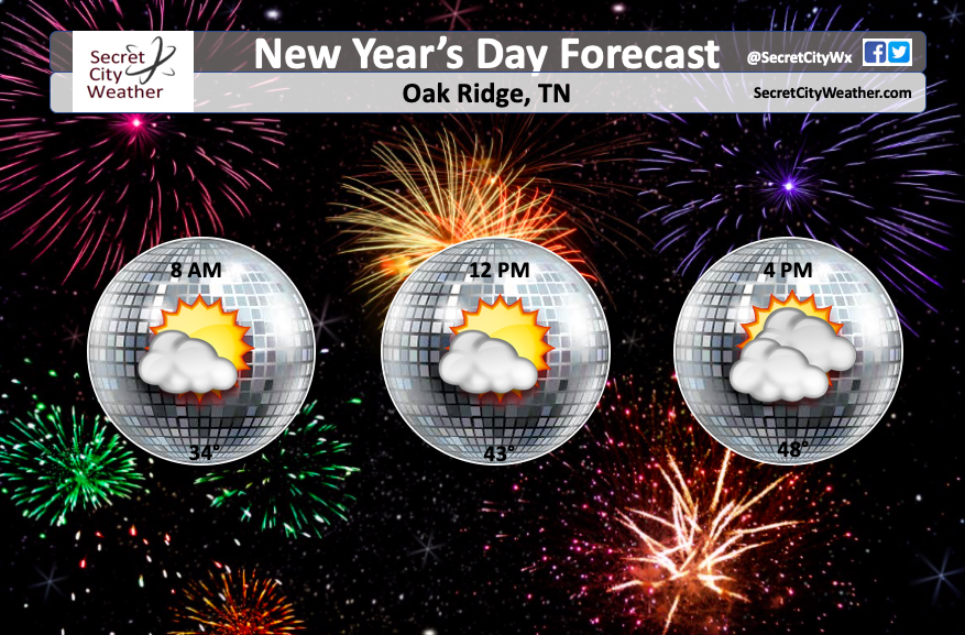
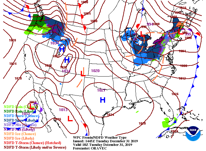
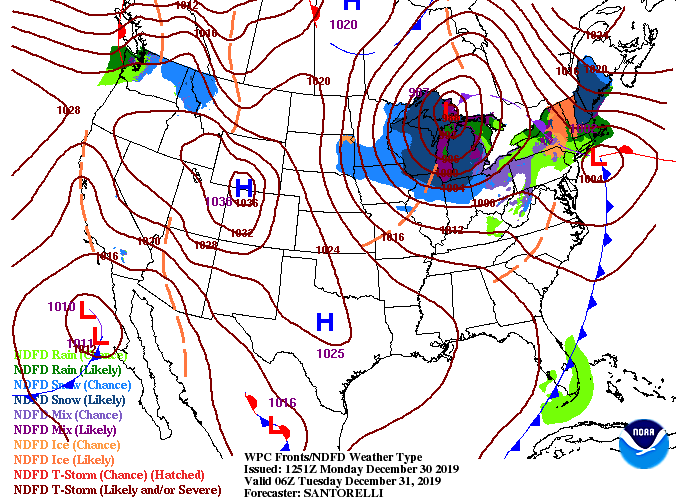
Do you have plans for New Year's? We will stay dry through the day with high's in the 40's. For today, partly cloudy skies with high's, average, in the mid 40's. We started cloudy (with the system to the north) but will gradually thin out by this afternoon. For those planning to go out tonight, dress warm. Temperatures overnight will be in the 30's with partly cloudy skies. Looking at the latest surface map, a high to the south will keep things dry the next couple of days before rain moves in late work week. With the next system, expect temperatures to increase into the low 60's by Friday before a cold front sweeps through drying things out and cooling temperatures off. Model guidance shows showers to arrive by Thursday early afternoon and continue into Friday before moving out early Saturday. Unlike our last system, showers won't be as heavy this time around. Some rumbles of thunder and gusty winds aren't out of the discussion, but the severe threat is very low. That wraps up the last forecast of 2019 but have a great day and wonderful start to the new year!
0 Comments
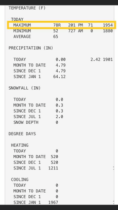
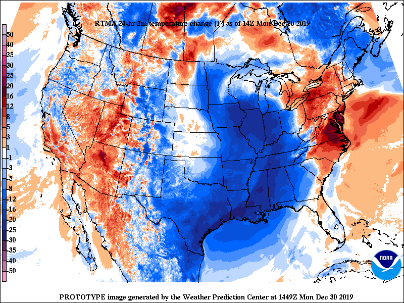
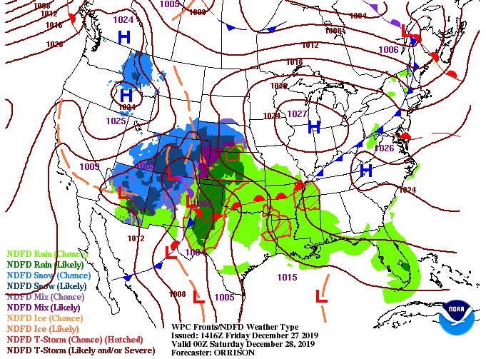
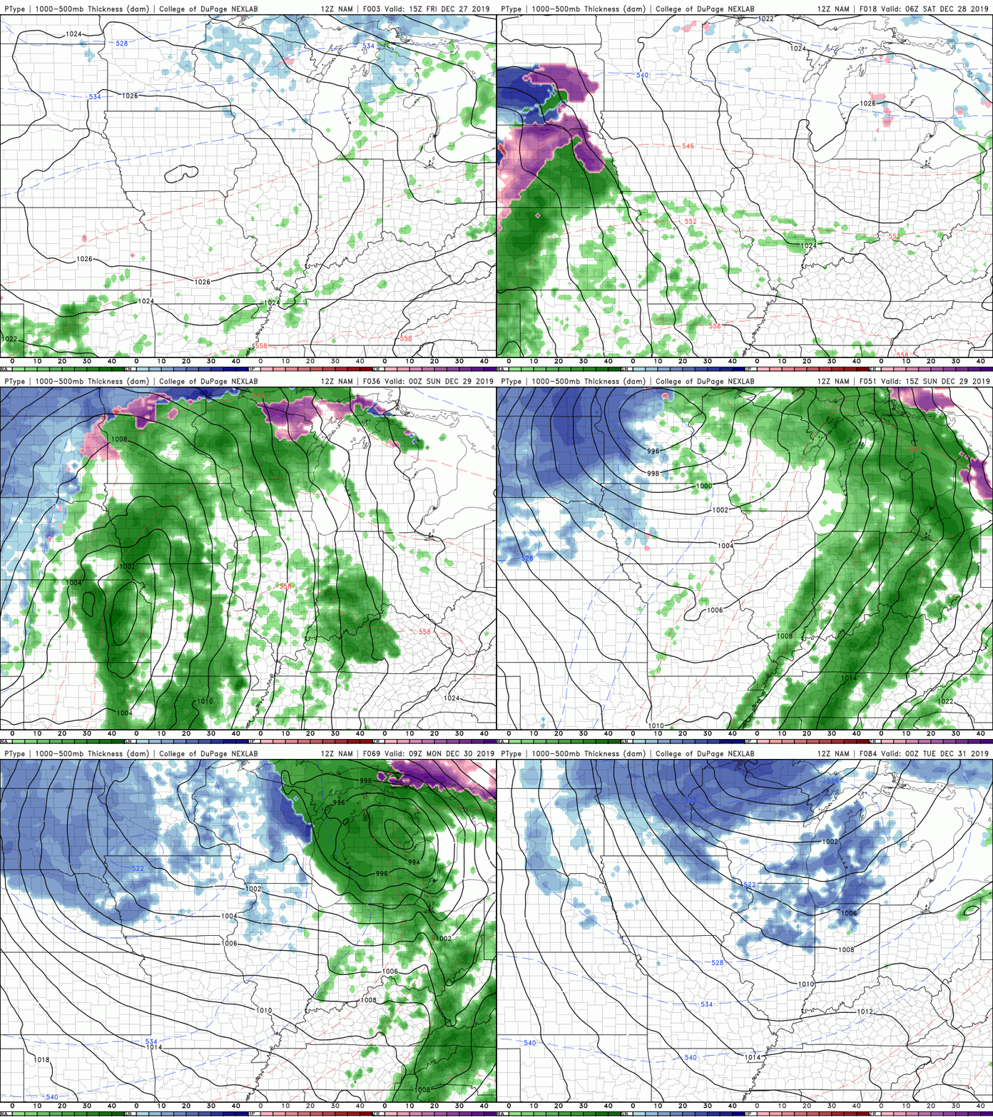
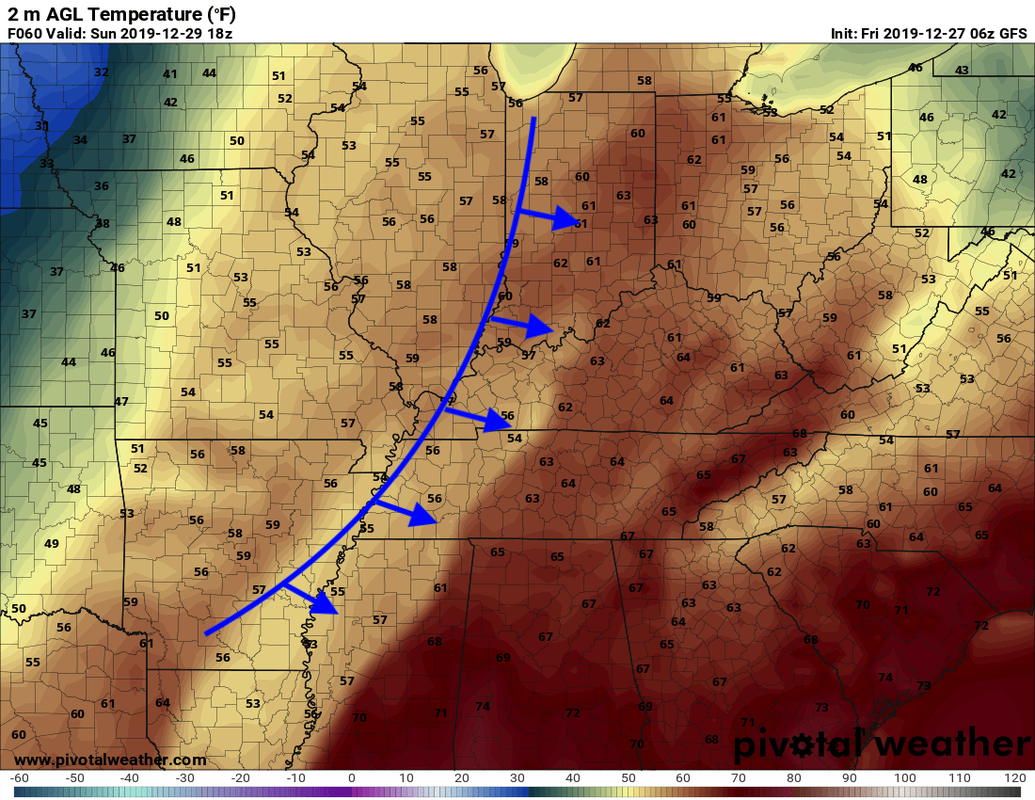
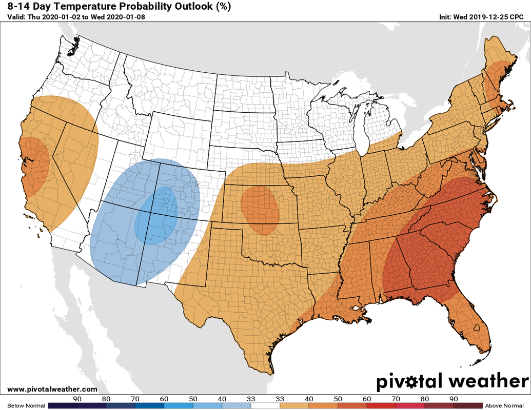
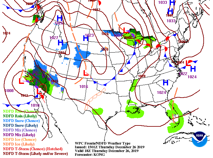
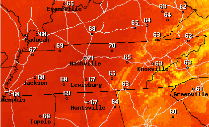
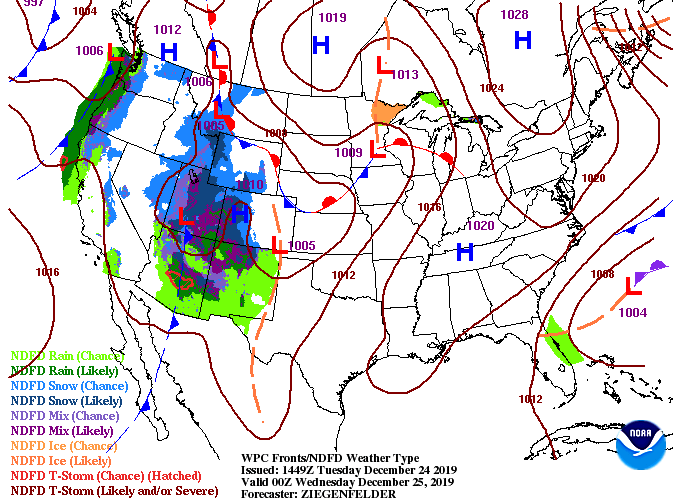
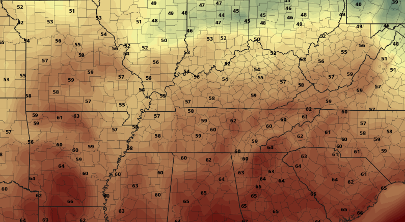
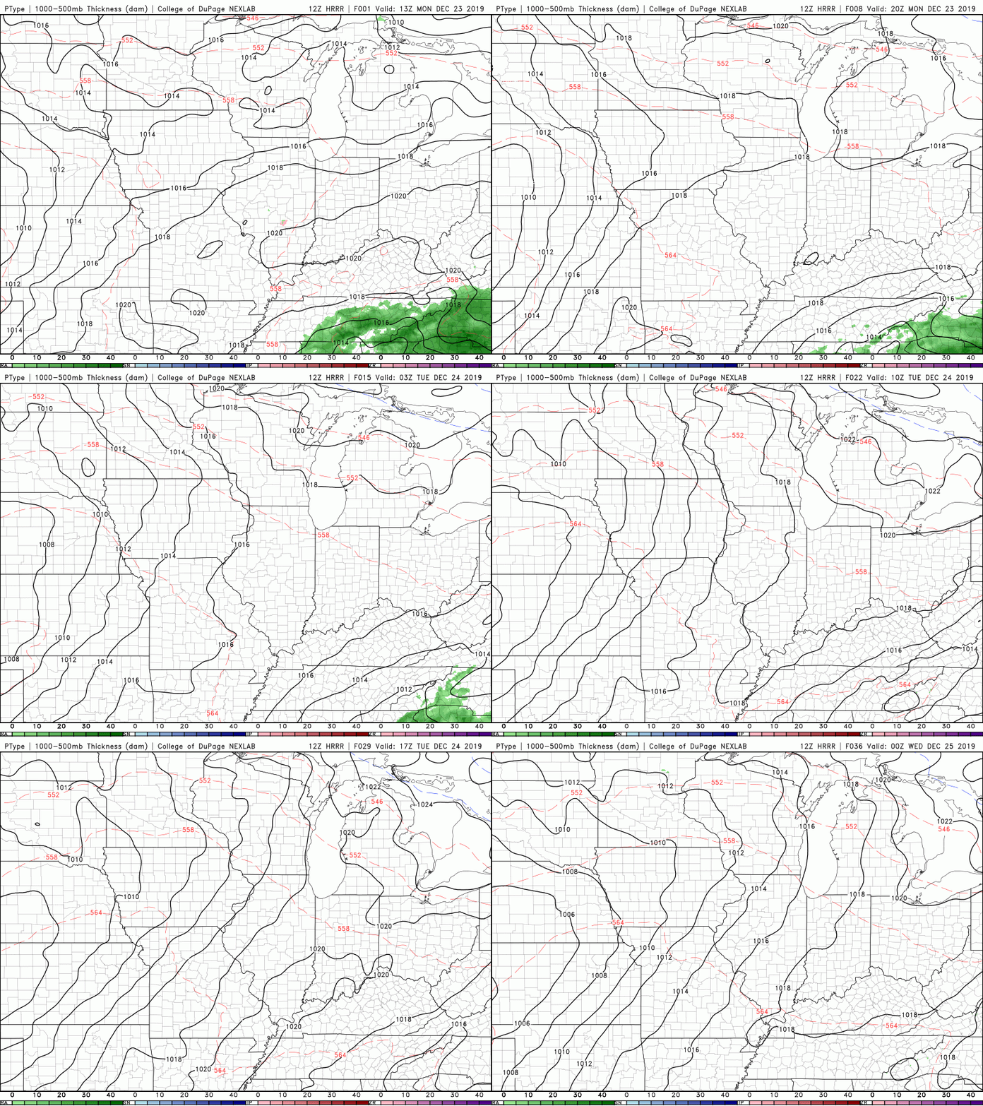
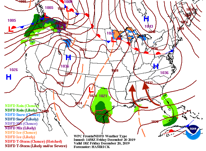
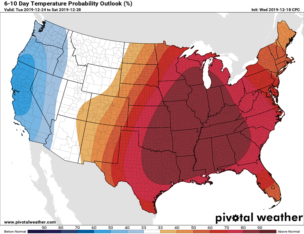
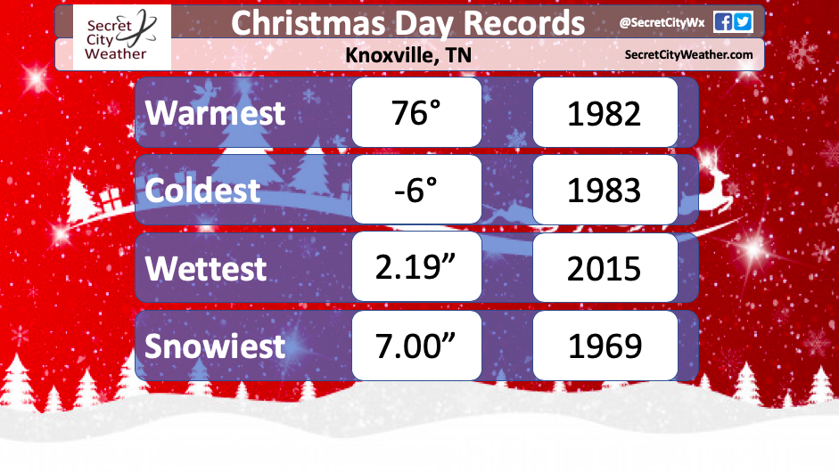
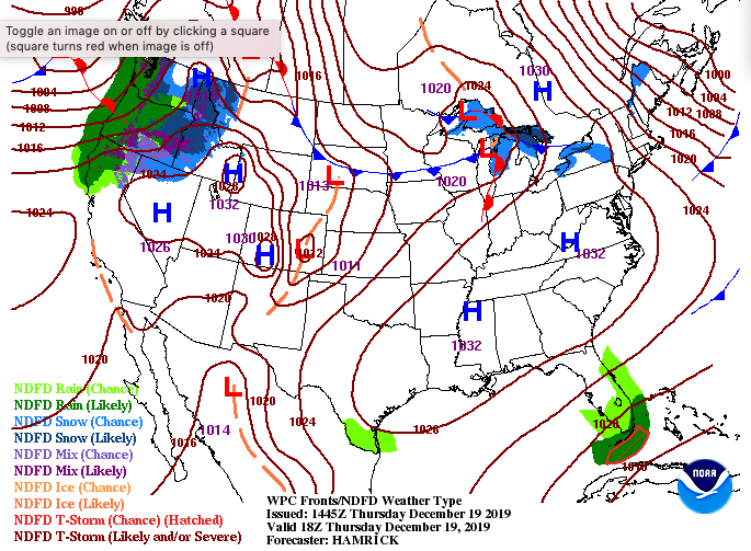
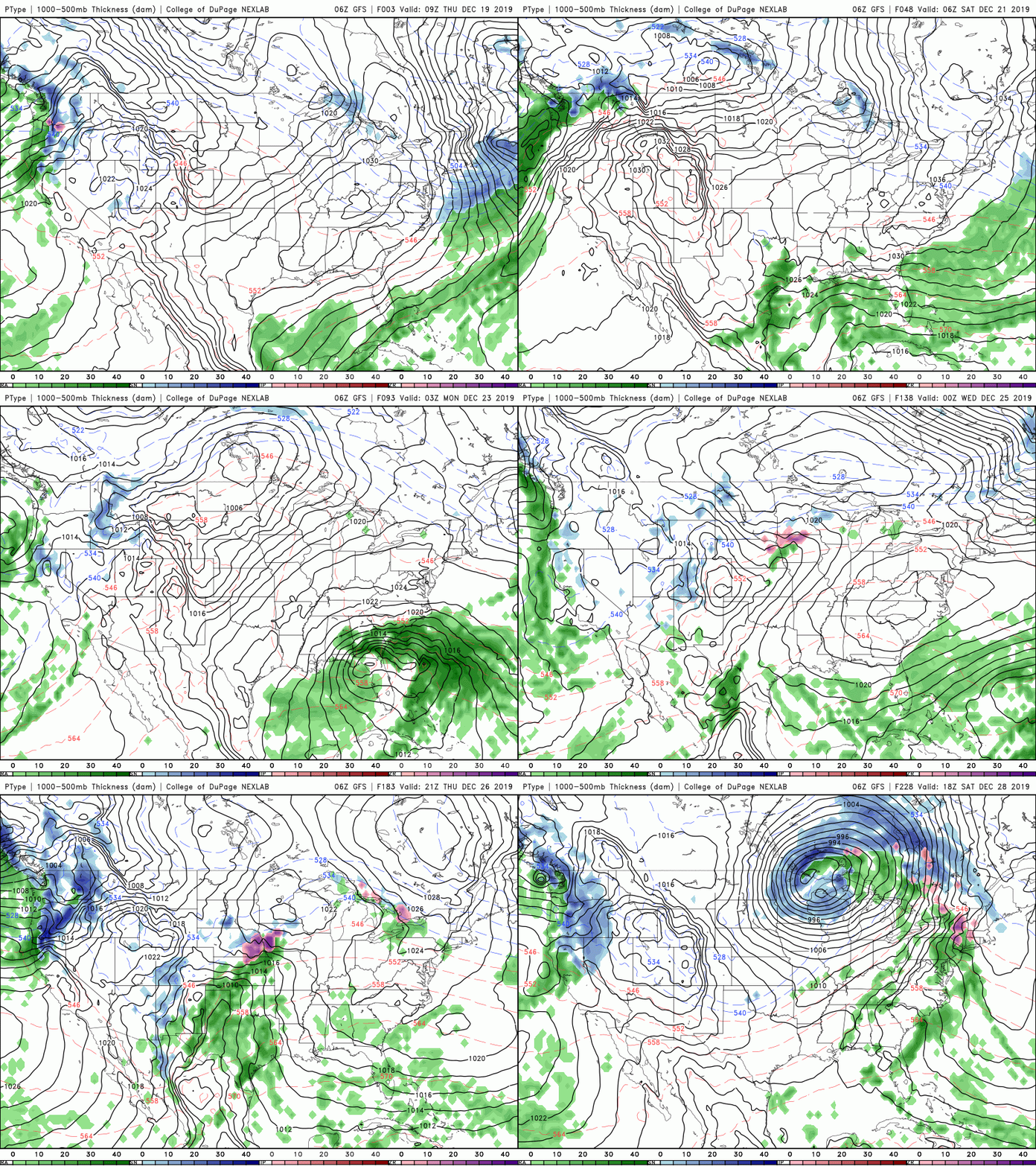
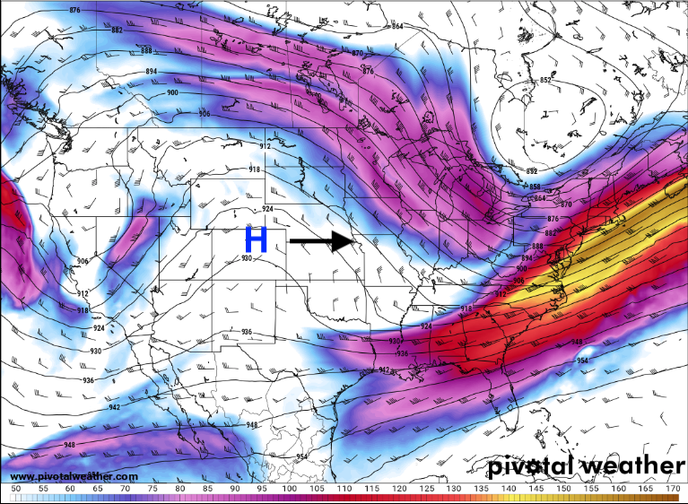
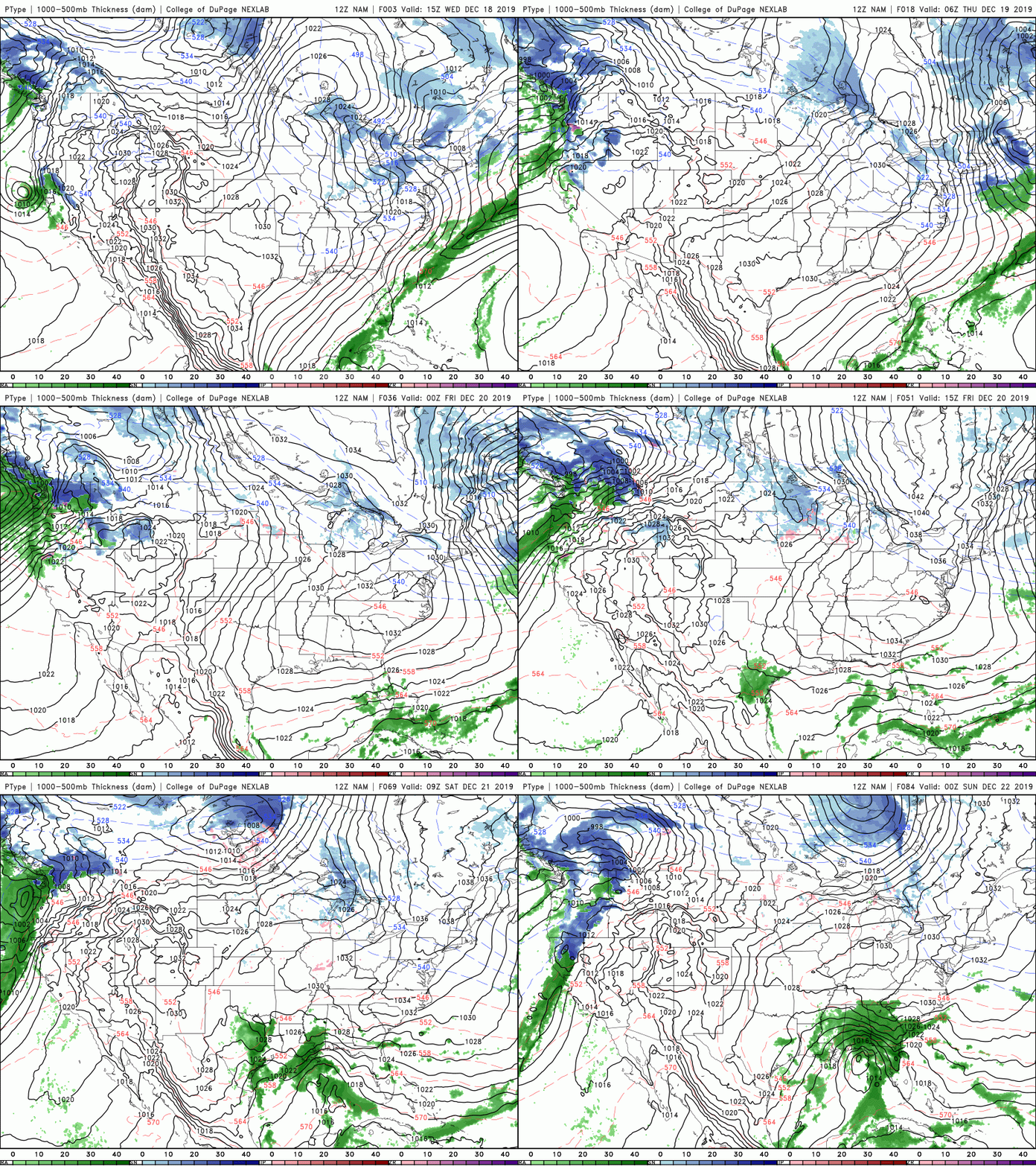
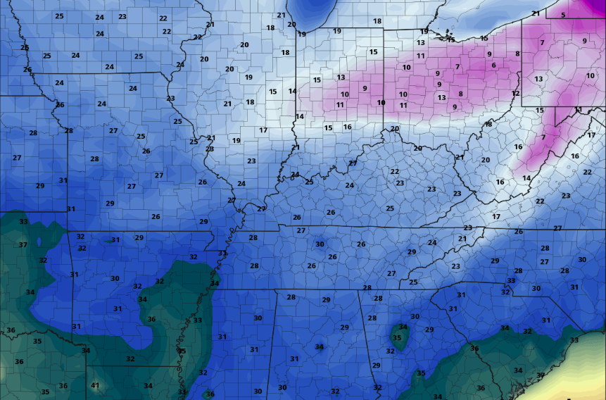
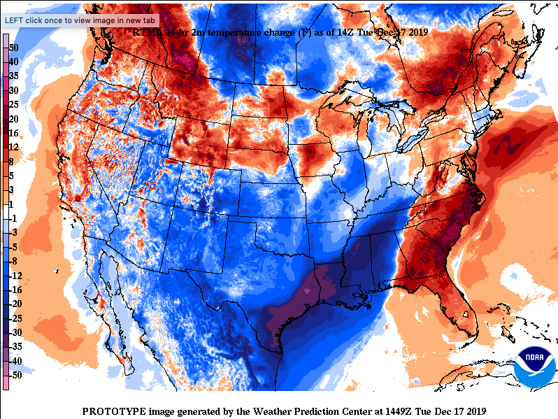
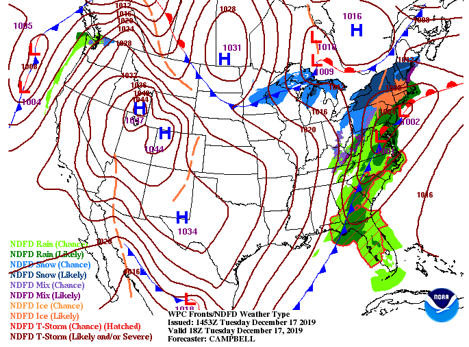
Happy Monday to all! We can finally breathe a sigh of relief as cooler air is working back in. Yesterday afternoon we set a new high temperature record (for the 29th) with a high of 78 degrees, previously being 71 (in 1954). As you can see, much cooler air is set to work through today and tomorrow. With temperatures already 10 to 15 degrees cooler than 24-hours ago, expect high's to be near average Tuesday (mid to upper 40's). As for today, it'll be breezy with gusts up to 25 mph. Temperatures will stay comfortable (for this time of the year) in the mid 50's under partly sunny to sunny skies. Looking ahead through this week, we will stay dry and comfortable the next several days before a system to the south arrives by late work week. As seen from the surface map, the system to the north will continue to work north and east bringing snowfall to the Great Lakes and New England states, but keeping things dry here at home. Working into Thursday, a system from the Gulf will arrive bringing showers through the day, into Friday, and eventually moving out Saturday. For now, enjoy the average to above average temperatures before we gradually warm back up into the 60's Friday. Don't forget to sign up to get this years almanac at SecretCityWeather.com/almanac. Have a good one! Good afternoon! Cloudy skies have arrived to end the work week and will continue through much of the weekend, too. As seen below, a system to the west is bringing in cloud cover for east TN. It will continue moving east, arriving Saturday night and through the day Sunday. The bulk of this system will move in Sunday mid-morning and move out by the evening. A trailing cold front will bring back sunny skies and cooler temperatures as we get into the new work week. Average high's for this time of the year are in the mid 40's and even with cooler air by next week, high's will be in the upper 40's and lower 50's (remaining above average). Outside of heavier showers and storms Saturday night and through the day Sunday, expect to stay stay mostly dry with cooler air arriving early next week. The cold front can be seen from the west by Sunday afternoon. This front will drop temperatures (high's) into the upper 40's and low 50's Monday and Tuesday before temps slowly build back up. Along with decreasing temperatures, drier air will also work in thinning the cloud cover and bringing back sunnier skies for the new work week. Gusty winds are also likely throughout Sunday and Monday with gusts up to 45 mph. That is all we have for today but showers and some storms are on the way, eventually bringing some cooler air into the region. Have a great weekend and don't forget to sign up to get this coming year's Almanac two weeks early! (SecretCityWeather.com/almanac) For all the winter & cold air seekers out there, I am sorry to say winter is on hold for a few weeks. Looking at the latest from the CPC (Climate Prediction Center), above average temperatures are expected to continue into early January. With the polar jet hanging further to the north, warmer air is expected to stay around to begin the new year. The current surface map shows a high pressure system to the south and east which will keep things dry through the day today. As we get into the afternoon, clouds increase with a system in the Great Lakes region. This could bring an isolated shower into Friday, but the biggest threat arrives Sunday. The latest data from model guidance varies from model to model but to keep it safe, a chance for isolated showers is possible tomorrow. The best chance for light showers are those in middle TN and the plateau. Overall, a majority of the area will stay dry Friday into Saturday. Working into Sunday, heavier showers and storms arrive early and work throughout the day. We will clear out for Monday with cooler temperatures to begin the new work week. Keep in mind "cooler temperatures" for the start of next week will still be near to above average in the upper 40's/low 50's. I want to remind everyone we are releasing East Tennessee's FIRST Almanac in February and if you'd like to get yours early, subscribe at SecretCityWeather.com/almanac. We also encourage you to submit some of your best pictures throughout the year, which you can submit at the link above. If you aren't a fan of cold weather, I have great news for you! We will continue our streak of well above average temperatures as you can see below. For Christmas Day (below) expect low to mid 60's here in the valley with 70's possible as you work west. These warm temperatures will stay around much of the week before colder air arrives early next week. With a high pressure system overhead, dry air will stick around today and tomorrow. Working into late Thursday and the day Friday, a system in the great lakes region could bring some light isolated showers to areas of the plateau and central valley. Our next real weather maker arrives Saturday night and into Sunday with heavier showers and storms possible. With ridging in place today, dry conditions will stick around today and tomorrow. Working into Thursday and Friday, light scattered showers are possible from west to east. Anticipate little rainfall toward the end of the work week with better chances arriving on Sunday. For a full video forecast and a look at your Christmas day, watch the latest below. I wish everyone a Merry Christmas! Happy Monday to everyone! Showers have moved out (for the most part) and clouds will continue decreasing this afternoon and overnight. Working into Christmas Eve, sunny skies and warmer temps return. Looking at the latest data below, expect high's in the 60's Christmas Day. (That is 15-20 degrees ABOVE average for this time of the year) The system to the south will continue working out today as a high from the west works in. The high will lock in warm temperatures and dry air for the next several days. Our next weather maker isn't expected to arrive until the weekend; meaning lots of sunshine and warm temps this week. To back up what we see from the surface map, the last from model guidance shows some remnant showers to the south and east working out. This will continue this afternoon with cloud cover thinning out overnight. Dry conditions with limited activity is expected the remainder of the work week (besides the very abnormally warm conditions) That concludes today's forecast but don't forget to subscribe to get an early release of this year's Secret City Weather East TN Almanac -> SecretCityWeather.com/Almanac A high pressure system overhead will continue to keep things dry this afternoon with high's in the low 50's. Clouds will continue increasing throughout the day leaving mostly cloudy skies tomorrow. We will stay dry Saturday but showers will work in Sunday. Model guidance is having trouble depicting how far the moisture will travel north into Sunday afternoon and night but this is the worst case scenario of the models. A system to the south will develop and move east this afternoon and Saturday. Showers will eventually arrive (mainly to our south) Sunday afternoon and overnight. Expect showers to be light and rather quick moving as clearer skies return Monday afternoon. We will stay warm (60's) and sunny Christmas Eve and Christmas Day. If you have any outdoor plans this weekend, Saturday is your best day to do them. A Few scattered showers are possible Sunday afternoon and night but we will quickly dry back out by the following afternoon. Announcement: Secret City Weather is releasing the first annual East Tennessee Almanac February 17th, 2020. If you would like to receive a copy early (February 3rd, 2020), simply subscribe here: Another gorgeous day today with high's expected to top out in the mid 40's this afternoon. If you're enjoying this weather, it only gets better tomorrow with high's increasing into the lower 50's. Slight changes come this weekend with cloudy skies Saturday and a slight chance of an isolated shower (Sunday), but warm temperatures and sunny skies return for much of next week. With Christmas less than a week away what can you expect? Unfortunately, it won't be anything close to the desired white Christmas. In fact, Santa may want to leave his winter coat in the North Pole. The latest from the CPC shows well above average temperatures as we roll into next week. The average for this time of the year is around 48 degrees and we are anticipating temps in the mid 50's to 60's through much of next week. Though this Christmas will likely not be memorable weather-wise, here are the records from the NWS in Morristown through the years. Getting into the weather for the next couple of days, very seasonable. A high on the east coast will funnel in warmer temperatures Friday (in the lower 50's) and keep things sunny. Saturday, a system to the south will bring cloud cover to the region but we will stay mostly dry. Sunday is our best chance for any rainfall and even then, chances are very limited. Staying dry and mild the next several days continues to be the pattern but as we get into the weekend, a system on the Texas panhandle develops and moves east. This will increase clouds Saturday and bring isolated shower chances into Sunday. Most, if not all of the moisture, will be contained to southern TN and to the south. We will clear out Monday afternoon and stay sunny and abnormally warm through much of the remainder of the next week. Toward the later half and into the weekend, another system arrives bringing heavier showers and storms (even some colder air). Overall, if you are making Christmas plans here in east TN conditions for travel will be just fine. Expect above average temperatures and mostly dry conditions for much of this next week. As for Friday and this weekend, mostly dry and slightly above average before even warmer temperatures arrive Monday. Have a good Thursday and be sure to enjoy the seasonable conditions the next couple of days. Good afternoon all! It was a crisp start to the day with temperatures starting in the mid 20's this morning but we are gradually warming up to mid 40's this afternoon. Looking at the latest data, a large ridge is hanging through the mid west and will continue moving east this afternoon and into Thursday. With high pressure staying over head, expect sunny skies and warming temperatures to remain into the weekend. Model guidance shows much of the same as high pressure will dominate the next couple of days. Working into the later half of Friday and Saturday, clouds increase with a system to the south. Light scattered showers are possible Sunday but these will stay primarily to the south of Knoxville (Chattanooga, Georgia, and Alabama). As we push into early next week, return flow will increase temperatures to well above average in the 60's. Sunny skies will stick around as a high dominate through much of early next week. If you have any evening/overnight plans tonight be sure to dress warm! The latest model guidance suggests low's in the mid to upper 20's but we will likely see low's in the lower 20's for most overnight. With the lack of cloud cover and a northwest flow, model guidance struggles with these variables (typically trending a bit warmer). That will close it out for today's forecast, but be sure to stay warm this afternoon and into Thursday. We will have a look into what is expected for Christmas tomorrow, so don't miss it! (Hint: it won't be a white Christmas) Brrr! What a change from this time yesterday. With high's around noon in the lower 70's (yesterday), we are currently sitting in the mid 40's across the valley. As you can see below, a strong cold front is continuing to work in dropping temperatures 15 to 25 degrees from this time yesterday. We are anticipating temperatures in the upper 30's to low 40's on your way home from work and school. Are you sick of the rain and clouds we have been dealing with for several days? I have good news for you! Sunny skies to return Wednesday and the reminder of the week with a high moving in. This will dry things out and gradually warm temps up too with 50 degrees returning Friday and into the weekend. With ridging placed over the central US, sunny skies are set to stick around the next several days. Along with plentiful sunshine, temperatures will gradually warm each day. Expect to stay cool Wednesday (low 40's) and Thursday (mid 40's) but Friday and into the weekend high's in the 50's return. Continue keeping those winter coats handy tomorrow before more seasonable conditions arrive the later half of the week. |
Your trusted source for everything weather in East Tennessee.
Social Media
|

