|
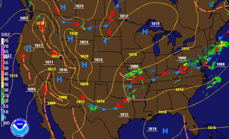
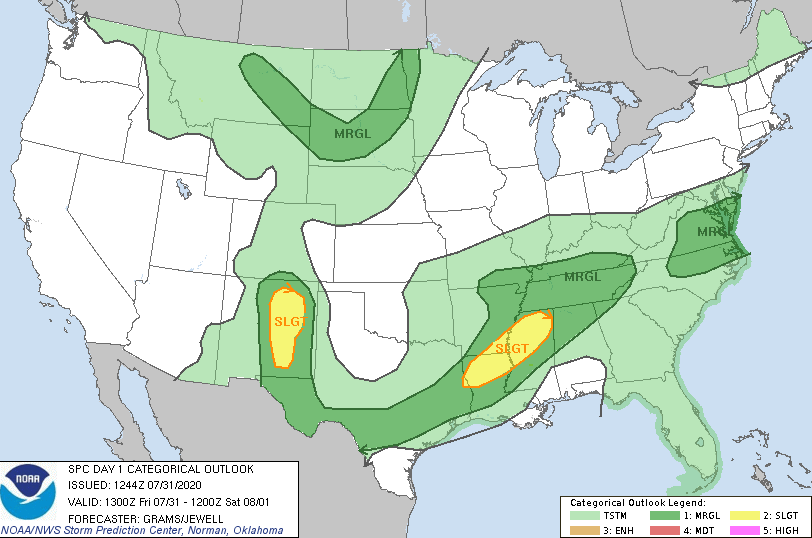
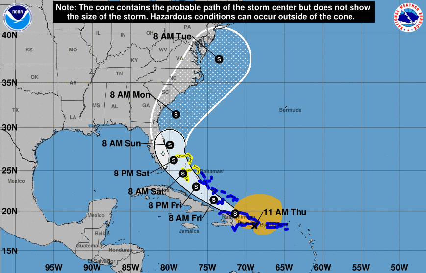
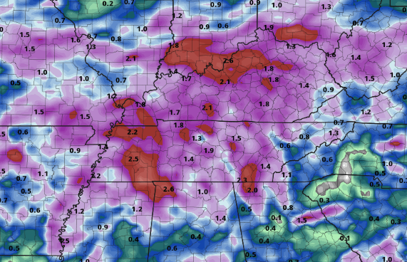
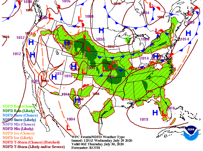
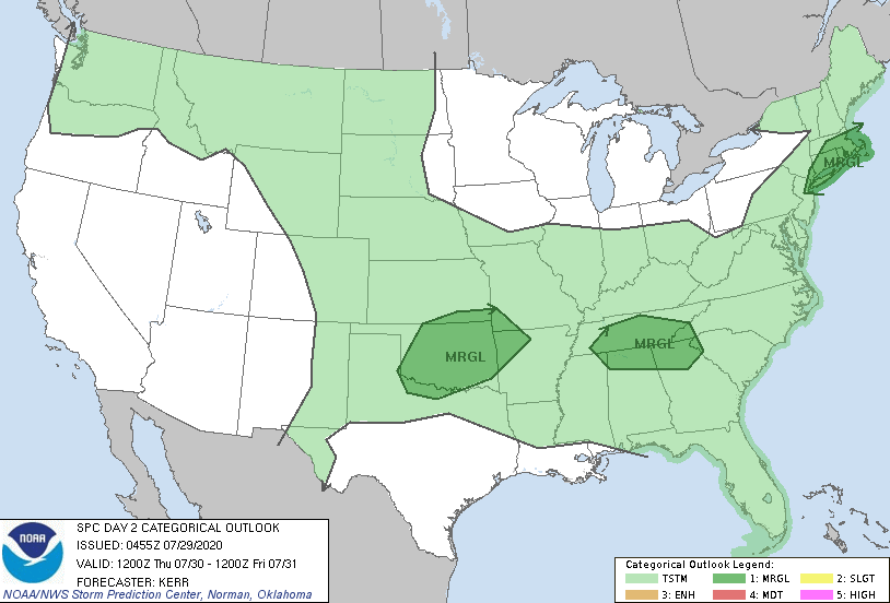
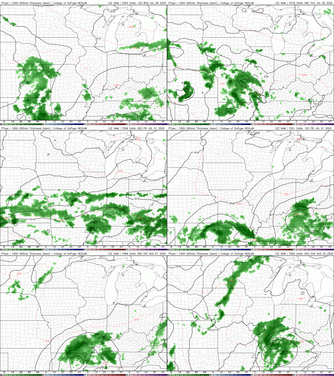
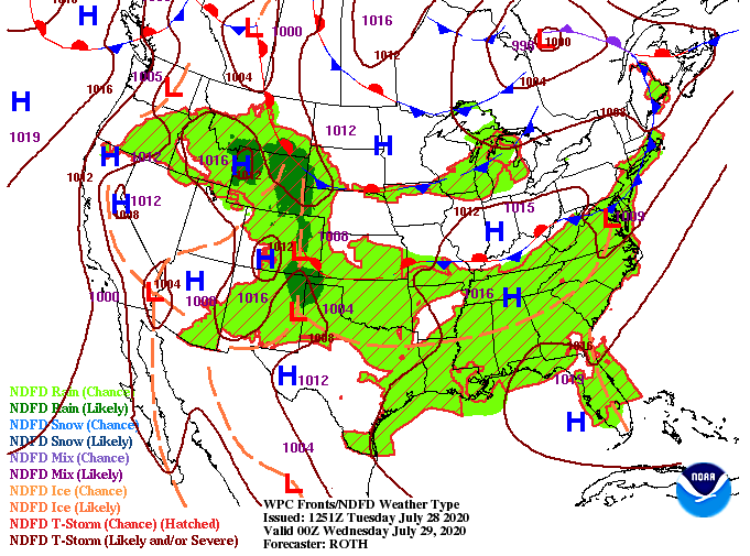
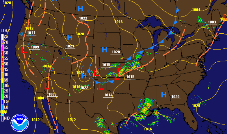
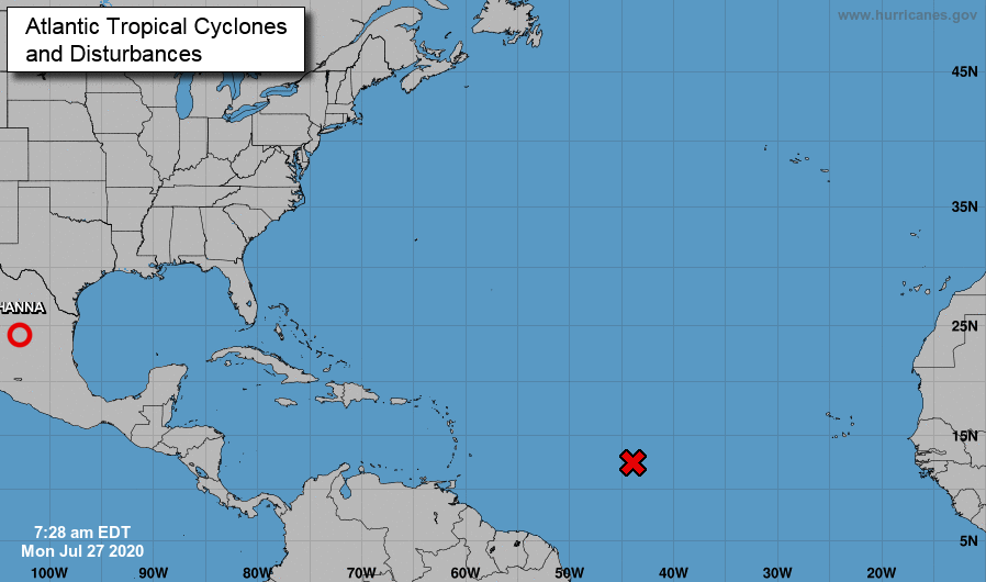
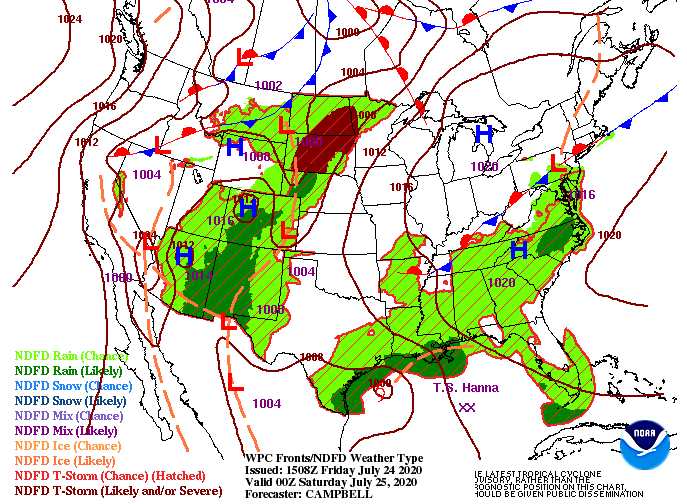
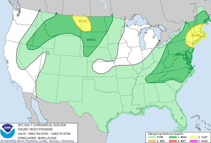
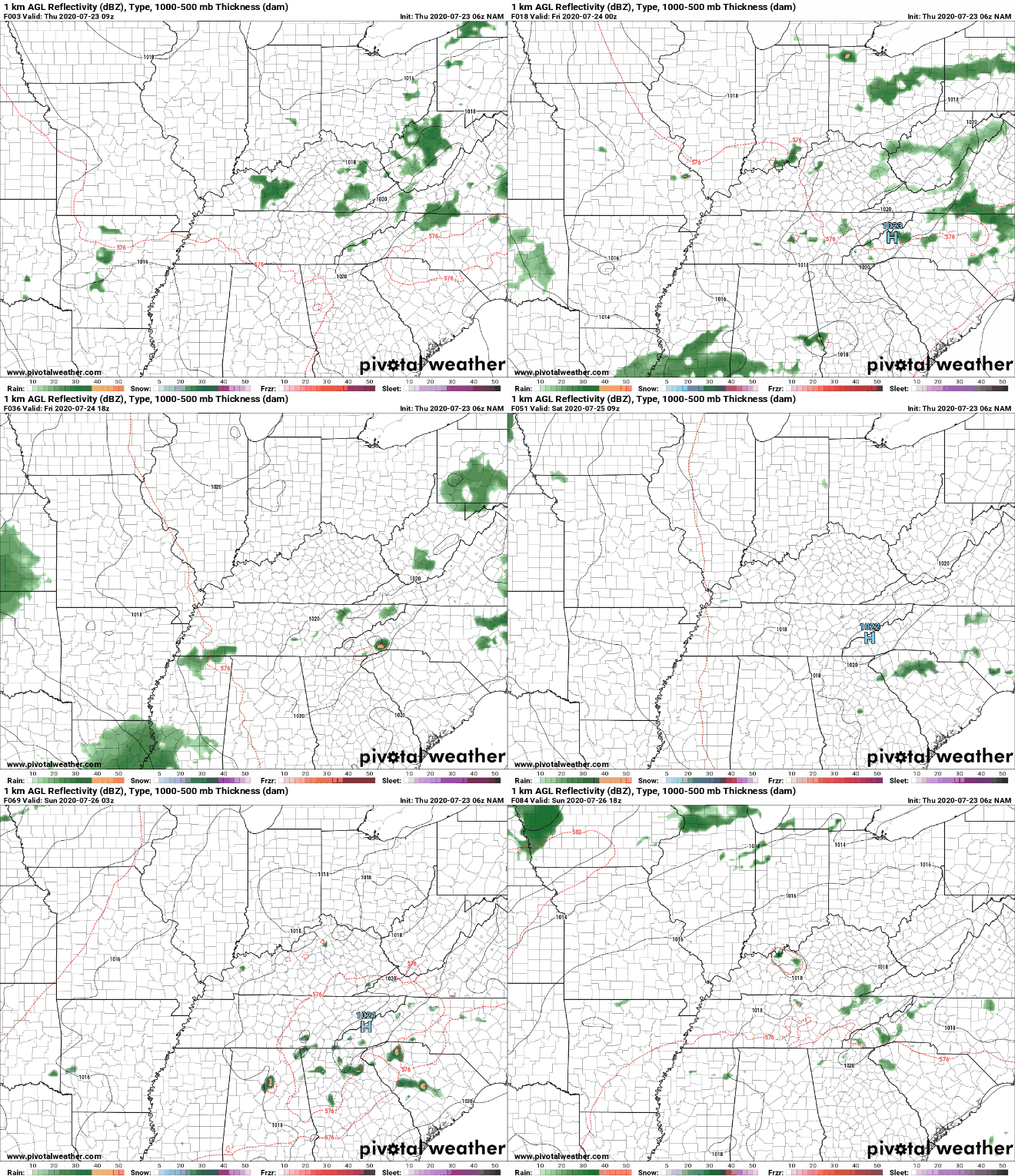
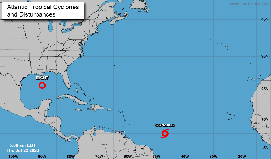
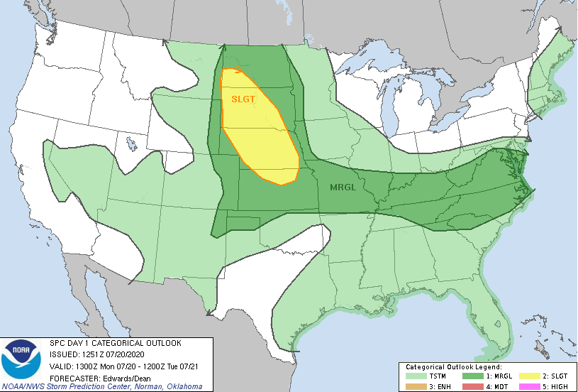
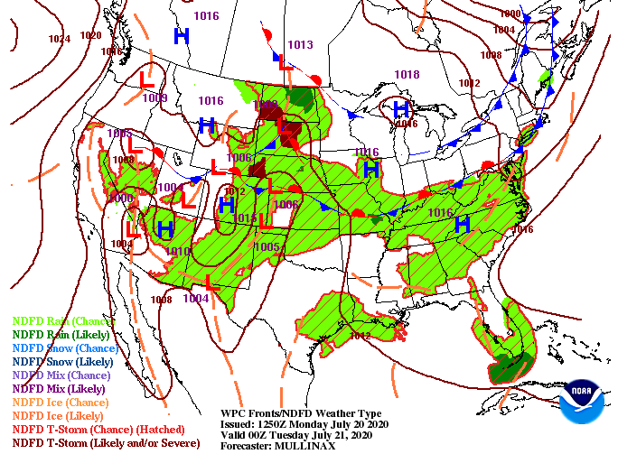
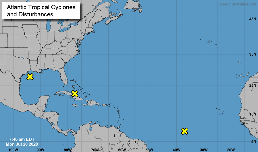
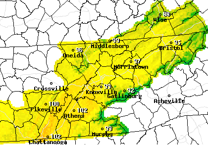
Good afternoon! We have stayed quiet so far today with the main threat being the temperatures. Heat indices across the region are sitting in the low to mid 90's as of noon. As we progress further into the day, showers and storms will begin firing off. A Marginal risk is in place again today as some storms could be strong to severe. With patches of sunshine beaming in early this afternoon, we could see the likelihood for stronger storms later today. Short term high resolution model guidance paints a similar story if things stay peaceful and mixed with a bit of sunshine. As seen below, showers begin developing early this afternoon and move east. These will be scattered in nature so not everyone will be impacted. Some will likely be strong at times, especially given the pockets of sunshine we have seen today These could bring gusty winds, heavy downpours, and lighting. We'll update you throughout the day. As of now, a strong batch is likely to develop and work into the northern valley with a second batch to impact the central and southern valley later today. An update in the tropics shows Isaias now a category 1 hurricane with the potential to strengthen to a category 2 in the days ahead. The path remains similar to yesterday: riding the eastern Florida coast and potentially making landfall in the Carolinas next week. In addition to Isaias, two more unorganized systems have developed west of Africa. We will keep a close eye on these as well for any development in the coming days. With lots of activity and the potential in the tropics, check in for updates through the weekend via social media. Be sure to tune in this afternoon as some storms could be strong to severe at times. Saturday will contain scattered showers in the afternoon with partly cloudy skies returning Sunday and next week. Afternoon pop up showers still remain, but they will be scattered and contained to mainly the higher elevations.
1 Comment
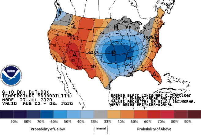
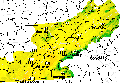
Tropical storm Isaias (pronounced ee-sah-ee-ahs) how now formed in the Caribbean and is currently working through Hispaniola. The projected path has changed a bit from yesterday but is expected to still impact Florida by the weekend. Landfall could be made on the eastern seaboard of Florida and again in North Carolina by early next week. Time will tell but for now, let family and friends in the area know of the impacts and to plan accordingly. Here at home, drought conditions remain similar to those of last week. Abnormally dry conditions stick around for east TN and far western TN. The good news is rainfall is expected this afternoon, Friday, and parts of Saturday which should help combat the drier conditions we are seeing. Rainfall totals vary model to model, but it is agreed the bulk of rainfall will stay north and west of our area. With that said, anywhere from half an inch to an inch and a half can be expected now through Saturday evening. Strong to severe storms are possible today and again Friday bringing localized heavy rainfall to some counties (bringing slightly higher totals for some). Showers and storms are already developing in the Plateau and moving east late this morning. Expect these to become more widespread by the afternoon bringing with it heavy rain, small hail, gusty winds, and lightning. A Marginal risk for severe weather is in place today meaning severe potential is low but not out of the question. Much of the same can be expected for Friday and parts of Saturday before sunnier skies and drier air works in Sunday and next week. As showers and storms continue to develop this afternoon, check in for updates on impacts and location. We'll also keep a close eye on the Caribbean today and the days ahead. Have a good Thursday and stay dry! Happy Hump Day! A front to the north continues to pester us bringing widespread activity in the days ahead. For today, showers and storms will develop in the higher elevations and work east this afternoon. We are already seeing some development just east of Crossville and west of Dayton. As activity increases for Thursday, a Marginal risk has been placed over the area (for tomorrow). Showers will begin firing off in the late morning to afternoon with a chance for heavier showers/storms later in the day. Severe potential is low but gusty winds, small hail, heavy downpours, and lightning are all something to be cautious of. A few isolated showers are possible this afternoon and into the evening hours before widespread activity arrives Thursday. Rainfall will stick around for Friday as well before showers turn more scattered Saturday. Sunday will likely be our "best" day of the weekend with a mix of sunshine, cloud cover, and afternoon showers. By next week, a bit of tropical moisture could be possible in our neck of the woods. Tropical cyclone (likely) nine is expected to work west in the days ahead before turning north around Cuba. More details on the expected path and timing can be found in the video below. Let family and friends in the Gulf area know what could be coming their way. For now, stay cool this afternoon and keep the umbrellas handy for tomorrow! As we touched on last week, a cooling trend in temps is expected early next month. In fact, we will see a glimpse of that Thursday and Friday with high's topping out in the mid 80's. Muggy conditions will make it feel a bit warmer but we'll take something not in the 90's. The front to the west and north continues to slowly work in providing some of the showers we've seen this morning and will again see this afternoon. Showers will pop up tomorrow after lunch before widespread activity arrives Thursday and Friday. Just like we saw yesterday, today and Wednesday will contain scattered afternoon showers and storms. Severe potential remains low but heavy downpours, gusty winds, and frequent lightning are all possible through the next 36 hours. By Thursday and Friday, the front will arrive to the area bringing with it widespread rainfall and the chance for embedded thunderstorms. With drought conditions increasing throughout the state, this will definitely help combat the issue. Rainfall totals for east TN, now through Friday, will be anywhere from 0.5" to 1.5". Localized larger totals are possible within heavier cells. If you have plans for a beach trip this weekend or have family in Florida, let them know some of the potential impacts coming their way. Invest nine will continue gaining strength in the days ahead and will likely impact the US by the weekend. More details can be found on the daily forecast below and by checking out the National Hurricane Center's website. I hope you enjoyed your weekend! As we kick off the new work week, keep your umbrellas handy. A front to the west will slowly work eastward the next couple of days. This will allow for moisture to funnel into the area the next several days and provide afternoon showers and thunderstorms off of the Plateau and higher elevations. As you can see below, showers and a few thunderstorms are more than likely the next couple of days. These will begin firing off early in the afternoon and work into the valley by days end. With little forcing overnight, showers and storms will fade out, turning into broken cloud cover. This will be the general pattern through midweek before the front brings widespread shower and storm activity. The severe parameters will be held at bay the next couple of days, but we can't rule out heavy downpours, lightning, and gusty winds at times. Cooler temperatures are also expected to follow in the days ahead with high's by Thursday in the mid 80's. Looking again at the Atlantic, another system is expected to develop in the next 24 to 48 hours. Questions still remain if this will impact the US but for now, this is expected to continue working westward. We will continue to monitor and keep you up to date on the latest. Keep your heat safety in mind as well as those umbrellas handy and I wish everyone a good start to the new work week! Good afternoon! I would like to start by pointing out the MRX radar site in Morristown is down until 2pm today for routine maintenance and testing. Both the Huntsville and Jackson sites will be useful in covering our area. Getting back into it, drought conditions are starting to appear across the state. Abnormally dry conditions both for east TN and far western TN as of yesterday. This could be a precursor for a persistent drought ahead so we'll keep a close eye. August and September are our driest months of the year so we could see this get worse before it gets better. For right now, scattered showers continue moving east ahead of a front. By tomorrow, a high pressure system will build in, allowing for sunnier skies and increasing temperatures. A summer pattern will be present with partly cloudy skies and the occasional pop up shower/ storm possible in the afternoon hours. Better shower chances arrive Tuesday and midweek as a new system works in. As the round of showers from this morning continues to move east, additional scattered showers will be possible this afternoon. This will fade out overnight leaving sunnier skies to return for the weekend. Pop up showers and storms (mainly in the higher elevations) will be possible Saturday and Sunday but the main story will once again be the heat. High's will return to the mid 90's, so keep your heat safety a priority. A glimpse of hope appears towards the end of July and into early August. For more details, watch our daily forecast below. That will do it for this week but have a wonderful weekend and don't forget to share with us on social media or by email. Getting back on track today, east Tennessee remains under a Marginal risk for severe storms. Development will begin early this afternoon, allowing for scattered storms through the afternoon and into the evening hours. Some could be strong to severe so check in for updates the later half of the day. As for temperatures, we'll see some cooler high's (in the upper 80's & lower 90's) but heat indices remain in the mid to upper 90's. Showers will likely begin developing early this afternoon to the west and work eastward through the day. The bulk of activity will arrive in the mid to later part of the afternoon, so be careful on the home commute. Heavy downpours, lightning, and gusty winds are all possible. In addition, the severe threat is low but not out of question. A significant development of these two systems has been made in the past 24 hours. Gonzalo is currently a tropical storm but is expected to strengthen into a hurricane by Friday. The path for Gonzalo will continue to be westward, likely falling between South American and the Caribbean. For the Gulf, tropical depression Eight has formed. This system will likely intensify into a tropical storm by the weekend, eventually making landfall in southern Texas sometime Saturday. After a brief pause in the Atlantic earlier in the month, things look to be right back to normal. With a better chance for widespread shower/storm activity this afternoon, have a way to receive alerts. This weekend we will dry back out, warm back up, and continue to see your typical afternoon pop up showers/storms. I hope you are staying cool on this Tuesday! Temperatures as of 11:15 this morning are already in the low to mid 80's. The cloud cover to the north and west is associated with a slow moving front. Moisture will begin streaming in tomorrow along this front, allowing for better shower chances Wednesday and Thursday. As for today, shower activity will remain limited. The bulk of activity will stay in the higher elevations. The main focus remains on the very warm temperatures. Afternoon heat indices today will top out, again, in the triple digits. High's alone will be in the mid to upper 90's. We will see a slight break in temps the next couple of days, but don't get too excited, we'll still be in the lower 90's. As seen from model guidance, the NAM continues to suggest better shower chances Wednesday and Thursday. As the front moves eastward, moisture from the Gulf will funnel through the area providing scattered showers and storms. By Friday, a high pressure system will arrive, clearing things out (for the most part) for the weekend. A Marginal risk is in place again today and for Wednesday, so be weary of strong storms producing gusty winds, hail, and frequent lightning. Thank you for viewing our content today and everyday! Stay cool as feel-like temps will find their way back into the triple digits this afternoon. As a front to the north and west shifts in, moisture values will increase across the region. The SPC has labeled east TN under a marginal risk for severe storms this afternoon. Though severe levels are low, some cells could be strong to severe at times. As we saw yesterday, the bulk of activity stayed in the higher elevations. I expect this to be the case again today but some storms could roll through the valley this afternoon. A set of fronts will slide eastward the next couple of days providing opportunities for afternoon showers and storms. The first one comes today and remains in tact for tomorrow. As we work toward Wednesday and the second half of the work week, guidance is hinting at better precipitation chances. As we saw Sunday, afternoon pop up showers and storms (mainly in the higher elevations) will likely develop. By Wednesday, a second front to the north will allow moisture to funnel in from the Gulf. This will allow for better and more widespread activity the second half of the work week. Depending on how deep the front dips down will depend on how likely showers will be. Regardless, expect a chance for afternoon showers and storms each day. Lastly, an update on the Atlantic shows some hot spots for activity. In recent weeks, activity has been limited due to the Saharan dust plume. Now that it has passed, a more normal July is present. Guidance and the overall general pattern is hinting at more activity in the weeks ahead, so we'll continue to eye the Atlantic for any Tropical Storms, Depressions, or Hurricanes in the future. Continue keeping your heat safety in mind. Heat indices this afternoon are expected to return to the lower 100's. In addition to the heat, check back in for updates as showers/ storms are likely to develop for some parts of the region later today. A slight change will begin taking place today with a chance for afternoon showers. A front to the north has pulled in a bit of moisture, allowing for a few afternoon showers/storms to develop. This will continue for the foreseeable future with sunny to partly cloudy skies in between. Shower activity will remain limited in the days ahead, but don't be surprised if you do see some rainfall. A typical summer pattern is setting up with afternoon rain/storm chances. Most will develop in the higher elevations (due to orographic lift) and slowly move into parts of the valley at times. Severe potential is low but like all summer time storms, some can be strong to severe. These are typical very slow moving and relatively short in length. Updates will be provided on impacts, location, and severity if showers/storms do arise. The main threat, as it will continue to be, are the afternoon temperatures. Saturday's heat indices will remain in the upper 90's to lower 100's across the region. Expect this to continue not only for the weekend, but also next week. Drink plenty of water, stay cool (maybe at the lake or pool!), and pace yourself throughout the day. Do your best to enjoy these temperatures; they look to be around for the foreseeable future. Have a good weekend and don't forget to share your outdoor adventures with us on social media or email! |
Your trusted source for everything weather in East Tennessee.
Social Media
|

