|
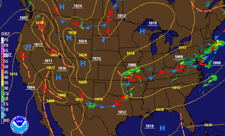
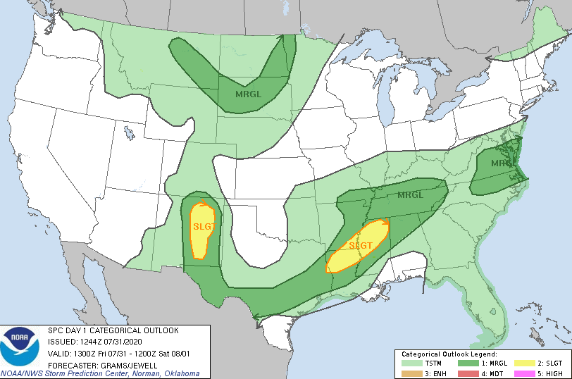
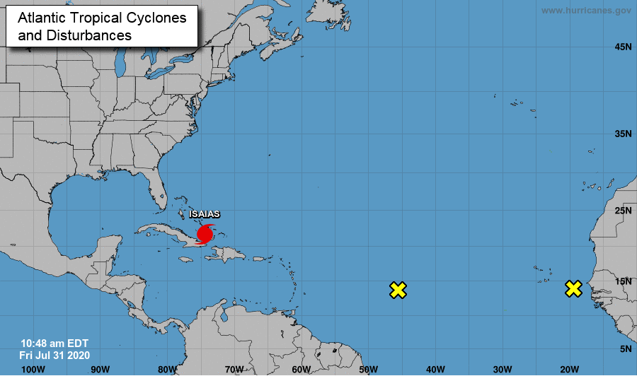
Good afternoon! We have stayed quiet so far today with the main threat being the temperatures. Heat indices across the region are sitting in the low to mid 90's as of noon. As we progress further into the day, showers and storms will begin firing off. A Marginal risk is in place again today as some storms could be strong to severe. With patches of sunshine beaming in early this afternoon, we could see the likelihood for stronger storms later today. Short term high resolution model guidance paints a similar story if things stay peaceful and mixed with a bit of sunshine. As seen below, showers begin developing early this afternoon and move east. These will be scattered in nature so not everyone will be impacted. Some will likely be strong at times, especially given the pockets of sunshine we have seen today These could bring gusty winds, heavy downpours, and lighting. We'll update you throughout the day. As of now, a strong batch is likely to develop and work into the northern valley with a second batch to impact the central and southern valley later today. An update in the tropics shows Isaias now a category 1 hurricane with the potential to strengthen to a category 2 in the days ahead. The path remains similar to yesterday: riding the eastern Florida coast and potentially making landfall in the Carolinas next week. In addition to Isaias, two more unorganized systems have developed west of Africa. We will keep a close eye on these as well for any development in the coming days. With lots of activity and the potential in the tropics, check in for updates through the weekend via social media. Be sure to tune in this afternoon as some storms could be strong to severe at times. Saturday will contain scattered showers in the afternoon with partly cloudy skies returning Sunday and next week. Afternoon pop up showers still remain, but they will be scattered and contained to mainly the higher elevations.
1 Comment
7/31/2020 21:24:45
We have seen different climates and that is normal. The world is always changing and we need to adopt to the different changes for us to live. We know that changes are hard, but it is worth the wait. There are different battles that we needed to face and there are other remarks that we want to ask but there will be answers soon. We just need to keep on searching for that answer, answers that are there if we will just look at every side of the situation. I am sure that we can all understand and make an improvement in our lives.
Reply
Leave a Reply. |
Your trusted source for everything weather in East Tennessee.
Social Media
|


