|
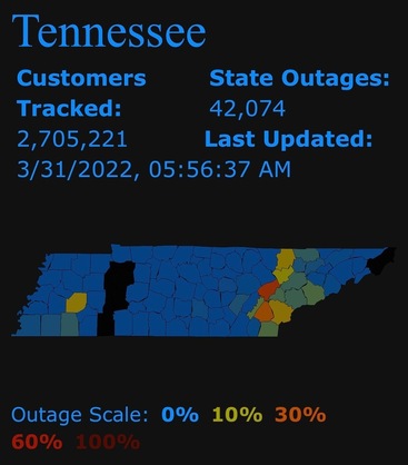
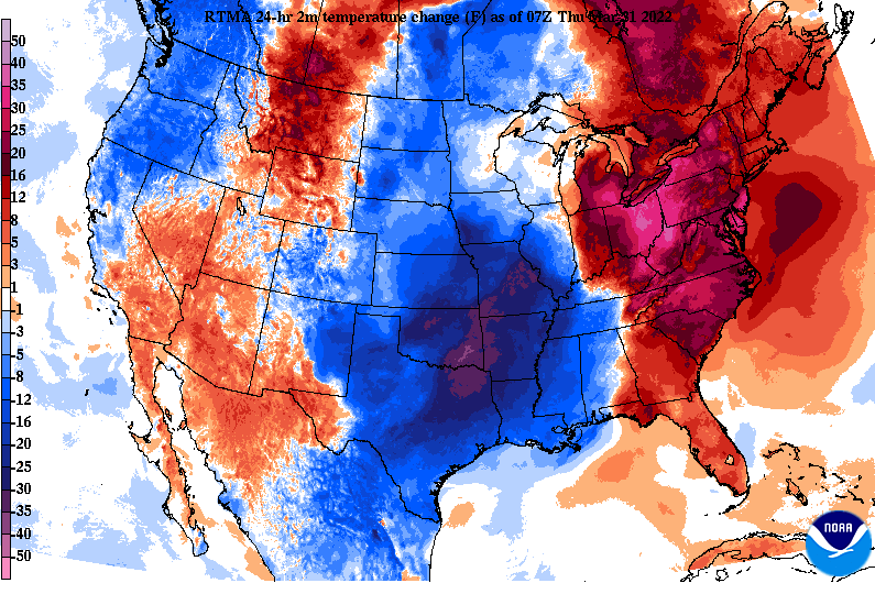
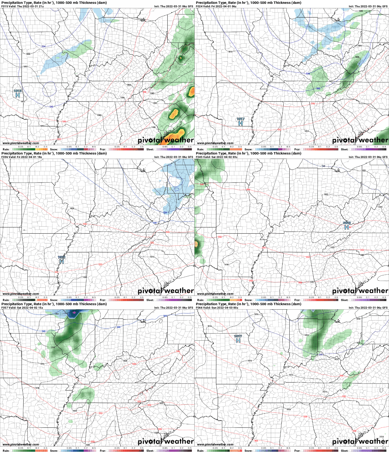
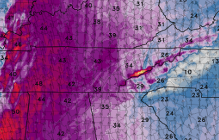
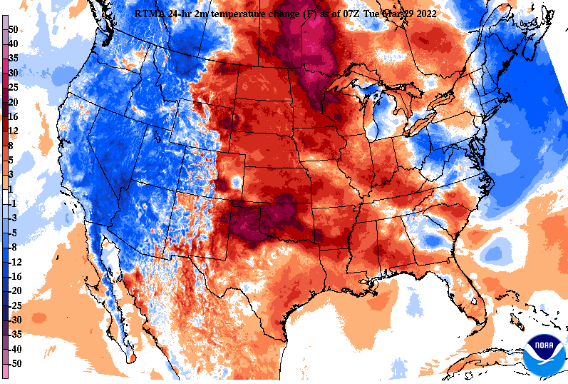
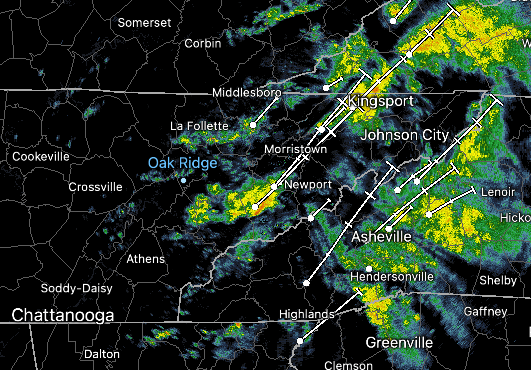
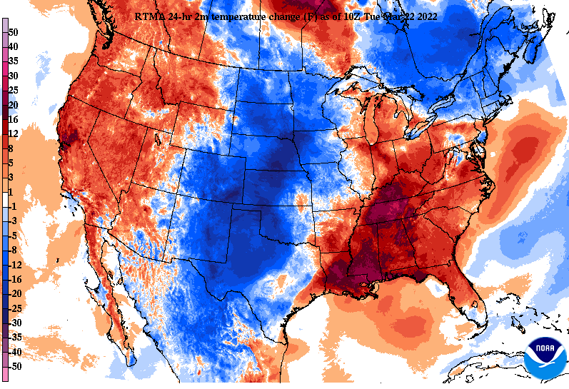
Due to gusty winds and a line of showers and storms, tens of thousands of power outages are being reported this morning. East Tennessee has the bulk of these from the gusty winds, and crews are out now rapidly trying to restore power. This map is as of 6 am this morning. Looking at nation-wide temperatures changes, much cooler air is across the Central and Southern Plains. This will filter in across our neck of the woods today and especially Friday. Highs to end the work week tomorrow will range from the mid to upper 50s under mostly sunny skies. Over the next several days, the most significant rainfall expected will come Tuesday and towards midweek. A passing and weak disturbance will graze the area Saturday, providing isolated showers to sprinkles, otherwise cloudy skies will be the main result. Friday, Sunday, and into next week will primarily be sunny to partly sunny with warming temperatures from Friday and onward. We will highlight some of the strong winds gusts reported from last nights event tomorrow, with the mountains reporting gusts well over 70 mph. For now, cooler air finds us today and tomorrow before temperatures warm each day thereafter. Have a good one! Pre-recorded for 5pm show
0 Comments
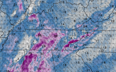
A warm front pushing north will both increase temperatures today as well as winds. Gusts through this afternoon could be as high as 40 mph +, so be sure to secure any loose objects and use caution if driving high profile vehicles. Because of the gusty winds, a wind advisory is in place for the area through early tomorrow morning. Additionally, conditions will be very dry today - leading to an enhanced risk for wildfires. As such, the NWS has issued a Red Flag Warning due to the low relative humidity and gusty winds. Please avoid burning if possible and reserve doing so another day. Getting into tonight, a line of showers and storms will build in from the west, some of which could be strong to severe. Highlighting the winds today, this is a clip of Hi-Res model guidance depicting gusts between 35-45 mph this afternoon. If you are in the Smokies these will be much stronger with gusts up to 60 mph+ possible. As far as the showers and storms tonight, the timing comes mainly between 8 pm and 2 am from west to east. Depending on how quick this boundary shifts east throughout the day today will dictate exact details, but this is the general time range you can expect. Within this line, strong to damaging winds gusts as well as isolated tornadoes will be possible. With the overnight timing, use extreme caution as many will be asleep. Have a way to receive watches or warnings if they are issued and know your secure place and what to do now if these were to go into effect. Drier and cooler air then filters in for Friday, with isolated shower chances Saturday before sunshine again Sunday. That will do it for now. Have a way to receive alerts tonight as we'll be following along with this line of convection through West Tennessee and eastward. Give us a follow on Twitter and Facebook @SecretCityWX
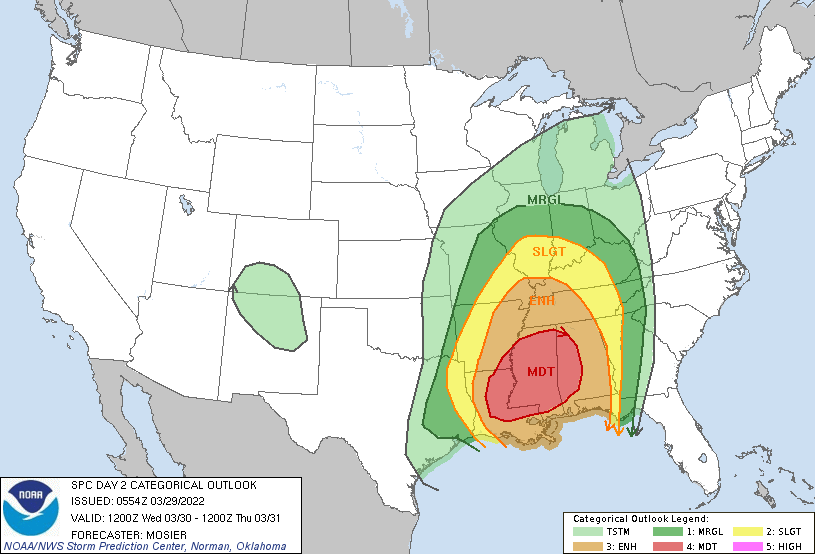
Temperatures will continue to warm today as cloud cover sticks around through the afternoon. Winds will be light as well, blowing out of the northeast/east less than 10 mph. Moving forward, winds will pick up, with gusts tomorrow as high as 40 mph. Highs today to be in the low to mid 60s with highs tomorrow in the mid to upper 70s. As guidance comes into better agreement on how the environment will handle this next system, a high confidence in severe weather is expected across the Lower Mississippi Valley. A Moderate (4/5) risk is in place tomorrow, with a slight to marginal risk across East Tennessee. Given the strong low level winds pumping in moisture, high temps, and lots of shear, we will see the threat of strong to severe storms tomorrow night and into early Thursday. The biggest threat will be well to our south and west but we can't ruled out a few storms across the area. With that said, the biggest threat will be damaging winds, but an isolated tornado within the line of convection can't be ruled out. Looking at a run-through, guidance depicts a line of showers and storms working eastward the later half of the day tomorrow. This will be aligned along a cold front, where warm moist air sits on one side and cold drier air on the other. Even with lower energy (instability) associated with the system, winds will be high allowing for instances of straight line winds, isolated spin-up, and purely gusty conditions altogether. Secure any loose outdoor items you may be, have a way to receive alerts if watches/warnings are issued, and know what to do if a warning is over your area. The threat for severe weather is low, with the primary threat locations the Southern Valley and the Plateau. Continue to tune back in for updates regarding this system. For those living (or who you may know) west of us, let them know of the higher confidence in severe weather. For now, enjoy the warming temperatures and be sure to check back in with us tomorrow. Showers and storms shouldn't arrive until the late afternoon/evening tomorrow, with strong to severe thunderstorm potential overnight and into early Thursday morning.
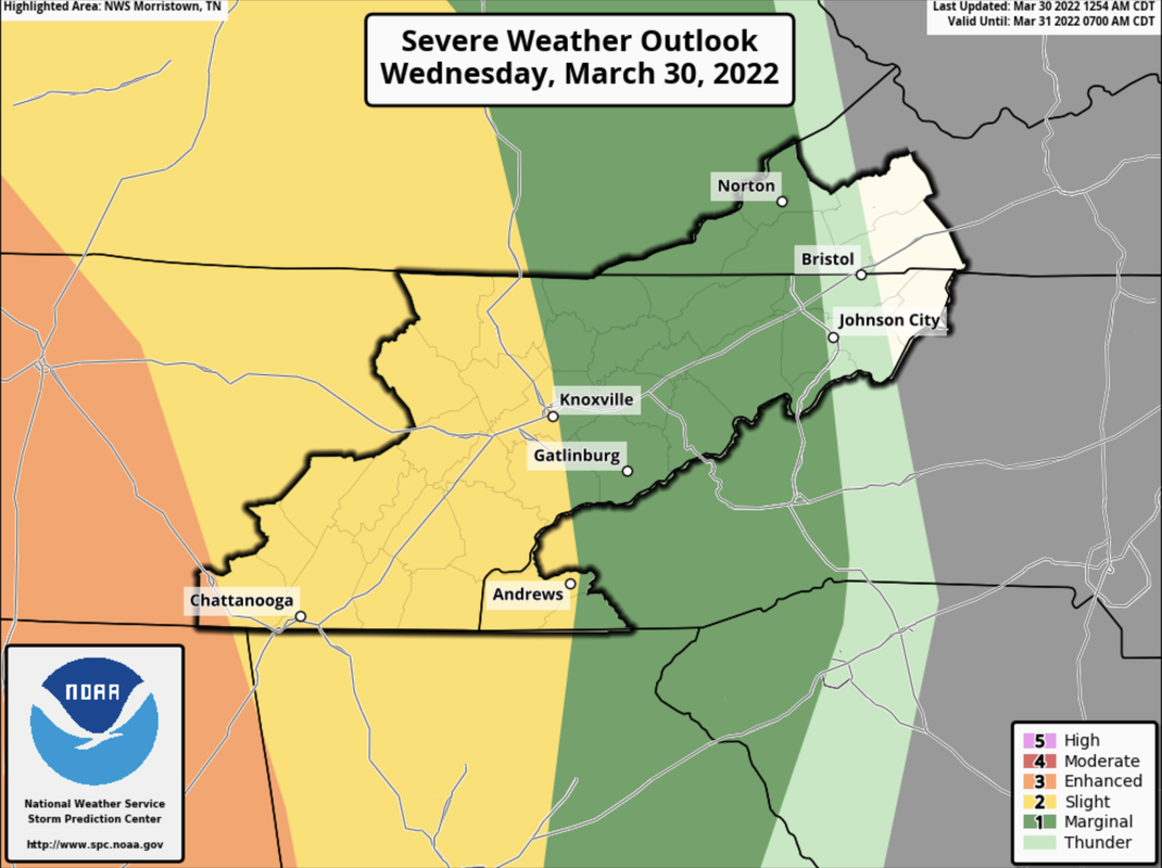
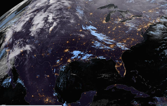
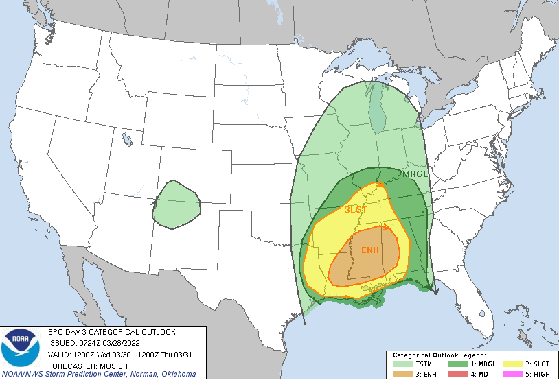
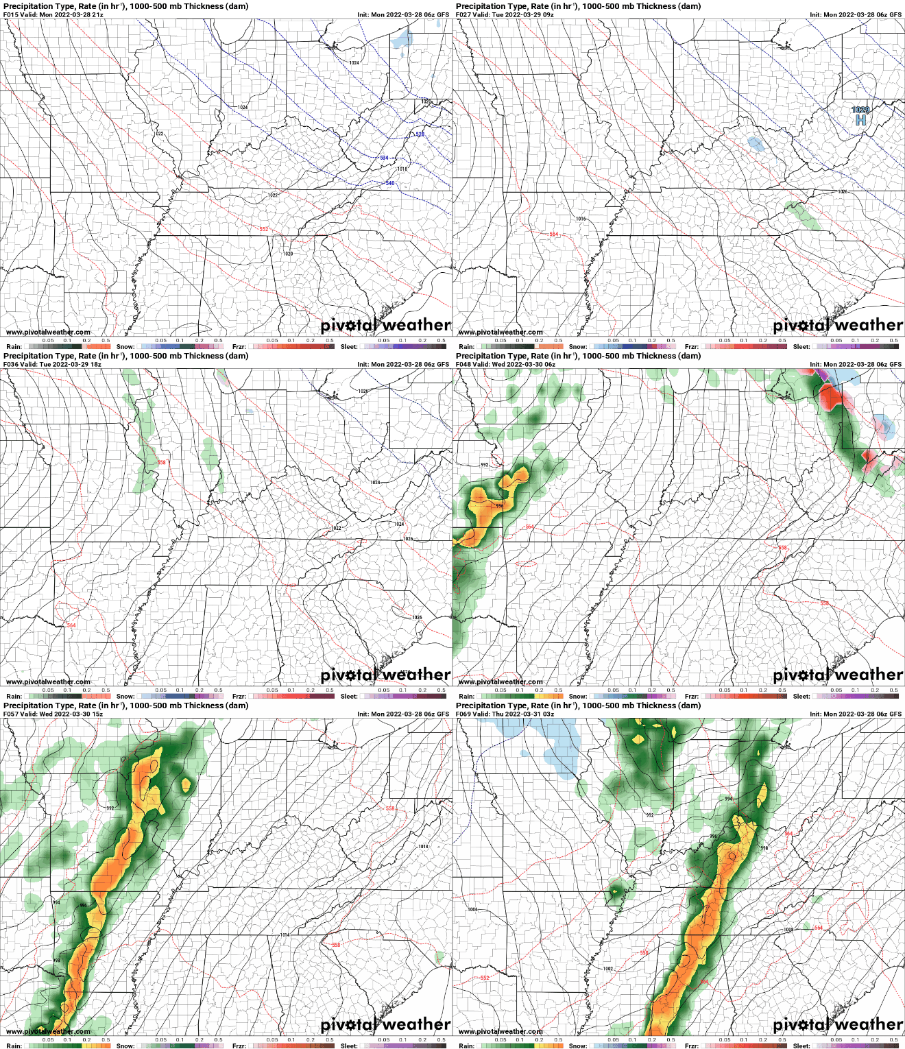
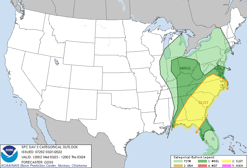
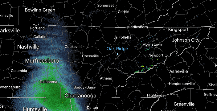
We will kick off the new work week with sunny skies and a few high clouds. Looking at the latest scan across the US, high coverage is present across the area, with increasing cloud cover expected overnight tonight. As far as temperatures, we remain cool and below average with highs to be in the mid to upper 50s. Working forward, a potent low pressure system will develop along the lee side of the Rockies, bringing warm temperatures followed by a line of showers/storms and cooler air thereafter. Breaking this down a bit further, the SPC has issued a day 3 Marginal for East Tennessee. The line, fortunately, comes during the overnight Wednesday and into Thursday. This means a lot of the instability (energy) associated will be cut into, limiting severe potential. With that said, there is still plenty of time in the forecast for things to change. The biggest threat will be damaging wind gusts and straight line winds. You can find the day 3 outlook below. Looking at guidance, a line of showers and embedded thunderstorms will work east late Wednesday and into Thursday, providing heavy rainfall and gusty winds. Given the weakening of this system, we pan out better but we will continue to eye the severity potential with this. By Friday, sunshine and cooler temperatures will be present with highs in the low to mid 60s. This comes after highs Wednesday and Thursday are in the 70s. That will do it for today, we start off the work week pleasant before cloud cover arrives Tuesday and onward. The good news is temperatures will progressively warm through the next couple of days, with highs by Wednesday in the upper 70s (and some low 80s). Pre-recorded for 5pm show
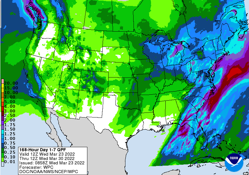
Showers will continue to work north and east this morning, allowing for drier air to fill in this afternoon. Cloud cover will still hang around but a few pockets of sunshine can be expected. Highs will remain warm as well, topping out in the mid 70s. Winds will be very breezy out of the southwest, blowing between 10 and 15 mph with gusts (in the valley) up to 30 mph. Atop ridges, gusts up to 40-50 mph can't be ruled out. Something we haven't touched on much is the drought map for the state. Fortunately, with the rounds of rainfall we have seen each week, it has kept things in check. I anticipate this trend to continue, with little changes over the next couple of weeks. As far as rainfall ahead, spotty isolated showers will be possible late Thursday/early Friday, though most will stay on the drier side, with dry conditions through the weekend. Looking over the next 7 days, upwards of a quarter of an inch will be possible. Temperatures will dip back into the 50s Friday and through the weekend, before warming back up next week. Overall, following today conditions will improve. Isolated showers to sprinkles will be possible tomorrow and Friday, otherwise drier and sunnier conditions find us for the weekend and into next week. Pre-recorded for 5pm show
A warm day is in the making as winds blow out of the southeast today. This will increase afternoon highs into the low and mid 70s. Warmer air pushes in again tomorrow as well, with most returning to the mid and (for some) upper 70s. Check out the change in temperatures already for the day, with a change of 15 to 20 degrees from this time yesterday morning. The warm temperatures can be thanked in large part to the warm front working through as a strong surge of winds blows in from the south. This will not only increase moisture and temperatures across the area but also provide breezy conditions this afternoon and especially into Wednesday. Looking below, areas could see gusts between 15 and 25 mph with ridges seeing the highest impacts with gusts up to 40 mph. These will be a bit stronger Wednesday, with some reports of 50+ mph not impossible. For reference, I am referring to non-convective winds (or wind gusts not associated with thunderstorms). The timing of showers and isolated storms will be come mainly after midnight. These will push east, working out by late morning to early afternoon. Following, drier air will briefly fill in before the chance for isolated showers come in the days ahead as well as cooler temperatures. Highs in the 50s (which is our lows tonight) will come by Friday. Showers and a few isolated thunderstorms will work in overnight and into Wednesday. The SPC does highlight a marginal risk for severe storms, but I still think the chances are low. With that said, the best chance for stronger storms will come during the morning to very early afternoon hours, with damaging wind gusts the primary threat. Outside of rain/storm chances, things will be breezy so be sure to secure any outdoor items and use caution if you are traveling in large profile vehicles. Pre-recorded for 5pm show
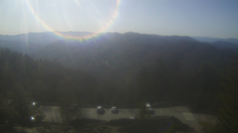
A beautiful start to the work week is in the works with sunny skies and highs expected to top out in the upper 60s and low 70s. Check out the view over Gatlinburg....it would be a gorgeous day for a hike or to enjoy the outdoors! Moving forward, a potent low pressure system is developing over the Central Plains and will look to provide our next round of rainfall. As far as severe potential, the chances are very low. The SPC has highlighted a marginal risk for Wednesday, but I think this was fortuitous as the environment won't be too favorable. With that said, the help of daytime heating Wednesday afternoon could spawn a few stronger storms as the system departs. Otherwise, anticipate the bulk of showers overnight Tuesday and into Wednesday, with activity decreasing through the afternoon. Hit or miss isolated showers will then follow for the second half of the work week. Breaking down our next system, strong storms are anticipated across the Deep South and Gulf States. Fortunately, we will dodge this, with mainly rain expected. Timing will come late overnight Tuesday and into the day Wednesday. Again, daytime heating could build enough energy for a few thunderstorms to develop, but these should be fairly isolated. Another highlight will be the winds. Southerly flow will allow for winds between 10 and 15 mph with gusts up to 30 mph during the day. The high terrain will feel this the worst, with gusts up to 50 mph not impossible. A better shot at dry air finds us the first half of the Thursday, before isolated spotty showers return at times late Thursday and Friday. Cooler air will also make a return, with 50s expected on Friday. That will do it for today, have a good one and enjoy these - now- Spring conditions! Pre-recorded for 5pm show
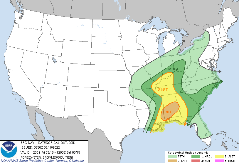
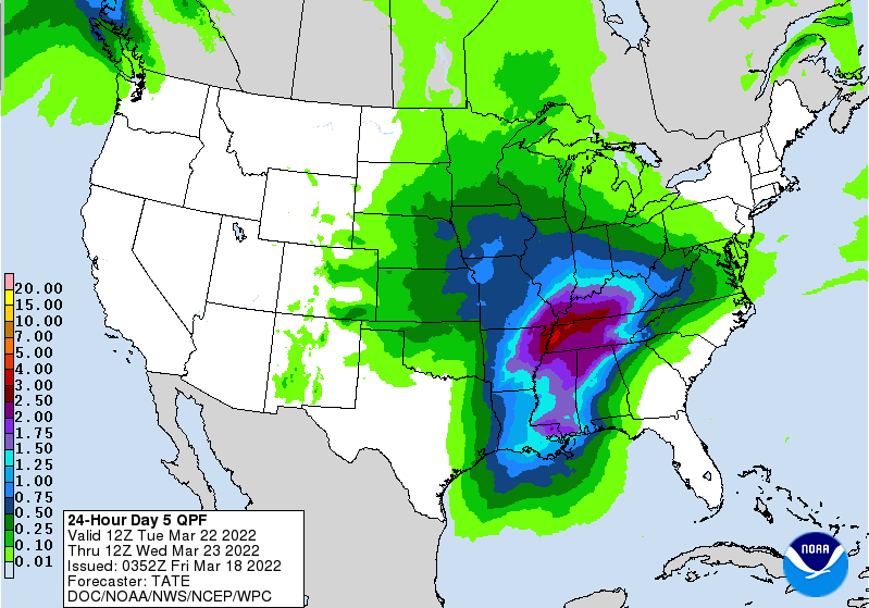
Good morning! Cloud cover increased overnight as showers begin to build in from the southwest. These will be a bit more widespread by this afternoon/evening, so don't forget those umbrellas! As far as temperatures today, it'll be a fairly seasonable one with highs topping out in the low (and a few spots) mid 60s. With a pretty stout low just to our west, the Storm Prediction Center does highlight the potential for severe weather today. The best opportunities will be well to our south, but West, Middle, and East Tennessee could see a shot as well. The primary focus will be westward, but a few storms could hold on long enough to make it into our neck of the woods. With that said, all severe weather is on the table for late this afternoon to early evening. The biggest threat will be damaging winds, but large hail, and isolated spin up can't be ruled out. The environment and dynamics overall are not very favorable for this development, but it is worth mentioning given the Marginal Risk in place. By late tonight, drier air will be slowly working back in, allowing for sunshine to return by Sunday. Warmer temperatures will also accompany, with highs Monday in the low to mid 70s. Our next system then takes aim towards mid week, bringing the opportunity for heavy rainfall and isolated thunderstorms. We will keep an eye on the development and trends of this ahead, as flash flooding/flooding could be an issue with this one. For now, have a way to receive watches and warnings if they are issued this afternoon. Again the threat is very low, but not ruled out entirely. Cloud cover will slowly decrease Saturday, with sunshine and warming temperatures expected Sunday and into the new work week. Pre-recorded for 5pm show
|
Your trusted source for everything weather in East Tennessee.
Social Media
|

