|
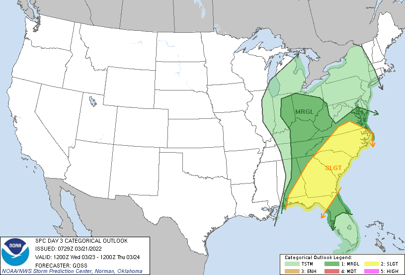
A beautiful start to the work week is in the works with sunny skies and highs expected to top out in the upper 60s and low 70s. Check out the view over Gatlinburg....it would be a gorgeous day for a hike or to enjoy the outdoors! Moving forward, a potent low pressure system is developing over the Central Plains and will look to provide our next round of rainfall. As far as severe potential, the chances are very low. The SPC has highlighted a marginal risk for Wednesday, but I think this was fortuitous as the environment won't be too favorable. With that said, the help of daytime heating Wednesday afternoon could spawn a few stronger storms as the system departs. Otherwise, anticipate the bulk of showers overnight Tuesday and into Wednesday, with activity decreasing through the afternoon. Hit or miss isolated showers will then follow for the second half of the work week. Breaking down our next system, strong storms are anticipated across the Deep South and Gulf States. Fortunately, we will dodge this, with mainly rain expected. Timing will come late overnight Tuesday and into the day Wednesday. Again, daytime heating could build enough energy for a few thunderstorms to develop, but these should be fairly isolated. Another highlight will be the winds. Southerly flow will allow for winds between 10 and 15 mph with gusts up to 30 mph during the day. The high terrain will feel this the worst, with gusts up to 50 mph not impossible. A better shot at dry air finds us the first half of the Thursday, before isolated spotty showers return at times late Thursday and Friday. Cooler air will also make a return, with 50s expected on Friday. That will do it for today, have a good one and enjoy these - now- Spring conditions! Pre-recorded for 5pm show
0 Comments
Leave a Reply. |
Your trusted source for everything weather in East Tennessee.
Social Media
|


