|
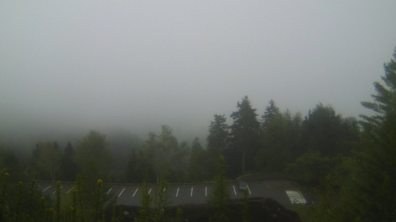
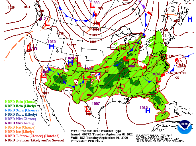
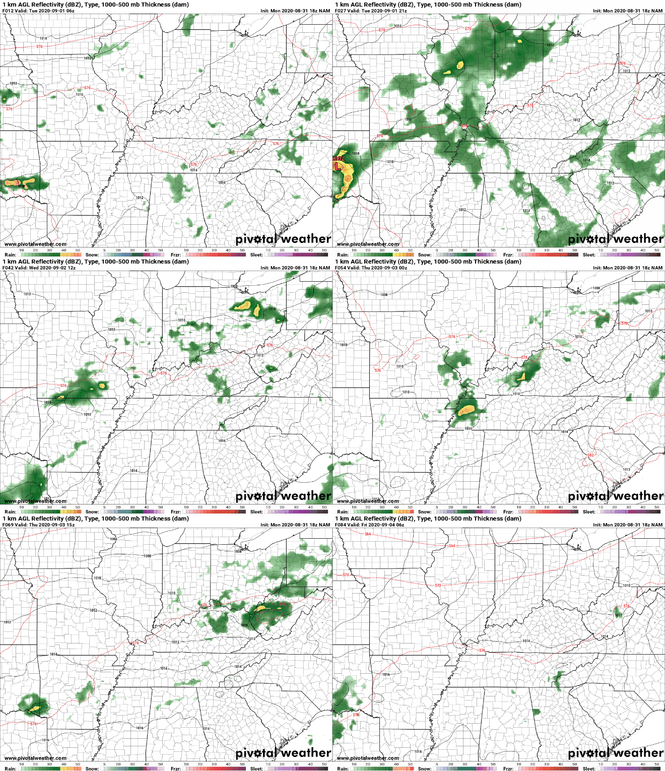
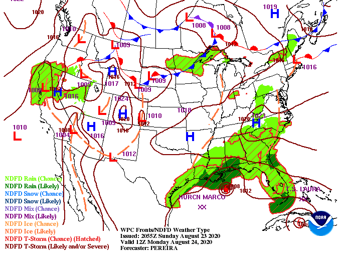
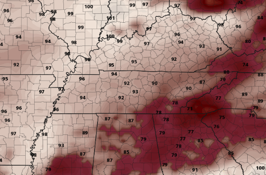
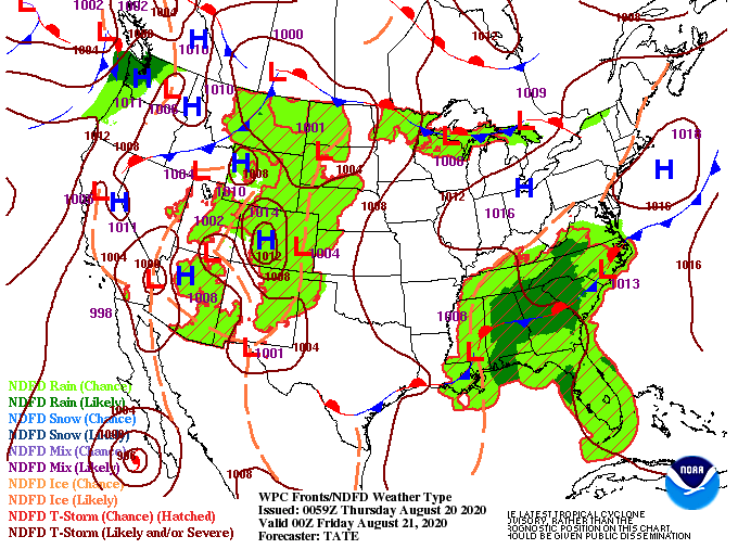
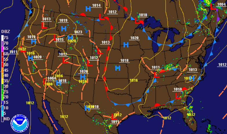
Patchy fog is hanging around this morning, especially for those in the higher elevations. This view, or lack of, comes from the Newfound Gap camera. For the remainder of us, cloudy skies are overhead. As we work through the day, clearing will take place allowing for sunnier skies by this afternoon with high's near 90 degrees. The current surface map shows us wedged between rounds of weak short waves through the region. As we saw yesterday and will continue to see through the week, rounds of afternoon showers are possible. More so tomorrow and Thursday, scattered afternoon showers and storms will develop in the early afternoon before dissipating overnight. To the north (top of the image) you can make out a cold front across southern Canada. This will be our "taste of Fall" as we work toward the weekend and early next week. With the added cloud cover to start the morning, that will help dampen shower activity this afternoon. For Wednesday, model guidance suggests pop up showers and storms in the afternoon before moving out overnight. This will likely remain the case through Friday before a cold front from Canada slides through. If you can make it through the heat, humidity, and occasional shower this week, a pleasant, dry, and cool weekend is ahead. Be sure to stay cool through the remainder of the work week. Afternoon feel-like temperatures today will be near the mid 90's with the lower 100's not out of question for Wednesday and Thursday. For more details and a look into temperatures this weekend, view today's forecast below.
0 Comments
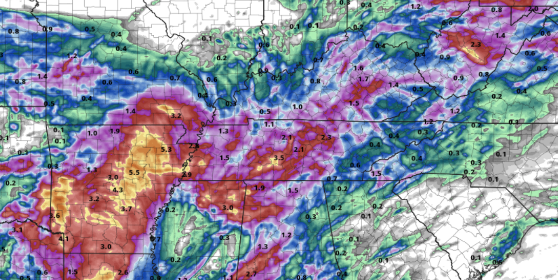
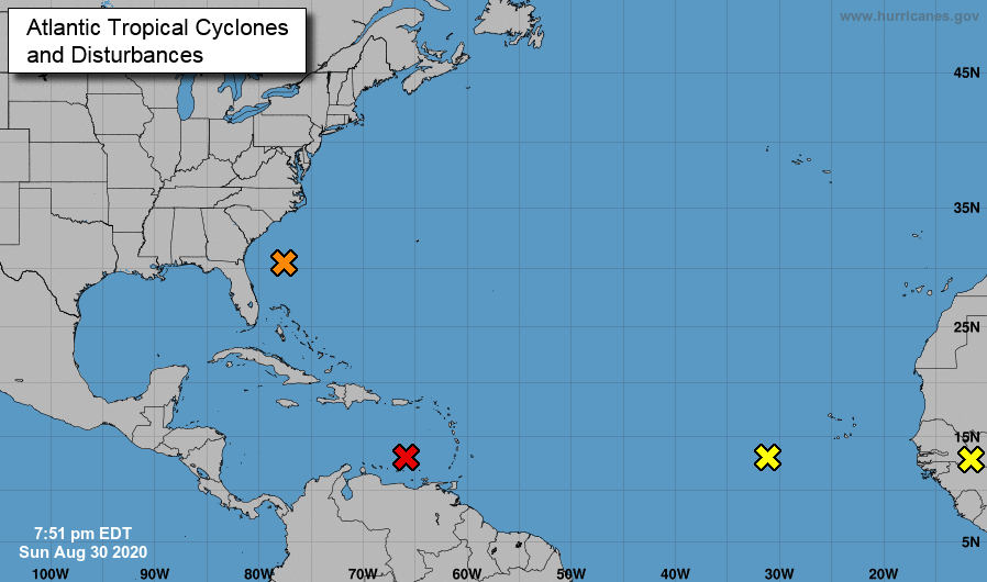
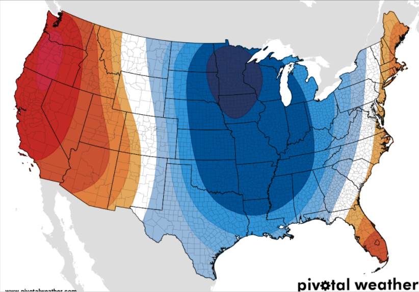
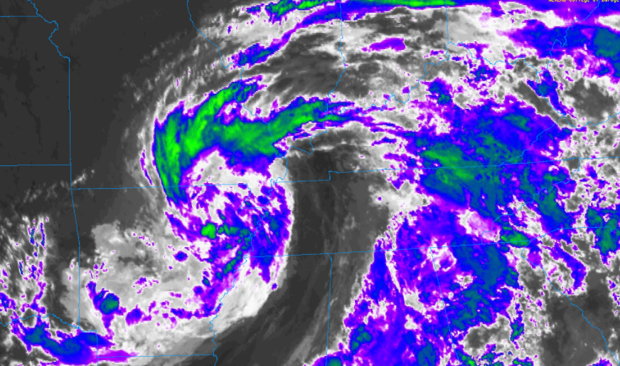
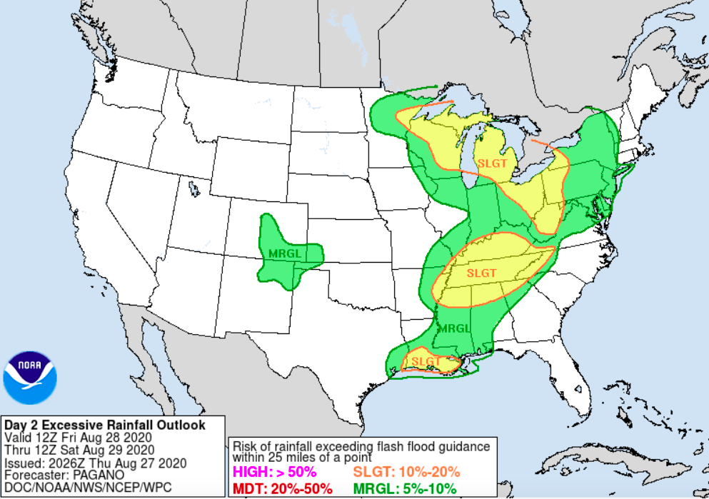
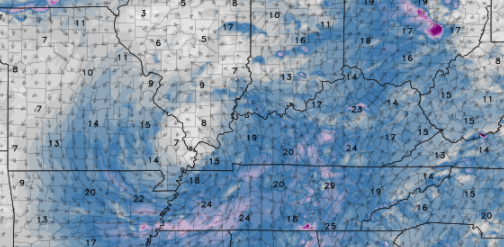
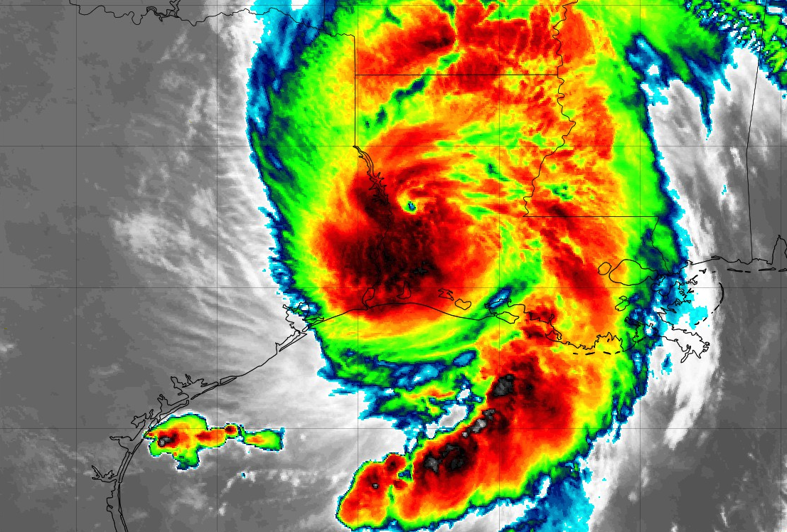
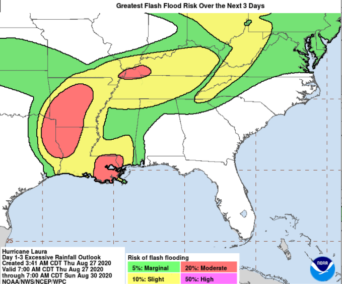
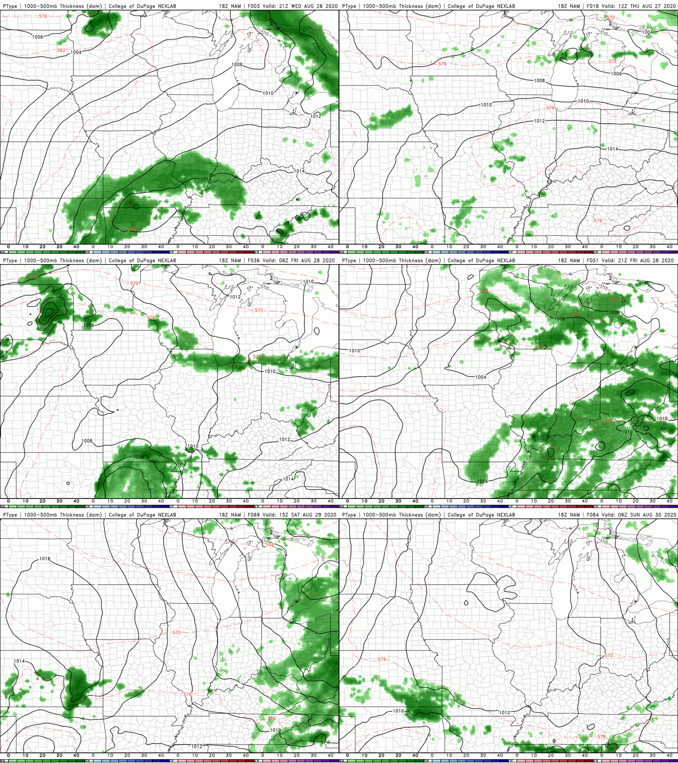
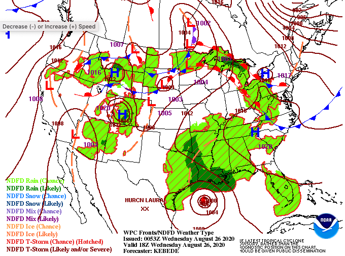
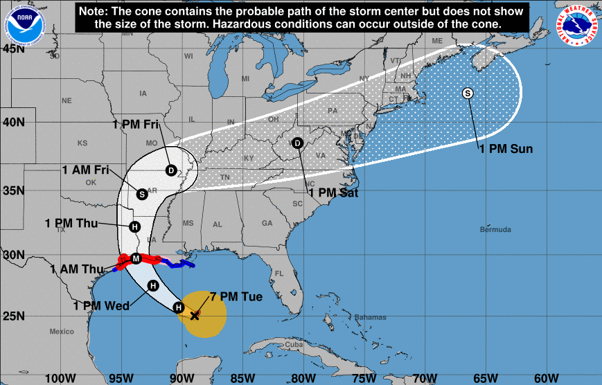
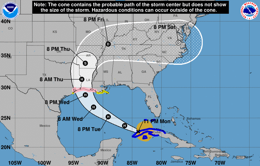
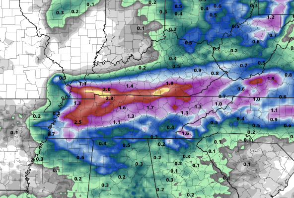
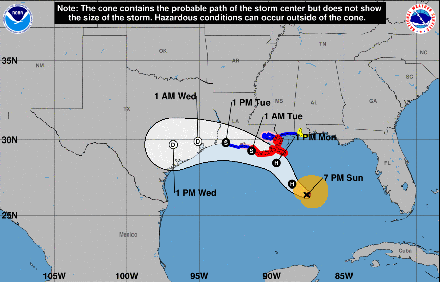
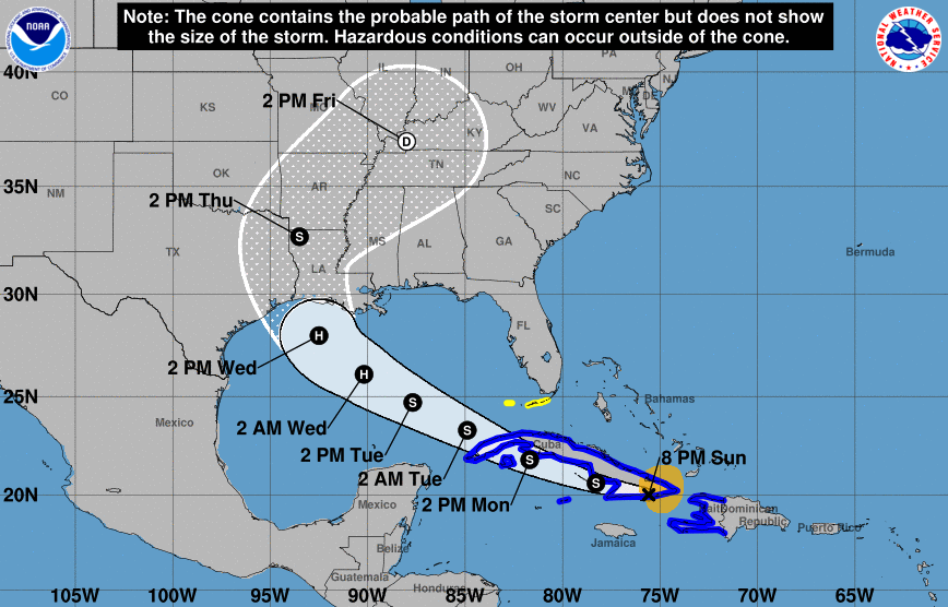
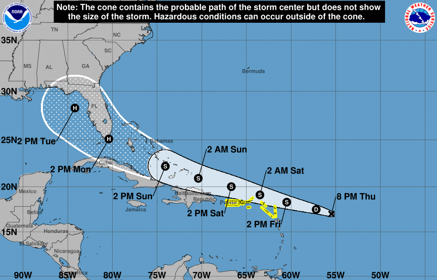
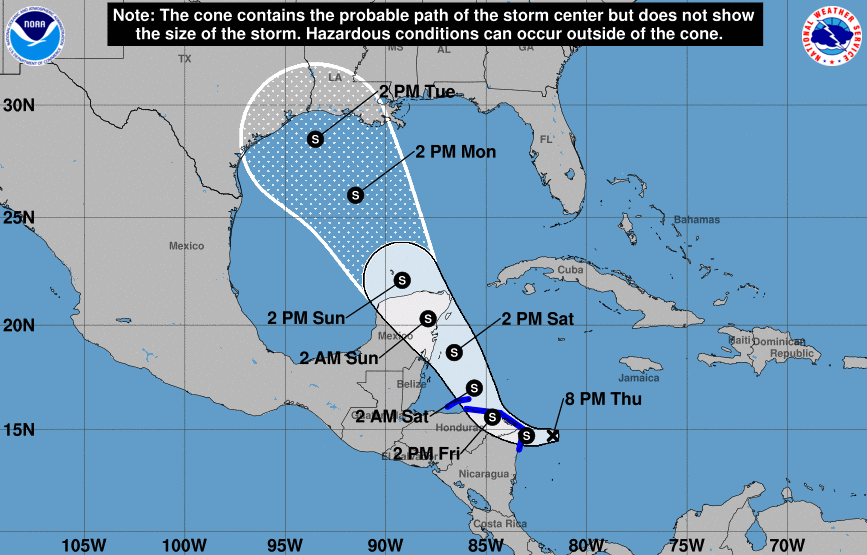
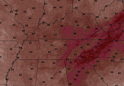
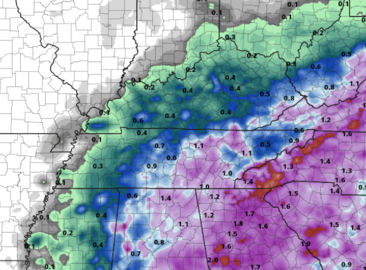
We start this morning with mostly cloudy skies and temperatures currently in the low 70's. A look back from this weekend shows rainfall rates in the Plateau were right on cue. As for the valley, shower activity weakened and the bulk of rainfall stayed north and west. Overall totals varied between 0.4 and just over an inch. For a reference, we recorded 0.88" here at the office. With Laura out of the way, more activity presents itself in the Atlantic. Activity is typically very high this time of the year and the Tropics make proof of that. Two systems in the Caribbean will likely organize in the next 24 to 48 hours, so all eyes will be on these systems. The one just off the coast of Jacksonville, specifically, is expected to work northeast; not making landfall in the US. Two more waves off the coast of Africa will be closely monitored for any impacts down the line as well. So far, the bulk of shower activity fell early this morning while most were asleep. Things now are mostly cloudy but scattered shower activity is expected to return this afternoon. For the days ahead, a bit more sunshine will return Tuesday but isolated to scattered showers are expected to continue each afternoon. By the end of the work week, we will be wedged between two high pressure systems, leaving things mostly dry. Though temperatures and precipitation lately have been above average, good news looks to be ahead. As we enter the month of September, a taste of fall could be around the corner. Next week and into middle September look to have below average temperatures across much of the southeast. Trends show high's topping out in the 70's and lower 80. If you can get through the warmth and mugginess this week, better news (temperature-wise) looks to be ahead. That will do it for today. Thank you for joining us as your weather provider and if there is anything Secret City Weather can do to help you, let us know! A range of the services we provide can be viewed under the "Services" tab above. This is what now remains of Laura as she works east this morning. A few light showers have popped up on radar and will continue to work in from our south and west. The bulk of activity will arrive later today providing heavy rains, gusty winds, and a few rounds of lightning. The regions greatest threat remains flash flooding. With several inches likely to fall in a 24-hour period, water levels can rise quickly. The excessive rainfall outlook shows a slight risk (10% - 20%) chance of flash flooding potential across Tennessee and Kentucky. Take the proper precautions now if you are in low-lying and flood prone areas. In addition to the heavy rainfall we will see at times this afternoon and overnight, wind gusts will pick up throughout the day. Anticipate a steady south wind between 10-15 mph and gusts up to 25. For those in the Plateau, wind gusts will be closer to the 30-35 mph range. If you have any lose objects in the yard, be sure to pin those down or bring them inside. The latest run from high-res guidance shows heavier showers and storms arriving around the evening commute. Heavy rain rates will impact visuals, so use extreme caution. Another round of heavy rain, as Laura works across the area, will come overnight while most are in bed. Saturday will contain showers early with lessening chances through the day. Sunshine and drier air find its way back for Sunday with high's in the mid 80's. Unfortunately, showers work their way back for Monday and early next week. Make sure you have a way to receive alerts the later half of the day and into Saturday. Flash flooding remains a concern for the entire region and we'll have that information as it comes in. If you would like to send reports, that would be much appreciated. Simply email us at [email protected] and share with us on social media. Stay safe, stay dry, and check in for updates today and tomorrow. Wow, we have to unfortunately start the morning with Laura making landfall near Cameron, Louisiana as a category 4 (nearly 5) hurricane. Sustained winds were recorded to be 150 mph at the time of landfall (near 1am), this just being 7 miles per hour off of a category 5 hurricane. As this tropical system works north and eventually east, heavy rains will follow in its path. Since last night, the WPC has upped the flash flooding potential Friday into Saturday to a Slight risk. As we have been warning through the week, high rainfall activity will likely lead to isolated flash flooding across the viewing area. Similarly, the NWS in Morristown has upped the expected rainfall totals to more closely match ours. As tomorrow's timing becomes more concrete, what can we expect this afternoon? As we saw yesterday, an isolated shower or two will be possible in the afternoon. A bit of added cloud cover should keep things from flaring up this today but Laura will eventually bring scattered showers late overnight. For Friday, Laura will begin bringing showers into the region after noon. These will begin as on and off showers before likely being steady overnight. For high school football fans: pack the rain gear!! A few thunderstorms mixed in are likely, so let us know about delays and we will share that information accordingly. The forecast for Laura remains in tact from Tuesday's afternoon video update. We are still expecting 1 to 2 inches across the viewing area with some spots as high as 3" Confidence still lies with the heaviest rainfall (totals) being in northwestern TN and southwestern KY. Counties in these areas can expect totals a bit closer to the 2-3 inch mark. With the chance for several inches in a 24-hour period, flash flooding is something very much on the table. Have a way to receive reports late Friday through Saturday and take the proper precautions if you are in flood prone areas. Ridging stays put across the area providing partly cloudy skies overhead this afternoon & warm temperatures around 90 degrees. With the cyclonic flow of Laura and the clock-wise flow of the high, expect warm moisture to begin pumping in this afternoon. This will make afternoon high's feel a bit closer to the mid to upper 90's. A little update in regard to Laura shows the path extending a bit further north. That is relatively good news for us as rainfall will likely lessen. Laura is expected to make landfall late tonight to early Thursday morning as a major hurricane (Cat 3 in this case but defined as a cat 3 or higher). She will then begin breaking down without the warm rich Atlantic waters. By late Thursday, an eastern trajectory will begin taking place. Laura will ride ahead of a cold front that will sweep through sometime late Saturday to Sunday. As we have seen the past couple of days, showers will be isolated to scattered. This, again, looks to be the case today. We could see a little more activity for Thursday as moisture continues to pump in and temperatures stay near 90 degrees. By Friday, remnants of Laura will be just to the west and we'll likely see bands of rain by the afternoon. Overnight Friday and into Saturday will be the best opportunity for showers and a few storms. This will also be the window we could see localized flooding taking place. The latest data suggests up to 2 inches for some spots, so plan ahead if you are in flood prone areas. Things will clear back out Sunday with partly cloudy skies, a few isolated showers, and high's comfortable in the low to mid 80's. That will do it for today...if you want more information on Laura, check out our daily video below, our previous update yesterday afternoon, or the National Hurricane Center. Stay cool and hydrated today! A beautiful morning is underway with a mix of cloud cover and sunshine. Current temperatures sit in the lower 70's, but changes come this afternoon. As the day carries on, anticipate high's to top out near 90 degrees with heat indices closer to the mid 90's. Stay cool and hydrated once again today as heat related illnesses can strike quickly. The latest update in the tropics doesn't look to be a pleasant one. As Laura begins to work into very warm Gulf waters, development into a major hurricane looks more promising. For reference, a major hurricane is defined as a category 3 or higher. Just when you thought 2020 couldn't get worse, how about the chance for a major hurricane to slam our Gulf states and then bring tropical depression winds and rainfall to Tennessee? Well, that's a bit more realistic than a fiction story. The latest trends have Laura pushing northward before cutting east. Since yesterday, the path has been pushed a bit more south, bringing heavy rains throughout Tennessee and Kentucky by the weekend. We will keep a close eye as this evolves, but definitely be aware of the possible impacts as we work towards the weekend. Today and the next few days will mainly consist of a few pop up showers/storms and warm and muggy conditions. The main focus, as described above, is Laura. The latest model trends show Laura staying north of east TN. Many changes are likely in the forecast so take these trends with a grain of salt. With that said, this particular model shows rain totals in the 2"-4" range for southern Kentucky and northwestern TN. Here at home, things are closer to the 1"-2" mark. Again, with the unpredictability of tropical systems and a how this will morph in the midlatitudes, we'll continue to provide updates in the days to come. With Laura on the table, check in frequently for updates in the days to come. Even if we get a bit more lucky and Laura works north of the area, we will likely still deal with gusty winds and heavy rainfall. For now, do your best to stay cool and enjoy your Tuesday. Good morning! I hope the beginning of your work week is off to a good start. With the biggest headlines of the week falling into the Gulf, that's where we will start. Two developed tropical systems have their eyes on the Gulf early this week. Marco (left) and Laura (right) are expected to make landfall Tuesday and Wednesday, respectively. Laura has the opportunity to provide tropical moisture here in east TN late this week so we'll keep a close eye on her path and direction. For now, keep friends and family in mind if they are located in these areas to our south. Jumping into our region, ridging is taking place near the area. With the rotation of the high, and of course a tropical system in the Gulf, we'll see some moisture funneled into the area through early this week. The main threat for shower activity will come from diurnal heating (day-time heating), resulting in afternoon pop up showers/storms. Other than a few afternoon showers & storms, the next big threat will be the heat and humidity. As warm and muggy tropical air pushes into the south, we'll see heat indices early this week as high as 98 degrees. If you work outside or plan to be outdoors for long periods of time, keep your heat safety in mind. Cloud cover and rain cooled air can keep temperatures down for a period of time, but the combination of these two will likely not last long. The main trends today and tomorrow look isolated, but start to pick up later in the week as Laura moves north. By the end of the week, Laura will likely be stationed somewhere to our north and west providing heavy rainfall across parts of the region. With nearly a week of time out, many things still remain uncertain. Stay up to date here as we'll have the latest each day! That will wrap it up from us today...Stay tuned for both tropical systems, especially Laura, as we could see some activity by the weekend here in our neck of the woods. As we begin the final day to the work week, we can enjoy some improvement across our state. Drought conditions are nearly gone across east Tennessee and moderate drought conditions across western Tennessee have vanished. I expect this to continue improving with the added rainfall we are anticipating today and tomorrow. In other news, the Tropics are very active right now. Two active Tropical Depressions are swirling around in the Atlantic and expected to impact the US early next week. Tropical Depression 13 (bottom left), will continue working westward, likely gaining hurricane strength by late weekend. A bit further west, Tropical Depression 14 is expected to find Tropical Storm strength within the day and potentially hurricane strength as it enters the warm Gulf waters. Both systems are expected to impact states from Florida to Texas (the entire Gulf) by early next week. For those who have friends/family in these areas, let them know what is to come. Jumping back to home, light showers are working in from the south now and will continue as we get into the afternoon. Scattered storm activity can't be ruled out either. Gusty winds will be the primary threat but isolated areas of flooding are possible as well. As we work overnight tonight, showers will begin to fade out a bit before redeveloping into Saturday. Sunday looks to be the best day of the weekend with cloud cover early and some clearing by the afternoon. Showers remain possible in the PM hours, but things will be more isolated to scattered. By the work week next week, things return to "normalcy" with high's returning near 90, partly cloudy skies, and the chance for a few afternoon showers/storms. With high school football kicking off for most this evening, make sure you have the latest weather forecast. Be sure to tune in this afternoon as we will provide your high school football forecast via social media. This weekend will remain on the cooler side but showers will haunt us the first half. Stay safe, stay dry, and have a great weekend! Good morning! With current temperatures in the upper 60's things have started cool and peaceful so far. As we transition into the day, temperatures are expected to stay cool but scattered rainfall with work in. Check out tomorrow's high's across east Tennessee! With the cold front working through a couple days ago, cloud cover, and rain cooled air, expect to top out 6 to 8 degrees below average. A system to the south and west will have an attached warm sector just to our south. This will allow for shower and storm activity to begin firing off this afternoon. As it works north on Friday, widespread activity is more than likely the second half of the day. Keep in mind severe chances are limited but are not out of the woods. Isolated flash flooding could also be an issue for Friday, so look out if you are in flood prone areas. Scattered showers will develop this afternoon and eventually work out by the overnight hours. A Marginal risk is in place for the lower half of the state so be mindful of strong storms at times today. Moving into Friday, we will more than likely begin the morning with a few light scattered showers before transitioning to more widespread and heavy (at times) activity in the afternoon. Again, a Marginal risk will be in place with the chance for strong to severe storms at times during the second half of the day. Though flooding isn't qualified as a severe parameter, this, damaging winds, small hail, and isolated spin-up can't be entirely ruled out. Stay dry and check in for updates this afternoon. The southern half of TN (Knoxville and south) will likely see the heaviest showers and storms today, with similar activity more widespread Friday. Stay safe! A low across the area will provide the energy and spark needed for a few afternoon showers and thunderstorms. With the latest position just to the south, we are seeing cooler air throughout east TN. That will be shown in the high's today as they are expected to top out a few degrees below average (low to mid 80's). Don't forget the umbrellas this morning as shower activity is possible this afternoon. Showers and a few storms will likely develop early this afternoon and dissipate by the evening hours. As we work ahead, Thursday and Friday will provide the best chance for coverage. As a cutoff low develops to the south and west of us, widespread showers are expected Thursday, with more opportunity Friday. Severe potential remains low, but flood prone areas should remain vigilant. Additional activity will be possible Saturday as the low moves north. By Sunday, drier air will begin working in and average to above average temperatures will return for the week ahead. Model guidance is suggesting anywhere from an inch to an inch and a half in the next few days. The bulk of this precipitation will fall Thursday and Friday. Some areas will likely see higher amounts in heavier cells so be weary of flash flooding potential. Gusty winds, small hail, isolated flooding, and heavy downpours are all possible for Friday. Thank you for joining us today! If you'd like more information about Secret City Weather and what we can do for you, check out our "Services" tab above. Don't forget to also check out our daily broadcast below. |
Your trusted source for everything weather in East Tennessee.
Social Media
|

