|
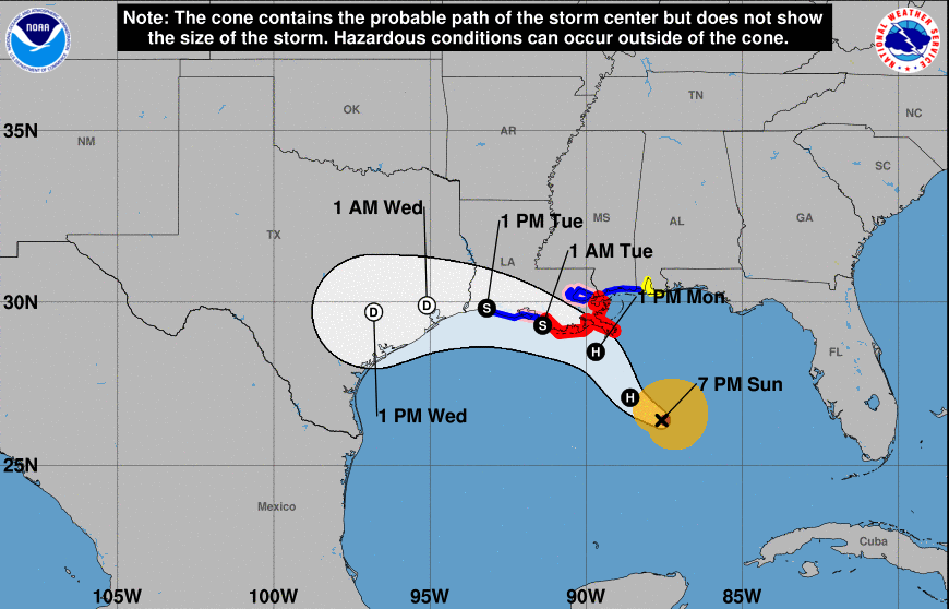
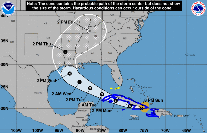
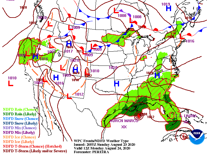
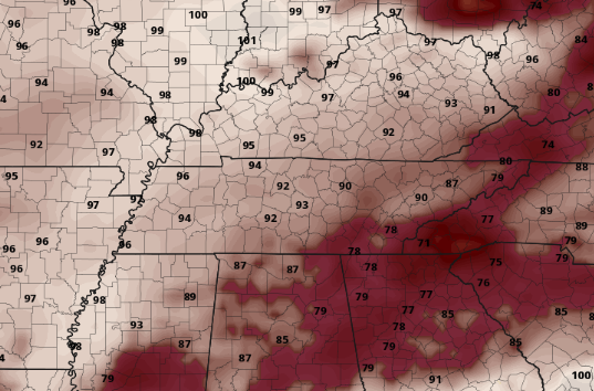
Good morning! I hope the beginning of your work week is off to a good start. With the biggest headlines of the week falling into the Gulf, that's where we will start. Two developed tropical systems have their eyes on the Gulf early this week. Marco (left) and Laura (right) are expected to make landfall Tuesday and Wednesday, respectively. Laura has the opportunity to provide tropical moisture here in east TN late this week so we'll keep a close eye on her path and direction. For now, keep friends and family in mind if they are located in these areas to our south. Jumping into our region, ridging is taking place near the area. With the rotation of the high, and of course a tropical system in the Gulf, we'll see some moisture funneled into the area through early this week. The main threat for shower activity will come from diurnal heating (day-time heating), resulting in afternoon pop up showers/storms. Other than a few afternoon showers & storms, the next big threat will be the heat and humidity. As warm and muggy tropical air pushes into the south, we'll see heat indices early this week as high as 98 degrees. If you work outside or plan to be outdoors for long periods of time, keep your heat safety in mind. Cloud cover and rain cooled air can keep temperatures down for a period of time, but the combination of these two will likely not last long. The main trends today and tomorrow look isolated, but start to pick up later in the week as Laura moves north. By the end of the week, Laura will likely be stationed somewhere to our north and west providing heavy rainfall across parts of the region. With nearly a week of time out, many things still remain uncertain. Stay up to date here as we'll have the latest each day! That will wrap it up from us today...Stay tuned for both tropical systems, especially Laura, as we could see some activity by the weekend here in our neck of the woods.
0 Comments
Leave a Reply. |
Your trusted source for everything weather in East Tennessee.
Social Media
|


