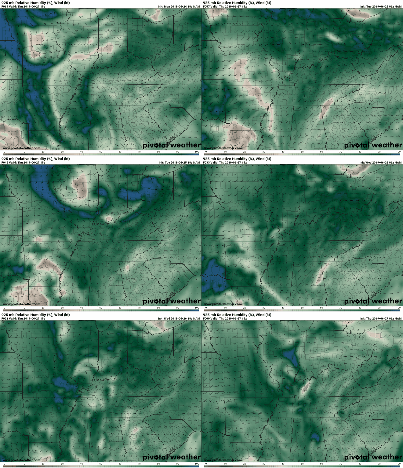
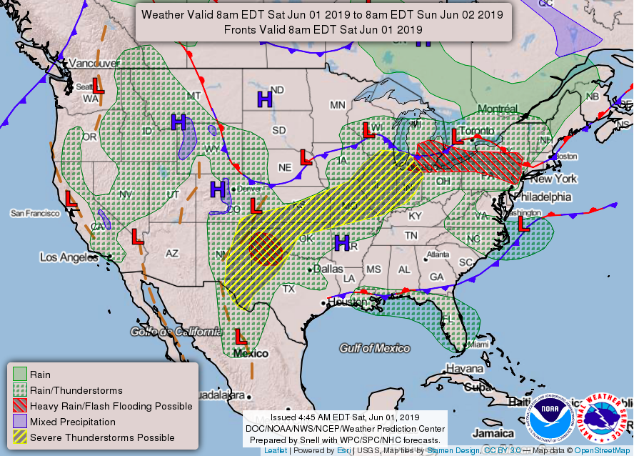
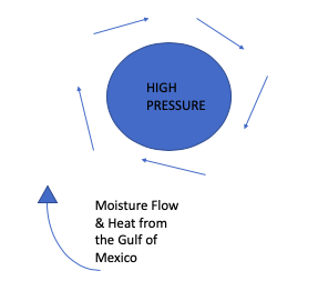
 Good afternoon, I hope everyone is staying cool as it will continue being warm. Taking a look below is the the 500mb height level analysis. Think of mb levels as pressure levels within the atmosphere. Instead of analyzing the atmosphere by height levels (feet, miles, km, etc.) we analyze the atmosphere at specific pressure levels (250mb, 500mb, 700mb, etc.) In this case you can see ridging (or a "hump") look positioned over the northeast. This is due to a high pressure system stationed over the mid southeast. As we work our way into Friday and the weekend, this high pressure system will move more eastward allowing for anticyclonic flow (clock-wise flow). As done in the diagram above, this flow will allow for the advection of moisture to move in. Along with this moisture are shortwaves (pockets of energy), which could trigger some afternoon pop-up thunderstorms. These thunderstorms will mainly be produced due to topographic features and could live long enough to impact areas of east TN. Overall, most of these afternoon pop ups will be held to the plateau and Smoky Mountains. The chance for pop up storms will hang around for the weekend and into early next week. Chances are low for you to see much rain, but the chance is there nevertheless. Stay up to date on where these showers may be by checking out our "radar" tab. As I mentioned, the darker blue show areas are of higher moisture content. Much of the afternoon storm potential resides to our west, but these storms could live long enough to reach areas of east TN. Like I said, chances are low and will be isolated in spots over the next few days, but it is possible. Below shows a modeled run of those pop up showers/storms through Sunday. As you can see, much of the shower potential will be in west TN or in the mountains (to our north in KY) or far eastern TN. Besides the shower potential, brace for that summer time heat. The temperatures will stay in the upper 80's to low 90's for the next several days. Partly sunny skies will also be the main story, so this weekend may be a good lake/pool day. Humidity values could make some days feel pretty sticky, as well. I hope everyone has a good rest of their week and remember to stay cool! Also, you can always share your awesome pictures of the lake, mountains, clouds, sunset/sunrise, etc. anytime. Simply email them to us at: [email protected] or tag us on Facebook or Twitter.
1 Comment
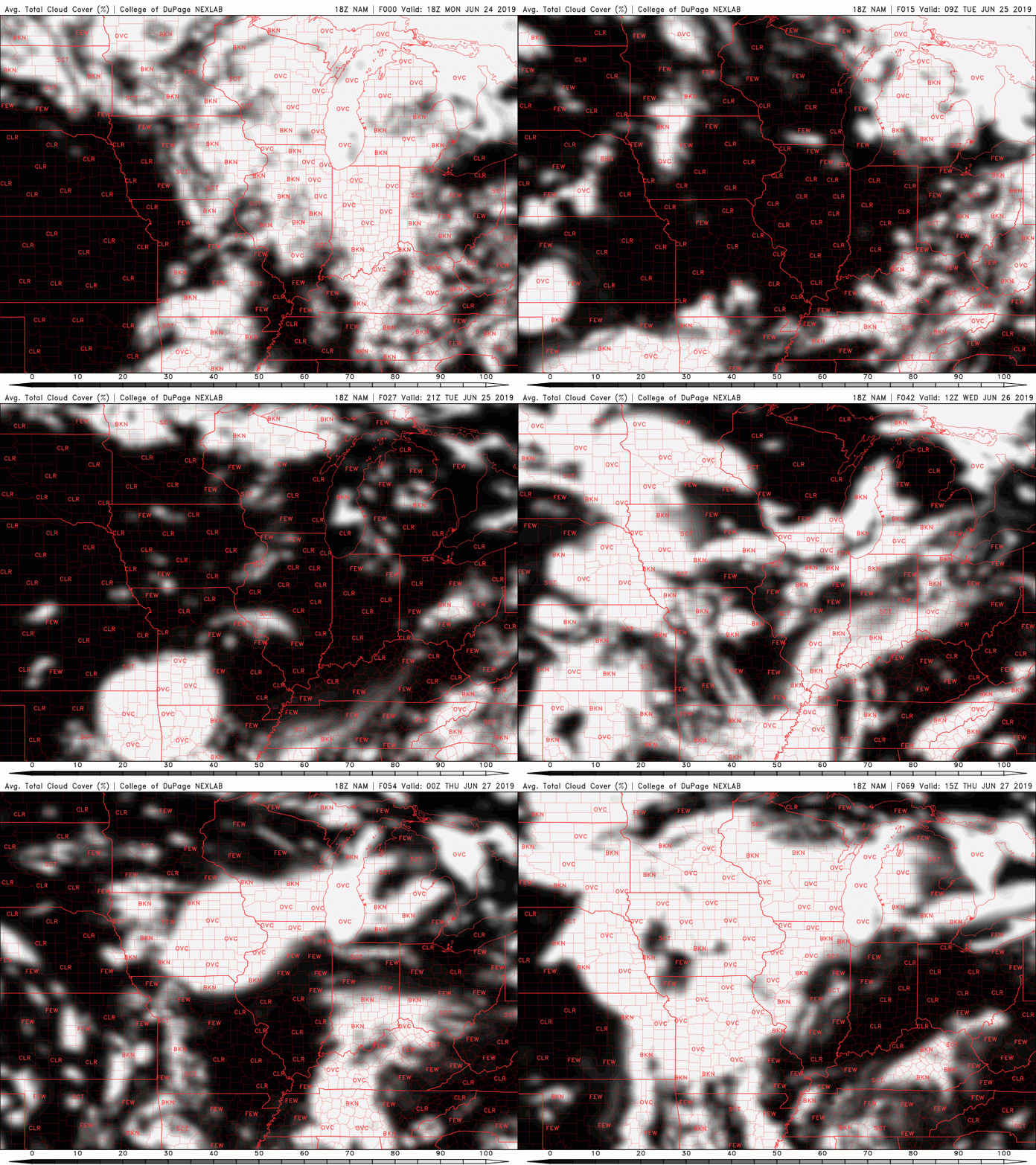
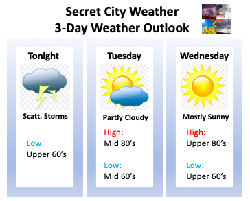
It has been a very active evening thus far with many severe thunderstorm warnings and even a tornado warning. As of now, there has not been a confirmed tornado from the NWS in Morristown. The tornado warning (at the time) was radar indicated. Taking a look below at a modeled reflectivity map, the brunt of the system still resides in the eastern most portion of TN (Newport, Gatlinburg, Pigeon Forge, etc.). Luckily, the storms have decreased in strength and are beginning to move out of the area entirely. Following that line of storms could be some isolated showers/storms but they will be few and far between. As we push into the overnight hours tonight, showers will move out and so will the dense cloud cover. As seen from the latest NAM cloud cover run, Tuesday will be filled with broken cloud cover. We will see rounds of clouds and sunshine throughout the day. Isolated showers may occur in the western portion of TN and into parts of the Plateau, but generally, east TN will remain dry. Wednesday you can expect a bit of an improvement with mostly sunny skies expected. We will begin to generate some southern flow by Wednesday afternoon, helping in increase our temperatures into the upper 80's. We will, though, continue staying precipitation free. As we head into the second half of the week, afternoon pop up showers are in the forecast, but we will remain much quieter than we have the past several days. Go out and enjoy some much needed summertime sunshine and I hope everyone has a good rest of their week! More posts and updates for the website will be made Thursday. Here is your graphical three-day weather outlook. Your full detailed forecast can be found in the "Weekly Forecast" tab at the top of this page.
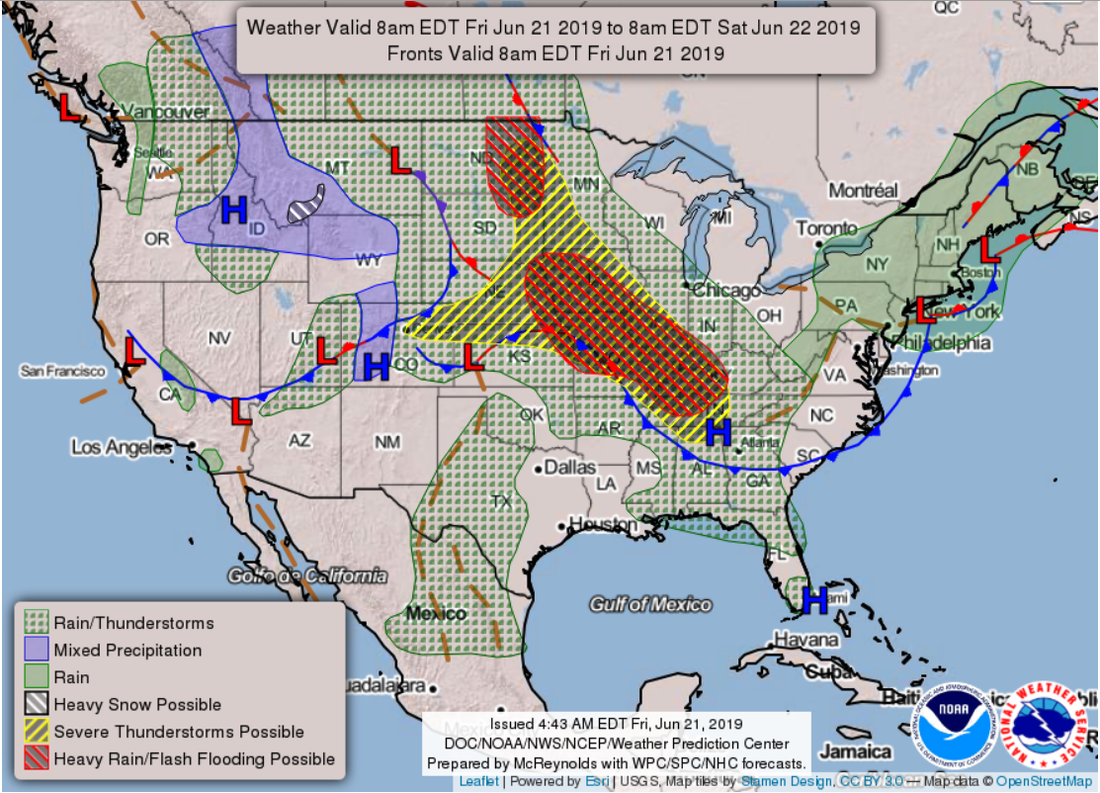
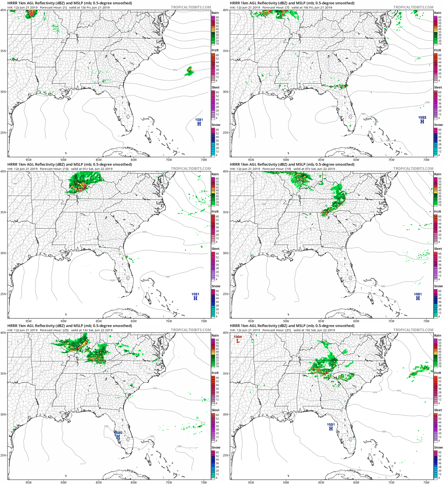
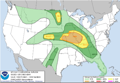
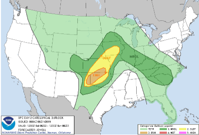
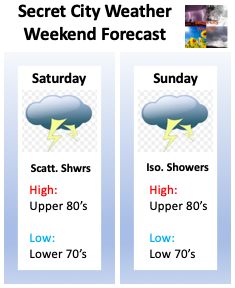
Happy Friday to everyone! It is only fitting to have the sunshine return today, as it is the first day of Summer. Today is known as the Summer Solstice because it is the longest day (most daylight) of the year. Soak up the sun today as these pretty skies won't be hanging around long. Jumping into the pattern across the USA right now, we see a strong low sitting across the Plains. This will allow for the production of severe potential this afternoon in west TN, west KY, IL, and MO. By this evening we could see an isolated shower or thunderstorm roll through, but it is not likely. So what will this low do to us? You called it, bring more showers and storms into the area. Saturday will be our best day for activity as we are likely to have storms move into east TN during the morning hours. This will be followed by mostly cloudy skies until the early afternoon hours where the next round of storms will move in. These will likely become more scattered by the mid afternoon hours and eventually move out by Saturday night. For Sunday, isolated storms are possible across the area, otherwise we will have mostly cloudy skies. Temperatures starting today will begin increasing as southern flow returns. Monday will likely be our warmest day (over the next 5 days) with high's around 90 degrees and humidity that could make conditions feel very sticky. As I mentioned above, the severe potential this afternoon and into tonight will be held to our west. For us, we cannot rule out an isolated storm, but confidence on that is on the lower end of the spectrum. Severe potential remains possible this weekend as storms will arrive in waves throughout Saturday. The primary impacts will be damaging winds, but small hail and downpours are possible at times. Check out your weekend forecast below. As I talked about, it will not be the best weekend for outdoor activities, so kick back and relax indoors. Stay weather aware and continue to check back in with us Via Twitter & Facebook for the latest. If you can hang in there a few more days, Wednesday is the "light at the end of the tunnel" with these storms. I hope everyone has a blessed first day of Summer and stays dry this weekend.
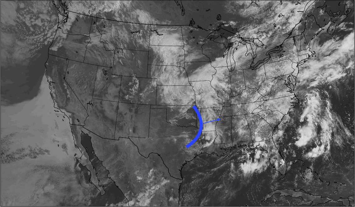
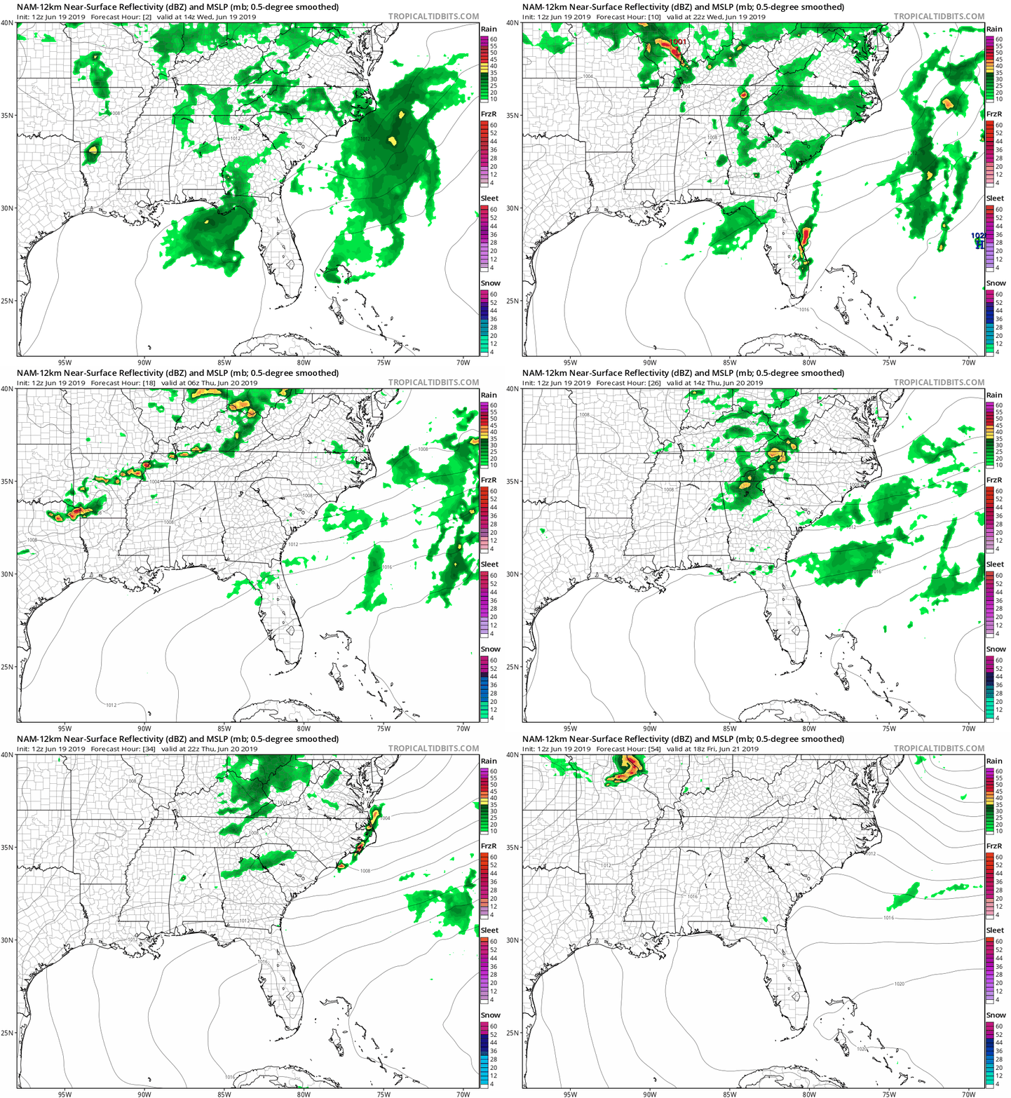
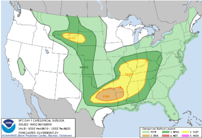
It has been an active pattern as of late due to rounds of energy known in the meteorology world as "shortwaves". These can be thought of as spokes of energy off of a larger long wave trough (associated with a low pressure system). These shortwaves can be caused for a number of reasons ranging from cold air to vorticity (spinning winds). In this case, shortwaves have moved into a warm and moist environment, perfect for thunderstorm production. Looking at satellite below I have annotated where a cold front is associated (blue vertical line). This cold front will force lots of energy into an area (as I described) rich for thunderstorm production. Fortunately for us, this system will be passing through during the overnight hours where day time heating won't play a part. It will be interesting to see the latest 18z HRRR model run and how it takes this system. I will tweet and update you the details from these runs later this evening via Twitter and Facebook. As for now, continue following along below for thoughts on tonight into tomorrow. As I described, a cold front will help in the supply of energy ahead of this system. This, combined with a lower level jet (forcing warmth, moisture, and winds overnight) will help with the possibility of severe storm production. Overall, I believe the environment is conducive to see a few severe thunderstorm warnings, but the track of this system has the largest risk of severe weather to our north in south central Kentucky. Checking out below, you can see what I am referring to, as much of the heavier rains are in the plateau and to the north, in KY. As I mentioned, it'll be interesting to see how the models will handle new data as it comes in. The models are in agree-ance with the track, it is timing that is troubling to pinpoint. Moving forward from tonight into Thursday, we will begin to clear out a bit leaving only isolated storms Thursday night. Friday will likely be your best day for any outdoor activities as another pocket of energy will move through Saturday. As for high's over the next several days, we will be in the low 80's with temperatures increase into the mid to upper 80's by Friday and this weekend. Below is the latest SPC outlook for severe potential across the USA. If you reference the previous map (posted on our social media pages late last night) the SPC did move the slight risk further east as expected. As for how much more they will move it is still in question, but my guess, not much if any. In my opinion this will likely stay mostly the same. For our forecast, severe weather is possible across east TN with likely isolated areas of severe thunderstorm warnings very late "tonight" and into Thursday morning and again in the afternoon. The heaviest portion of this system will arrive between the 7-9 o' clock hour, so use extreme caution for those apart of the morning commute. Impacts could include isolated areas of strong winds, hail up to a quarter in size, thunder, and downpours. Another round of strong to severe storms are also possible in the afternoon hours, but these will be more scattered. Remember to stay up to date with Secret City Weather on our social media sites or through our website here by viewing all of our tweets (on the right side of the home page). Have a good rest of your afternoon and stay "Weather Aware" tomorrow morning.
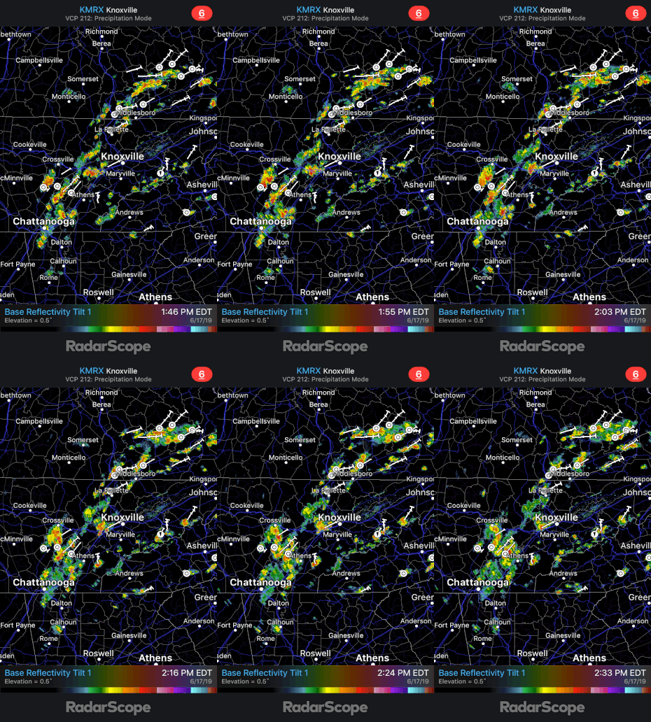
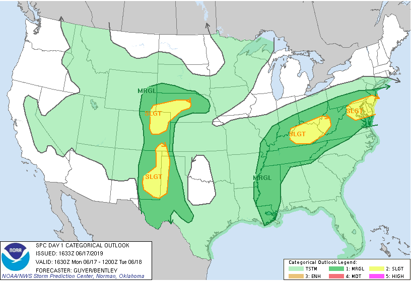
Happy Monday to everyone! I hope all have enjoyed the great weather we had the second half of last week and into this past weekend. Sadly, some changes in the weather pattern are taking place if you have not noticed already. Taking a look below at radar we see scattered storms throughout much of the east Tennessee area. These storms are capable of producing heavy winds, thunder, downpours, and small hail. Further investigating the remainder of today through Wednesday afternoon, we see much of the same story. Due to a southern flow into our area, those temperatures and "sticky" conditions will stick around for today before we cool down slightly Tuesday and Wednesday. The warmth and humidity will act as fuel (we call this convection) and help in the production of these storms we are seeing pop up this afternoon. Please use caution if you do get caught in one of these cells. The severe potential is on the lower confidence level, but I would not be surprised to see a severe thunderstorm warning or two issued sometime this afternoon and evening. I will be the first to let you know if this does occur, where at, and what you can expect. Below is the Storm Prediction Center's severe weather out look for today. We are under a Marginal risk with a slight risk to our friends to the north in Kentucky. Over the next few days (today through Wednesday) we will remain under a Marginal risk. If any changes occur I will let you know, but as of now, severe potential is held to a minimum. As for the remainder of the work week, expect pop up storms and showers, similar to today, to be the main story. As described and shown above, we are under a marginal risk for severe weather today through Wednesday. This means thunderstorms are likely but the potential for tornadoes is very low. As I referred to, temperatures will decrease sightly as we work our way into Tuesday with high's in the low to mid 80's through Thursday. Friday looks to be our best day (work week wise) for any outdoor activities with only isolated pop up storms expected. I will let you know what you can better expect this weekend and early next week in the coming days. Until then, follow us on Twitter (@SecretCityWX) and Facebook (@SecretCityWX) for the latest updates throughout the day. This can be seen on the right-hand-side of our website, as well. Also, don't forget we have a 24/7 radar you can access in the "Radar" tab at the top of the page. If you are ever unsure of where the rain is, check it out so you don't get caught in a shower! I hope everyone has a good week, and try and stay dry out there.
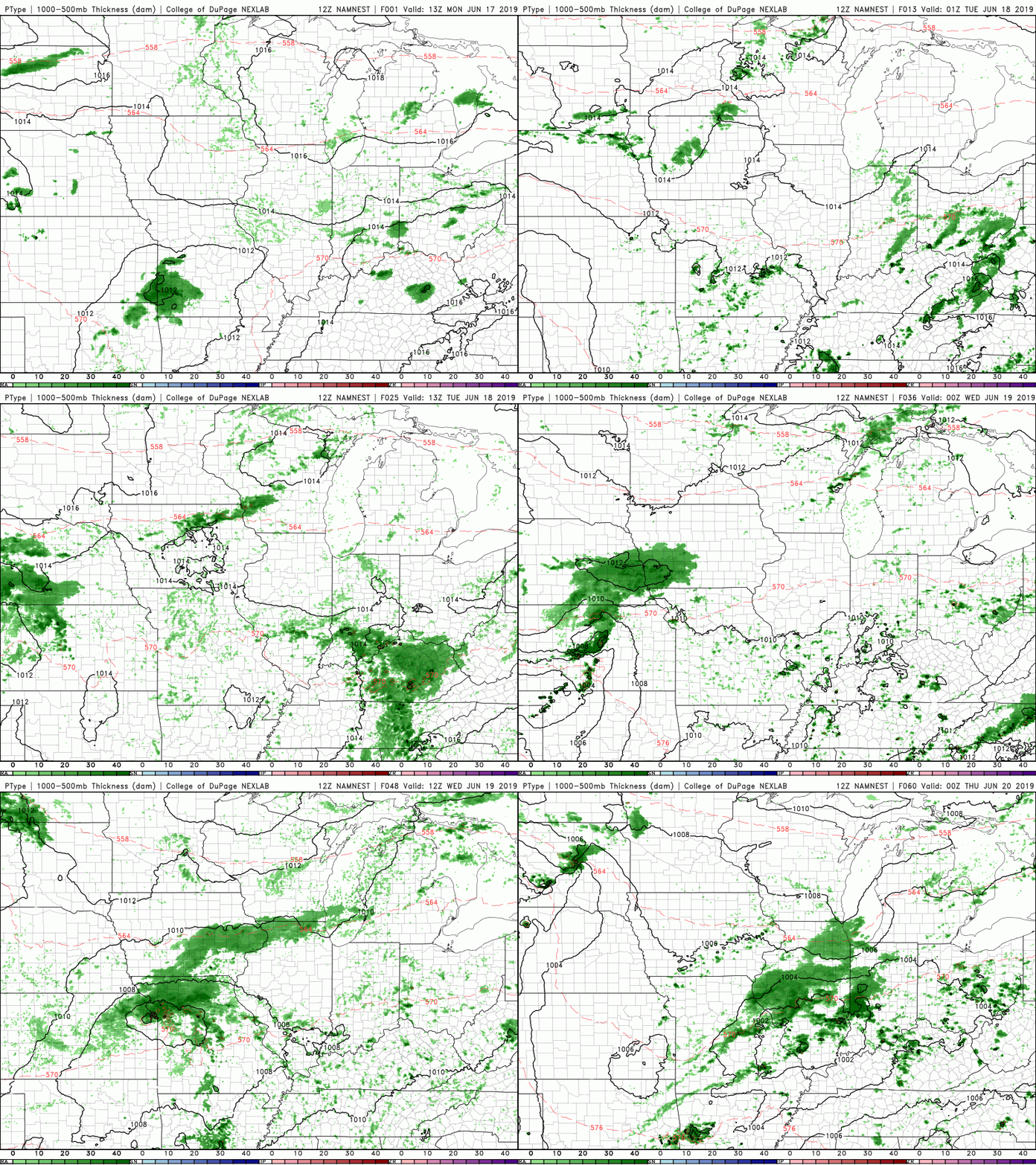
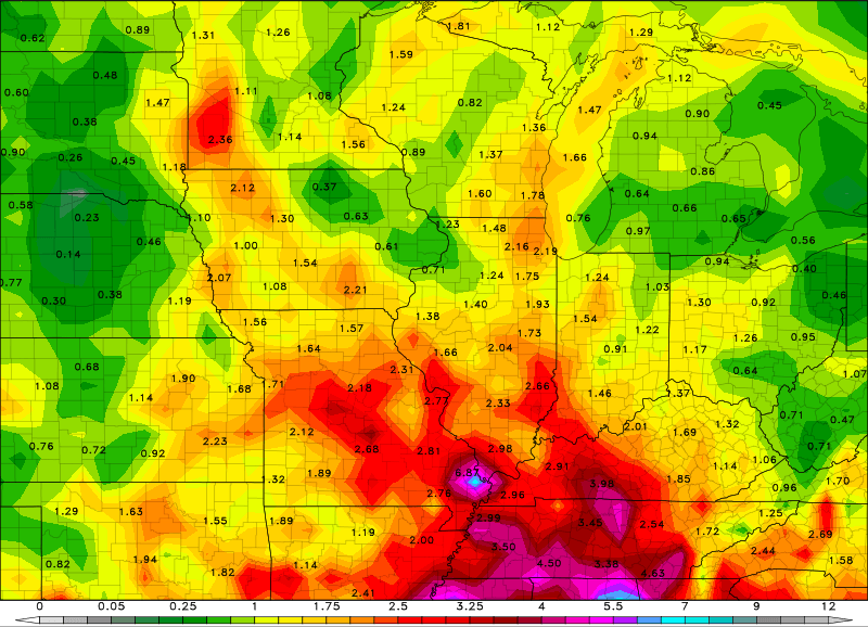
Happy Monday to everyone! We had some showers and thunderstorms roll through early this morning, but we have stayed partly cloudy since. This evening we could see some isolated showers, but thankfully, we will begin clearing overnight. Tuesday will be partly sunny and dry thanks to a much needed high pressure system moving in (as seen below) from the west. This will allow us to dry out a bit and enjoy some sun Tuesday. Looking at our modeled precipitation type run (below), we see those isolated showers this evening before clearing takes place overnight and into Tuesday. Sadly, this won't last long as extended showers from a low to our north will bring scattered showers Wednesday afternoon and evening. This system will be very brief though, allowing for more sun to arrive later Thursday, Friday, and a good portion of the day Saturday. A final total of rain will be released tomorrow, but so far 1.5-3 inches has been the average range throughout the region. Enjoy some much needed sun Tuesday and the later part of the week, before our next big rain maker arrives Sunday and early next week.
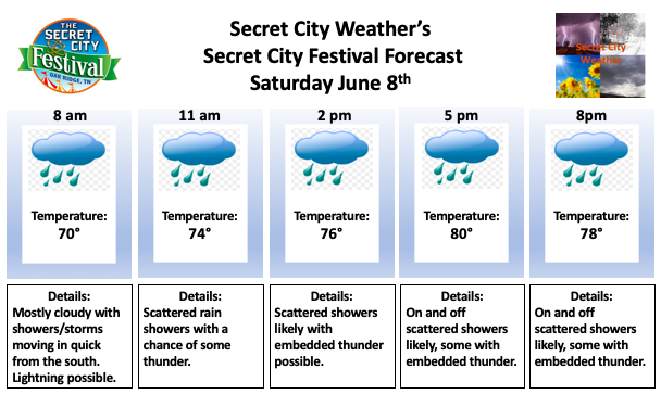
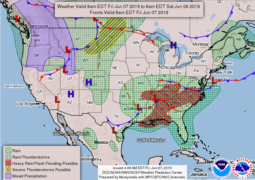
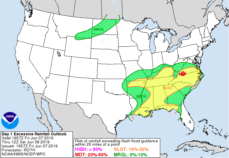
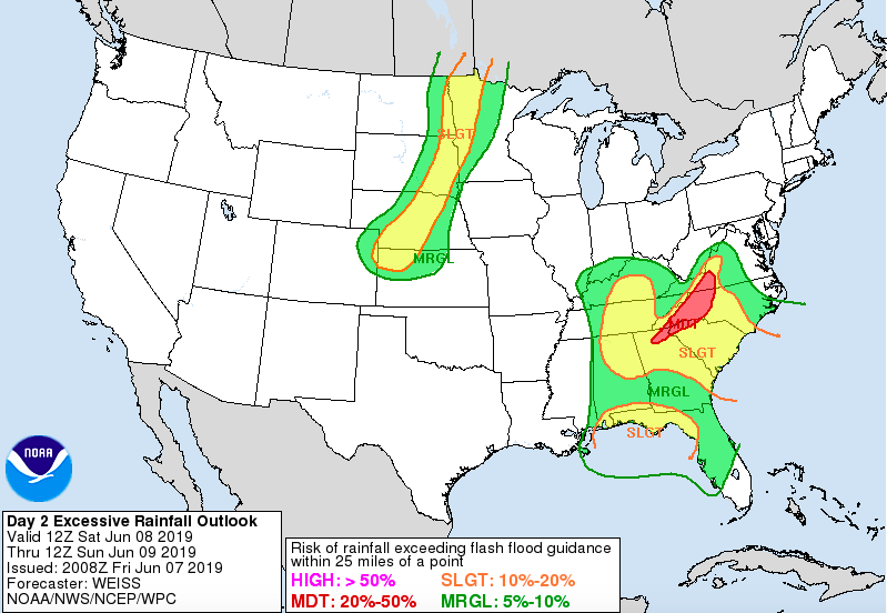
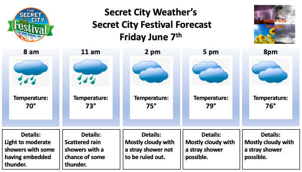
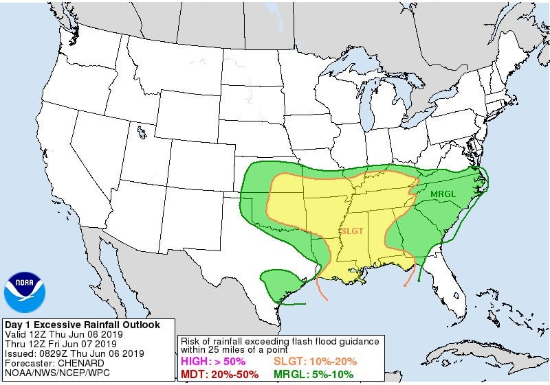
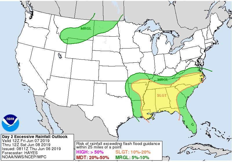
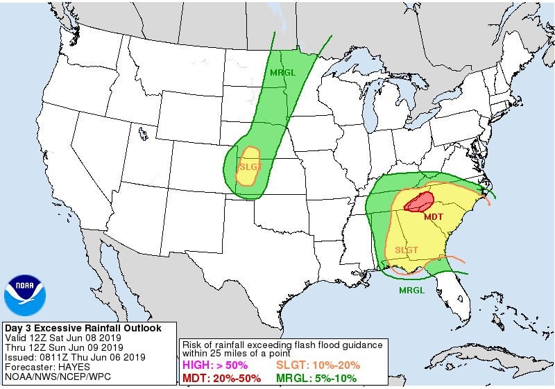
A quick summery for those wanting to attend the Secret City Festival in Oak Ridge below. Waves of showers and thunderstorms are expected on and off throughout the day Saturday. Within these "waves" is the possibility of lightning, heavy winds, and downpours. The severe threat is low, but you still need to remain weather aware. As for the festival forecast, it will be a wet one. Showers will arrive sometime around the 8am hour and carry through until the early afternoon. By 2pm showers will become more scattered, coming in "waves" as described above. If there was a best time to go, it would be later in the day between 3-8. Scattered showers are likely, so try and enjoy the festival during these dry slots. Happy Friday! I hope everyone is staying dry with all the rain we have had the past few days. Unfortunately, this pattern will continue for the next several days thanks to a low pressure system bringing lots of tropical moisture out of the Gulf of Mexico. As you can see below, lots of heavy rain and embedded thunder is expected for much of today across a large portion of the southeast. This will continue into your Saturday and Sunday, with the heaviest of showers likely to occur these days. Taking a look below, this is one of several model runs depicting the rain throughout the state over the next couple of days. As you can see, these waves of showers followed by scattered showers move through the area for both Saturday and Sunday. As I highlighted, some of these will contain heavy winds, heavy rains, and lightning. Please use caution if you plan to be outdoors. Below highlights the risk of flash flooding today (the 7th) and tomorrow (the 8th). The WPC at NOAA has placed east TN under a slight risk. This means flash flooding, and flooding altogether, cannot be ruled out. With a slight drought a concern prior to the two systems moving through and now a saturated ground, flooding could be an issue Saturday. Use your best judgment during storms and always remember "turn around, don't drown". That saying may get old, but it is very true. You never know how fast water is flowing in that area or if the road/bridge is washed out from under that water. It's always better to be safe than sorry. By Tuesday morning this system will have begun moving south allowing for a weak high to dry us out for a good portion of the day Tuesday. By Wednesday, remnance of the low will bring isolated to scattered showers mid week. A more detailed description for the expectations for next week will be released Monday, so stay tuned. Until then, stay dry and safe!
For those who enjoy the annual festival in Oak Ridge and plan to go Friday, here is what you can expect. Moderate to heavy showers early (with embedded thunder) likely, with scattered showers for the afternoon and early evening hours. The heaviest showers will move out late morning giving way to scattered showers the rest of the afternoon. Your best bet for attending the festival will be in the afternoon hours. It will be mostly cloudy with a few quick showers rolling through off and on. Overall, it will be a wet day but the afternoon (3-8) is likely the best time to go if you are wanting to stay the most dry. Your Saturday forecast will be out tomorrow, but the rain and thunderstorms will be the heaviest on this day, so I would advise attending tomorrow (Friday). As I mentioned, the Secret City Festival forecast for Saturday will be out tomorrow, as well as a full forecast for the weekend and early next week. Lots of rain is expected Saturday and Sunday with the potential for flooding and flash flooding. Below is a 3 day outlook highlighting the risks.
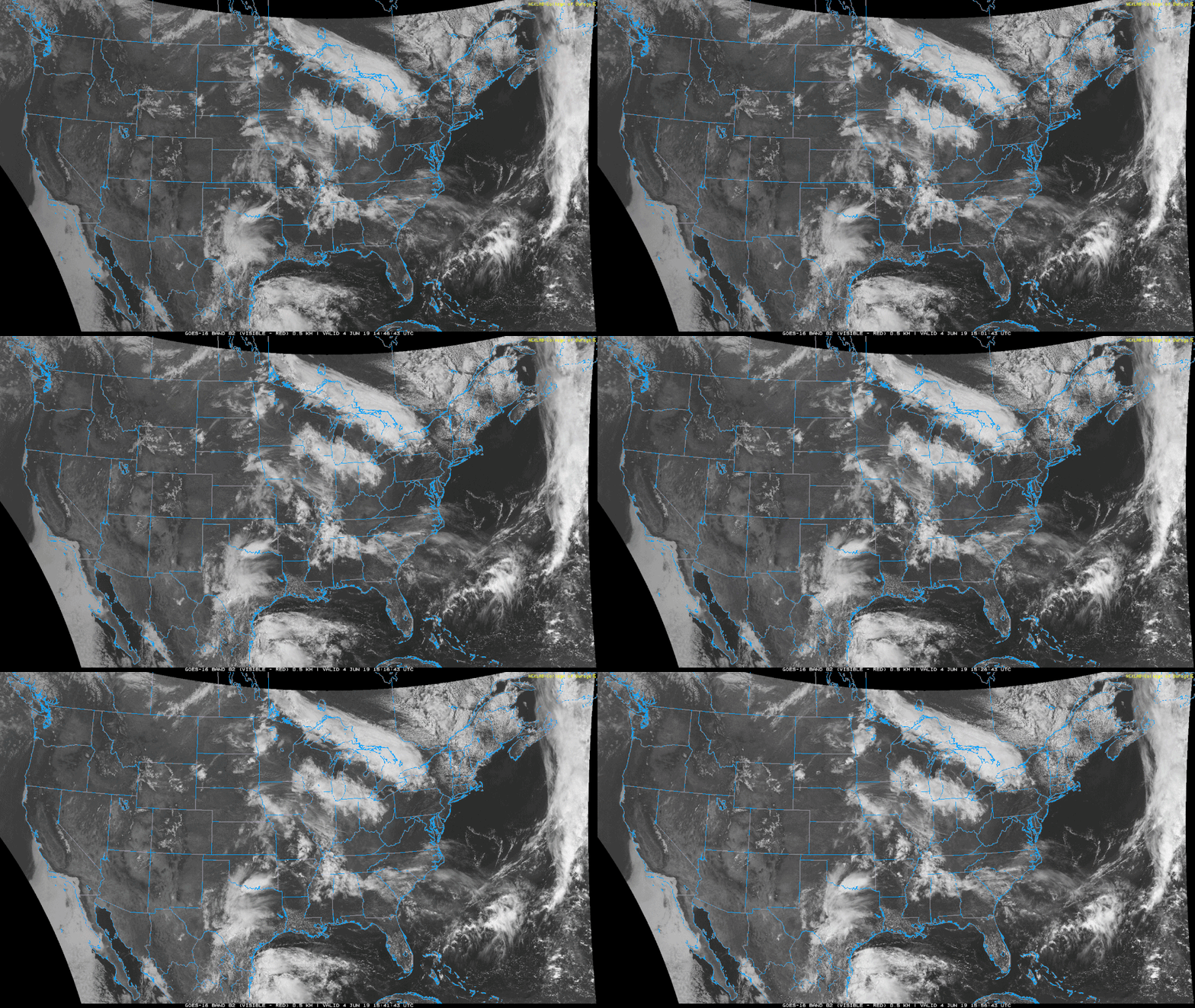
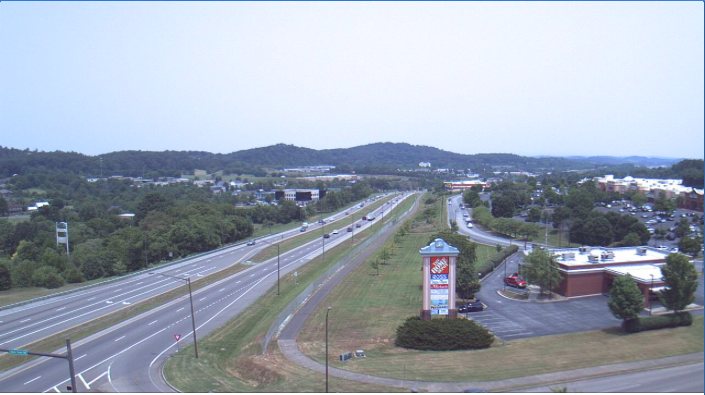
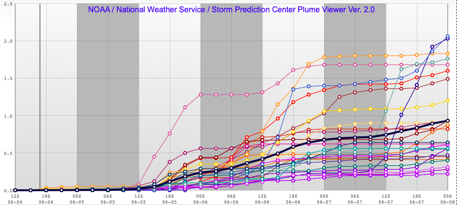
Taking a look at satellite below, we see it is mostly clear across the area...for now. This imagery can be compared to a webcam image located in the Johnson City area (thanks to WeatherBug). As I hinted above, the sun won't stick around for long due to clouds expected to move in from the west this afternoon. The new pattern we are set in will be wet over the next 5 to 6 days. Two low pressure systems will be rolling through over this time period, allowing for lots of rain in the area. 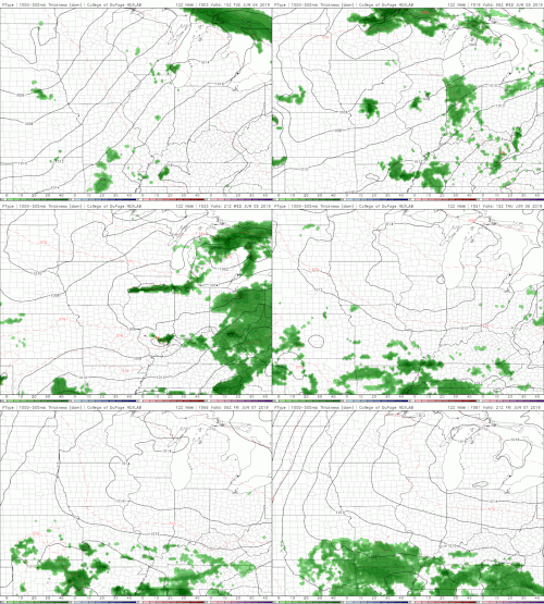 Taking a look at the latest NAM run, we see those scattered showers work their way through the area Wednesday afternoon. Some of these showers will be heavier at times with embedded lightning, heavy winds, and small hail. The severe threat is low, but can't be ruled out. As we work our way through the remainder of the work week (through Friday) we will see shower continue. The image above is known as a Plume. A plume can be thought of as different models running for a specific variable. In this case, numerous models are ran to find the total precipitation from Wednesday until Friday night. The black line indicates the mean (average) between all the runs. So, as you can see, the average rainfall up to Friday evening is around the 1 inch line for the Knoxville area. Farther to our south, the data is indicating an average of 1.5 inches by Friday night. The combined two systems could land 3+ inches of rain through Monday night. Much of the higher totals will be to our south in Chattanooga, but we are likely to see 2+ inches for the majority of east Tennessee. I will keep you updated on the track of these lows, the severe potential as we move into tomorrow, and updated rain totals/expectations over the next 5 to 6 days. Stay dry as we welcome some needed rain in the region.
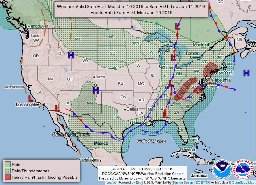
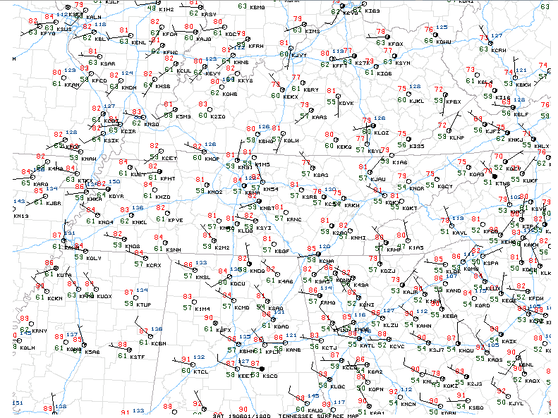
Following a very strong ridge that moved out earlier this week and a cold front bringing scattered storms, we are left with comfortable temperatures back in the low to mid 80's. Looking at surface observations, we see winds are light at around 5 mph out of the northwest. Temperatures are currently in the lower 80's with mostly sunny skies. For the rest of the weekend and early portion of next week, expect it to be comfortable. The next several days will be filled with sunshine and seasonal temperatures. Tomorrow (Sunday) looks to be the best chance of rain for the area until mid week. As a weak disturbance moves through Sunday, a few scattered showers/storms are possible in the afternoon and early evening hours. Once the front moves through, expect cooler temperatures to follow. Below is the forecasting map for the United States, as of this morning. The low pressure system to our north is providing the setup for a few scattered storms Sunday afternoon and early evening. Once the front moves through, we will have a high pressure system tail and bring beautiful conditions for the first half of the work week. Below is a running precipitation type model run showing those scattered tomorrow afternoon and evening. Most of the storms will be in the plateau and mountains (to our east) but isolated showers for the valley cannot be ruled out. Heading into Monday we will dry out leaving a beautiful day with high's in the upper 70's. (Hint: another good weekend for the lake & pool) The gif below shows the predicted temperatures across the region over the next couple of days. As you can see, Monday is expected to be comfortable with high's topping out in the upper 70's. A weak cold front will allow for slightly below average temperatures and sunny skies for the start of the work week. Enjoy the seasonal conditions before the threat of rain returns mid-week.
|
Your trusted source for everything weather in East Tennessee.
Social Media
|


