|
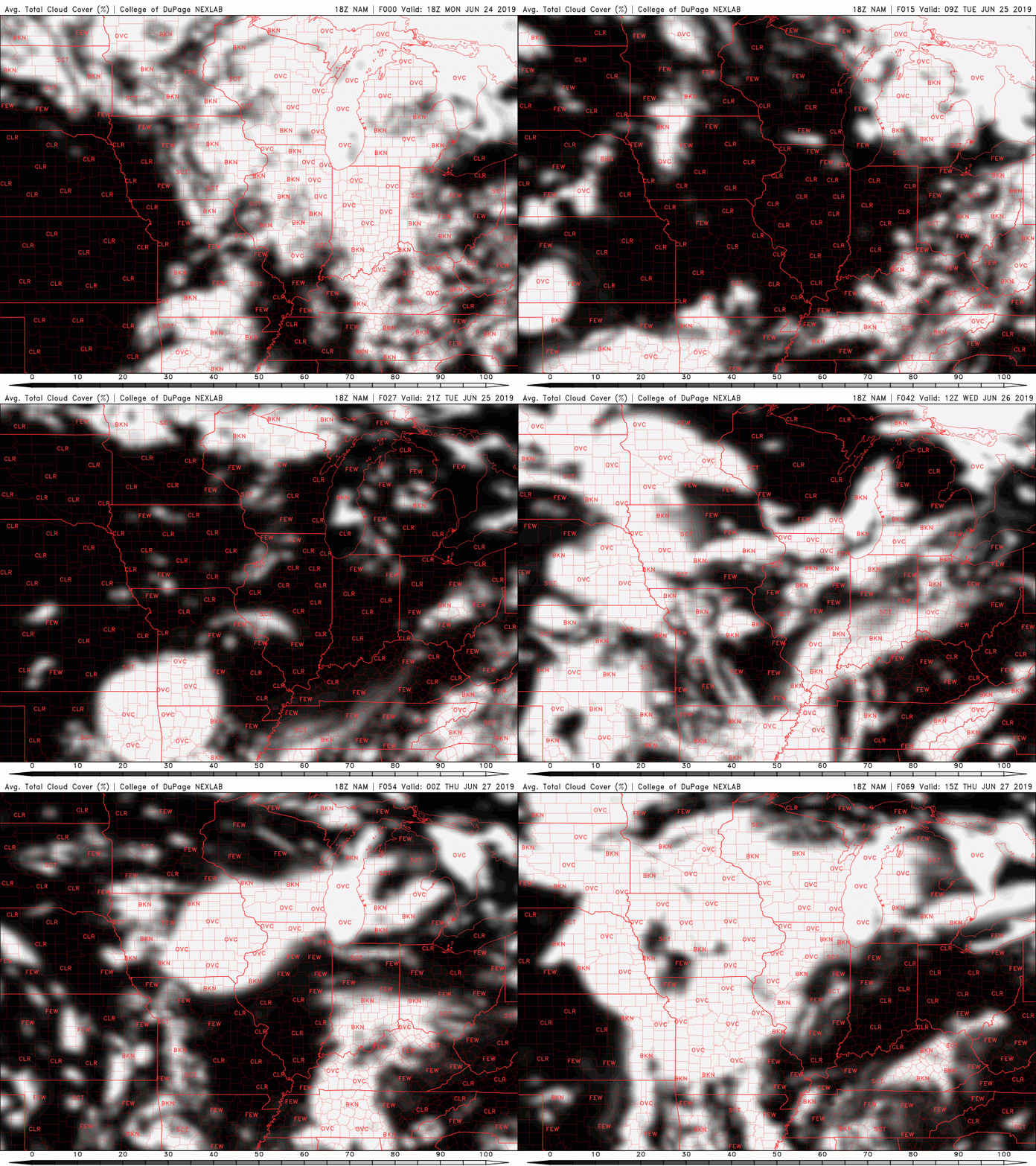
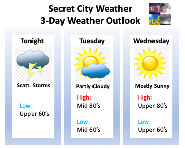
It has been a very active evening thus far with many severe thunderstorm warnings and even a tornado warning. As of now, there has not been a confirmed tornado from the NWS in Morristown. The tornado warning (at the time) was radar indicated. Taking a look below at a modeled reflectivity map, the brunt of the system still resides in the eastern most portion of TN (Newport, Gatlinburg, Pigeon Forge, etc.). Luckily, the storms have decreased in strength and are beginning to move out of the area entirely. Following that line of storms could be some isolated showers/storms but they will be few and far between. As we push into the overnight hours tonight, showers will move out and so will the dense cloud cover. As seen from the latest NAM cloud cover run, Tuesday will be filled with broken cloud cover. We will see rounds of clouds and sunshine throughout the day. Isolated showers may occur in the western portion of TN and into parts of the Plateau, but generally, east TN will remain dry. Wednesday you can expect a bit of an improvement with mostly sunny skies expected. We will begin to generate some southern flow by Wednesday afternoon, helping in increase our temperatures into the upper 80's. We will, though, continue staying precipitation free. As we head into the second half of the week, afternoon pop up showers are in the forecast, but we will remain much quieter than we have the past several days. Go out and enjoy some much needed summertime sunshine and I hope everyone has a good rest of their week! More posts and updates for the website will be made Thursday. Here is your graphical three-day weather outlook. Your full detailed forecast can be found in the "Weekly Forecast" tab at the top of this page.
0 Comments
Leave a Reply. |
Your trusted source for everything weather in East Tennessee.
Social Media
|


