|
Good afternoon and I hope you are staying warm. As you can tell below, much cooler air has moved in for the southeast as this system works through. Expect chilly temps to remain in place tomorrow before we gradually warm back up to average temperatures Thursday and Friday.  We have good news ahead as warmer temperatures and sunnier skies will return for the next several days. Once this system works out entirely tonight, clearer skies will return tomorrow afternoon and the days to follow. Our next real rain chance doesn't return until the later part of the weekend and into early next week.  Longer term (early to mid-April), the CPC suggests average to above average temperatures to be the case. If you would like more details for the up and coming growing/planting season (Growing Degree Days (GDD), Frost dates, etc.) shoot us an email at [email protected]. 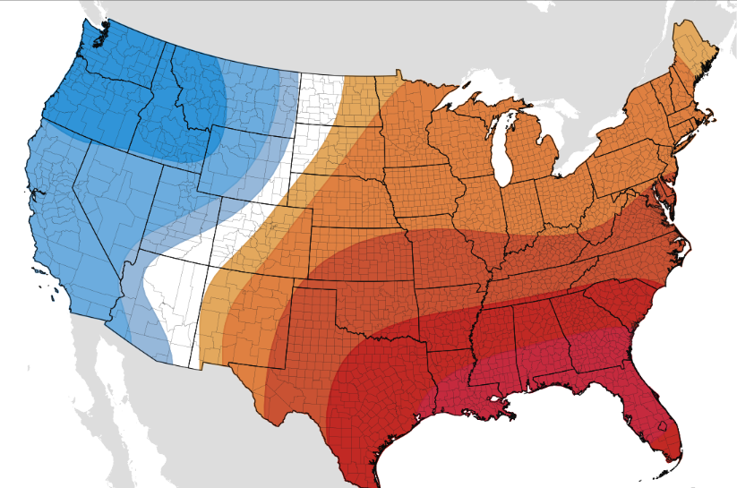 That will wrap up today's forecast but stay dry and warm as we work into this afternoon. Chilly temperatures will stick around tomorrow with sunshine likely in the afternoon. The second half of the week looks great for any outdoor adventures!
1 Comment
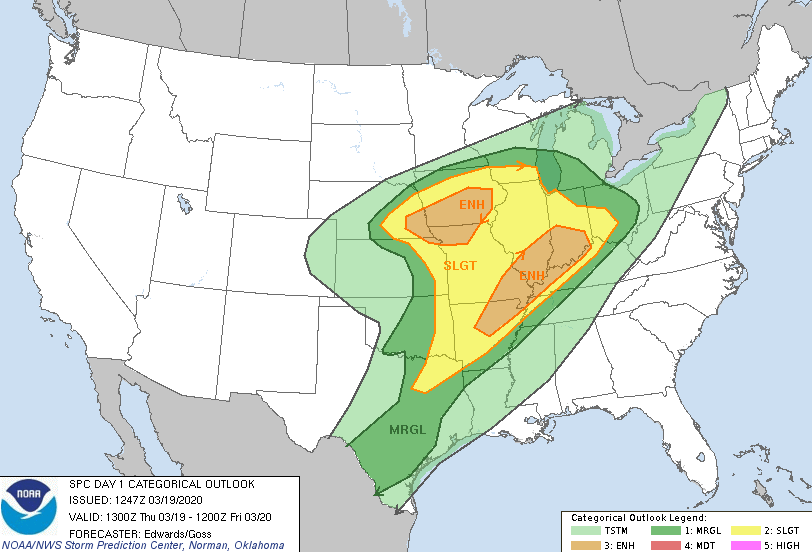
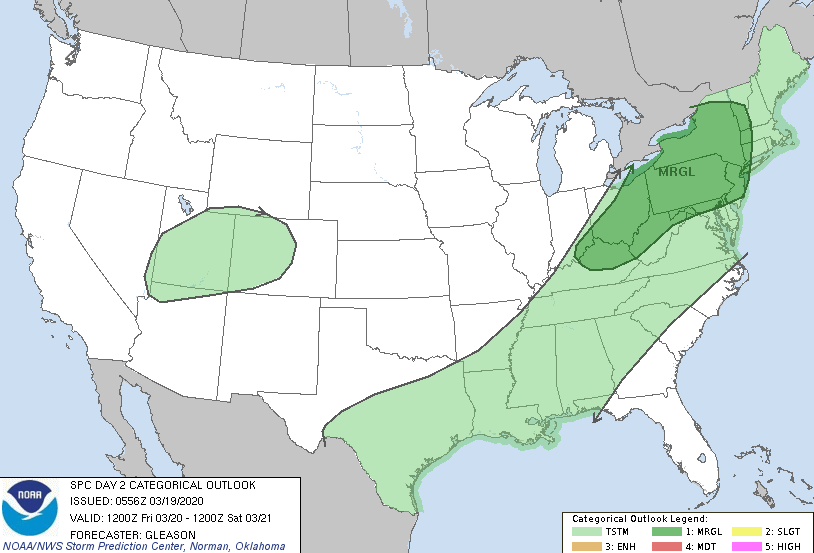
Good afternoon! Another beautiful day filled with sunny skies and comfortable temperatures. Unfortunately, changes are on the way with our next weather maker (as seen to the west). Along with showers throughout Tuesday, we'll also see much cooler air. 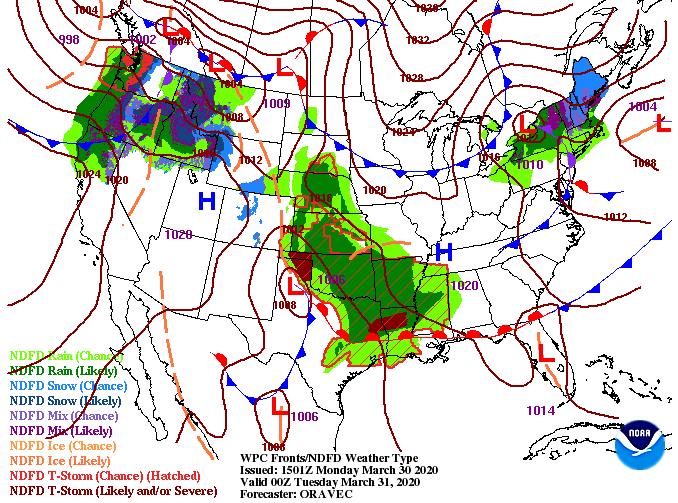 Looking into the forecasted high's tomorrow, we'll top out in the lower 50's. Cooler air will work in throughout the day (decreasing temperatures) with high's back to an early Spring feel. Overnight low's will be chilly as well in the upper 30's to low 40's here in the valley.  Looking at this next system, it will arrive early into Tuesday and continue throughout the day. Unlike our last system, severe weather will stay south with a few rumbles of thunder possible tomorrow afternoon. Overall, expect moderate showers and cooler air throughout the day. Overnight, the highest elevations of the Smokies could see snow as temperatures dip below the freezing mark above 5000 feet. We'll clear back out for Wednesday with decreasing clouds and remain dry through much of the work week. 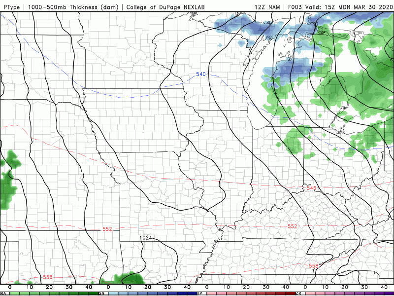 That will do it for today but check in for the latest forecast and be sure to stay dry and WARM through the day tomorrow. I hope you are having a good Friday! Looking at the latest surface map below, a powerful system will begin setting up this afternoon and Saturday. With a strong jet in place to the north, severe activity is likely in parts of Missouri and Illinois. 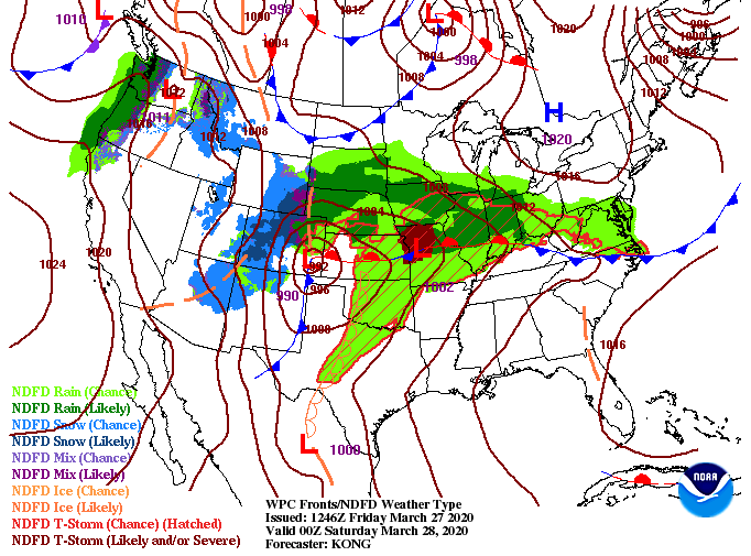 Looking at the day 2 outlook, a MODERATE (4/5) risk is in place for northern Illinois tomorrow. This means a severe weather outbreak is likely tomorrow with large long track tornadoes, large hail, and damaging winds all possible. As we get closer to home, the Knoxville area sits under a marginal risk with a slight risk for middle and western TN. 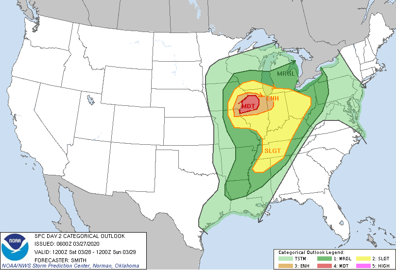 Looking more in depth at our next weather maker, a line of showers & storms ahead of a cold from will begin working through tomorrow afternoon (from west to east). The timing of this line comes in the overnight hours and into early Sunday morning (this is good news). As we get into the overnight hours, instability will begin to die off, decreasing storm activity as the night progresses. We'll likely see some gusty winds and areas of heavy rain but severe risks are low. Nonetheless, pay close attention for updates throughout the day so you know what to expect late tomorrow.  If you haven't already, go out and enjoy the warmth and spotty sunshine before shower chances increase throughout the day tomorrow. Sunday looks to be pleasant the second half of the day with high's in the mid 70's and broken cloud cover. Enjoy your weekend! Looking high in the skies above is the latest satellite imagery showing sunny skies across the state. Expect this to be the main story through the day today and into the overnight hours. If you look toward the north and west, cloud cover is beginning to develop. This next system will shift winds out of the south, drawing in very warm temperatures tomorrow afternoon. 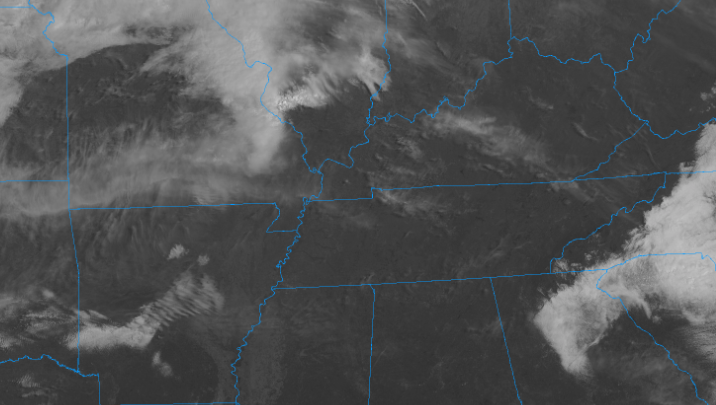 Tomorrow's high's could be record setting in the low to mid 80's. Not only will it be hot in Tennessee but southern Georgia, Alabama, and Mississippi can expect high's in the lower 90's (Summer-like heat in late March). Tomorrow's high temperature record stands at 84 degrees (set back in 1910) so we'll be keeping a close eye and let you know if we manage to surpass that. 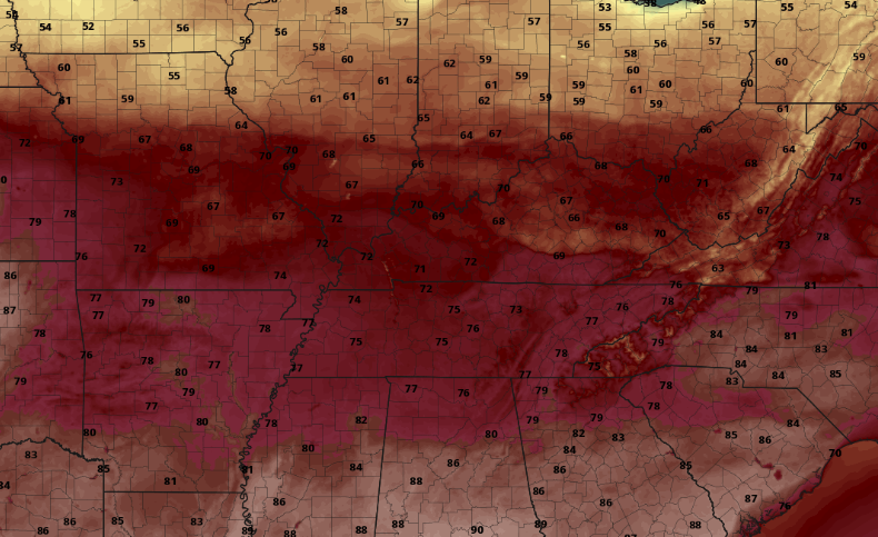 Looking ahead, the high to our east (contributing to the beautiful weather we have had) will continue to work out of the area. Cloud cover will begin increasing through the day tomorrow with showers eventually working in the later half of Saturday. 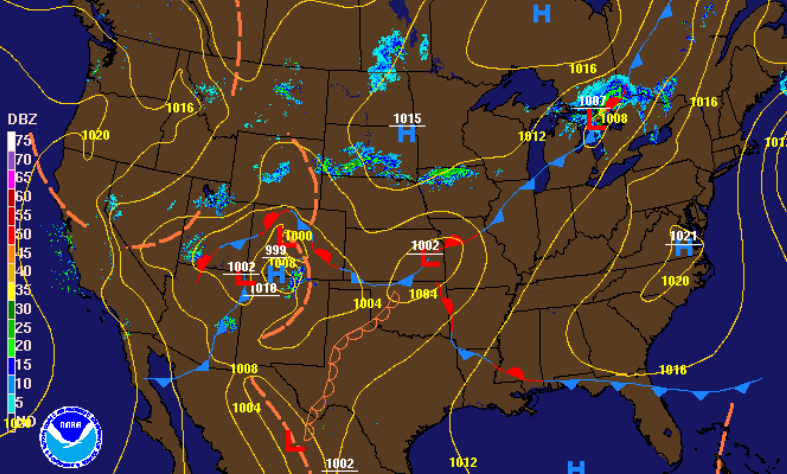 Model guidance picks up on these showers working through mainly in the overnight hours and into early Sunday morning. With the timing coming in the overnight hours, instability factors quickly diminish. We'll continue to monitor this closely though, as strong to severe storms could develop in western TN early in the day. For the time being expect this system to die out overnight providing moderate showers and cooler air into Sunday and Monday.  Enjoy some outdoor time if you have the opportunity today as it will be a beautiful one! If you are panning a hike or walk, send us your views by tagging us on Twitter/Facebook or sending them to [email protected] Sunnier skies....in East Tennessee? Yes! Taking a look below we see a mix of sunshine and cloud cover working in this afternoon. With a high pressure system located to the north, we'll see sunny skies and comfortable temperatures stick around for tomorrow as well. 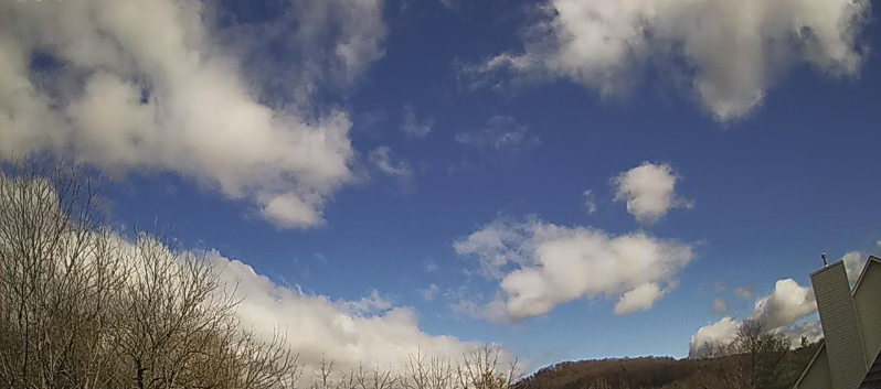 Sunny skies back on the Stansfield's Webcam As a high pressure system works in this afternoon, cloud cover will continue decreasing throughout the day. Sunny skies will work back in for tomorrow with temperatures in the lower 70's. 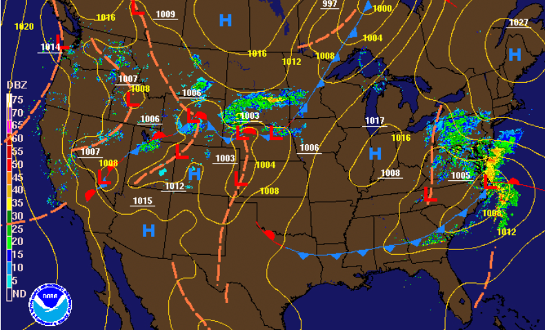 Friday will be another mostly dry day with increasing clouds. A system will work to our north drawing in warm air throughout the day Friday. Depending on the flow and how much sunshine we receive through the day, we could be close to setting a record high. I think given the latest data we'll be right under the record of 84 degrees, but it puts into context how warm temperatures will be for this time of the year.  Looking at those forecasted temperatures for Friday afternoon we see 70's and 80's across the board for the southeast. The East TN Valley can expect high's in the upper 70's and lower 80's Friday afternoon. A warm front to the north will help shift winds out of the south, pulling in those warmer temperatures and higher dew points throughout the day. 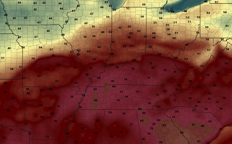 That concludes today's forecast but if you get the chance, be sure to enjoy some sunshine outside. With the warm season beginning to work back in, many outdoor industries are opening up their doors. If weather plays a big part in your business (Ex: farming, lawn care, outdoor recreation, sporting events, etc.) send us an email or visit SecretCityWeather.com/Services and let us know how we can help you. We offer a wide variety of services we can personalize for your operation. Showers and rumbles of thunder are working through east TN now and will continue throughout this afternoon. With a nice bed of atmospheric parameters in place, we will likely see strong to severe storms work in this evening and overnight. As seen below, these will mainly be limited to the southern half of the valley. The biggest threat will be damaging winds but hail and isolated tornadoes can't be ruled out. 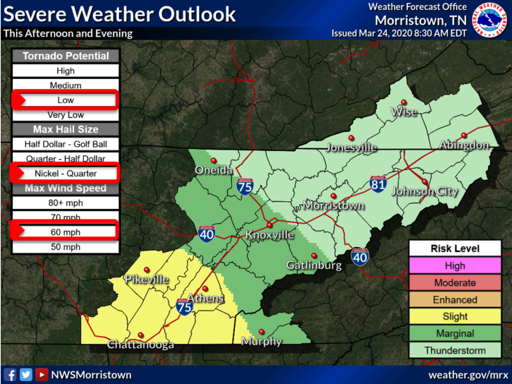 The low pressure system will continue to work through today as a front slides in. Along the warm front, data suggests strong convection will develop this evening. This will provide the opportunity for stronger to severe storms to slide through east TN before we begin clearing out late overnight. 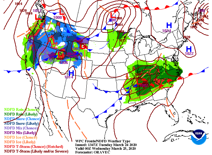 Looking more in depth, the HRRR (a model) has done a good job with picking up areas of heavier showers late this morning. As we get into the afternoon, showers will become more scattered before the low draws closer. If you look toward the end of the animation, the model suggests heavier storms working through the southern valley (dark orange, reds, and purples). The timing of these heavier showers/storms falls between 9 PM and midnight. 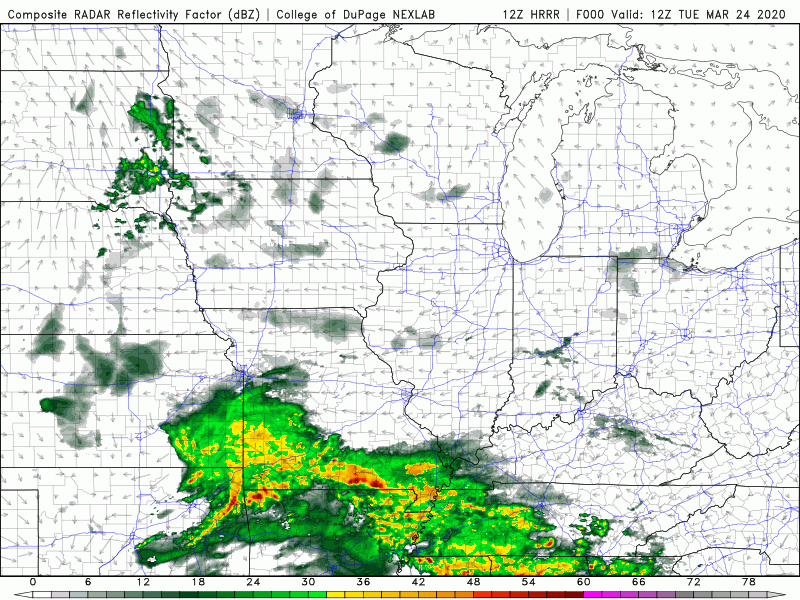 Be sure to have a way to receive watches and warnings this evening. We are getting our first taste of the Spring "Severe Season" with more likely ahead (possibly this weekend). As always, check in with us on Twitter & Facebook as we'll have the latest! Stay safe and stay weather aware tonight. We had a nice round of "sleeping weather" overnight and into early this morning but showers are fading out this afternoon. As this system works east, mostly cloudy skies will stick around this afternoon and overnight. High's will remain cool today with a warming trend set for this week. 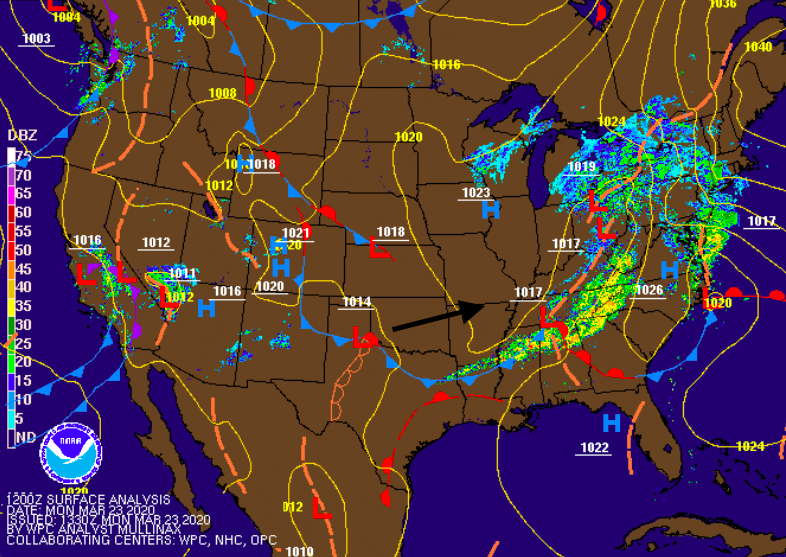 As a low pressure system develops in north Texas today, it will begin to work eastward. This will allow the opportunity to see stronger showers and storms tomorrow afternoon. As seen below, a slight risk (2/5) is labeled for Middle and Western TN tomorrow. Depending on the amount of instability (vertical motion) we see will vary the chances for storm activity. Given the latest models, scattered showers will start the day and continue into the early afternoon. If cloud cover is broken at times (providing some sunshine in spots), we could see a better chance for stronger storms. The main threat will be damaging winds but isolated areas of spin-up and hail are possible. We'll continue to monitor the latest and keep you up to date. 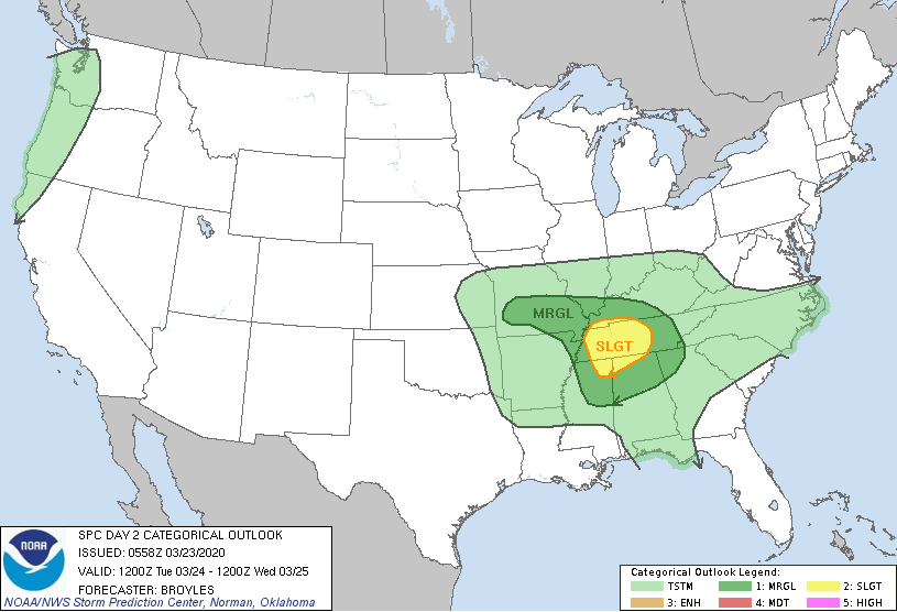 Scattered showers will start the day off before heavier showers and storms move in by the later half of the day. These will move east overnight tomorrow, allowing for clearing to take place Wednesday afternoon. This means SUNSHINE is finally back in the forecast for late Wednesday and through the day Thursday.  As heavier showers and storms move through the day tomorrow, we'll see a fair amount of rain. Flash flooding potential isn't the greatest threat but it is possible for those in low lying areas and locations prone to rising waters. Expect an additional 1.5"-2" tomorrow to the 1.25" we picked up through today. 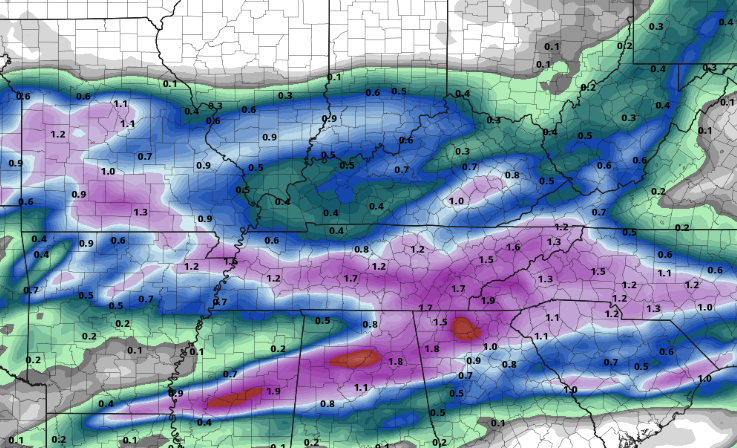 Though severe potential remains on the lower confidence level, many severe parameters are in place. We'll monitor the instability potential as we work into Tuesday. This will give us a real idea on severe possibilities for tomorrow afternoon. Until then, stay dry and stay up to date for the latest! Happy first FULL day of Spring to you! Spring officially started last night at 11:50 pm. As we get into today's weather, the SPC has Marginal risks to the north and south this afternoon. This means we could experience some gusty winds and a few thunderstorms at times but the severe potential is very low. In a larger sense, this will be good sleeping weather for most as we push into the weekend. 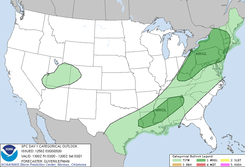 In addition to the Storm Prediction Center's outlook, this is the latest excessive rainfall outlook for today. With heavier showers expected this evening, flood prone areas could see a flash flooding risk. The odds remain low but do be weary if you are in low lying, flood prone areas. 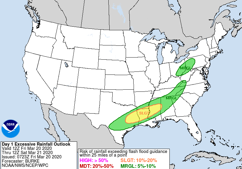 As showers move through this afternoon and evening, a trailing cold front will provide cooler and drier air Saturday. "Cool" is a relative term to the above average temperatures we have been dealing with the past several days. Expect high's near average in the lower 60's this weekend. 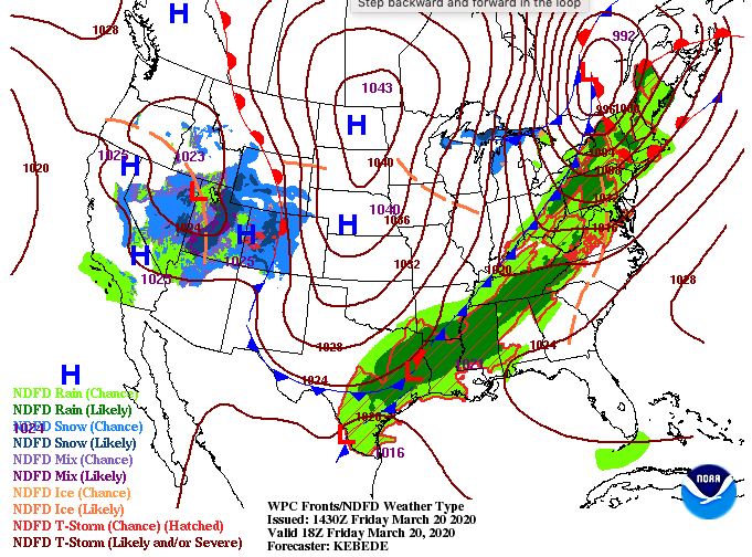 Looking ahead, model guidance shows a brief break for the central valley this afternoon before additional showers and rumbles of thunder return tonight. As a cold front slides through overnight, drier and cooler air will follow. This will allow for a dry start to the weekend with a chance for rounds of sunshine in the afternoon hours. Cloud cover and shower chances return Sunday afternoon and into early next week.  That'll wrap it up for today but enjoy seasonable temperatures and the chance for some sunshine tomorrow afternoon. Satellite is picking up on cloud cover thinning out across east TN this afternoon. Try to go out and enjoy those warm temperatures and spotty sunshine before rain returns tomorrow. Looking below, our next weather maker lies just to the west. 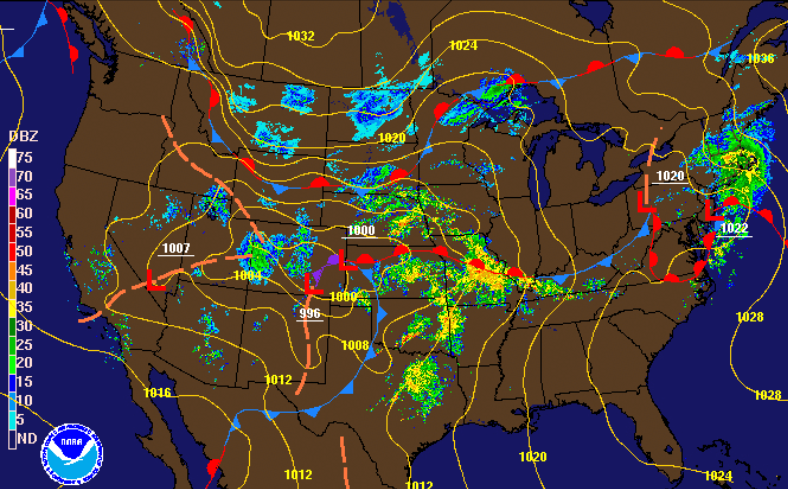 The day 1 SPC outlook (bottom left) shows two enhanced notches (category 3/5). If you have friends or family in these areas, let them know the risks and impacts possible this afternoon and evening (anything is on the table). Looking into tomorrow, (bottom right) the SPC has any severe activity to the north and east. As this system works north and east overnight, any instability will quickly break down as lines of showers work in tomorrow morning. A few rumbles of thunder and gusty winds are possible at times, but any severe weather will stay north.
Looking into how this could play out, we'll see showers work in tomorrow morning and continue on and off through the day. As we get into Saturday, a cold front will sweep through drying things out and cooling things off. This will knock high's back down to near average temperatures (upper 50's to low 60's). A few breaks in the cloud cover are possible Saturday afternoon (similar to today) before rain returns Sunday and Monday.  As of this morning, we have picked up just shy of 2" for the week and you can expect another 0.5" to 1" by the end of the day tomorrow. Some spots could pick up a bit more rainfall than others with heavier showers/storms, but overall, expect upwards of an inch through the day. 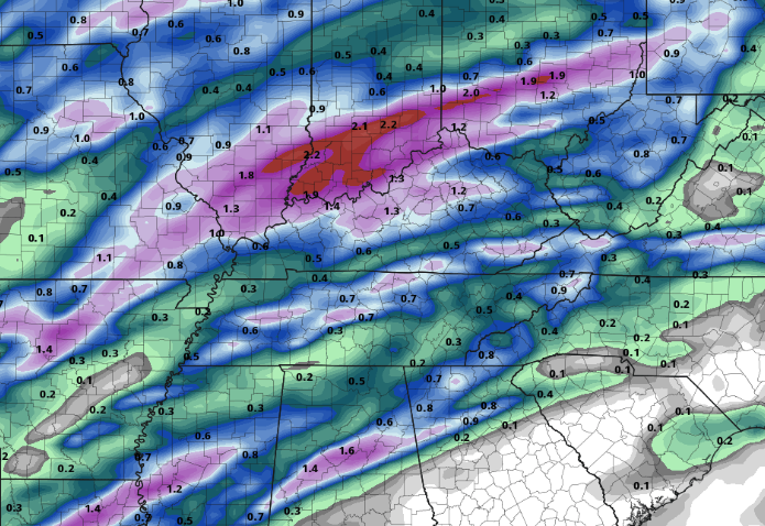 Enjoy any sunshine you see today as showers work back in for Friday. Stay dry and have a good end to the work week tomorrow! Good afternoon! Shower activity has been held at bay so far today as mostly cloudy skies have been the main story. Similar conditions will continue this afternoon with high's in the low to mid 70's. Looking below, a warm front is working through drawing in well above average temperatures from the south. 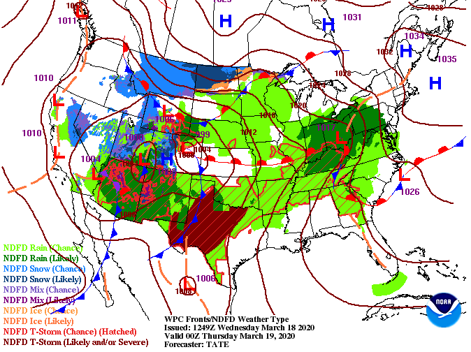 As we work into Thursday, we'll see high's pushing 80 degrees here in the valley. For reference, the average high in Knoxville this time of the year is 62. That means we'll be 15+ degrees warmer than average as we work into tomorrow afternoon. 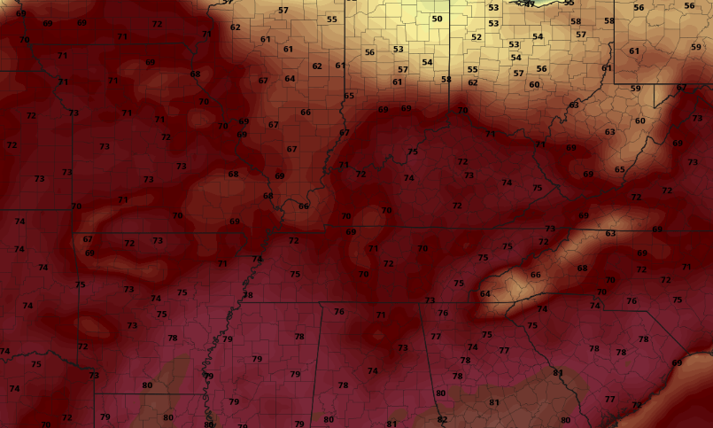 Along with increasing temperatures, we'll see moisture working in as well. The latest models continue trending downward for any severe activity Friday as this system will stay mainly to the north. With that said, waves of scattered showers will work in overnight and into Thursday morning and then again throughout Friday. The heaviest rains, and a few rumbles of thunder, will work in Friday ahead of a cold front. As we get into Saturday, much cooler and drier air works in providing the chance for some limited sunshine in the afternoon hours. Enjoy it while it lasts, clouds and more rain chances return Sunday evening.  Looking a bit longer term at the latest from the CPC, this warm and wet pattern looks to continue to close out the last week of March. The likelihood for above average temperatures and above average precipitation is high, so account for more cloudy, wet, and warm days. 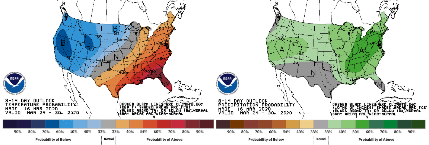 A light coat may be needed in the morning hours tomorrow, otherwise we'll stay very warm throughout the day. Don't forget the umbrellas either as scattered showers remain likely Thursday and again on Friday. If you'd like more information on how we can help your business out, send us an email at [email protected] or visit our services tab above. |