|
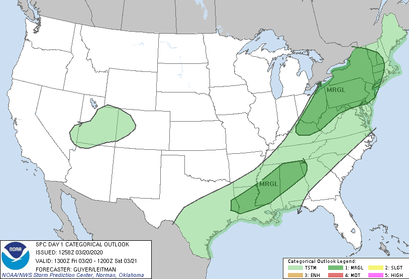
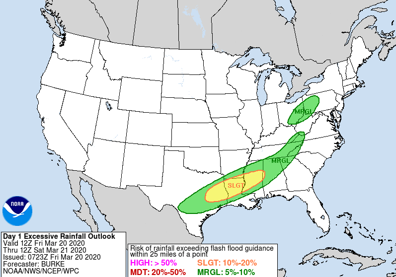
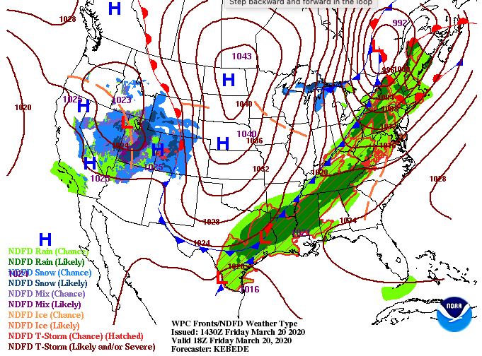
Happy first FULL day of Spring to you! Spring officially started last night at 11:50 pm. As we get into today's weather, the SPC has Marginal risks to the north and south this afternoon. This means we could experience some gusty winds and a few thunderstorms at times but the severe potential is very low. In a larger sense, this will be good sleeping weather for most as we push into the weekend. In addition to the Storm Prediction Center's outlook, this is the latest excessive rainfall outlook for today. With heavier showers expected this evening, flood prone areas could see a flash flooding risk. The odds remain low but do be weary if you are in low lying, flood prone areas. As showers move through this afternoon and evening, a trailing cold front will provide cooler and drier air Saturday. "Cool" is a relative term to the above average temperatures we have been dealing with the past several days. Expect high's near average in the lower 60's this weekend. Looking ahead, model guidance shows a brief break for the central valley this afternoon before additional showers and rumbles of thunder return tonight. As a cold front slides through overnight, drier and cooler air will follow. This will allow for a dry start to the weekend with a chance for rounds of sunshine in the afternoon hours. Cloud cover and shower chances return Sunday afternoon and into early next week. That'll wrap it up for today but enjoy seasonable temperatures and the chance for some sunshine tomorrow afternoon.
0 Comments
Leave a Reply. |
Your trusted source for everything weather in East Tennessee.
Social Media
|


