|
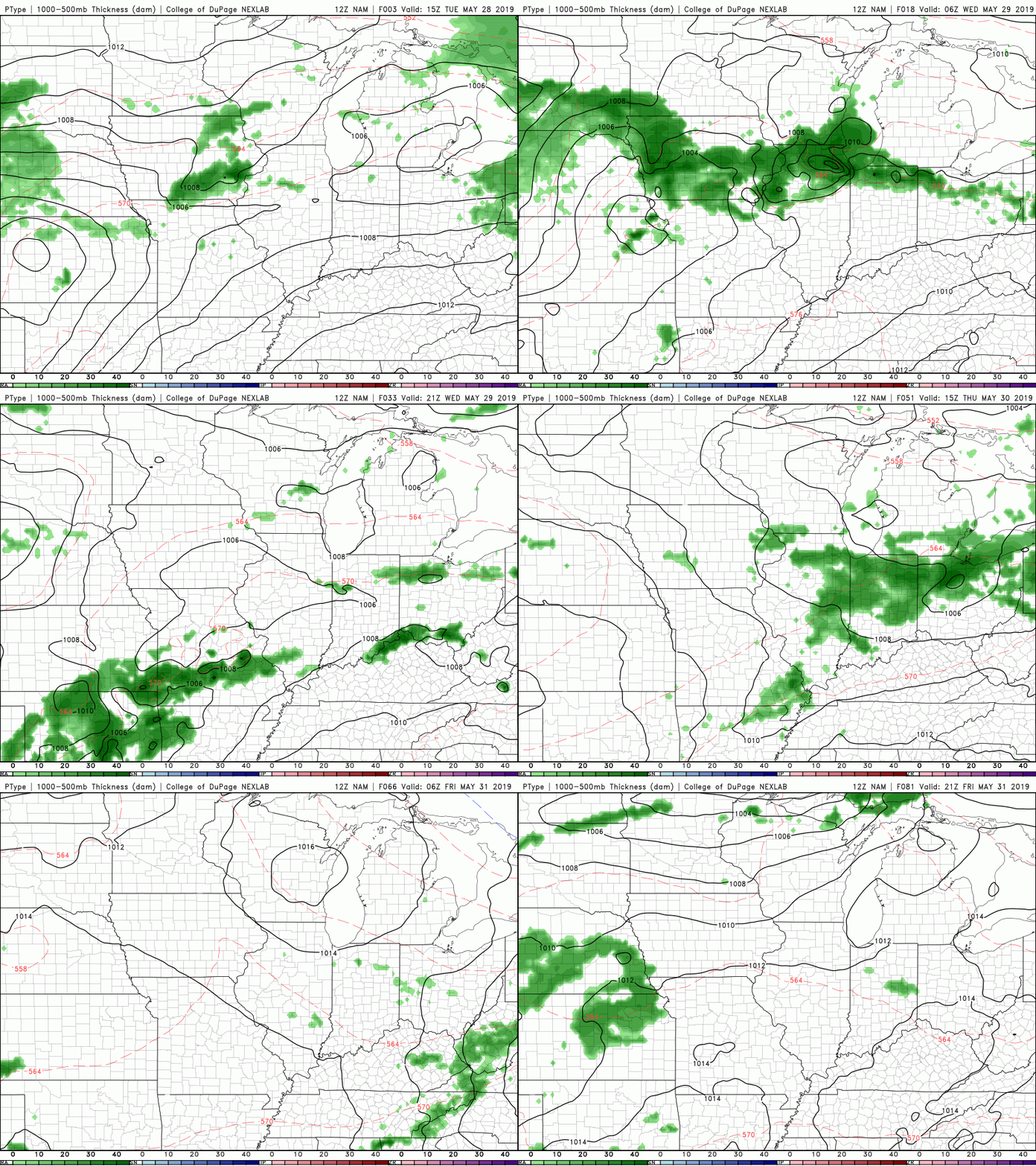
Taking a look at the current forecast map, we see that high pressure system beginning to break down and move out. Behind this ridge is a low that could bring us some rain later this week. As that ridge breaks down, temperatures will begin to decrease, leaving us with high's back in the mid 80's Friday and the weekend. Into Thursday, Friday, and this weekend, we could see some isolated showers and storms pop up, especially in the afternoon/early evening hours. As depicted below, the NAM has us staying dry until Thursday evening when a few showers move through. Take this model with a grain of salt, because I do expect a few isolated showers to find their way into east TN toward the end of the week and weekend. Sufficient precipitation water values and day time heating are factors that will be there later in the week, all we need is an initiation (Such as the mountains) source to fire off a few storms in the area. I will let you know of any changes in the forecast, until then, have a good rest of your work week!
2 Comments
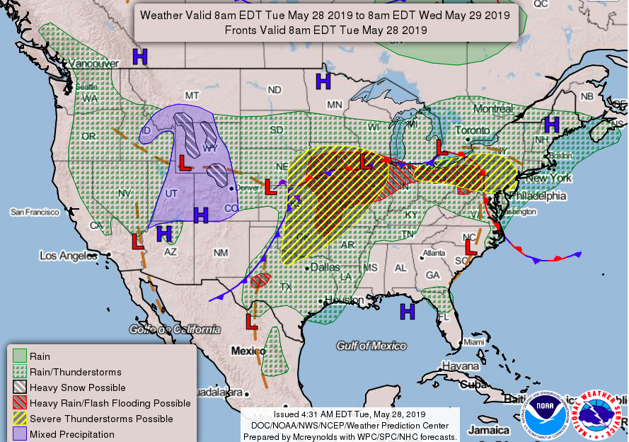
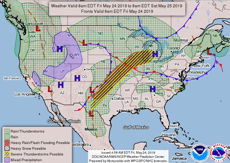
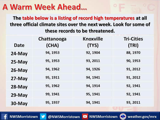
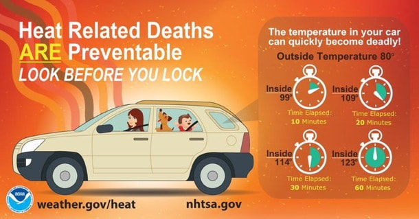
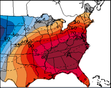
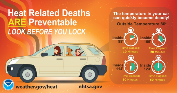
Good evening! It has been a warm week and unfortunately, it will only get a bit warmer. On the bright side, check out what that hot and hazy sky does for us in return. This picture was taken near Clinton on I-75 earlier this evening. I am sure many of you are asking "It's May, why is it so hot?". Well in simple terms, it can be blamed on a strong high pressure system (known as a blocking high) sitting on the east coast. This high pressure system creates "boring" weather and very warm temperatures. As you can see below, the western half of the USA is dominated by a low, while the east is dominated by a high. This pattern can last days to even weeks at a time. Lucky for us, the high is beginning to break down, weaken, and eventually will move out by mid week. This will allow for the potential for some showers and temperatures retreating back into the 80's. As you can see below we will be on the brink of breaking many records around east TN over the next few days. Our greatest threat for record breaking days will be Monday (Memorial Day) and Tuesday as we are expected to peak out around the mid 90's range. Keep in mind that from now until Wednesday, temperatures may be in the low to mid 90's, but adding in humidity, temperatures can feel near the triple digits range. Since the heat won't be leaving anytime in the next day or two, why not enjoy it, especially with an extra day off of work. With weather conditions staying mainly dry and sunny, especially for Memorial Day, why not enjoy yourself by cooling off at the pool or lake and soaking in some vitamin D, as well. Lastly, let me remind you the dangers of heat, especially in vehicles. With temperatures this hot already, it does not take long for your vehicles interior temperature to rise drastically in a short amount of time. Remember to check for children, pets, and even electronics before leaving your vehicle. Here is a quick guide to show you how hot it can get in your car. (NOTE: this is if the temperature outside is at 80 degrees, imagine starting 10-15 degrees warmer than this) Have a blessed weekend & holiday, be safe, stay cool & hydrated, and remember to use caution when outdoors for long periods of time!
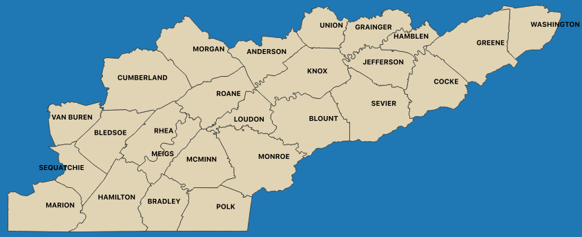
Good afternoon and happy Tuesday! As Secret City Weather continues to grow, I thought I would introduce a map that shows what counties we primarily forecast for on a daily basis. Of course all weather in and around Tennessee, and even the nation, are important and will be noted, but these counties are our primary focus. You can expect all of our forecasts, blogs, posts, and updates to encompass these 26 counties each day. Getting into the weather, a few changes are happening. I am sure many of you have noticed the change in temperature the past few days, and sadly, you can expect this to continue. It will be abnormally warm over the course of the next 7 to 10 days. This is because of a strong high pressure system currently sitting over the southeast. Taking a look below, you see lots of red and even purple colors dominating the southeast region. Sadly, this is not Kool-Aid on a map (though this will be essential to drink over the next week or so) but instead, a depiction of how hot the temperatures will be. As the model progresses, you can see the red colors begin to move farther and farther northward as we progress through the week. This means temperatures are likely to become warmer as we head into memorial weekend and early next week. High's are expected to reach the mid 90's and along with the humidity, feel like 100 by the weekend. These temperatures will be flirting with record high's each day, so I expect a few new records to be established. This week & weekend would be good for cooling off at the lake or in a pool. There is a slight chance of a stray afternoon shower or two through the week and this weekend, but otherwise we will stay mostly sunny and hot. Most of these showers will take place to the farthest east portion of east TN (in the mountains). I would also like to make it known the east TN area (as shown by the map above) is under a Secret City Weather HEAT ALERT from Tomorrow (May 22nd) to Wednesday (May 29th). This is advising you that abnormally high temperatures will occur over the course of this alert and to be cautious of this. Multiple types of health risks are associated with heat, so stay hydrated, take breaks, and stay cool.
Good afternoon! It has been a pretty warm weekend filled with mostly sunny skies. We did have a few severe thunderstorms move through later yesterday afternoon, knocking out power for a few thousand in Knoxville and Clinton. Luckily, most of that has been restored. For the remainder of this afternoon, partly cloudy skies with a chance of some pop up showers and storms. This evening and overnight will be the same with a chance of a few isolated storms possible. Looking forward to this week, get ready for a taste of summer. In simple terms this week is going to be HOT. With a strong ridge in place, high pressure will dominate most of the south this week. This will allow for warm temperatures to stick around until at least early next week. To add to the heat, humidity will make a few days feel sticky and that much warmer. Below is a graphic produced from the National Weather Service showing the heat values for this week. As you can tell, we will be having some well above average temperatures for quite a few days. To get an idea of the average temperature for this time of the year, the month of May typically averages in the upper 70's near 80 here in east TN. Expectations for this week include high's in the lower 90's from Wednesday of this week until at least Tuesday of next week (the 28th). Due to the temperatures expected over the next week, I am implementing a Secret City Weather HEAT ALERT from Wednesday May 22 to Tuesday May 28th. This is something new I plan to try out for weather events that I deem important. For this case, very warm (above average) temperatures combined with the humidity will make heat indices feel in the mid to even upper 90's a few days this week. A heat alert here at Secret City Weather basically is just advising that temperatures will be well above the average for numerous days and to be cautious of this. Remember your pets and children as temperatures can climb fast in a hot car. Also remember to stay hydrated and take breaks if you plan to be outside for long periods of time. Lastly, to answer your question, no, spring is not over...yet. We just have had a very active season since the start of the year that has contributed to the rain & snow (in the north and mid west) earlier this year, temperatures, and severe weather.
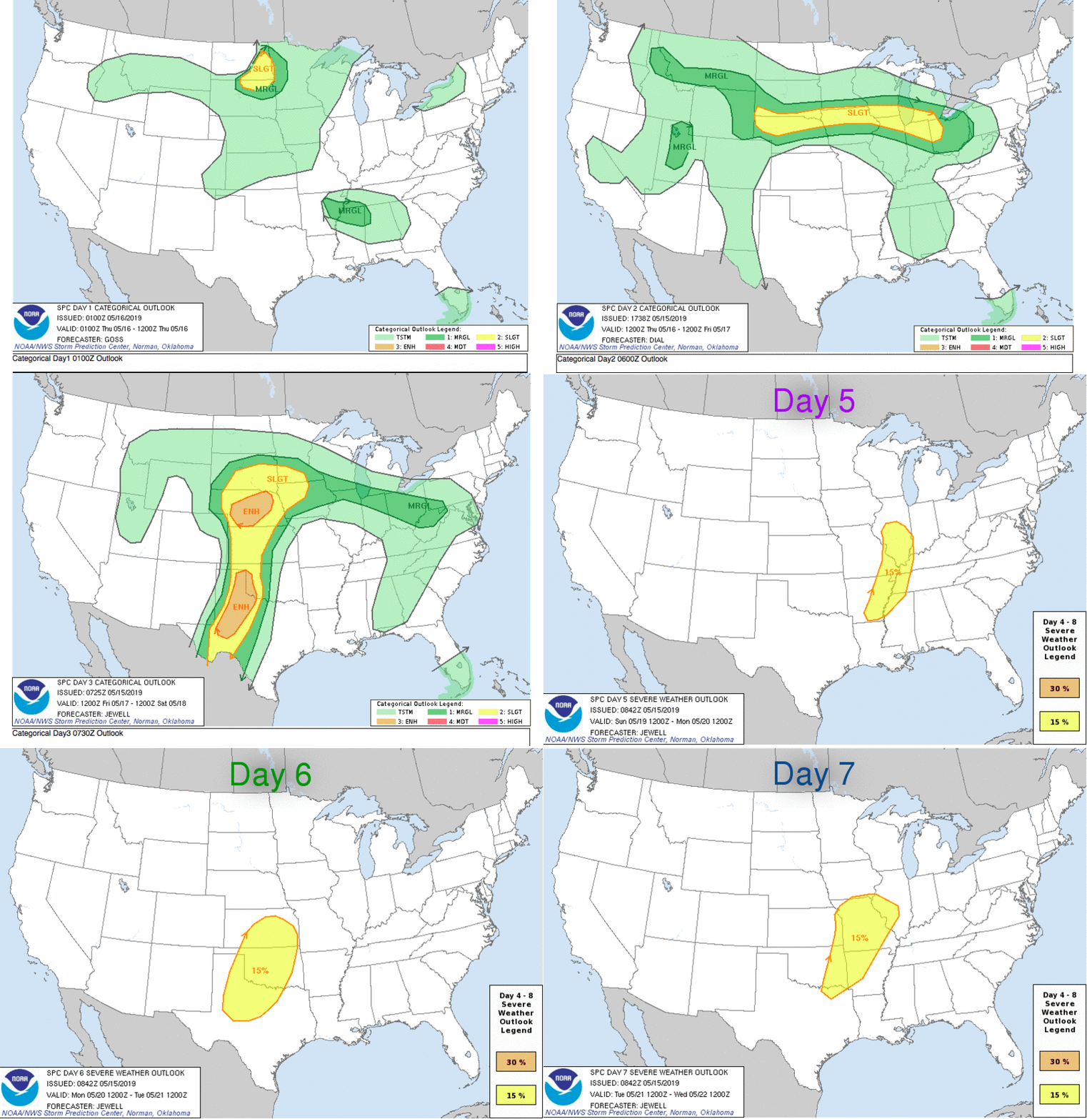
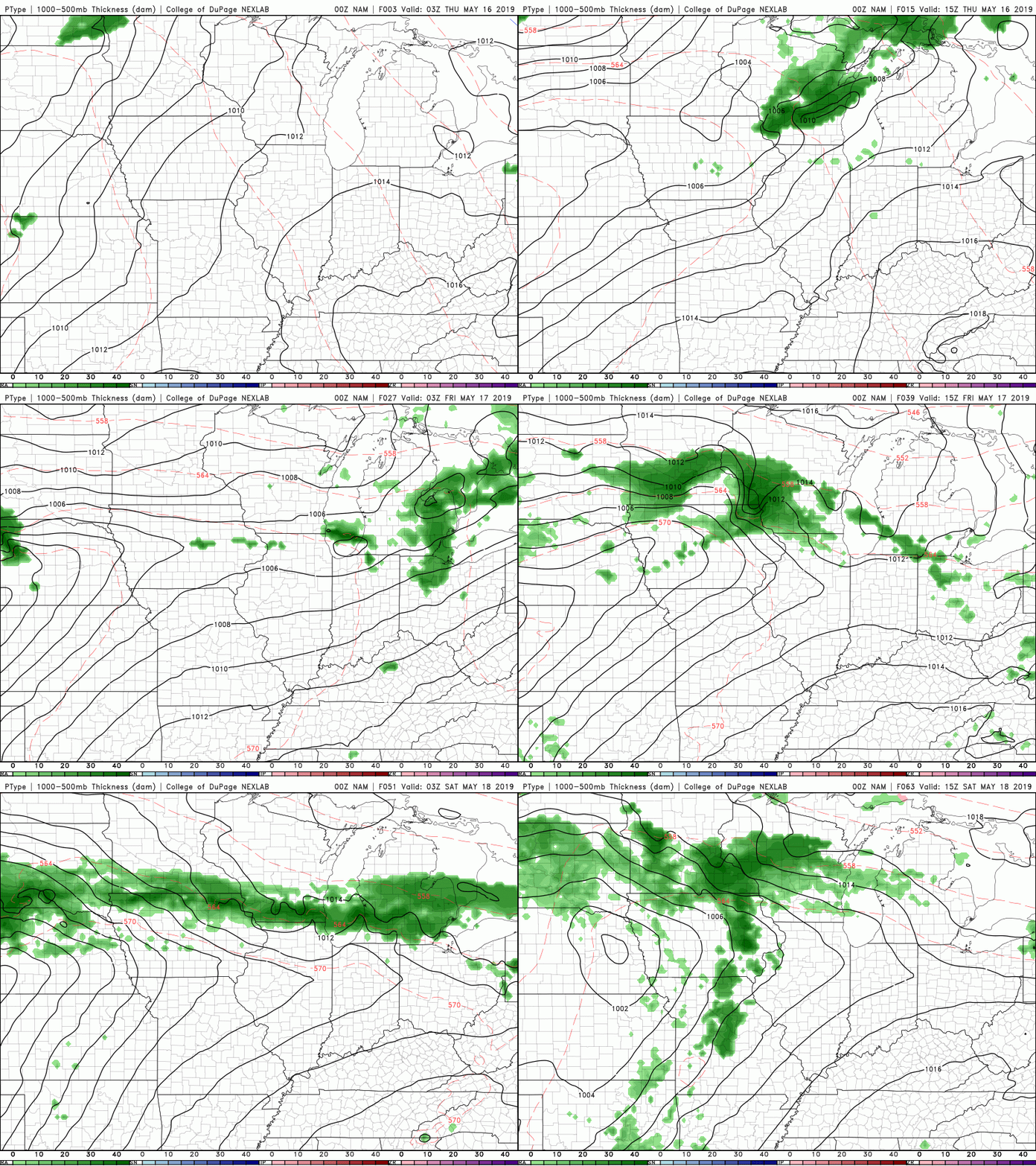
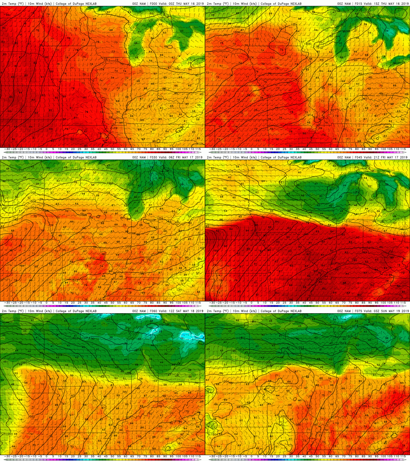
I hope everyone has a good remainder of their Sunday and remember to stay cool & hydrated this week (would be a good week for the lake or pool). Below is a quick guide reminding you the danger of heat in a parked car. Good evening and sorry I am posting so late. It has been a very busy past few days as I just graduated with a degree in meteorology and minor in GIS. Hopefully many of you have been keeping up with my tweets on Twitter (also seen to the right of our page). So.....Jumping right into the weather stuff, history was made Tuesday from the SPC (Storm Prediction Center). The SPC releases 8 day forecasts (daily) to give a general idea on any severe wether that may take place around the country. Tuesday was the first time EVER the SPC labeled severe weather possible for ever day of the 8-day forecasting period. The previous record was 5 consecutive days. Below you can see the latest SPC outlook and it gives severe potential up to 7 days out. This is something I will be monitoring, especially as we head later into the weekend and early next week. As of now, no severe weather is expected but we can see a few thunderstorms in our area. I hope many of you enjoyed the cooler weather recently as this will soon change starting tomorrow (Thursday). "Summer-time" heat and humidity will arrive by Friday, giving way to a hot and muggy weekend. Thursday looks to be seasonal with a high around 80, but Friday and into the weekend will be in the mid to upper 80's and high humidity. Because of this, we cannot rule out a day time pop up shower or thunderstorm. These will be short lived, but due to the heat and moisture present, these cannot be ruled out over the next few days. As you can see below, the NAM doesn't have rain arriving until Sunday, but like I mentioned, isolated showers/thunderstorms are possible during the afternoon hours due to the conditions. Below is one run of the heat that will be arriving Thursday and Friday and sticking around through the weekend. Tomorrow (Thursday) will be comfortable but Friday, Saturday, and Sunday will be in the upper 80's and those humidity values won't make things feel any better. Have a good rest of your week and brace for the mugginess as we move into the weekend.
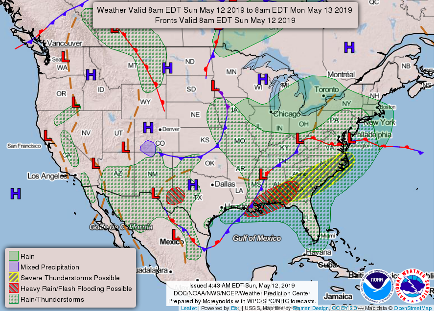
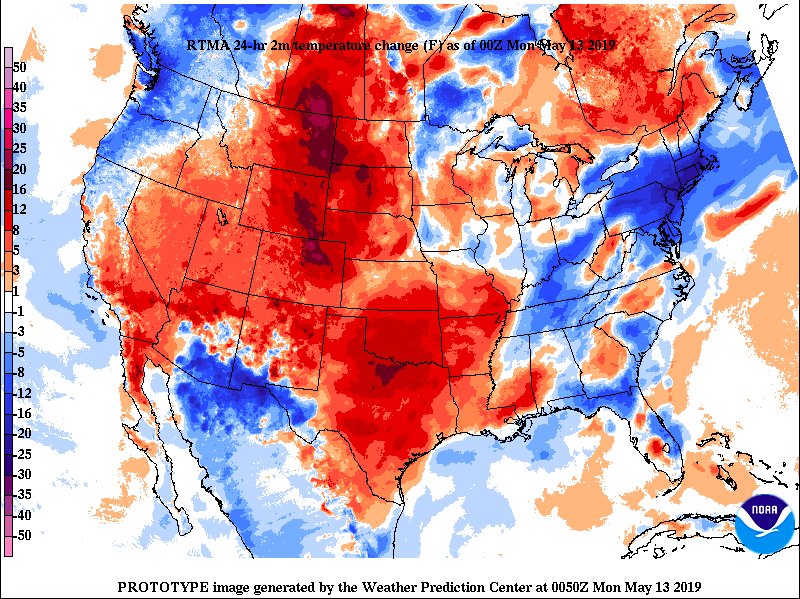
Happy Mother's Day to all mom's! I hope everyone has had a good weekend. It has been very wet with some locations receiving over 3 inches of rain the past 48 hours. Lucky for us, sunny skies are on the horizon. As you can see from the graphic below, we have had a slow moving front stationed over the southeast for most of the weekend. This will push eastward tonight allowing for a high pressure system (currently in Wisconsin) to fill its place. This means mr. sun will soon fill the skies the later half of Monday and through the first half of the day Wednesday. Along with lots of rain, I am sure many of you have felt the cooler temperatures associated with the front. This NOAA map shows the temperature change over the past 24 hours. These cooler temperatures will stick around the next couple of days leaving high's in the upper 60's and low 70's and low's in the upper 40's. To get an idea of what the norm is for this time of the year, we will be around 70 degrees for the next 2 days and the average temperatures for the month of May are in the upper 70's. Enjoy these cooler temperatures as they last, though, because more rain and warm temperatures (in the 80's) will arrive toward the end of the week. Below is a model run for cloud cover. Much of the cloud cover will move out overnight tonight allowing for a partly cloudy start to Monday. As we work through the day, drier air will in forcing clouds to move out and leaving sunny skies by Monday afternoon. You can expect sunny skies through the first half of Wednesday before the chance of showers returns. Enjoy some much needed sun and the cooler temperatures!
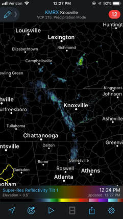
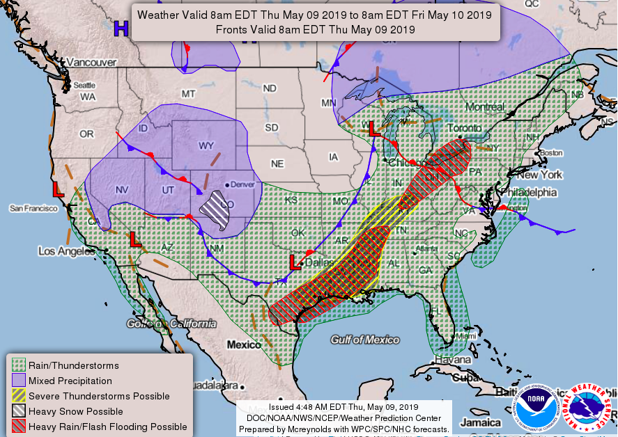
It has been pleasant but on the warm side the past few days. Sadly, this will change as the clouds have moved in and soon, the showers will too. Right now looking at radar we have a few light showers across the area in places like Loudon and Harriman. These showers will be moving east and will soon hit Oak Ridge, Maryville, and Knoxville. These showers will be light and short lived, so I expect little impacts. The bulk of today's showers will arrive this afternoon between 4-6. Use caution for those apart of the evening commute, as it will likely be a bit "wet and nasty". As you can see below, this "precipitation type" model shows showers likely moving in. These showers will likely be heavy at times with thunder embedded within. These should stick around until the overnight hours before moving out and leaving a mostly cloudy Friday. We cannot rule out some scattered showers and thunderstorms tomorrow, but these will be periodic throughout the day and relatively short-lived. To better paint the picture of what is happening weather-wise, this map shows the areas of low pressure in the country. Currently, a low to our north (in Wisconsin) is providing all the showers and thunderstorms we will receive this afternoon. As we move into tomorrow, a low pressure system will be making its way northeastward from northeast Mexico. With it, we can expect more showers and thunderstorms the later half of Saturday, Saturday night, and Sunday. By the start of early next week we will clear allowing for the sunshine to return. Stay dry and be cautious if you plan to be out. If you can get through the rest of the dreary week, lots of sunshine and comfortable temperatures (in the mid 70's) will return for the first half of next week.
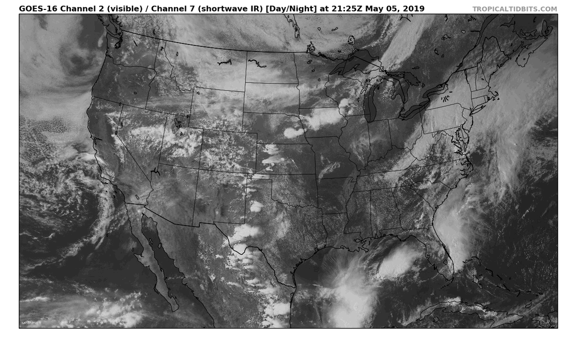
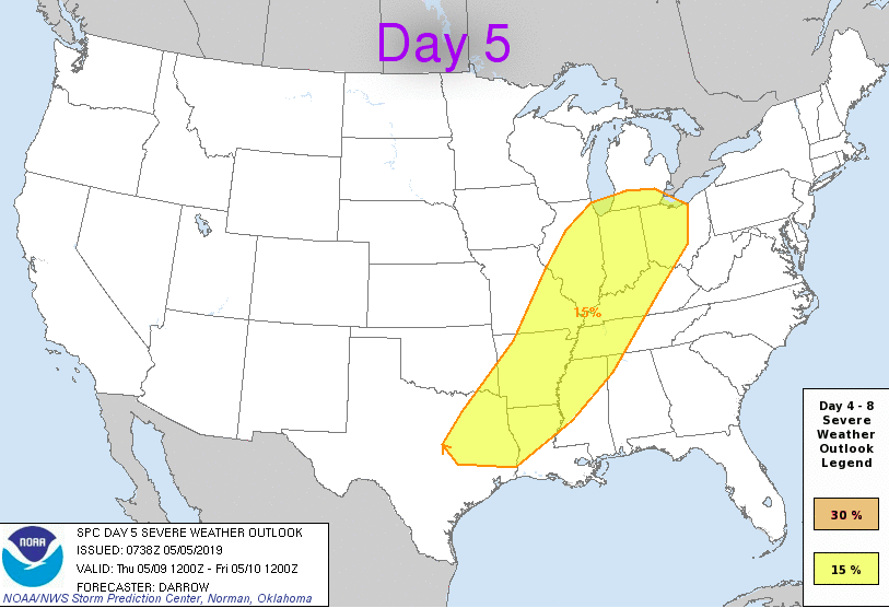
Happy Cinco de Mayo! It been a pretty wet weekend with roughly an inch to an inch and a half of total rain the past couple of days. Lucky for us, sunny skies return tomorrow for our Monday. We could start the morning with some patchy fog as dew points will be close to the temperature. As long as dew point values are within 2 to 3 degrees of the actually temperature, water vapor condenses to droplets and suspend, creating fog. As for now, you can see (below) clouds have been moving out the past few hours and will continue to overnight. Moving into Monday and Tuesday, clouds will remain out of the area giving us plentiful amounts of sunshine. Backed with the sun, will be comfortable temperatures in the low 80's. Mid week, showers will yet again find their way back into the Tennessee valley. Wednesday we will stay mostly dry with a few showers/thunderstorms possible in the later half of the day and overnight. Thursday will contain showers and thunderstorms on and off throughout the day. Something I am keeping an eye on is the severe threat Thursday into Friday. The SPC released the day 5 outlook (below) showing the chance of severe weather. As of now, the conditions are setting up to be favorable for a shot at some severe weather potential in western Tennessee, but not the eastern portion. Obviously, we are a number of days out so data will likely change. The trend so far has this system likely to impact us a bit sooner Thursday, which could land that yellow hatched circle a bit farther east (into our area). I will keep you posted on how this next system evolves. Until then, enjoy a pretty start to the week before the clouds and rain conditions arrive back mid-week.
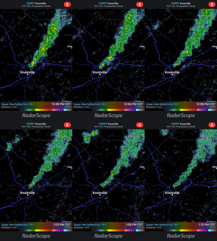
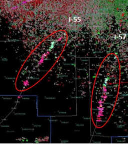
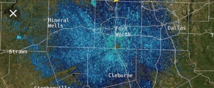
Good evening! An interesting phenomena occured today in Knoxville. Shown below is a few radar scans showing what you may think is rain BUT is actually smoke. A large fire occurred today in north Knoxville at a recycling plant and these smoke particles were reflected back to the radar beam. Seen below is the dense smoke associated with the fire today. This isn't the first time radar has picked up some quirky things other than precipitation. Other than the smoke (seen above), radar tends to pick up other things too. Seen below (from left to right), are examples of radar picking up dense traffic on interstate 55 and 57 to our south. The right image depicts a large amount of birds during their yearly migration. Now Getting Into The Weather...It has been a warm, summer-like week thus far with high's in the mid to upper 80's. Luckily, temperatures will be back in the 70's into this weekend. As for tonight and into tomorrow, scattered showers and thunderstorms are possible. Currently, there are some heavier thunderstorms in Loudon and Sweetwater moving northeast. Along with these storms is the chance of 1/2 inch hail and winds gusts of 45+ mph. Overall, we will stay mostly cloudy tonight and tomorrow with those scattered showers possible as I mentioned above. Below shows a modeled radar of rain showers from now until Sunday morning around 1am. Obviously, this is not exactly what will happen, but it paints the picture that scattered showers are likely over the next few days with the heaviest showers arriving Saturday and Saturday night. The severe potential looks low, but we cannot rule out the chance of some heavier storms over the next few days (especially Saturday). Sunday showers will end early leaving clouds to decrease as we move through the day. Next week we will start the week pretty with sunny skies and high's back in the 80's. Don't forget the umbrellas the next few days as you could encounter some pop-up showers and storms. The entire system should be moved out by Sunday morning, leaving this day your most productive outdoor day this weekend. SIDE NOTE: we have added Facebook as one of our platforms of releasing weather information in east TN. I know many do not have Twitter, so we have expanded to include Facebook. We are excited about what is to come, so help us by sharing and liking our new page shown at the link here: As always, we will keep you updated on any changes that may occur in the weather world here, Twitter (@SecretCityWX), and on our Facebook Page. For all our platforms, check out our "Contact" tab (located at the top of our site).
|
Your trusted source for everything weather in East Tennessee.
Social Media
|

