|
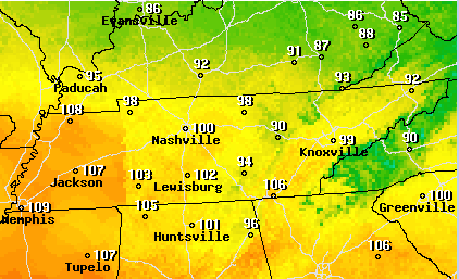
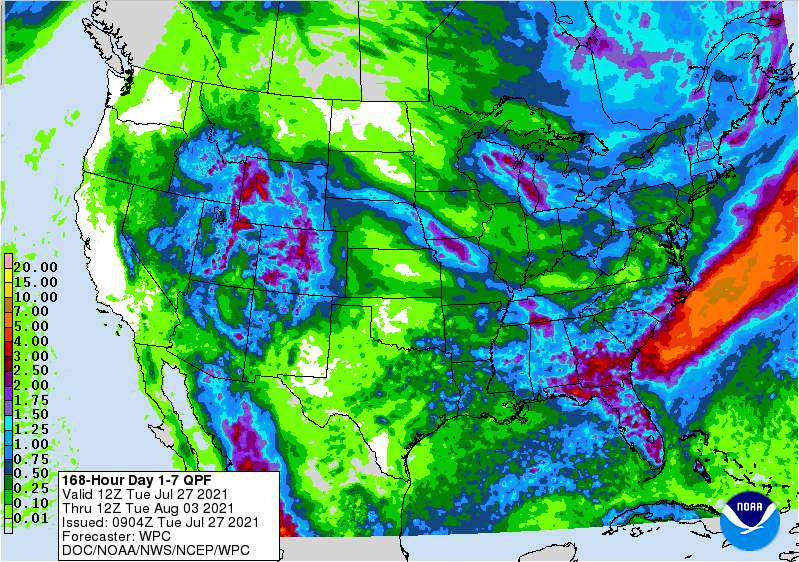
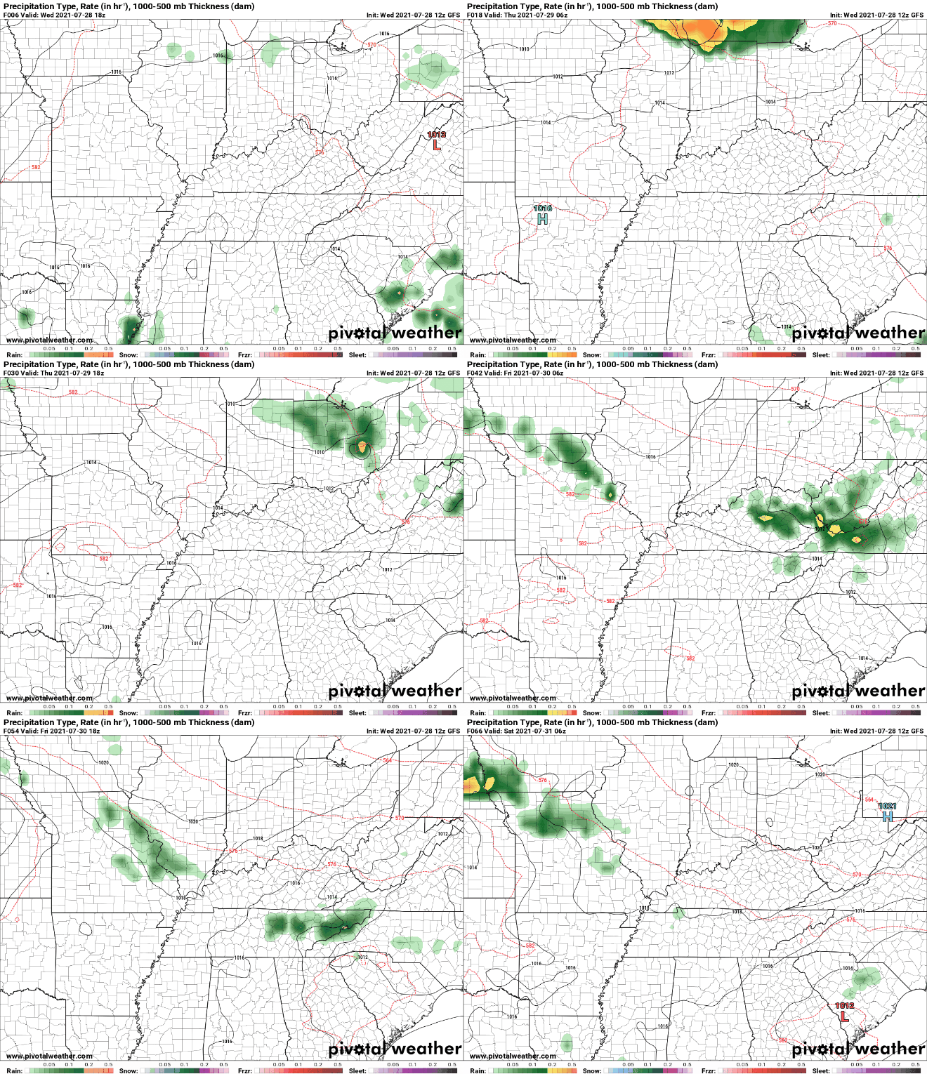
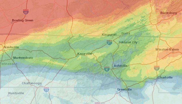
Though temperatures today are a bit cooler, the high humidity is making things feel just as hot. Below is the heat index forecast for this afternoon site-wide. Parts of Western Tennessee could be as high as 110 before days end. Looking ahead, our best chance of rain comes Sunday. As a system works through, we'll see widespread shower and storm chance on Sunday afternoon. This will provide cooler temperatures as well with highs to be in the low to mid 80s. Cooler temperatures (mid 80s) will continue into early next week as well. Overall rain totals for the next 7 days looks minimal. The bulk of precipitation will be to our west with an average of 0.25-0.5" expected across East Tennessee. This could add to the drought conditions seen statewide, so we'll keep a close eye on any changes in the weeks ahead. Another warm and muggy one is on tap for Saturday before a chance for showers & storms cools things down Sunday and into next week. Have a good weekend! Pre-recorded for 5pm show
0 Comments
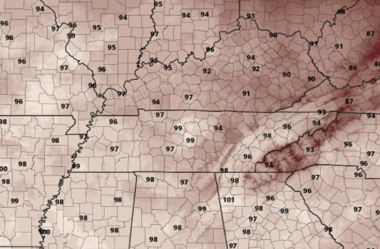
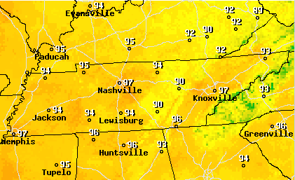
Good afternoon! Another hot one is in the plans for today. Below is the forecasted highs from the NWS today with most valley locations expected to be in the upper 90s. For reference, the record for today in Knoxville is 101 (set back in 1952). Though I don't think we will beat that we will likely be close before days end. We will continue to emphasize your heat safety today and tomorrow as temperatures and feel-like temps will be in the 90s and triple digits. As we work ahead, a cold front will drop down from the north. This will bring not only a relief from the heat into the weekend, but also the chance for showers & storms Friday and through the weekend. With the front not arriving until late Friday into Saturday, temperatures will again be hot and muggy to end the work week tomorrow. Temperatures will more than likely be the hottest of the summer this afternoon before cooling Friday and returning towards normal by the second half of the weekend. We will ride a more "normal" train into next week with highs in the mid to upper 80s each day. Pre-recorded for 5pm show
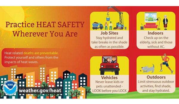
Good afternoon! We have been emphasizing heat safety the past several days because this week could be the hottest we see all year long. This graphic is from the NWS highlighting important heat safety tips to follow. As we work into Thursday, the heat will continue. The major cities around the Volunteer State will find the mid to upper 90s with Knoxville, Nashville, and Memphis all expected to be at 97 degrees. This doesn't account for what the feel-like temps will be (100s). With high pressure locking in hot and dry temperatures, don't expect much in the way of rainfall today or tomorrow. By Friday we could see a few isolated showers/storms trickle in from the north but most should stay on the dry side. Unfortunately, that means we'll see dew points and that muggy week increase. This will lead to feel-like temps up to 110 for some. It is important to drink water, stay cool, and react to any signs of heat-related illnesses. We will see some cooler (yet muggy) temperatures into the weekend with highs to be in the 80s for most. That trend of near norm temps will continue into early next week as well. Pre-recorded for 5pm show
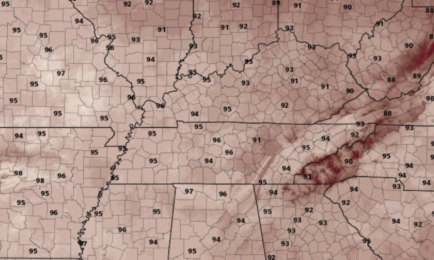
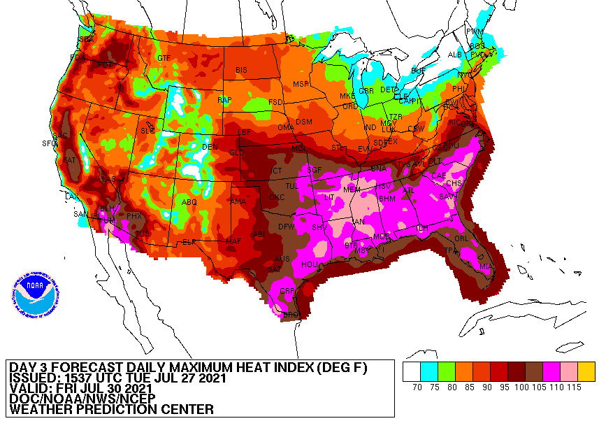
A few showers will be possible again today, but mainly for the far southern counties of Tennessee. This is where the front is currently positioned and where the best forcing will be. For the remainder of us, it should be a fair day with partly cloudy skies and highs in the lower 90s. Dew points will remain high but lower as northerly flow begins to take over. Looking below, these are the forecasted highs for Wednesday. As you can see, these will be the highest temperatures we have had all summer ranging in the mid to upper 90s. Thursday will be even warmer, so prepare for a hot one ahead. In addition to the hot temperatures, heat indices will make things feel even worse. Looking at the heat index map, nearly all of the Southeast is in the purple or higher. This means feel-like temps 105+ on Friday. Drink plenty of water, limit your outdoor time as much as possible, and stay cool. With the hottest days of the summer coming up on us tomorrow, make sure to properly prepare for the heat. I still wouldn't rule out a heat advisory given the highs and heat indices expected. Stay tuned for updates and be sure to stay cool! Pre-recorded for 5pm show
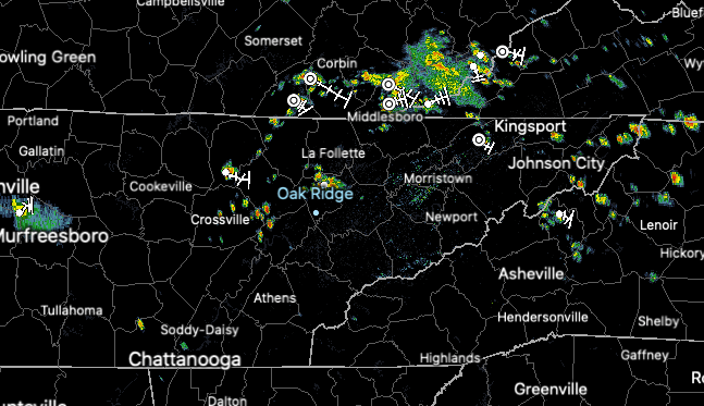
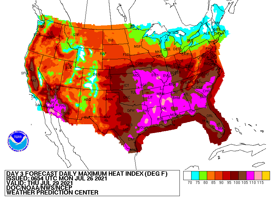
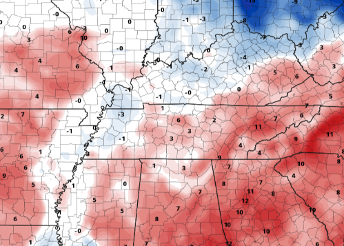
It is early in the afternoon and we are already seeing scattered showers & storms developing across the area. With a frontal boundary sitting to our north, anticipate more activity to develop through the next several hours. Locally heavy downpours, lightning, and gusty winds are all possible. Looking ahead, the biggest threat this week will be the heat. Feel-like temperatures (as we saw yesterday) will again be near to in the triple digits. To add to the issue, highs will continue to warm to find the mid and upper 90s Wednesday and Thursday. Looking below, feel like temps across East TN will be in the 100-105 range while Western TN is closer to the 105 to 110. Comparing highs in the mid to upper 90s with our typical average, we'll be 10+ degrees in some locations. Luckily, we will see a slight improvement Friday and this weekend as high pressure breaks down and rain chances/cloud cover return to the area. Be sure to adhere to any watches/warnings/advisories issued in the days ahead. I would not be surprised to see a heat advisory issued from the NWS for the heat and feel-like temps expected through the week. Drink & have plenty of water, take breaks, and limit outdoor time as much as possible. Pre-recorded for 5pm show
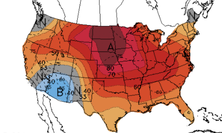
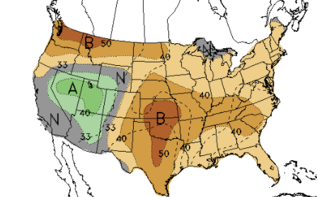
Smoke continues to fill the skies today as large wildfires continue to hit the Western US and Canada hard. This could create some health-related problems for some, so stay abreast to any alerts that are issued. After a fairly wet summer thus far, the end of July looks to be both warmer and much drier. Looking at the latest release from the CPC, most of the USA should expect above average temperatures. We will see that beginning this week as highs today and through early next week will be in the low (& for some) mid 90s. Precipitation will also be below average with parts of the West expected to be above the norm (much needed). As a front fades out to our south, mostly sunny skies can be expected across the Volunteer state. An isolated shower can't be entirely ruled out across the TN/GA/AL border, otherwise dry and hazy at times. This will be the trend again for Thursday before isolated afternoon pop-up showers/storms find us Friday and through the weekend. Keep your heat safety in mind. Not only will temperatures be hot but muggy conditions will make it feel that much warmer. In fact, some could find feel-like temps near the triple digit mark this weekend. Pre-recorded for 5pm show
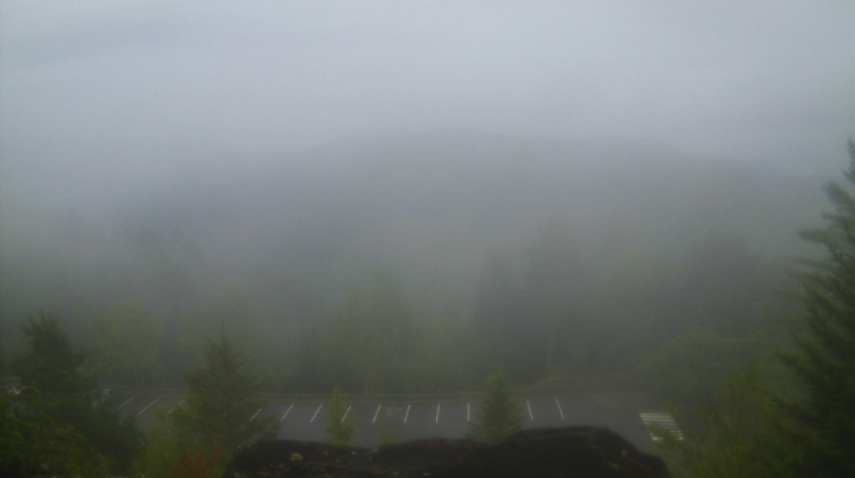
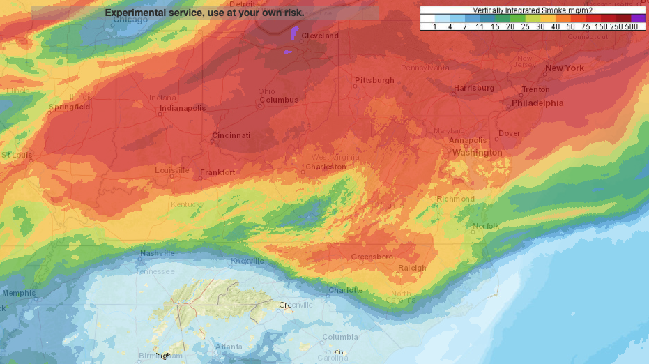
Good morning! The latest view from the Smokies shows dense fog, while patchy fog can be seen around valley locations. Take a little extra time to get to work & school this morning. For this afternoon, isolated showers & storms will be possible with highs in the low to mid 80s. We do have some light ongoing showers along the southeast (Chattanooga and east), which will be the primary area for any activity today. Something we don't typically see in East Tennessee is smoke. Looking at the vertically integrated smoke model, numerous wildfires out west and in Canada, along with high pressure, has allowed for smoke to fill in our upper atmosphere. This is especially true through Ohio and further north. Knoxville remains in the "green" but for those traveling north over the next day so could run into health related issues for those more prone to such exposure. This will also make for good sunsets for you photogenic folks! Don't forget to share them with us via Twitter/Facebook/Email. As for rain & storm chances ahead, things look to dry out a bit. Activity isn't entirely out of the question but with a front well to our south tomorrow and high pressure to our north and west, things will be warmer and drier. As the pattern shifts, scattered showers/storms will return for Friday and continue (mainly in the afternoon) through the weekend and early next week. Temperatures will also be very warm with highs running in the low 90s and feel-like temps nearing 100 for some. Today will likely be the coolest of the days ahead, so take advantage. High pressure will build in for Wednesday drying things out and warming temperatures up. Take a look at our video forecast below for more. Pre-recorded for 5pm show
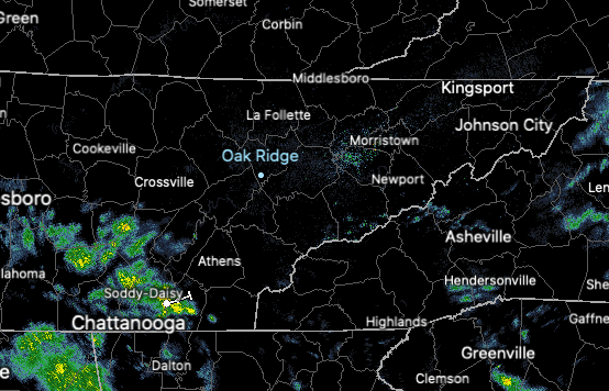
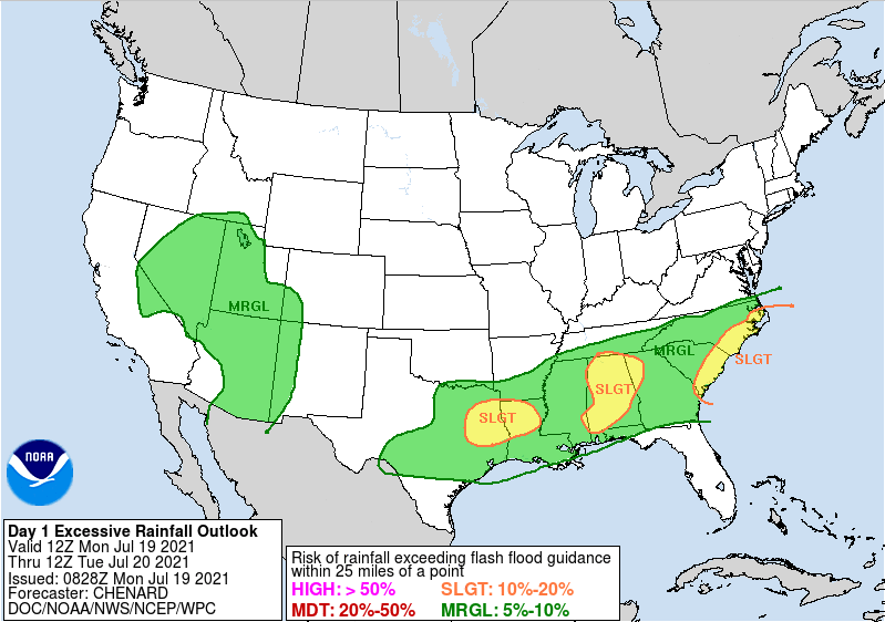
The latest radar scan does pick up on scattered showers across southern TN this morning. A front hangs across this area, providing the kick needed for activity this afternoon and again into Tuesday. Highs will generally be cooler as a result, topping out in the lower 80s today and tomorrow. With the front in place and rainfall we have picked up over the last several days, the WPC has continued to keep the area under a Marginal risk of flash flooding. Those near water bodies, flood prone areas, and low-lying locations should use extra caution. Parts of East TN remain under a Marginal risk into Tuesday as well. Looking at future guidance, scattered showers and storms will be the main story today and Tuesday. As the front exits, Wednesday will likely be the driest day of the week. Highs will warm up as well, finding the upper 80s Wednesday and through the end of the work week. Showers and storms will continue to pester us on and off this week, but drier conditions are expected for the end of the month. Take a look at our video forecast below for more details. Pre-recorded for 5pm show
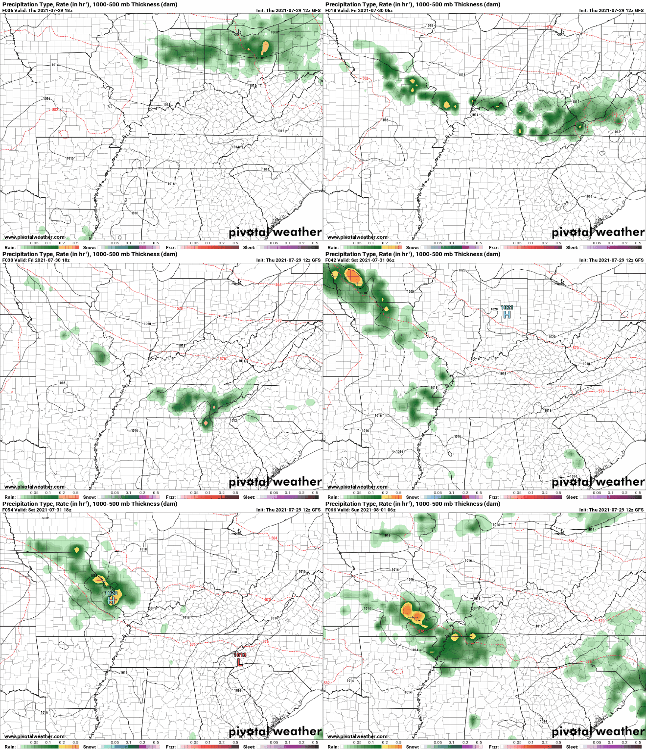
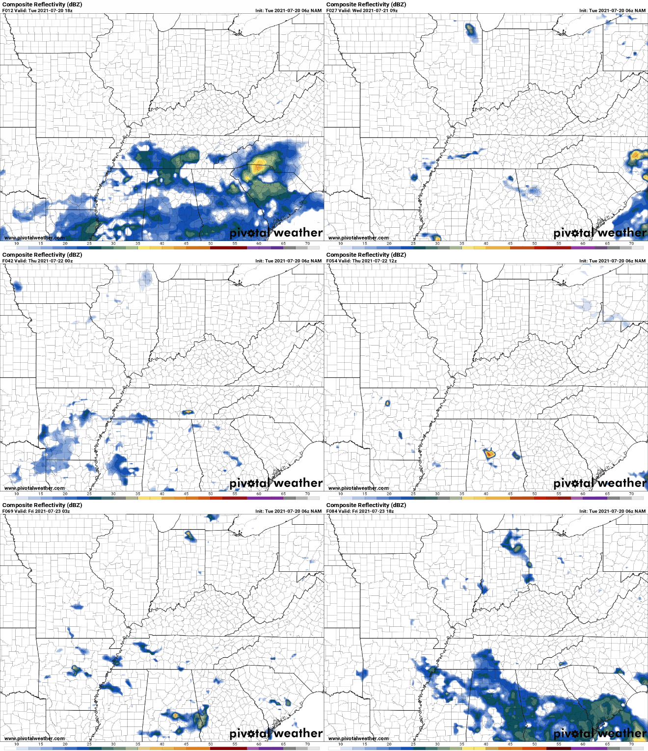
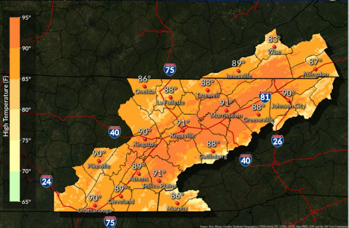
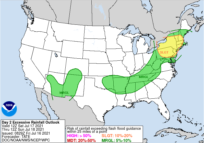
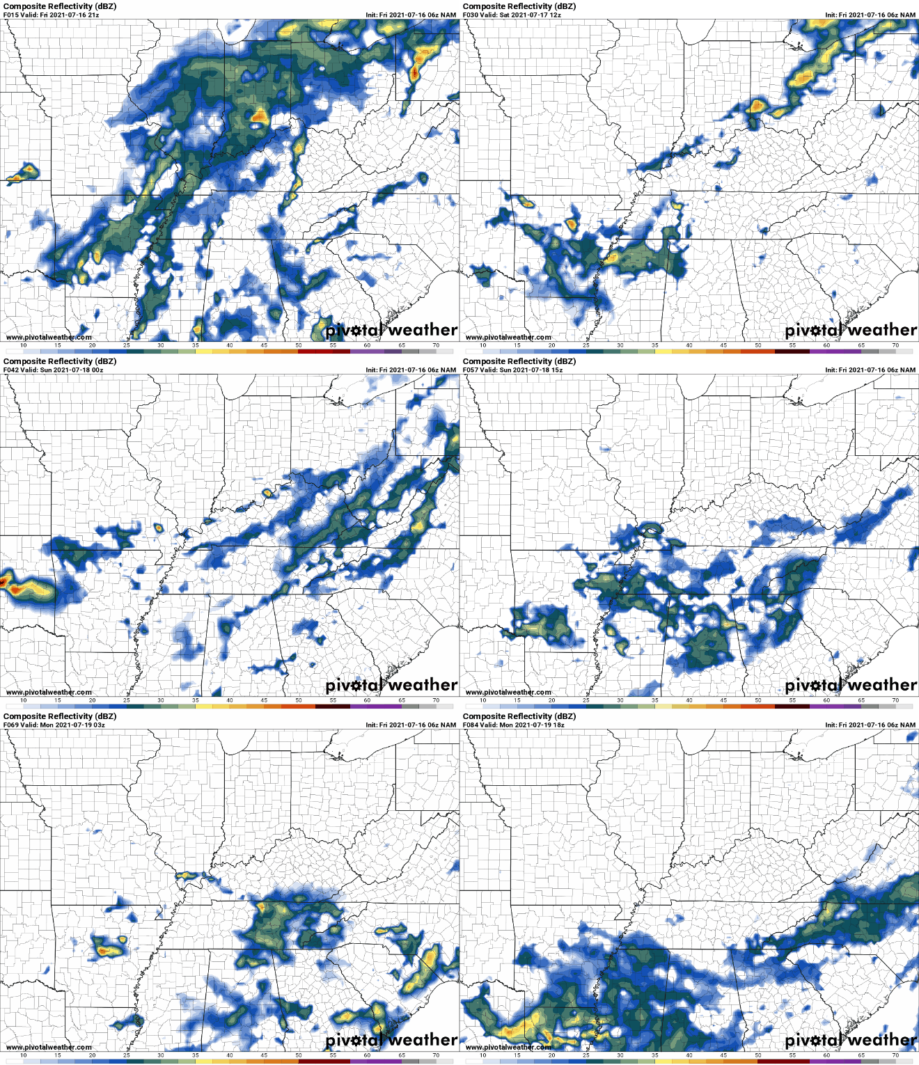
Good morning! Showers again will be fairly contained this afternoon with only isolated chances and mainly in the higher elevations. Unfortunately, temperatures look to continue warming with highs ranging from the upper 80s to lower 90s. The humidity will only make things feel even warmer this afternoon. Cloud cover, storms, and a front will reduce highs to the lower 80s this weekend and early next week. Given the nature of this slow moving front, the WPC has placed East Tennessee (and the entire state) under a Marginal Risk for flash flooding both Sunday and Monday. There is still some uncertainty in strength, which could bump up the rain forecast late weekend and early next week. We will keep a close eye, but use caution if you are in flood prone areas or near water bodies. A break down of the activity can be seen below. This model tends to be our "wetter" solution. Activity will likely be a bit more limited this afternoon than what is suggested, but widespread activity will follow for the weekend and into Monday. Overall rain totals will be between 1 and 3 inches with higher amounts likely in "training storm" situations. Keep close to a cellphone or computer....we will provide updates throughout the weekend with the latest in regards to these storms. Fortunately, drier conditions look to present themselves towards the middle of next week. Stay safe and don't forget to provide us reports via email or social media! Pre-recorded for 5pm show
|
Your trusted source for everything weather in East Tennessee.
Social Media
|

