|
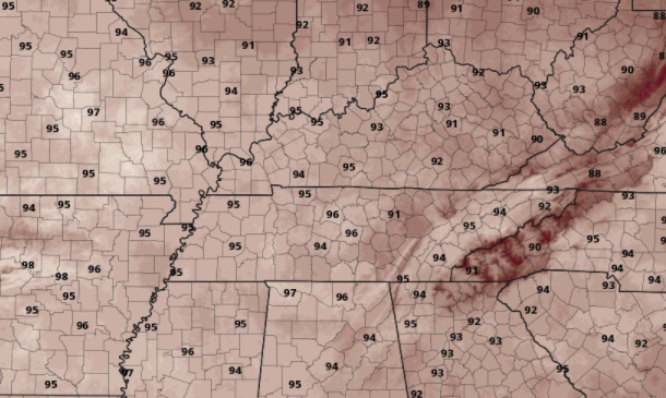
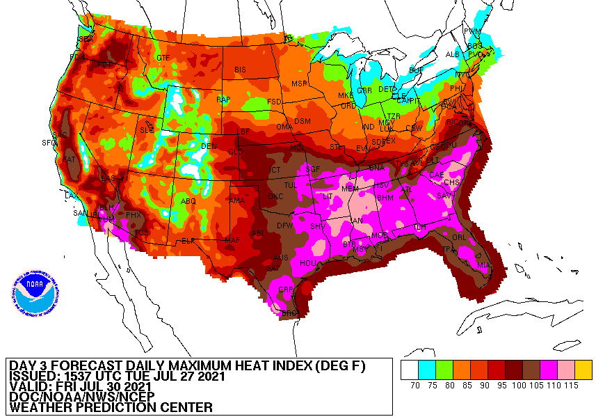
A few showers will be possible again today, but mainly for the far southern counties of Tennessee. This is where the front is currently positioned and where the best forcing will be. For the remainder of us, it should be a fair day with partly cloudy skies and highs in the lower 90s. Dew points will remain high but lower as northerly flow begins to take over. Looking below, these are the forecasted highs for Wednesday. As you can see, these will be the highest temperatures we have had all summer ranging in the mid to upper 90s. Thursday will be even warmer, so prepare for a hot one ahead. In addition to the hot temperatures, heat indices will make things feel even worse. Looking at the heat index map, nearly all of the Southeast is in the purple or higher. This means feel-like temps 105+ on Friday. Drink plenty of water, limit your outdoor time as much as possible, and stay cool. With the hottest days of the summer coming up on us tomorrow, make sure to properly prepare for the heat. I still wouldn't rule out a heat advisory given the highs and heat indices expected. Stay tuned for updates and be sure to stay cool! Pre-recorded for 5pm show
0 Comments
Leave a Reply. |
Your trusted source for everything weather in East Tennessee.
Social Media
|


