|
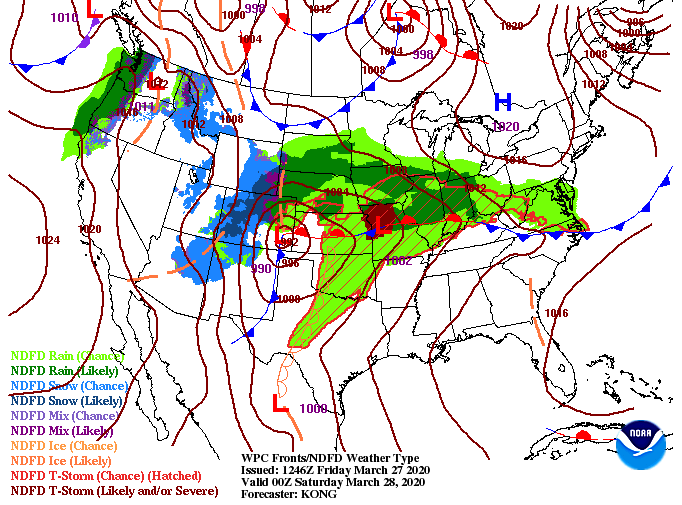
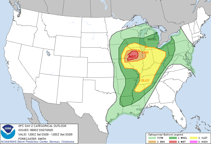
I hope you are having a good Friday! Looking at the latest surface map below, a powerful system will begin setting up this afternoon and Saturday. With a strong jet in place to the north, severe activity is likely in parts of Missouri and Illinois. Looking at the day 2 outlook, a MODERATE (4/5) risk is in place for northern Illinois tomorrow. This means a severe weather outbreak is likely tomorrow with large long track tornadoes, large hail, and damaging winds all possible. As we get closer to home, the Knoxville area sits under a marginal risk with a slight risk for middle and western TN. Looking more in depth at our next weather maker, a line of showers & storms ahead of a cold from will begin working through tomorrow afternoon (from west to east). The timing of this line comes in the overnight hours and into early Sunday morning (this is good news). As we get into the overnight hours, instability will begin to die off, decreasing storm activity as the night progresses. We'll likely see some gusty winds and areas of heavy rain but severe risks are low. Nonetheless, pay close attention for updates throughout the day so you know what to expect late tomorrow. If you haven't already, go out and enjoy the warmth and spotty sunshine before shower chances increase throughout the day tomorrow. Sunday looks to be pleasant the second half of the day with high's in the mid 70's and broken cloud cover. Enjoy your weekend!
0 Comments
Leave a Reply. |
Your trusted source for everything weather in East Tennessee.
Social Media
|


