|
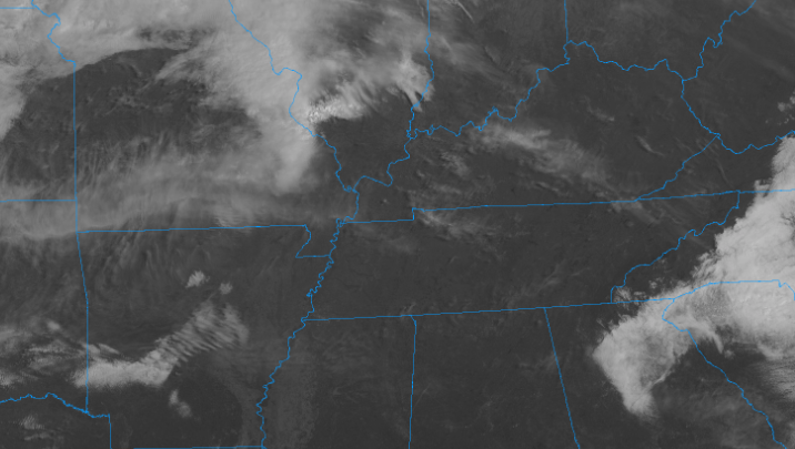
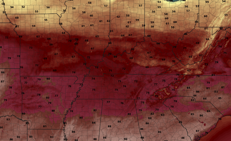
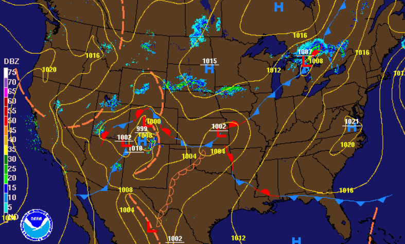
Looking high in the skies above is the latest satellite imagery showing sunny skies across the state. Expect this to be the main story through the day today and into the overnight hours. If you look toward the north and west, cloud cover is beginning to develop. This next system will shift winds out of the south, drawing in very warm temperatures tomorrow afternoon. Tomorrow's high's could be record setting in the low to mid 80's. Not only will it be hot in Tennessee but southern Georgia, Alabama, and Mississippi can expect high's in the lower 90's (Summer-like heat in late March). Tomorrow's high temperature record stands at 84 degrees (set back in 1910) so we'll be keeping a close eye and let you know if we manage to surpass that. Looking ahead, the high to our east (contributing to the beautiful weather we have had) will continue to work out of the area. Cloud cover will begin increasing through the day tomorrow with showers eventually working in the later half of Saturday. Model guidance picks up on these showers working through mainly in the overnight hours and into early Sunday morning. With the timing coming in the overnight hours, instability factors quickly diminish. We'll continue to monitor this closely though, as strong to severe storms could develop in western TN early in the day. For the time being expect this system to die out overnight providing moderate showers and cooler air into Sunday and Monday. Enjoy some outdoor time if you have the opportunity today as it will be a beautiful one! If you are panning a hike or walk, send us your views by tagging us on Twitter/Facebook or sending them to [email protected]
0 Comments
Leave a Reply. |
Your trusted source for everything weather in East Tennessee.
Social Media
|


