|
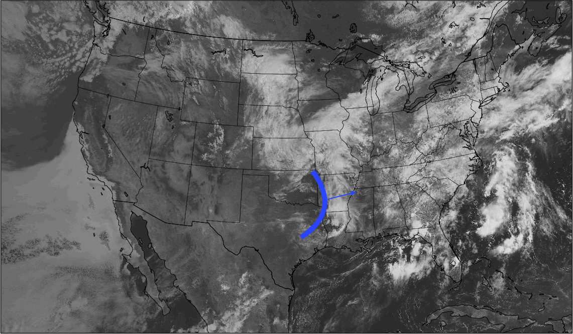
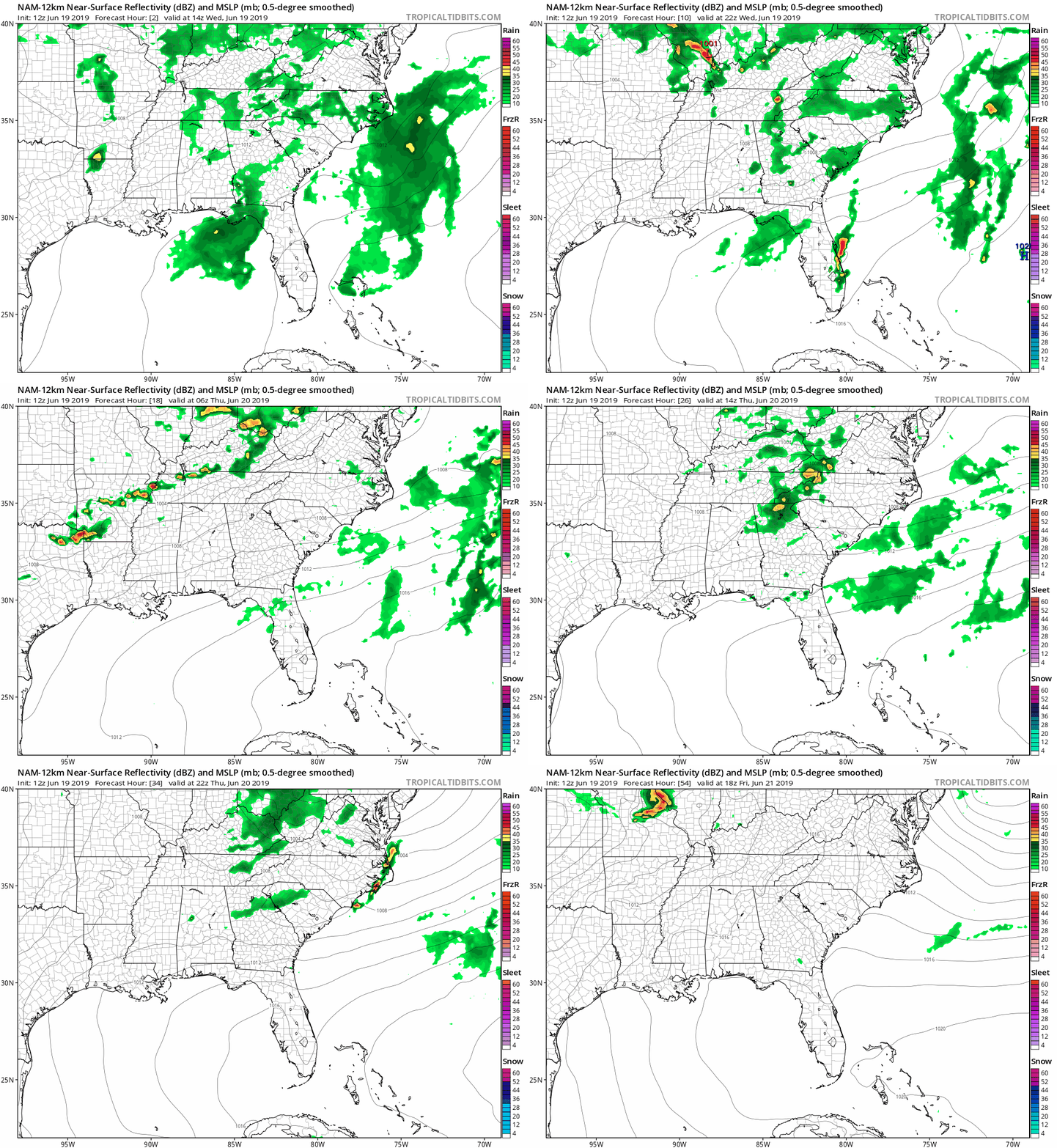
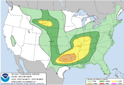
It has been an active pattern as of late due to rounds of energy known in the meteorology world as "shortwaves". These can be thought of as spokes of energy off of a larger long wave trough (associated with a low pressure system). These shortwaves can be caused for a number of reasons ranging from cold air to vorticity (spinning winds). In this case, shortwaves have moved into a warm and moist environment, perfect for thunderstorm production. Looking at satellite below I have annotated where a cold front is associated (blue vertical line). This cold front will force lots of energy into an area (as I described) rich for thunderstorm production. Fortunately for us, this system will be passing through during the overnight hours where day time heating won't play a part. It will be interesting to see the latest 18z HRRR model run and how it takes this system. I will tweet and update you the details from these runs later this evening via Twitter and Facebook. As for now, continue following along below for thoughts on tonight into tomorrow. As I described, a cold front will help in the supply of energy ahead of this system. This, combined with a lower level jet (forcing warmth, moisture, and winds overnight) will help with the possibility of severe storm production. Overall, I believe the environment is conducive to see a few severe thunderstorm warnings, but the track of this system has the largest risk of severe weather to our north in south central Kentucky. Checking out below, you can see what I am referring to, as much of the heavier rains are in the plateau and to the north, in KY. As I mentioned, it'll be interesting to see how the models will handle new data as it comes in. The models are in agree-ance with the track, it is timing that is troubling to pinpoint. Moving forward from tonight into Thursday, we will begin to clear out a bit leaving only isolated storms Thursday night. Friday will likely be your best day for any outdoor activities as another pocket of energy will move through Saturday. As for high's over the next several days, we will be in the low 80's with temperatures increase into the mid to upper 80's by Friday and this weekend. Below is the latest SPC outlook for severe potential across the USA. If you reference the previous map (posted on our social media pages late last night) the SPC did move the slight risk further east as expected. As for how much more they will move it is still in question, but my guess, not much if any. In my opinion this will likely stay mostly the same. For our forecast, severe weather is possible across east TN with likely isolated areas of severe thunderstorm warnings very late "tonight" and into Thursday morning and again in the afternoon. The heaviest portion of this system will arrive between the 7-9 o' clock hour, so use extreme caution for those apart of the morning commute. Impacts could include isolated areas of strong winds, hail up to a quarter in size, thunder, and downpours. Another round of strong to severe storms are also possible in the afternoon hours, but these will be more scattered. Remember to stay up to date with Secret City Weather on our social media sites or through our website here by viewing all of our tweets (on the right side of the home page). Have a good rest of your afternoon and stay "Weather Aware" tomorrow morning.
0 Comments
Leave a Reply. |
Your trusted source for everything weather in East Tennessee.
Social Media
|


