|
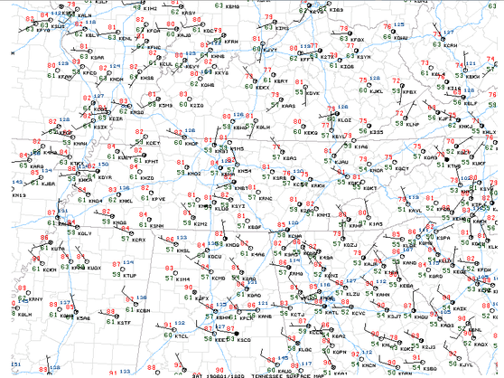
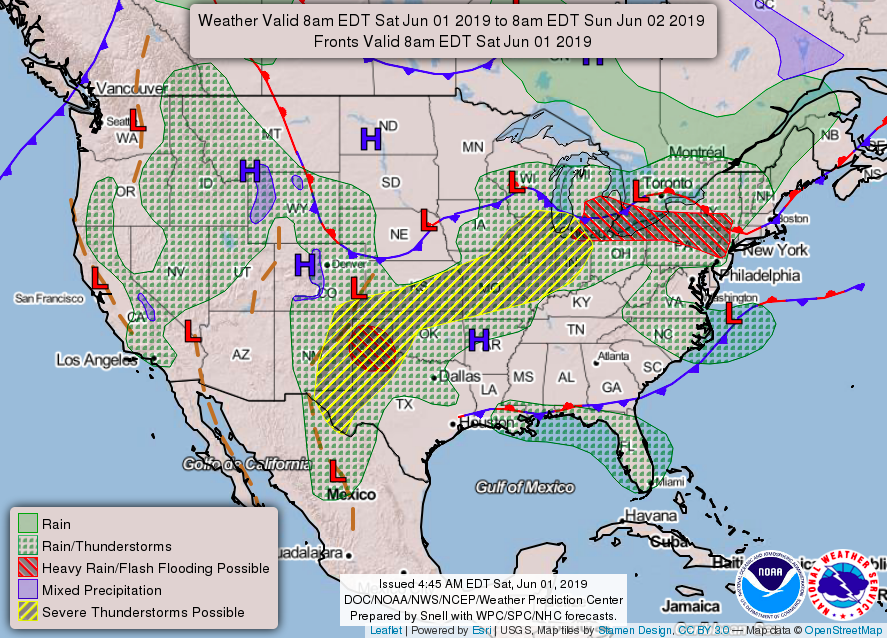
Following a very strong ridge that moved out earlier this week and a cold front bringing scattered storms, we are left with comfortable temperatures back in the low to mid 80's. Looking at surface observations, we see winds are light at around 5 mph out of the northwest. Temperatures are currently in the lower 80's with mostly sunny skies. For the rest of the weekend and early portion of next week, expect it to be comfortable. The next several days will be filled with sunshine and seasonal temperatures. Tomorrow (Sunday) looks to be the best chance of rain for the area until mid week. As a weak disturbance moves through Sunday, a few scattered showers/storms are possible in the afternoon and early evening hours. Once the front moves through, expect cooler temperatures to follow. Below is the forecasting map for the United States, as of this morning. The low pressure system to our north is providing the setup for a few scattered storms Sunday afternoon and early evening. Once the front moves through, we will have a high pressure system tail and bring beautiful conditions for the first half of the work week. Below is a running precipitation type model run showing those scattered tomorrow afternoon and evening. Most of the storms will be in the plateau and mountains (to our east) but isolated showers for the valley cannot be ruled out. Heading into Monday we will dry out leaving a beautiful day with high's in the upper 70's. (Hint: another good weekend for the lake & pool) The gif below shows the predicted temperatures across the region over the next couple of days. As you can see, Monday is expected to be comfortable with high's topping out in the upper 70's. A weak cold front will allow for slightly below average temperatures and sunny skies for the start of the work week. Enjoy the seasonal conditions before the threat of rain returns mid-week.
0 Comments
Leave a Reply. |
Your trusted source for everything weather in East Tennessee.
Social Media
|


