Secret City Weather
  • Home
  • About
  • Store
  • 5-Day Forecast
  • Radar
  • Services
  • Contact & More
    • Submissions
    • Almanac
    • Contact
  • Home
  • About
  • Store
  • 5-Day Forecast
  • Radar
  • Services
  • Contact & More
    • Submissions
    • Almanac
    • Contact

August 27th, 2020

8/27/2020

0 Comments

 
This is what now remains of Laura as she works east this morning. A few light showers have popped up on radar and will continue to work in from our south and west. The bulk of activity will arrive later today providing heavy rains, gusty winds, and a few rounds of lightning.
Picture
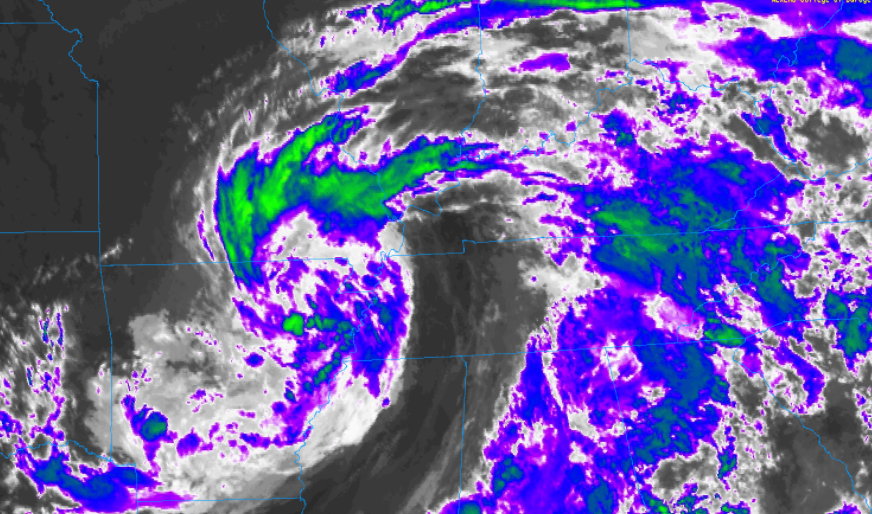
The regions greatest threat remains flash flooding. With several inches likely to fall in a 24-hour period, water levels can rise quickly. The excessive rainfall outlook shows a slight risk (10% - 20%) chance of flash flooding potential across Tennessee and Kentucky. Take the proper precautions now if you are in low-lying and flood prone areas. 
Picture
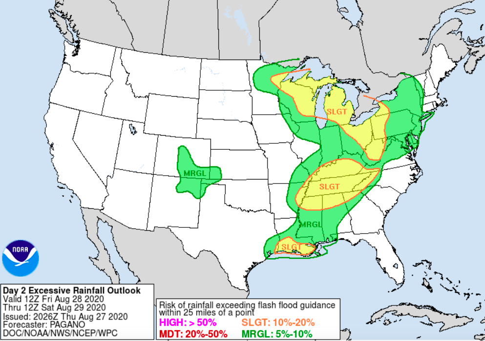
In addition to the heavy rainfall we will see at times this afternoon and overnight, wind gusts will pick up throughout the day. Anticipate a steady south wind between 10-15 mph and gusts up to 25. For those in the Plateau, wind gusts will be closer to the 30-35 mph range. If you have any lose objects in the yard, be sure to pin those down or bring them inside. 
Picture
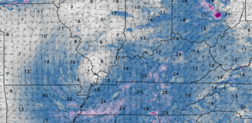
The latest run from high-res guidance shows heavier showers and storms arriving around the evening commute. Heavy rain rates will impact visuals, so use extreme caution. Another round of heavy rain, as Laura works across the area, will come overnight while most are in bed. Saturday will contain showers early with lessening chances through the day. Sunshine and drier air find its way back for Sunday with high's in the mid 80's. Unfortunately, showers work their way back for Monday and early next week. 
Picture
Make sure you have a way to receive alerts the later half of the day and into Saturday. Flash flooding remains a concern for the entire region and we'll have that information as it comes in. If you would like to send reports, that would be much appreciated. Simply email us at [email protected] and share with us on social media. Stay safe, stay dry, and check in for updates today and tomorrow.
0 Comments


Leave a Reply.

    Donate Today!
    Your trusted source for everything weather in East Tennessee.

    Social Media
    Follow us!

    Follow @SecretCityWX

    Archives

    February 2026
    January 2026
    December 2025
    November 2025
    October 2025
    September 2025
    August 2025
    July 2025
    June 2025
    May 2025
    April 2025
    March 2025
    February 2025
    January 2025
    December 2024
    November 2024
    October 2024
    September 2024
    August 2024
    July 2024
    June 2024
    May 2024
    April 2024
    March 2024
    February 2024
    January 2024
    December 2023
    November 2023
    October 2023
    September 2023
    August 2023
    July 2023
    June 2023
    May 2023
    April 2023
    March 2023
    February 2023
    January 2023
    December 2022
    November 2022
    October 2022
    September 2022
    August 2022
    July 2022
    June 2022
    May 2022
    April 2022
    March 2022
    February 2022
    January 2022
    December 2021
    November 2021
    October 2021
    September 2021
    August 2021
    July 2021
    June 2021
    May 2021
    April 2021
    March 2021
    February 2021
    January 2021
    December 2020
    November 2020
    October 2020
    September 2020
    August 2020
    July 2020
    June 2020
    May 2020
    April 2020
    March 2020
    February 2020
    January 2020
    December 2019
    November 2019
    October 2019
    September 2019
    August 2019
    July 2019
    June 2019
    May 2019
    April 2019
    March 2019
    February 2019
    January 2019

Proudly powered by Weebly