|
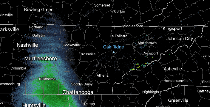
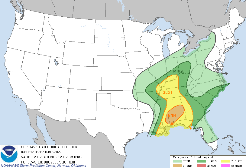
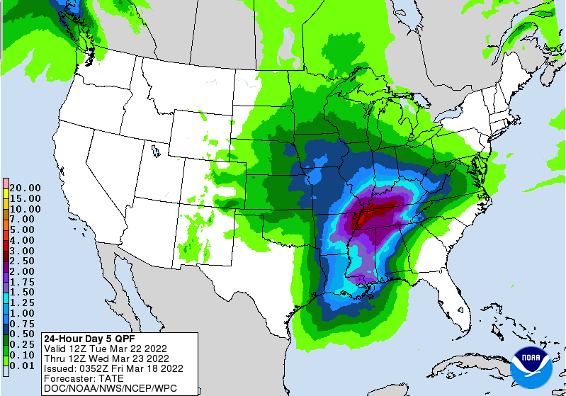
Good morning! Cloud cover increased overnight as showers begin to build in from the southwest. These will be a bit more widespread by this afternoon/evening, so don't forget those umbrellas! As far as temperatures today, it'll be a fairly seasonable one with highs topping out in the low (and a few spots) mid 60s. With a pretty stout low just to our west, the Storm Prediction Center does highlight the potential for severe weather today. The best opportunities will be well to our south, but West, Middle, and East Tennessee could see a shot as well. The primary focus will be westward, but a few storms could hold on long enough to make it into our neck of the woods. With that said, all severe weather is on the table for late this afternoon to early evening. The biggest threat will be damaging winds, but large hail, and isolated spin up can't be ruled out. The environment and dynamics overall are not very favorable for this development, but it is worth mentioning given the Marginal Risk in place. By late tonight, drier air will be slowly working back in, allowing for sunshine to return by Sunday. Warmer temperatures will also accompany, with highs Monday in the low to mid 70s. Our next system then takes aim towards mid week, bringing the opportunity for heavy rainfall and isolated thunderstorms. We will keep an eye on the development and trends of this ahead, as flash flooding/flooding could be an issue with this one. For now, have a way to receive watches and warnings if they are issued this afternoon. Again the threat is very low, but not ruled out entirely. Cloud cover will slowly decrease Saturday, with sunshine and warming temperatures expected Sunday and into the new work week. Pre-recorded for 5pm show
0 Comments
Leave a Reply. |
Your trusted source for everything weather in East Tennessee.
Social Media
|


