
|
Wow! 3 o' clock heat indices will be in the lower 100's across the central valley. Make sure your heat safety is your number one priority if you are outdoors during the day today. Higher dew points are what are contributing to these very hot temperatures expected this afternoon. 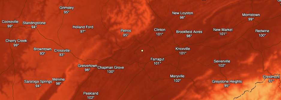 As a front to the west draws near, moisture will begin transporting into the area this afternoon. If it wasn't clear enough above, it will create a very hot and sticky environment today and the days ahead. This will also allow for the development of afternoon showers and thunderstorms. As we have seen the past several weeks, isolated to scattered showers will develop in the PM hours (mainly off of the higher elevations) and work into parts of the valley. A few strong storms are possible Friday and into the weekend so do be weary of these as well as the heat.  The long-term view shows little change in the weeks ahead. Very hot and above average temperatures plan to stick around through the end of July. Typically, the end of July and into August is our transition period to drier days. August and September is our "dry period", where we see the least amount of precipitation during the year. Looking below, the CPC suggests average to above average to end out of the month of July. This is good in helping limit drought levels as we work toward the drier time of the year. We'll keep an eye on any changes but anticipate the heat and humidity to continue with a few showers mixing in the next couple of weeks. 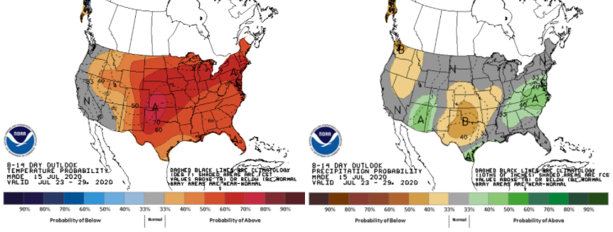 That will do it for your Thursday but stay cool and hydrated. It does not take long for heat related illness to impact you when it is in the lower 100's. Stay safe and have a good one!
0 Comments
With Mother Nature cranking up the outdoor thermostat this week, here are some ways to beat the heat: High's today will be in the mid 90's with feel like temperatures in the upper 90's and lower 100's. Heat related illnesses can strike fast, so keep the following information on-hand. 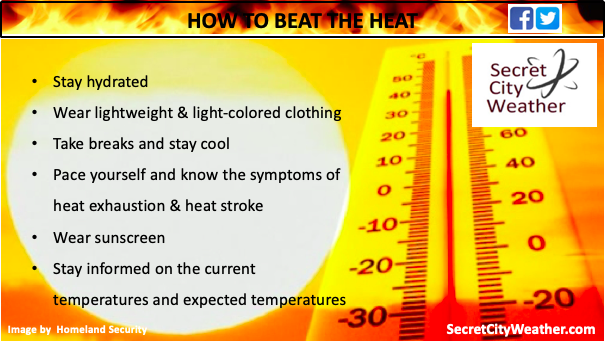 Thursday afternoon heat indices will be extremely hot, especially for western Tennessee. High dew points ahead of a front will contribute to feel-like temps as high as 110 in the upper NW quadrant. Here at home, anticipate heat indices between 100 and 108. Slightly cooler conditions will be in place for the higher elevations, but not by much. I still think the NWS might put a heat advisory into effect, but time will tell. 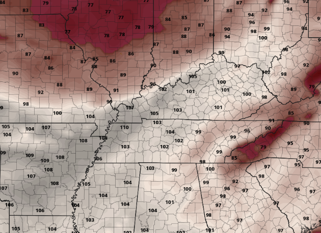 As a front from the north and west slides east, increasing moisture will contribute to afternoon pop up showers & storms. Friday and Saturday will be the best days for rainfall, but even then, not everyone will get wet. Severe potential Friday is low but gusty winds, lighting, and small hail are something to be cautious of. We'll keep you updated, but for now, your heat safety is the number one threat today and tomorrow. 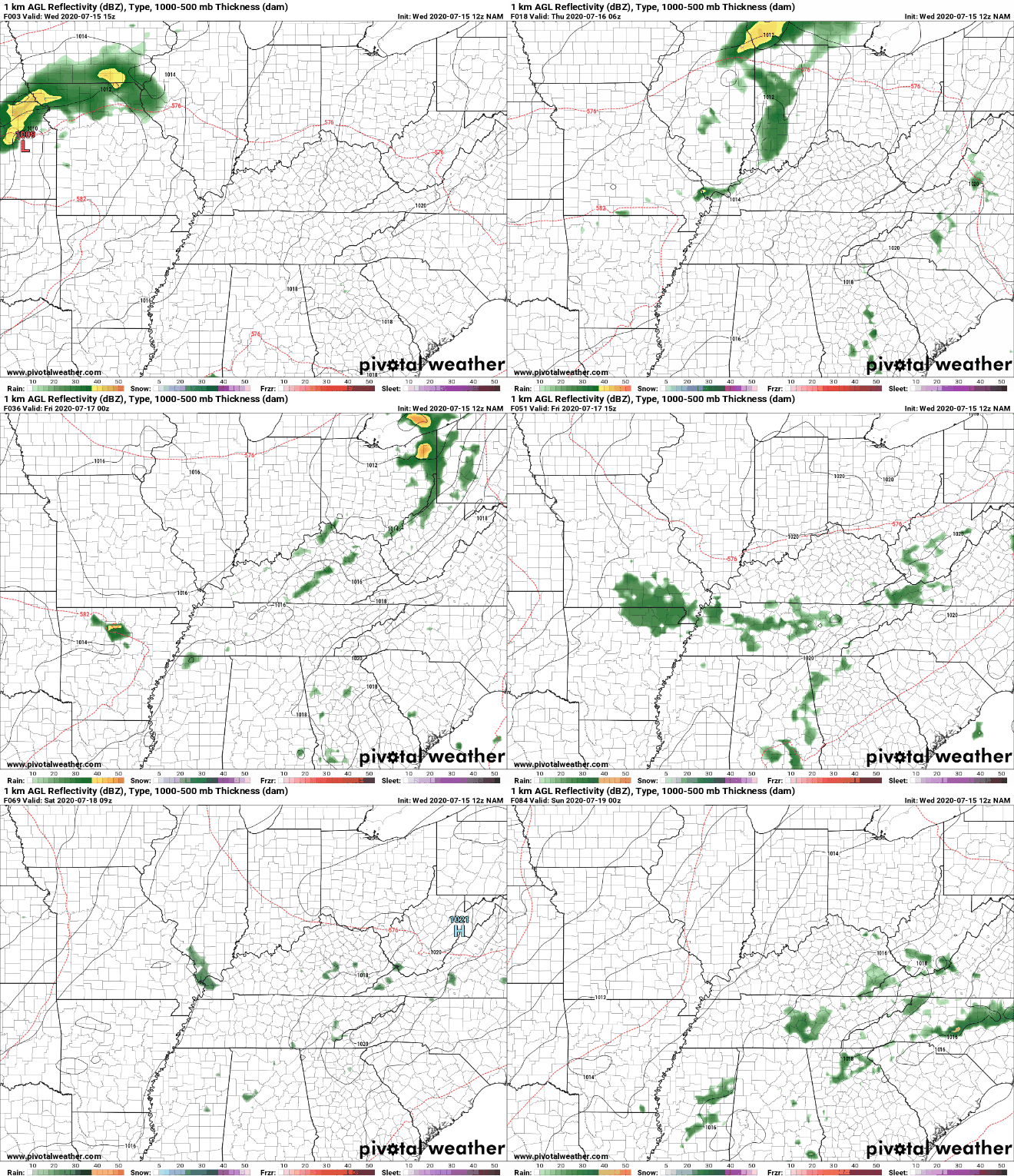 According to the EPA, an average of 1,300 deaths occur every year due to extreme heat. Make sure to take all the precautions in the book if you work or plan to be outside for long periods of time. In our daily forecast below, we highlight some easy and affective ways to combat the heat. Thanks for checking in with us today and I hope you have a good Hump Day. Good afternoon to you! Very warm temperatures will continue to migrate in today and tomorrow with dew points on the rise in the days ahead as well. For reference, feel-like temperatures will likely be near 100 tomorrow and 101-108 range on Thursday. I would not be surprised to see heat advisories go into effect sometime in the next day or so. 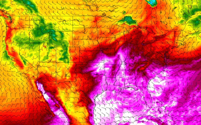 The contributor to these very warm temperatures is a high pressure system to the north. This high is locking in hot and dry conditions but changes are on the way. A front is slowly moving eastward, eventually providing some limited opportunity for showers/storms Thursday, Friday and parts of the weekend. Because these are not expected to be widespread and well developed, higher dew points will contribute towards higher heat indices the second half of the work week. 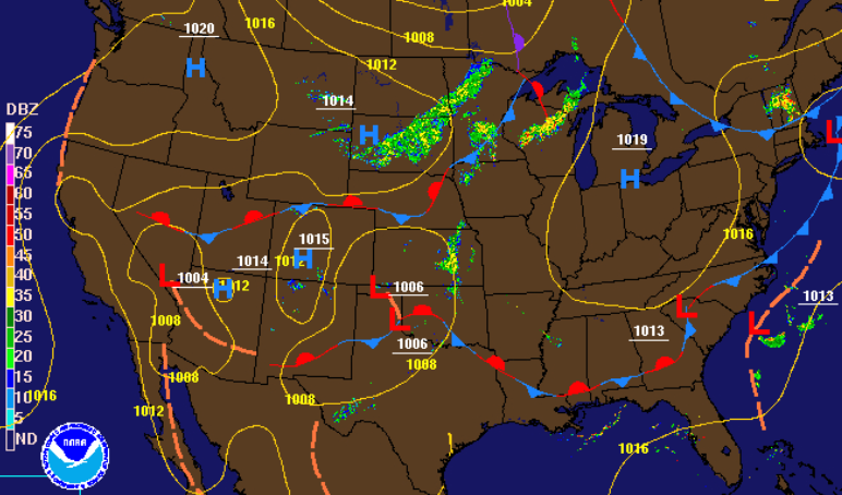 For now, sunny skies and dry conditions stick around today and much of tomorrow. By Thursday, a front to the north will allow the transport of higher dew points and the chance for some afternoon pop up showers and storms. This will continue for Friday and the weekend as well. Not everyone will get wet of see rain but the chances remain nonetheless across east Tennessee.  We will be eyeing any heat related advisories in the days ahead but for now, take the proper precautions if you plan to be outdoors for extended periods of time. Heat related illnesses can strike fast in these conditions, so stay cool, well hydrated, and take frequent breaks. I am sorry to say but today will be the coolest day of the week. With an oppressing high pressure system over much of the eastern half of the US, hot and sunny conditions will be locked in the next few days. 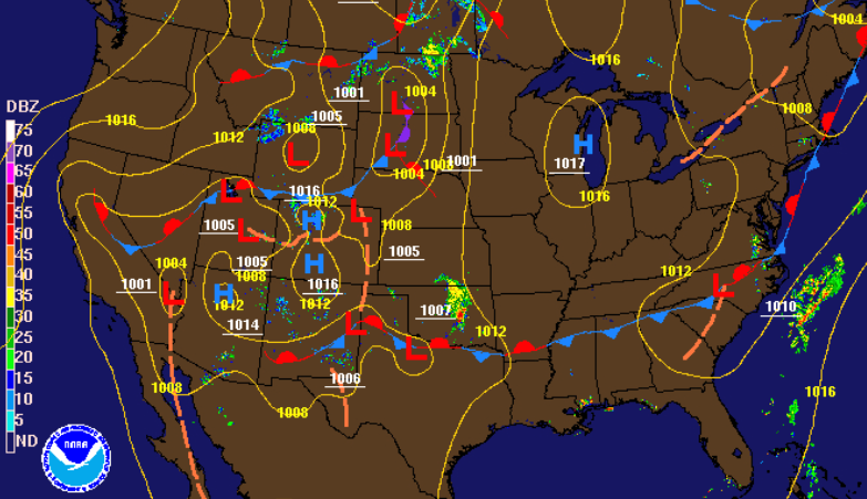 A look into Tuesday's highs show low to mid 90's across the region. Humidity won't be as big of a factor tomorrow as it will the later half of the work week, but this is all relative. This will be the warmest week we have had in 2020 to date, so please keep your heat safety in mind. 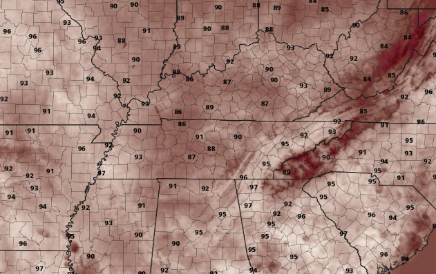 With a large ride dominating the eastern half of the USA, little activity is expected the next few days. It won't be until the second half of the work week we could see some limited action. A front will slide to the north late Wednesday and early Thursday, providing the chance for isolated showers across the area. Unfortunately, the majority of us will stay sunny and hot this week and into the weekend.  As we progress into mid-summer, the heat will play a big part in daily operations. Make sure to take all the precautions this week as we will more than likely see triple digit heat indices for several days and high's ranging from the low to upper 90's. Be safe, stay cool, and have a good week! As always, updates will be provided through social media. I hope you are enjoying your Friday so far! If you recall earlier this week, a low pressure system in the Gulf was on its way to the Carolinas. That same low has now developed into Tropical Storm Fay along the eastern seaboard. This will begin to impact New York, Connecticut, Delaware, and much of New England this weekend. 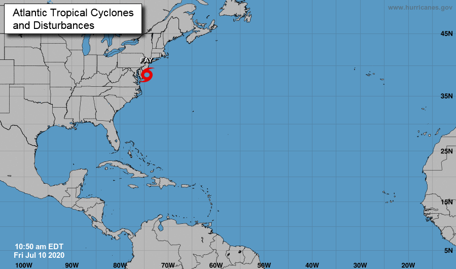 Looking closer to home, a front will bring scattered showers and storms this afternoon. The majority of activity will stay to the north and east of the central valley, but don't be alarmed to see a few showers through the day. In behind the front will be a high, clearing things out for much of the weekend. 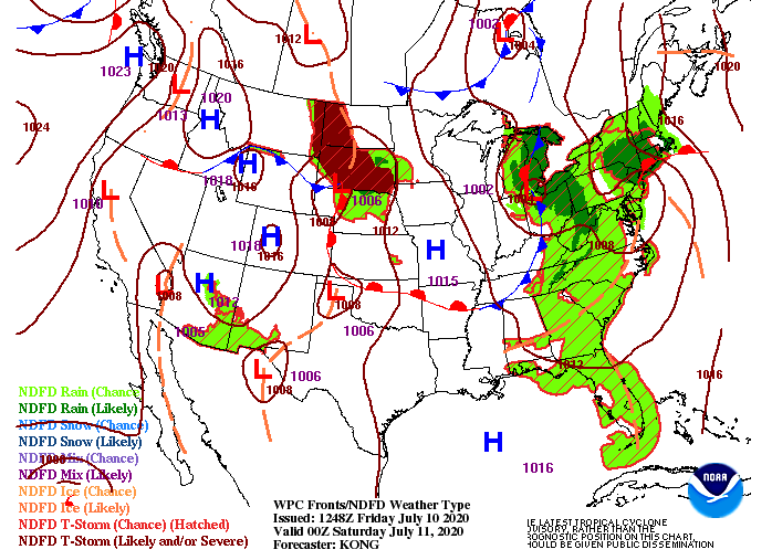 A faint line of showers and storms can be seen on model guidance through the second half of the day today. We are already seeing some development for parts north of Oak Ridge and into La Follette and New Tazewell. Cloud cover will clear out tonight though, leaving a sunny and warm Saturday. Sunday will be very similar with a stray shower or two possible (mainly in the higher elevations). 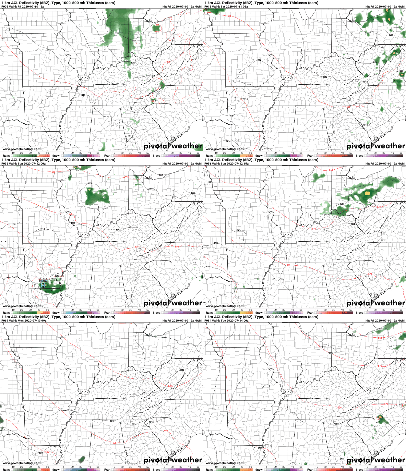 A peek into the start of the next work week (Monday) shows slightly cooler temperatures in the forecast. Though this will still feel very warm wand muggy with dew points in the upper 60's, it is nice to see temperatures 5-7 degrees lower than what we have been dealing with this week. "Enjoy it", 90's return by Tuesday and Wednesday. 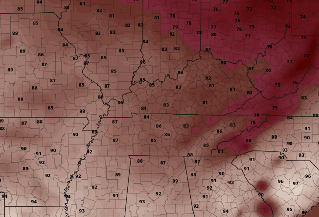 Hot and sticky conditions will remain through this weekend so stay hydrated and stay safe. This would be another good weekend to enjoy the outdoors on the lake! If I could describe the weather today it would be this: very hot! Check out these feel-like temperatures for 5 o' clock today. Triple digits is expected to our south for parts of Peakland and Chattanooga. Closer to home, it doesn't get much better with 96, 97 and 98 in the central valley. Make sure to keep your heat safety in mind through the day today. 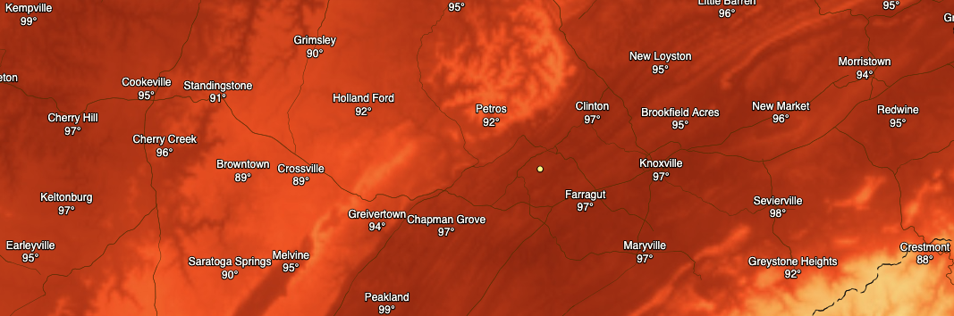 We do have some better news in the days ahead. A low near the Great Lakes will extend a cold front down providing a better chance for showers tomorrow afternoon. Towards the later part of the weekend, the cold front will swing through providing a slight reprieve from the 90's with high's in the mid 80's. Not to get too excited though, upper 80's and lower 90's will return by early to mid next week. 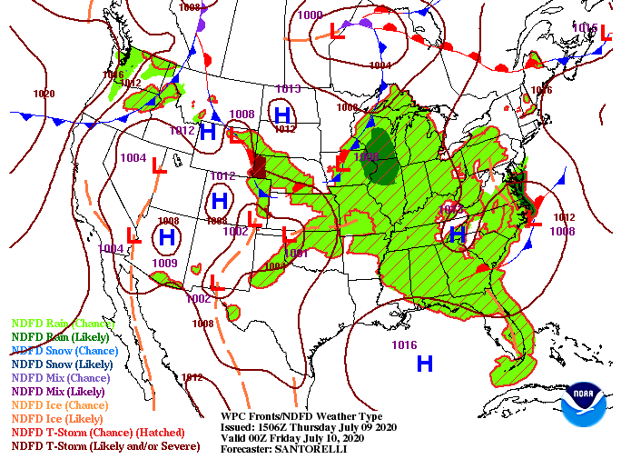 A look at model guidance shows a stray pop up shower is possible this afternoon, otherwise the majority of us will stay dry. As a cold front works through scattered shower activity will develop Friday afternoon. With the front hanging a bit further north, models are having trouble with rainfall amounts across the area. Depending on how far this front dips down will depend on the likelihood of showers for the day. As of now, I do anticipate some shower activity to develop, especially for the northern & eastern parts, but I don't think everyone will see rainfall. A couple tenths of an inch is likely the best outcome each county can expect before sunshine returns Saturday. 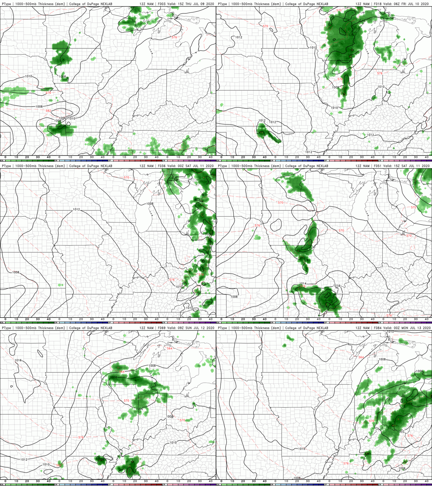 Drink LOTS of water today as afternoon heat indices will top out near the triple digits. A bit of a break comes in the days ahead though with some rainfall tomorrow and cooler temps by the end of the weekend. McCloud Mountain shows the hot and hazy conditions throughout the region early this afternoon. Current conditions (as of noon) have high's in the low to mid 80's and feel like temps in the mid to upper 80's. A line of showers and storms have also developed along the Plateau bringing heavy downpours, lightning, and gusty winds. 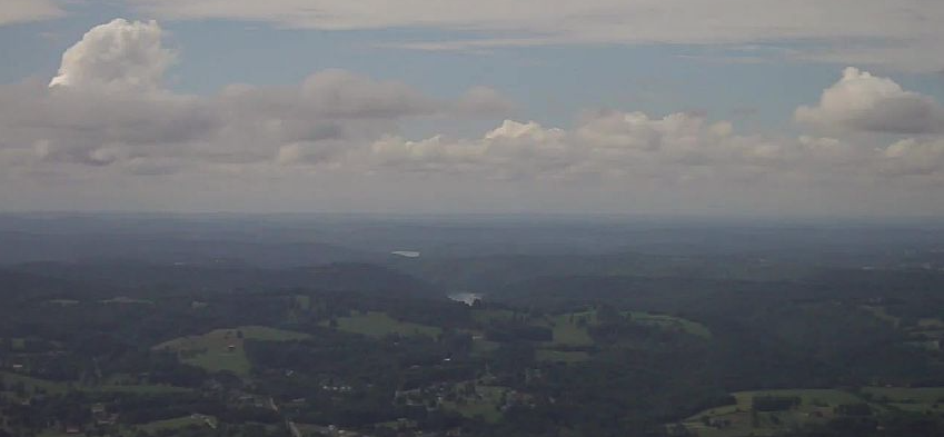 This afternoon and the days ahead will feature similar conditions. Showers and storms will likely develop in the afternoon hours before dissipating in the evening and overnight. This pattern looks to continue for the next several days, so keep the umbrellas handy incase you get caught in a couple of these cells.  As will be the case this afternoon, high's will top back out to around 90 degrees for your Thursday. Dew points will continue staying in the upper 60's to lower 70's, so keep your heat safety in mind. This will make temps feel closer to the mid 90's by the afternoon hours. If you are working outdoors, take frequent breaks, hydrate, and stay cool. This is also a good reminder to check the back seat before leaving your car. Ten's of heat related deaths in children occur every year, so "look before you lock". 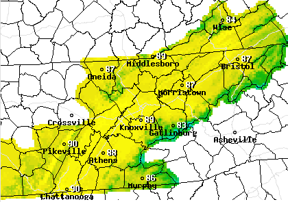 Thank you as always for viewing our page and I hope you have a great day! If you don't already, follow us on Facebook and Twitter @SecretCityWx Good morning! The latest view of Newfound Gap shows some patchy fog still trying to lift out. As we look towards this afternoon, we'll likely see some isolated to scattered showers develop. High's will be slightly cooler with the added cloud cover, but not by much. Expect high's to top out in the upper 80's, near 90 degrees. 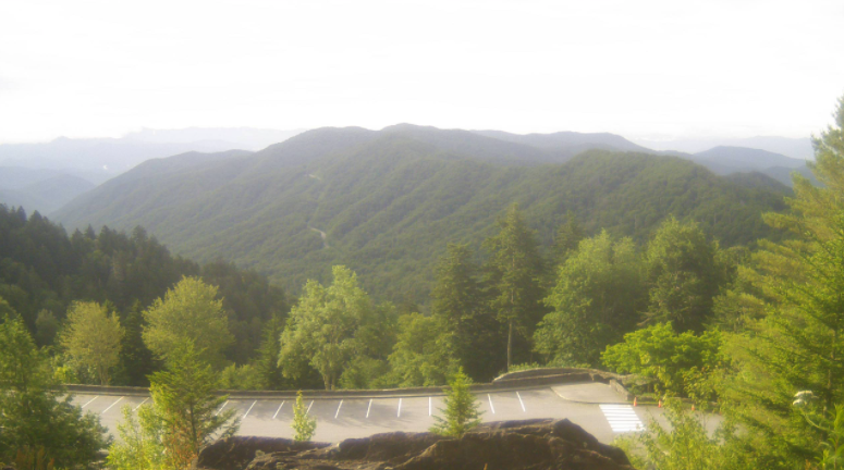 The low pressure system continues to move north and east today keeping the chance for showers in effect through the remainder of the week. High dew points and warm temperatures will continue to stick around as well making for an uncomfortable and sticky week. 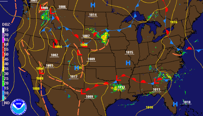 Model guidance shows those afternoon pop up showers and storms developing each day. Not everyone will be impacted each day, but some will definitely see some activity over the next few days. Keep in mind as well that severe potential is low but some of these storms could pack a punch with heavy downpours, lightning, and gusty winds. Showers and storms will more than likely develop to the south (& higher elevations) and work northward during the afternoon hours. Keep the umbrellas handy just in case you are impacted.  A glimpse into Wednesday shows similar conditions to what we have been dealing with. Very warm and muggy conditions will lead to heat indices in the mid to upper 90's across the region. Remember your heat safety and take frequent breaks, stay well hydrated, and limit your outdoor time. 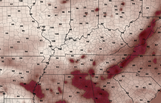 That does it for today, but stay cool and well hydrated the remainder of this week. If you don't already, be sure to give us a follow on Twitter & Facebook (@SecretCityWx). We provide updates day and night with the latest weather conditions around east TN. Good afternoon! I hope you enjoyed the holiday weekend. As we begin the new work week, temperatures will remain hot and sticky with high's today in the lower 90's. Slightly better news is ahead as a low pressure system (currently in the Gulf) plans to work north and east. This will provide better chances for showers/storms in the afternoon and additional cloud cover at times. Even with a few rounds of showers and some cloud cover at times, high's are expected to hang around that 90 mark through the week. 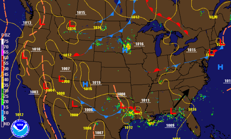 A look at model guidance shows the shower activity associated with the low pressure system. As it work northward, spokes of energy will allow for shower and storm activity (mainly in the afternoon hours). This will continue for much of this week before a more summer-like pattern returns the second half of the weekend.  A look into the overall temperatures for the weeks ahead shows unfortunate news. The southern Plains are expected to get hit hard with well above average temperatures and little rainfall. Similar conditions present itself here at home with temperatures more than likely to be at or above average. Rainfall will be minimal the second half of July, so drought is something we'll be keeping a close eye on. Long term models and patterns indicate changes for August with more average conditions (rain & temperatures & a more active Atlantic Ocean), but for now we have to deal with the oppressing heat. 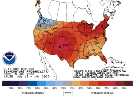 Showers and storms each day could make things a little cooler at times but overall we will stay very warm. Some of these afternoon storms could be strong to severe at times (similar to Sunday) so be weary and pay attention if you are out and about. Good afternoon! It is already a warm one with lunch time temperatures sitting in the mid 80's. A high pressure system is continuing to build in allowing for the heat and humidity to rise today and the days ahead. 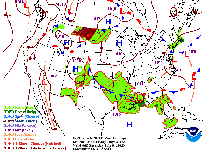 A peak into your Independence Day shows feel-like temperatures in the mid to upper 90's across the region. If you plan to be outdoors for extended periods of time make sure to have plenty of water! High's in the upper 80's and lower 90's is expected to stick around for the foreseeable future. 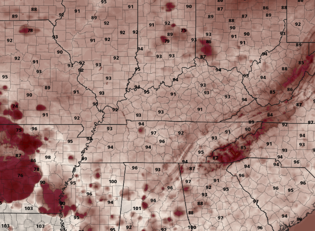 With warm and muggy conditions hanging around this weekend and early next week, don't be surprised to see a few afternoon pop up showers and storms. The bulk, as mentioned yesterday, will be in the higher elevations, but a few will likely pass through the valley. As we push into the second half of the weekend and early next week, more widespread activity is expected. The low that brought us lots of rainfall, flash flooding, and a few storms will begin pushing back north (currently along the Gulf).  As for today and the weekend, stay well hydrated. Heat related illnesses can strike very quickly, so take the proper precautions. Have a wonderful Independence Day and don't forget to send in those pictures! |