|
Sunshine has finally returned across the region as a high moves in from the north. This will continue to stick around for the next several days as major ridging is setting up across the United States. What does that mean for us ahead? Well....VERY warm temperatures and muggy conditions. 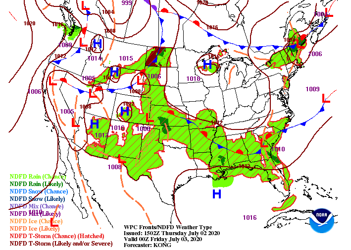 With dew points in the upper 60's and lower 70's, muggy conditions will be present tomorrow, this weekend, and next week. This will make the primary "forcer" orographic lift. This means moist air is forced vertically due to the higher elevations acting as a buffer. This is where we see afternoon pop up showers/ thunderstorms that are short-lived during the summer months. Anticipate this to be the case over the next week or so. With that said, shower activity will be very limited over the next several days. The bulk of any pop up showers/storms will be in the higher elevations, eventually rolling into parts of the valley. 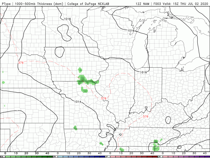 The main threat we'll be eyeing ahead isn't the rainfall, but instead, the temperatures. A look on Independence Day shows heat indices nearing the triple digits for some across the region. This will only continue into Sunday and next week as the "Death Ridge" plays its part. 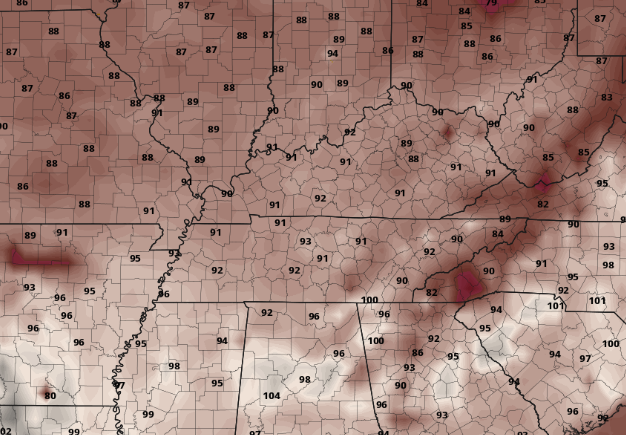 Be sure to stay well hydrated this weekend, wear lots of sunscreen, and find plenty of shade if you plan to be outdoors for extended periods of time. A look into the middle and later part of July can be found in the latest video forecast below (Hint: it remains HOT).
0 Comments
Sick of the rain and cloud cover? So am I. The good news is sunnier skies are back in the forecast. A few isolated to scattered showers are possible this afternoon, otherwise mostly cloudy skies and high's in the lower 80's will be the main story. As a front slowly meanders south, a high pressure system will fill its place. Anticipate decreasing clouds overnight tonight and through Thursday.  This afternoon will be somewhat calm. A few showers and storms from the west will develop but severe potential is very low and not everyone will see rain. Continuing into tonight, cloud cover will begin decreasing allowing for sunshine by Thursday afternoon. Friday and the weekend will be warm, but mostly dry. With that said, an isolated shower/storm or two could pop up in the afternoon hours in the days ahead but these will mainly stay contained to the higher elevations.  A peak into Independence Day shows sticky and muggy conditions. Afternoon high's will be in the upper 80's to lower 90's (for some) with dew points in the mid to upper 60's and even lower 70's. We call this the "bad hair day" forecast as conditions will feel rather sticky and uncomfortable. Not only does this raise the "feel like temperature" but also could lead to afternoon pop up showers through the weekend.  For now, keep the umbrellas handy as a few showers are possible the remainder of the day. Sunshine will make a return tomorrow, Friday, and through the weekend. |