|
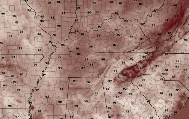
I am sorry to say but today will be the coolest day of the week. With an oppressing high pressure system over much of the eastern half of the US, hot and sunny conditions will be locked in the next few days. A look into Tuesday's highs show low to mid 90's across the region. Humidity won't be as big of a factor tomorrow as it will the later half of the work week, but this is all relative. This will be the warmest week we have had in 2020 to date, so please keep your heat safety in mind. With a large ride dominating the eastern half of the USA, little activity is expected the next few days. It won't be until the second half of the work week we could see some limited action. A front will slide to the north late Wednesday and early Thursday, providing the chance for isolated showers across the area. Unfortunately, the majority of us will stay sunny and hot this week and into the weekend. As we progress into mid-summer, the heat will play a big part in daily operations. Make sure to take all the precautions this week as we will more than likely see triple digit heat indices for several days and high's ranging from the low to upper 90's. Be safe, stay cool, and have a good week! As always, updates will be provided through social media.
0 Comments
Leave a Reply. |
Your trusted source for everything weather in East Tennessee.
Social Media
|


