|
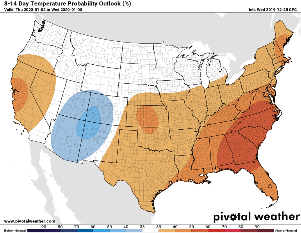
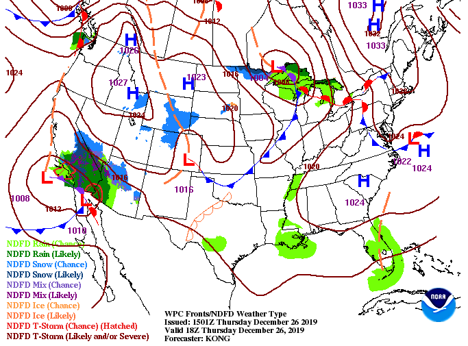
For all the winter & cold air seekers out there, I am sorry to say winter is on hold for a few weeks. Looking at the latest from the CPC (Climate Prediction Center), above average temperatures are expected to continue into early January. With the polar jet hanging further to the north, warmer air is expected to stay around to begin the new year. The current surface map shows a high pressure system to the south and east which will keep things dry through the day today. As we get into the afternoon, clouds increase with a system in the Great Lakes region. This could bring an isolated shower into Friday, but the biggest threat arrives Sunday. The latest data from model guidance varies from model to model but to keep it safe, a chance for isolated showers is possible tomorrow. The best chance for light showers are those in middle TN and the plateau. Overall, a majority of the area will stay dry Friday into Saturday. Working into Sunday, heavier showers and storms arrive early and work throughout the day. We will clear out for Monday with cooler temperatures to begin the new work week. Keep in mind "cooler temperatures" for the start of next week will still be near to above average in the upper 40's/low 50's. I want to remind everyone we are releasing East Tennessee's FIRST Almanac in February and if you'd like to get yours early, subscribe at SecretCityWeather.com/almanac. We also encourage you to submit some of your best pictures throughout the year, which you can submit at the link above.
1 Comment
Leave a Reply. |
Your trusted source for everything weather in East Tennessee.
Social Media
|


