|
Pre-recorded for 5pm weather broadcast
0 Comments
Pre-recorded for 5pm weather broadcast
Pre-recorded for 5pm weather broadcast
A beautiful start across the Smokies as the sun inches up this morning. Another pleasant day is on tap, as sunny skies give way to highs in the mid 70s. We will continue our warming trend the next couple of days, with the warmest day Thursday and Saturday (both around 80 degrees). We will also stay dry through Thursday, with shower chances returning Thursday night through the weekend. Isolated to scattered showers will be possible Thursday night through Saturday, with bettering chances Saturday into Sunday ahead of an approaching cold front. 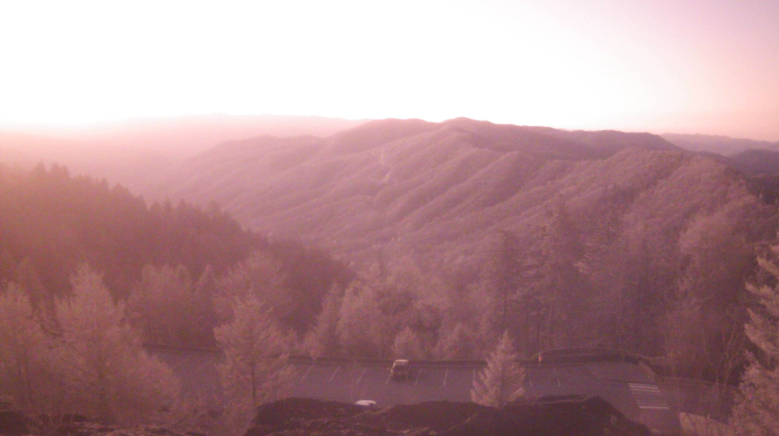 Looking even longer term, a cool down appears to be in store. This doesn't mean a second round of winter just cooler than average temperatures. Our usual highs this time of the year, as reference, are the low 70s. Paring this with the precipitation outlook (not shown), below average rainfall is forecast from the Climate Prediction Center as well. Though it's much too early to say, this could pose some fire concerns if we do steer dry for quite some time. Only time will tell, but this next batch of rainfall this weekend definitely won't hurt anything. 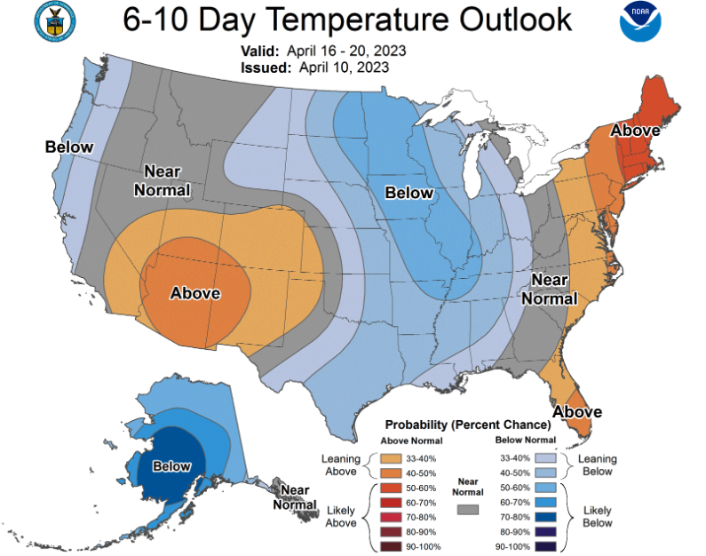 That will wrap it up for today, be sure to take advantage of the sunshine and warming temperatures. We will continue to trend up with highs Wednesday in the mid to upper 70s and around 80 on Thursday. Don't miss our video forecast below as well. Pre-recorded for 5pm weather broadcast
Showers and storm chances increase through the day, with the best chances tonight into Thursday. A few storms could be strong to marginally severe, with damaging wind gusts the main threat. Fortunately, the best storm chances will be north and west of the area. There is also a low end flash flooding risk. Bottom line, have a way to receive warnings tonight, even if the risk overall is fairly low. Showers will then linger Friday and Saturday, with dry and warming temperatures starting Sunday into early next week. Good morning! After a seasonably cool day yesterday, today will be much warmer. Highs will soar into the upper 70s to low 80s for highs, and we are already seeing warm temperatures reflected on the latest 24-hour temperature change map. Cloud cover and fog has also hampered in the area this morning, but not to worry as sunnier skies are quickly on the way! Enjoy this one pleasant day for the week, as unsettled weather returns later tomorrow and through the early weekend. 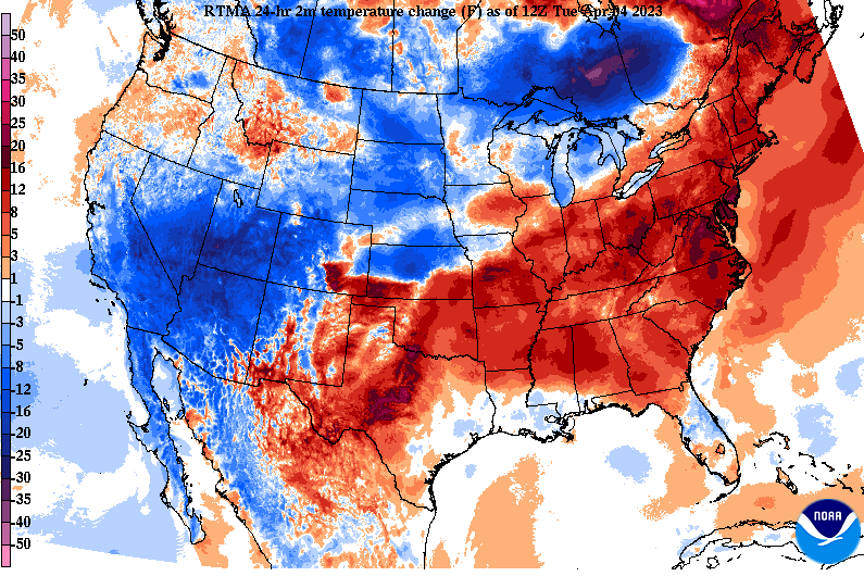 Just like the expectations for today, Wednesday will be another warm one but also breezy. Comparing forecast highs to those of the usual norm, we will be 15-20 degrees above average. Though not record setting, it is still going to be a warm one! In addition to the warmth, breezy south to southwest winds of 10 to 15 mph and gusts up to 35 mph will be possible. No, this will not be like our most recent event, but do keep in mind the increased flow as it relates to outdoor unsecured objects. Cloud cover will also be on the increase Wednesday, as a cold front takes aim to the region. 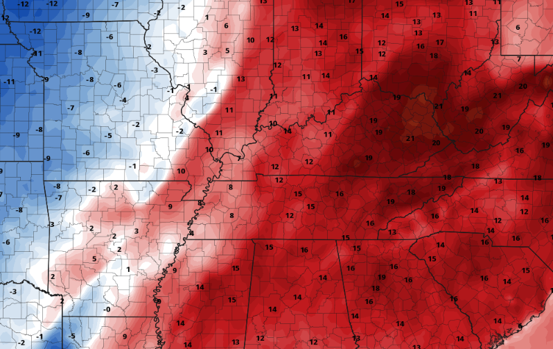 This attendant cold front to a potent low will glide across the Mississippi Valley, bringing showers and storm chances Wednesday night into Thursday. The good news is strong to severe storm chances stay much further north and west than our most recent system. This can be thanked in large part to a strong area of high pressure off the Southeast Coast. That said, a strong storm or two can't be entirely ruled out for portions of the plateau to central valley early tomorrow night. After that, general showers linger through Thursday, with additional (scattered) chances each day through Saturday. We will also see a cool down upon frontal passage Thursday, with highs in the mid 60s cooling to the low 60s on Friday. 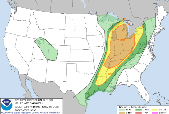 That will do it for today. Enjoy some sunshine into this afternoon as well as the warm temperatures. Unsettled weather returns tomorrow evening/night, with shower chances lasting through late Saturday morning.
Unsettled weather will be the overall trend this week along with a mixed bag of temperatures. Starting first with the current, here is a shot of radar as of 10:30 AM. A swath of light to moderate showers is working across the heart of the area, with scattered rounds to continue this afternoon. With the cloud cover and bouts of showers, temperatures will be near seasonable norms: in the low to mid 60s. A big change is in store for Tuesday though, as better sunshine and much warmer temperatures find us. Highs will swing nearly 20 degrees, peaking in the upper 70s and low 80s. 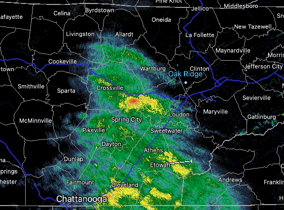 Further ahead, our best chance for rain comes mid week. A strong low pressure system will again bring severe weather across portions of the Mississippi Valley, while blizzard conditions haunt the Midwest and Northern Plains. Locally, we generally scathe by in a more promising outlook. That said, a few strong storms along with a flash flooding risk is possible. A marginal risk of severe storms is currently in place from SPC, while a slight is across the greater part of the area according to WPC (as shown below). Given the bouts of rain today followed by moderate showers to a few strong storms mid week, this outlook seems fair. 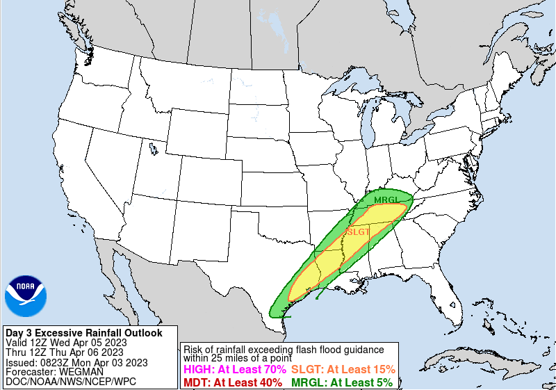 So how much rain are we talking today through the weekend? Well, that will depend on the development of thunderstorms Wednesday into Thursday, but general outlooks place us between 1 to 2". We should be able to handle this for the most part, but again, heavy downpours or within areas that see repeated rainfall midweek could see a few isolated issues. 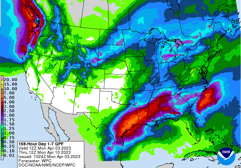 In general, showers will diminish this evening allowing for clouds to break up into Tuesday. Partly sunny will be the trend for the day, with warm high temperatures. By Wednesday, a low pressure system and approaching cold front will bring increased clouds followed by showers and storms towards the evening, overnight, and into Thursday. Some could be strong but severe chances along with the flash flooding risk is low. Lingering shower chances then follow Friday and into the weekend. Temperatures also take a tumble after Wednesday, falling back into the 60s through the remainder of the week. Check out our video forecast below for more details. Pre-recorded for 5pm weather broadcast
|