|
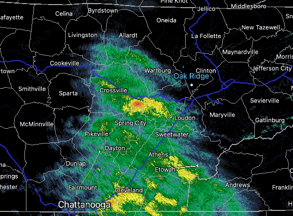
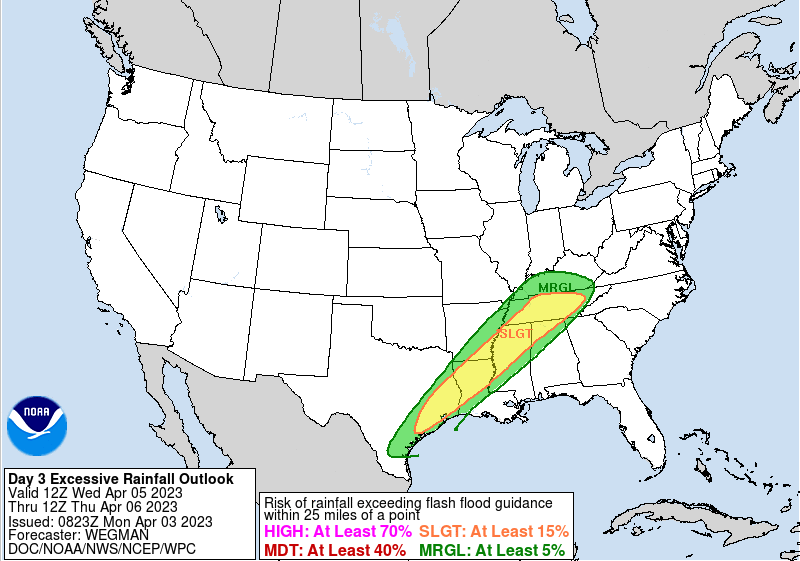
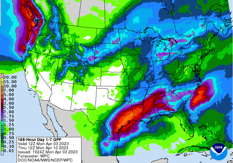
Unsettled weather will be the overall trend this week along with a mixed bag of temperatures. Starting first with the current, here is a shot of radar as of 10:30 AM. A swath of light to moderate showers is working across the heart of the area, with scattered rounds to continue this afternoon. With the cloud cover and bouts of showers, temperatures will be near seasonable norms: in the low to mid 60s. A big change is in store for Tuesday though, as better sunshine and much warmer temperatures find us. Highs will swing nearly 20 degrees, peaking in the upper 70s and low 80s. Further ahead, our best chance for rain comes mid week. A strong low pressure system will again bring severe weather across portions of the Mississippi Valley, while blizzard conditions haunt the Midwest and Northern Plains. Locally, we generally scathe by in a more promising outlook. That said, a few strong storms along with a flash flooding risk is possible. A marginal risk of severe storms is currently in place from SPC, while a slight is across the greater part of the area according to WPC (as shown below). Given the bouts of rain today followed by moderate showers to a few strong storms mid week, this outlook seems fair. So how much rain are we talking today through the weekend? Well, that will depend on the development of thunderstorms Wednesday into Thursday, but general outlooks place us between 1 to 2". We should be able to handle this for the most part, but again, heavy downpours or within areas that see repeated rainfall midweek could see a few isolated issues. In general, showers will diminish this evening allowing for clouds to break up into Tuesday. Partly sunny will be the trend for the day, with warm high temperatures. By Wednesday, a low pressure system and approaching cold front will bring increased clouds followed by showers and storms towards the evening, overnight, and into Thursday. Some could be strong but severe chances along with the flash flooding risk is low. Lingering shower chances then follow Friday and into the weekend. Temperatures also take a tumble after Wednesday, falling back into the 60s through the remainder of the week. Check out our video forecast below for more details. Pre-recorded for 5pm weather broadcast
0 Comments
Leave a Reply. |
Your trusted source for everything weather in East Tennessee.
Social Media
|


