|
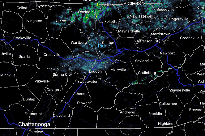
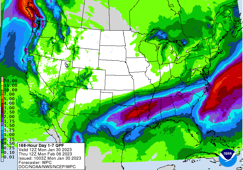
Isolated showers start the morning off (6:30 am) as a boundary sits just to the west. This cold front will break east today, passing through into this afternoon. As it does so, mostly cloudy skies will be present today with cooler air to follow Tuesday. As far as highs today, warmer, topping out in the mid 50s. Moving forward, a cool and active pattern is expected this week. The cold front, currently to our west, will pass by later today stalling just to our south. A few passing upper level disturbances will then bring rain and wintry mix opportunities to the region through Thursday. First up, an upper level disturbance will bring rain chances tomorrow, where early on portions of the northern Plateau could see this in the form of sleet or freezing rain. Road surfaces are generally slightly too warm, but a few impacts could be possible. As temperatures warm all rain is expected through the day. Another rounding system will then bring additional rain to wintry mix chances Wednesday night into Thursday morning. Again some impacts will be possible, primarily on the usual cooler surfaces (bridges, overpasses, etc). Check back in for the latest. The good news is outside of portions of the plateau, all rain is expected across the valley through Thursday. You can definitely make out where the boundary is expected to stall out at. Heavy bouts of rain will find the Deep South, with 1-2" possible across the southern valley. Elsewhere, rainfall amounts fall off the further north you head, with up to an inch possible bordering Kentucky. Note: any changes to this boundary and how far it dips south (or doesn't) could bring large changes to the forecast. Stay tuned for more details into Tuesday. We will veer more dry than wet today, so take advantage of any outdoor plans you might have. Better shower chances arrive Tuesday and continue at times through Thursday. Temperatures will also be much cooler through the work week, topping out in the low to mid 40s each day.
0 Comments
Leave a Reply. |
Your trusted source for everything weather in East Tennessee.
Social Media
|


