|
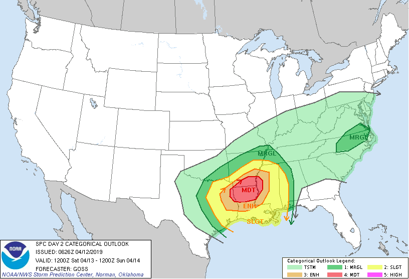
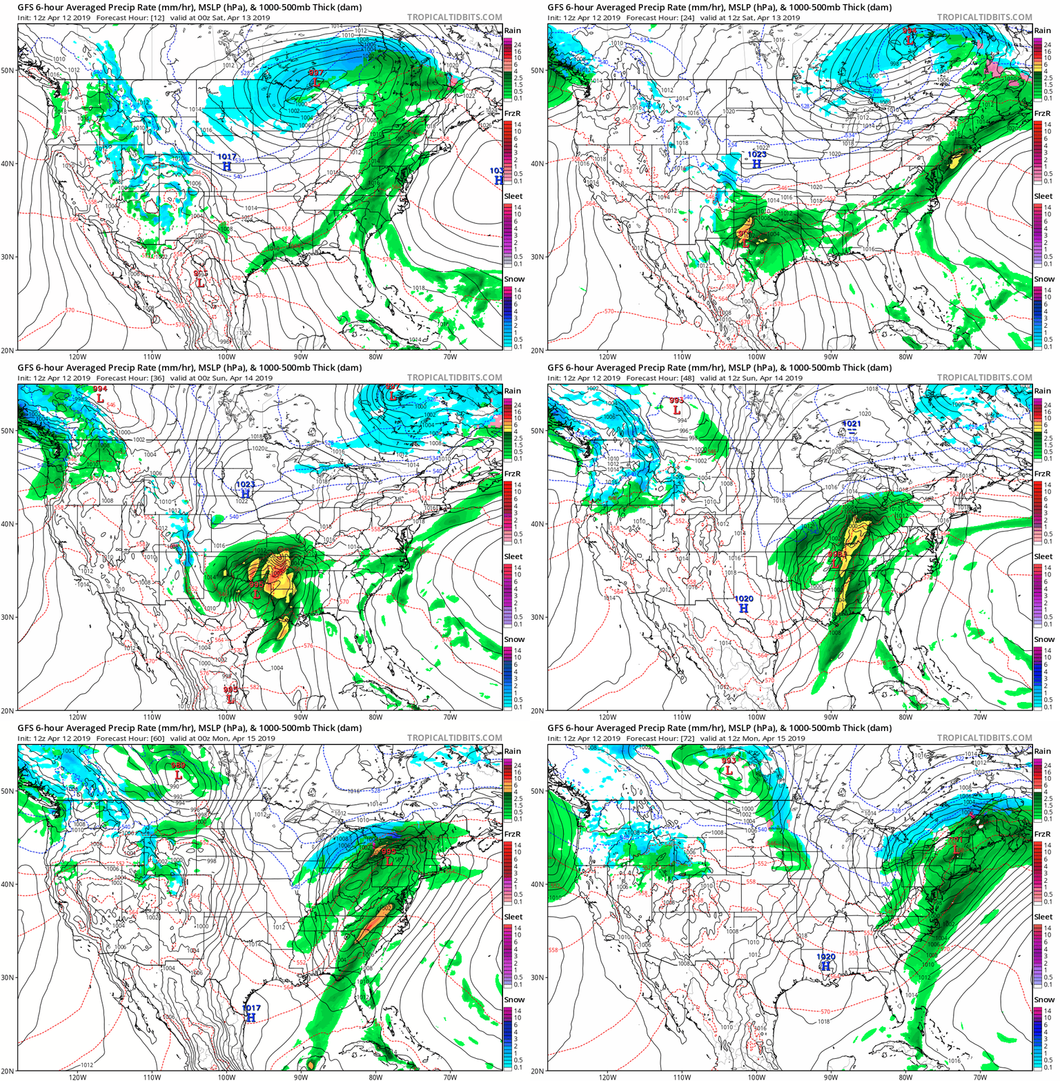
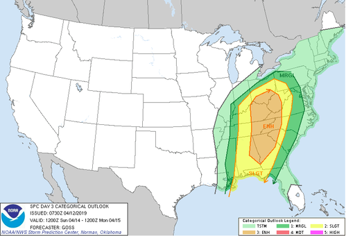
All eyes will be on the low pressure system moving out of the southwest (from Mexico) as we move into this weekend. This low is expected to deepen and increase in strength as it moves northeast. Supplied with lots of gulf moisture, warm temperatures, lifting mechanisms, and ample initiation ingredients, tornadoes, hail, strong winds, and heavy rain is likely in northern Louisiana, parts of Mississippi, and Arkansas (as indicated by the dark red Moderate risk below). As for us, we will receive some scattered showers and a few rumbles of thunder. Saturday can be thought of as the day we are stuck between two systems. A low pressure to our far north (near Wisconsin) is what is providing those scattered showers today and into tomorrow. Once this low moves out and into Canada, a stronger low to our southwest will fill in, raising questions on the severe threat. Seen below is a model simulation of the track of the low and precipitation associated with it. Moving into late Saturday and early Sunday, the rain looks to begin impacting us in the morning with some light scattered showers. The bulk of this event (strongest period) will take place early afternoon and into the evening hours. Stay weather aware later this weekend, knowing a severe risk is at the enhanced level. Things are likely to change slightly being we are a couple of days out so check back frequently here and on our Twitter page (@SecretCityWx) for the latest updates! All twitter posts can be seen on the right side of our home page, so if you do not have Twitter, do not worry.
Main impacts: Heavy rains at times, damaging winds possible, hail possible, and isolated spin-up or tornadoes possible. WHEN/Timing: Scattered showers will begin Sunday morning with the main threat in the early afternoon and into the early night. Remember: Always have a plan of action if severe weather does occur. In the event of a tornado seek shelter immediately in the most interior portion of your home, away from windows and doors. Stay tuned with your NOAA radio until you hear the "all-clear" or until the warnings have ended. If you do not have access to a NOAA radio, stay updated on your phone, computer, or tablet (https://noaaweatherradio.org).
0 Comments
Leave a Reply. |
Your trusted source for everything weather in East Tennessee.
Social Media
|


