|
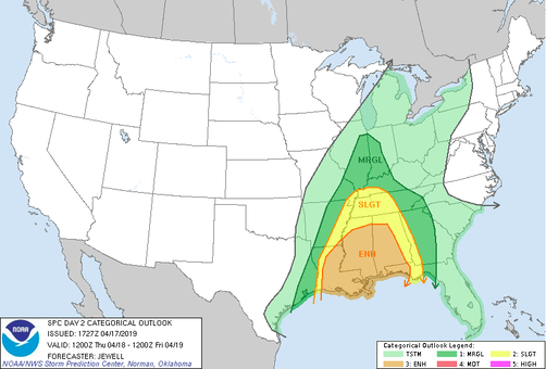
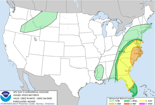
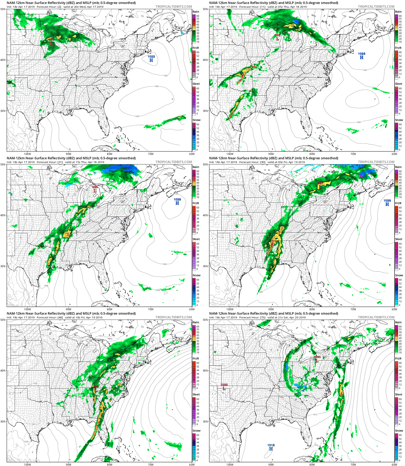
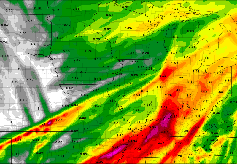
Happy Hump Day! I hope you all have enjoyed this Spring weather as it has been mostly sunny and warm with temperatures in the mid 70's most days this week. These conditions will soon change, as lots of moisture is on the way. As this next low pressure system nears, we are getting a better outlook on the severe potential. The graphic above was released by the SPC showing areas of the highest risk for severe weather. Based on this, we are under a Marginal risk. This basically equates to the likeliness of heavy winds and thunderstorms (small hail & small isolated tornadoes are given a chance but not likely). This risk is from 8am Thursday until 8am Friday. Remember, things can change! I would not be surprised to see the "Slight" risk to move a little farther east by tomorrow, but we will see. The next SPC graphic shows a similar story, but from 8am Friday until 8am Saturday. A similar outcome is likely, with the most of this system producing heavy winds and a few thunderstorms. Based on my analysis I agree with what the NWS has put out. The "energy" supply for this system isn't there. The predominant factor associated with this system is winds and thunderstorms. There could be isolated reports of small hail, but I will keep this on the "lower potential" side of things. As seen above, a low pressure system will move in from our west bringing with it lots of rain and severe potential to our south in states like Alabama, Mississippi, and Louisiana on Thursday. As for us, this system will be arriving mainly overnight Thursday. This in itself, is a good thing. During the day, heating and additional processes happen that "ramp up" the severe potential. So, for this to be arriving at night, the lower severe chances are in line with the SPC maps. I am concerned with the possibility we have recently death with the past few months here in east TN, flooding. Seen above is just ONE of many model outputs predicting the total rainfall in our area. As for east TN I believe we can expect between 1 and 2.25 inches (depending on where you live) between Friday morning and Saturday night. Some areas could expect less and some could get more, but generally, that is a good rough estimate. So what does this mean? Flash flooding is possible, and the overall flooding potential is there, as well. Even though we have had some clear days with lots of sun, rivers and tributary heights, along with soil moisture, are still above average. Remember if water does begin to build up and rise on road ways, its better safe to find an alternate route. As for Thursday expect clouds to build and for it to be mostly cloudy throughout the day. Temperatures will stay warm with a high in the upper 70's. Late Thursday night, rain and thunderstorms will move in and stick around most of the day Friday and early Saturday. Saturday showers will move out leaving behind much cooler temperatures (due to a cold from associated with the low). For you Easter Sunday, we will rebound and warm up a bit with mostly sunny skies. Don't forget umbrellas Friday, and I will keep you updated on any changes that may occur over the next couple of days.
0 Comments
Leave a Reply. |
Your trusted source for everything weather in East Tennessee.
Social Media
|


