|
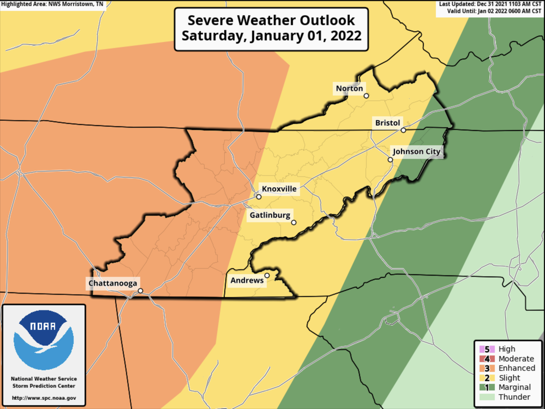
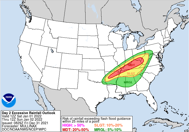
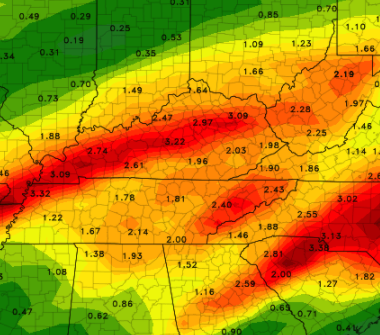
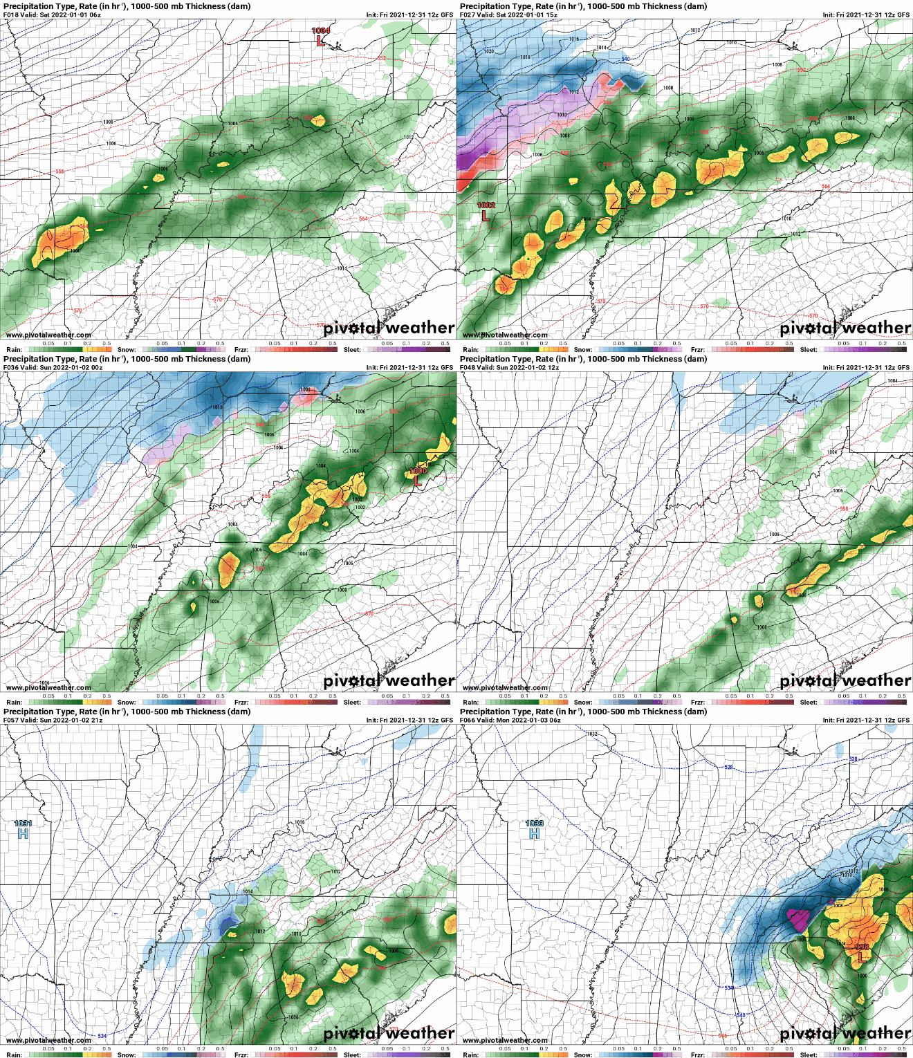
Good afternoon and happy last day of 2021! We look to enter the new year with a bang, as SPC has further increased the severe risk tomorrow evening/night. An Enhanced (3/5) risk is now present across the western half of East Tennessee. A powerful cold front will work east, bringing the opportunity for damaging wind gusts, tornadoes, and heavy rainfall. There lies a threat for damaging winds and isolated spin-up tonight as well, but this threat will primarily be to our west. In addition to the severe risk, heavy rainfall could lead to areas of flash flooding/flooding. A slight risk (10-20%) of flash flooding remains in place Saturday morning through Sunday morning. Depending on how heavy showers/storms are tonight and how many work across similar areas could dictate the results of tomorrow. Showers and thunderstorms are expected tomorrow and areas that see consistent rainfall over the same area will pose the biggest risks. Those near water bodies, flood prone areas, or low lying areas should use caution and stay up to date for the latest alerts. The threat for the heaviest swath of rainfall has thankfully shifted a bit further north and west, but there still remains a low to medium concern for Saturday. Heavy rainfall rates will bring 2-3 inches of rainfall with locally higher amounts up to 4+ inches possible in thunderstorms & training activity. Breaking it down a bit further, isolated to scattered showers continue this afternoon, picking up to be more widespread tonight. A risk of strong to severe storms will be present, but confidence is low and the better opportunities sit west. Into Saturday, a lull in activity will be possible mid morning and through the early afternoon. By tomorrow evening and night, a band of strong to severe storms will work east, providing the opportunity for embedded damaging winds, tornadoes, and heavy rainfall. This will gradually work east, decreasing in strength with time and leaving scattered showers into Sunday. As the front passes late Sunday, enough moisture could be left behind to see a few snow flakes across the area. Though we aren't looking at accumulations (for now) across the valley, it will be nice to see a change. Accumulation chances will be the best atop the Smokies or elevations above 2500 ft. We will then start off Monday with highs in the upper 30s to low 40s with sunshine overhead. With severe potential at a medium confidence, have a way to receive alerts. Watches and warnings will be possible, especially tomorrow afternoon and night. All severe hazards are on the table, so prepare now and know what to do if severe weather strikes. We'll be providing updates via Twitter/Facebook this weekend, so be sure to give us a follow if you don't already (@SecretCityWx) Pre-recorded for 5pm show
0 Comments
Leave a Reply. |
Your trusted source for everything weather in East Tennessee.
Social Media
|


