|
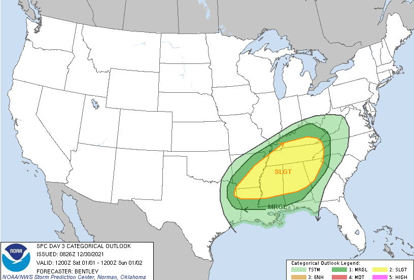
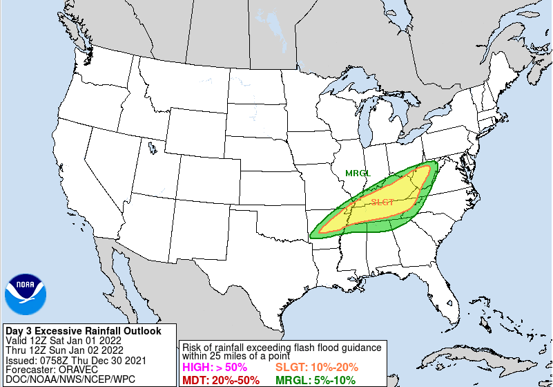
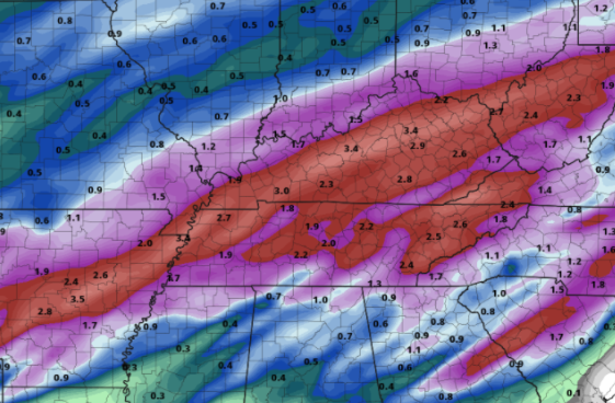
Another dynamic storm system looks to take aim at the Volunteer State. A front is wavering across the area today and will lift north in the form of warm front. As such, warm and moist air will advect back in tonight, leading to increasing shower chances Friday. The SPC has placed the area under a Marginal risk for severe storms tomorrow evening, and a Slight risk for Saturday. The biggest threat with this system will be damaging winds, but hail, and localized spin-up can't be ruled out. Additionally, heavy and consistent rainfall will accompany this system. As a warm front lifts north today, showers will spawn in for Friday and Friday night. With this eventually working far enough north, we'll see a break from activity (briefly) before a powerful cold front works eastward bringing the severe threat. This will also leave an opportunity for flash flooding as heavy rainfall with yesterday's system, combined with the rainfall expected the later half of tomorrow, could lead to quickly rising waters. Use caution as this will likely dump heavy rains at times across East Tennessee. Looking at the one of many models offered, the consensus between them all is for between 2.5 and 3.5 inches with locally higher amounts not out of the question. Many locations picked up 2+ inches through this morning, with another 2-3+ to go. Given the saturated soils and little time for recovery, flash flooding will be a concern throughout Saturday. A powerful cold front looks to take aim at the area, bringing severe opportunities Friday night and throughout Saturday along with heavy rains and flash flooding/flooding potential. Anticipate for it to be breezy both Friday and Saturday. Once the front passes, MUCH cooler air is anticipated with highs on Monday lucky to break the 30s for some. Most valley locations will top out in the low 40s with overnight lows into Tuesday, for the higher elevations especially, in the teens. Pre-recorded for 5pm show
0 Comments
Leave a Reply. |
Your trusted source for everything weather in East Tennessee.
Social Media
|


