|
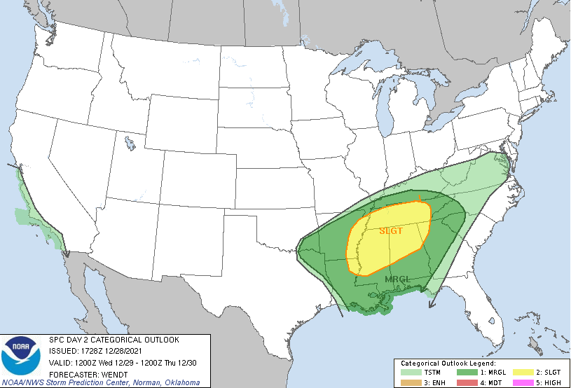
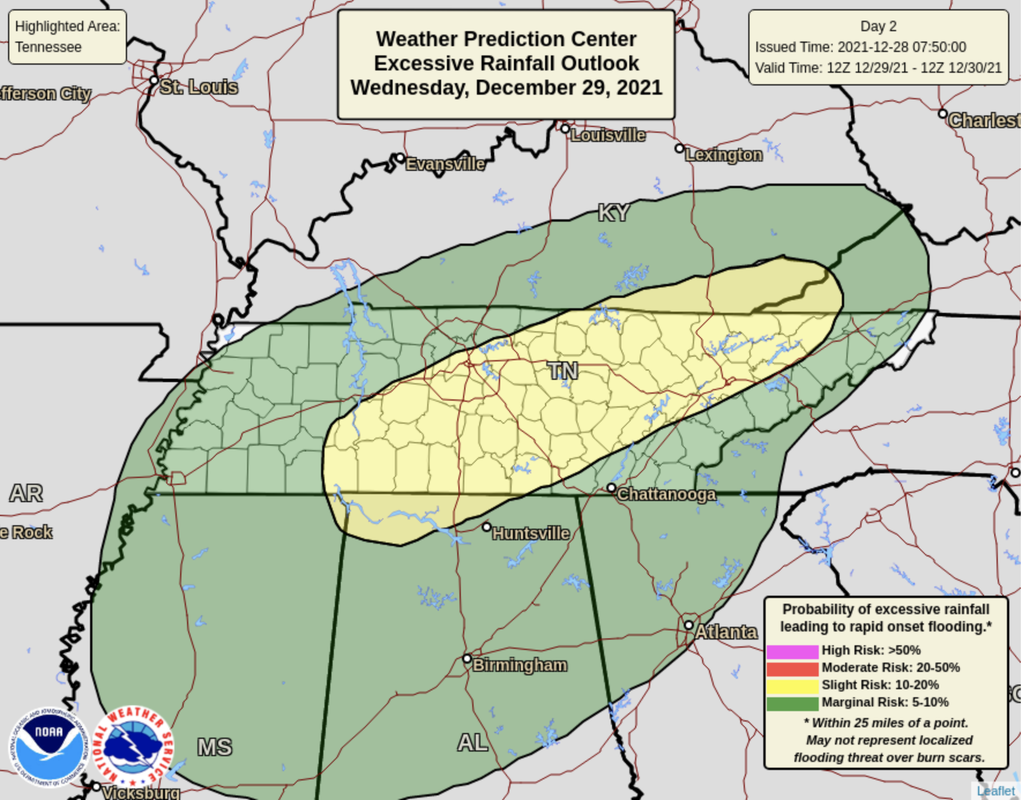
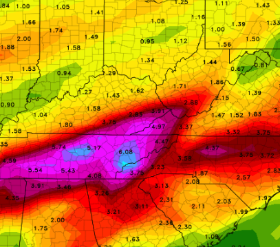
Theres lots to discuss, so we'll jump right into it. A cold front is expected to take aim at the area, bringing the opportunity for strong to severe storms and flash flooding/flooding. The Storm Prediction Center has upgraded the risk to a Slight. This includes an opportunity for: -Damaging/large hail -Low risk tornadoes -Damaging winds (60 mph) In addition to the severe threat, there is also a flash flooding threat. Given the rainfall expected to arrive later today/tonight and throughout the day tomorrow, heavy rains could easily lead to flash flooding. This risk has also been upgraded to a Slight chance (10-20%). Breaking down the day....Showers will be off and on throughout Wednesday (beginning this evening). An approaching cold front is then expected to develop a cluster of storms tomorrow evening to the early overnight. Timing for this is still a bit uncertain but generally between 6pm and 10pm is when the strongest of these storms will arrive. Moving forward, the potential for flash flooding and severe storms isn't over. A potent cold front will again bring the chance for flash flooding and severe weather. A peak into total rainfall between now and Sunday shows upwards of 7 inches possible. With between 2-3 inches expected through Thursday morning, another 4-5 inches is possible Friday and through the weekend. This system (of the two) looks to be the biggest concern. For now, we'll keep you updated with the latest alert and conditions through tomorrow, but more is to come. Please use caution into tomorrow. The bulk of hazardous activity will come tomorrow evening and into the overnight, but there could be opportunities (at times) during the afternoon as well. Have a way to receive alerts and know your game plan if warnings are issued. All severe hazards, along with flooding, are on the table. Pre-recorded 5pm show
0 Comments
Leave a Reply. |
Your trusted source for everything weather in East Tennessee.
Social Media
|


